 Block
Millington, Connecticut
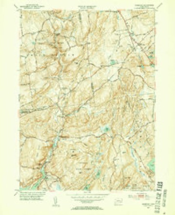
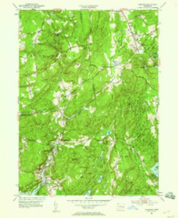
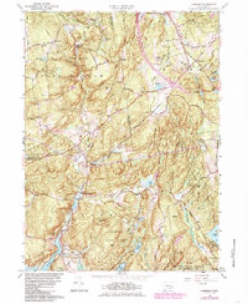
27 topographic sheets cover this place, the earliest surveyed in 1893 and the latest in 1983. It stands in East Haddam town. It lies in ZIP code area 06423. It stands on Early Brook. The Survey maps it on the Hamburg quadrangle.
On record in Millington
Buildings and businesses the archive holds for this place. Each opens its own page, with the source record it came from.
On the National Register 3 records
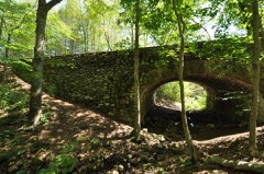 Bridge No. 1603listed 1993
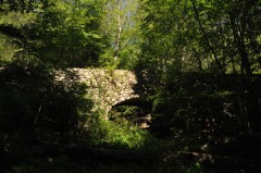 Bridge No. 1604listed 1993
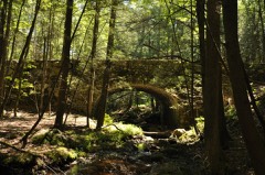 Bridge No. 1605listed 1993
Topographic sheets covering this place
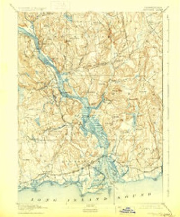
10 surveys from 27 printed sheetsMatched by testing this settlement's coordinate against the published boundary of every sheet in the United States Geological Survey's historical collection. Each opens the scanned sheet at the Survey.
- 1893 USGS Saybrook quadrangle1:62500, 8 printings
- 1947 USGS Hartford quadrangle1:250000, 2 printings
- 1948 USGS Hartford quadrangle1:250000, 2 printings
- 1952 USGS Hamburg quadrangle1:31680, 2 printings
- 1952 USGS Hamburg quadrangle1:24000
- 1961 USGS Hamburg quadrangle1:24000, 4 printings
- 1961 USGS Hartford quadrangle1:250000
- 1962 USGS Hartford quadrangle1:250000, 3 printings
- 1965 USGS Hartford quadrangle1:250000, 2 printings
- 1983 USGS New Haven quadrangle1:100000, 2 printings






In the county-history sources
43,998 words on this townshipHistory of Middlesex County, Connecticut, with Biographical Sketches of Its Prominent Men, published 1884 names this settlement in its chapter on East Haddam Town. These are the passages that mention it, exactly as the scans read.
First, or Center District, 37 scholars; Second, or Landing, 79; Third, or Red Lane, 53; Fourth, or Uptown, 27; Fifth, or Bashan, 68; Sixth, or Town Hill, 19; Seventh, or Nicket Lane, 33; Eighth, or Leesvill-, 16; Ninth, or Moodus, 130; Tenth, or Millington Green, 31; Eleventh, or Plain, 2r; Twelfth, or Olmstead, 16; Thirteenth, or Foxtown, 8; Fourteenth, or Tater Hill, 18; Fifteenth, or Millington West, 19; Sixteenth, or Acby, 20; Seventeenth, or Hadlyme, 47; a total of 633.
Passage source: History of Middlesex County, Connecticut, with Biographical Sketches of Its Prominent Men, published 1884.
The other grave yards in East Haddam were laid out or commenced as follows: Old yard in Hadlyme, 1723; Long Pond yard, 1726; Moodus yard, 1748; Meeting House^yard, in Hadlyme, 1750; Bashan, 1760; "Tater Hill," 1760; Near Millington Green, 1764; Eight Mile River, 1769; Landing, 1773; Mt. Parnassus, 1774; Center Congregational Church, 1778; Wicket old accounts refer to periods when virulent diseases prevailed throughout the town, but of nothing very serious. Within a few years past malaria~has prevailed to some extent along the river, and, in fact, it has prevailed throughout the whole State. In 1775, there were ^^^^ 40 deaths in the town; in the year following, more than 50. The population of East Haddam in 1800 was 2,805. The total number of deaths in the town for 10 years after was 614, or an average of over 60 each year, being h much larger average of mortality than has existed since that time. In 1870, the population was but 2,952, or 147 more thsn it was at the beginning of the century. The number of deaths during the year ending June ist 1870 was 54, or an average of one in 55 persons. Twenty of these deaths were caufed by consumption, six by typhoid fever, and two were accidental. The other deaths resulted from diseases pertaining to childhood and old age. Twenty-two of the number were under 33 years of age, ii over 70; 7 over 80, and one over 90 years. Thus while two-fifths failed to reach the average of human life, more than one-third passed the three score years and ten allotted to man.
Passage source: History of Middlesex County, Connecticut, with Biographical Sketches of Its Prominent Men, published 1884.
According to Field's history, the first settTer in Millington was Jonathan Beebe, from New London, who settled by the Long Pond about 1704, and was soon joined by several persons, who have now no descendants in East Haddam. They settled west of the pond, on the hill, about the Hayward farm, recently owned by Rowland Allen. Some traces of their houses still remain, but most of them are completely obliterated. Except at this spot, there were no inhabitants in Millington until about 1732-3-4, when families moved into it by the names of Arnold, Barnes, Brainerd, Chapman, Church, Cone, Emmons, Fuller, Gates, Olmsted, and Spencer, from East Haddam Parish; of Harvey and Hungerford, from Hadlyme; of Clarke, from Haddam; of Graves, from Colchester; and Stewart, fiom Voluntown. Daniel Smith, from some part of Plymouth Colony; Lemuel Griffin, from Lyme, and Thomas Fox, from Colchester, settled here not long afterward. Millington Society was for a number of years the most thickly settled and influential portion of the town. In 1810, there were 172 dwelling houses in that society, while in the First Society there were but 167. There were also a number of stores, and quite a large local business was carried on; Millington being the center of trade for quite a large tract of country.
Passage source: History of Middlesex County, Connecticut, with Biographical Sketches of Its Prominent Men, published 1884.
Machine-read from a century-old scan, so expect the errors a machine makes: misspelled names, dropped words, stray characters.
Read the whole chapter on East Haddam Town - it names this place 33 more 33 times.
Fires near this place
120 since 1992Regional context, not property-specific evidence. The federal wildfire occurrence database lists 120 fires within 5 miles of Millington between 1992 and 2020, burning about 188 acres in total. None started naturally. 5 were recorded as arson. Distance is straight-line from the map coordinates, so a fire counted here may appear on a neighbouring settlement's page as well.
| Reported cause | Fires |
|---|---|
| Missing data/not specified/undetermined | 70 |
| Recreation and ceremony | 18 |
| Debris and open burning | 18 |
| Smoking | 5 |
| Arson/incendiarism | 5 |
| Misuse of fire by a minor | 2 |
| Equipment and vehicle use | 1 |
| Fireworks | 1 |
The most recent of them, most recent first, with the day each was reported and the service that recorded it.
| Date | Cause | Size | Reported by | Name on the report |
|---|---|---|---|---|
| 8 September 2011 | Debris and open burning | under an acre | Connecticut Division of Forestry | COLCHESTER |
| 3 September 2019 | Missing data/not specified/undetermined | under an acre | Connecticut Division of Forestry | not named |
| 3 September 2011 | Debris and open burning | under an acre | Connecticut Division of Forestry | COLCHESTER |
| 28 September 2011 | Missing data/not specified/undetermined | under an acre | Connecticut Division of Forestry | COLCHESTER |
| 2 September 2017 | Recreation and ceremony | under an acre | Connecticut Division of Forestry | 81 SCHULMAN VESELAK |
| 14 September 2009 | Recreation and ceremony | under an acre | Connecticut Division of Forestry | not named |
| 8 August 2016 | Missing data/not specified/undetermined | under an acre | Connecticut Division of Forestry | 430 WEST RD, SALEM CT |
| 31 August 2011 | Recreation and ceremony | under an acre | Connecticut Division of Forestry | COLCHESTER |
Settlements close enough to share some of these fires:
Mines and quarries near this place
6 within 5 milesRegional context, not property-specific evidence. The federal mineral resources record lists 6 workings within 5 miles of Millington: 5 past producers, 1 producer. 1 still produces. What was taken out: Granite, Sand and Gravel, Construction, Stone. Distance is straight-line from the map coordinates, so a quarry counted here may appear on a neighbouring settlement's page as well.
| Where | Site | Commodity | Status | Recorded |
|---|---|---|---|---|
| Biotite Granitic Gneiss Rock Quarry No. Bj-014 | Stone | Producer | ||
| Haddam Pit Hood & Smith Pit | Sand and Gravel, Construction | Past Producer | ||
| Hood and Smith Sand & Gravel Pit | Sand and Gravel, Construction | Past Producer | Sedimentary | |
| Biotite Granitic Gneiss Rock Quarry | Granite | Past Producer | ||
| Rattlesnake Quarry | Granite | Past Producer | Granite | |
| Rattlesnake Quarry | Granite | Past Producer |
Storms near this place
1 since 2020Regional context, not property-specific evidence. The National Weather Service names Millington in 1 storm report in 2020: 1 hail. No death or injury is recorded in these reports. Each account below is quoted exactly as the forecast office filed it, from the NOAA Storm Events Database, and each date opens the federal record of that event.
| When | Event | Place named | Harm | What the report says |
|---|---|---|---|---|
| August 2020 | Hail | Millington | - | no account filed |
Nearest settlements
The eight closest, with where each one stands in the county. Distances are straight-line, computed from the Geographic Names Information System coordinates.
| Map | Place | Distance | Sheets |
|---|---|---|---|
| Haywardville | 2.4 miles | 29 | |
| Mount Parnassus | 3.2 miles | 29 | |
| Jewitt Corner | 3.6 miles | 27 | |
| Bailey Beach | 3.7 miles | 29 | |
| Tiffany Hill Corner | 4.5 miles | 29 | |
| Bashan | 4.5 miles | 29 | |
| Little Haddam | 4.8 miles | 29 | |
| Moodus | 5.2 miles | 29 |
Elsewhere
Matched on this settlement's Geographic Names Information System number rather than its name, so it cannot be a different place of the same name in another state.
| Wikipedia article on Millington | An encyclopaedic summary. Its text is share-alike, so it is linked here rather than copied. |
| Wikidata item Q6859685 | The structured record the population and elevation above come from. Public domain (CC0). |
Provenance
This settlement is recorded in the Geographic Names Information System as feature 212506. The sheet list is computed by point-in-boundary test against the United States Geological Survey's historical topographic inventory. Both are works of the United States government and carry no copyright under 17 U.S.C. 105.
Wildfire. Short, Karen C. 2022. Spatial wildfire occurrence data for the United States, 1992-2020 [FPA_FOD_20221014]. 6th Edition. Fort Collins, CO: Forest Service Research Data Archive. https://doi.org/10.2737/RDS-2013-0009.6 Collected with United States Government funding and usable without additional permissions or fees.
Mines and quarries. USGS Mineral Resources Data System (MRDS) https://mrdata.usgs.gov/mrds/ A work of the United States government, no copyright under 17 U.S.C. 105.
Storms. NOAA National Centers for Environmental Information, Storm Events Database https://www.ncei.noaa.gov/stormevents/ A work of the United States government, no copyright under 17 U.S.C. 105. Narratives are quoted verbatim from the National Weather Service report and are not edited or summarised.