 Block
Pine Meadow, Connecticut
31 topographic sheets cover this place, the earliest surveyed in 1892 and the latest in 1994. It stands in New Hartford town. It lies in ZIP code area 06057. It stands on Hallock Brook. The Survey maps it on the New Hartford quadrangle.
On record in Pine Meadow
Buildings and businesses the archive holds for this place. Each opens its own page, with the source record it came from.
On the National Register within a mile 2 records
The National Register names another town for these. They stand within one mile of this settlement's coordinate.
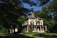 Philip Chapin Houselisted 1977 · 0.1 miles away
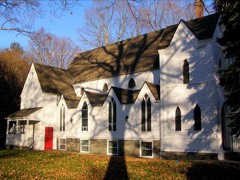 Pine Meadow Historic Districtlisted 1996 · 0.1 miles away
Topographic sheets covering this place
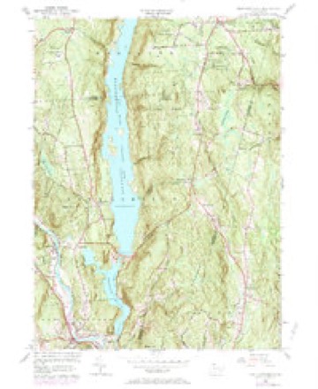
11 surveys from 31 printed sheetsMatched by testing this settlement's coordinate against the published boundary of every sheet in the United States Geological Survey's historical collection. Each opens the scanned sheet at the Survey.
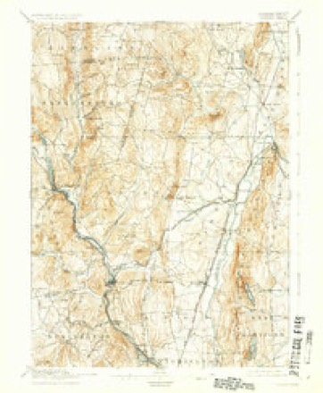
- 1892 USGS Granby quadrangle1:62500, 8 printings
- 1906 USGS Farmington quadrangle1:125000, 2 printings
- 1947 USGS Hartford quadrangle1:250000, 2 printings
- 1948 USGS Hartford quadrangle1:250000, 2 printings
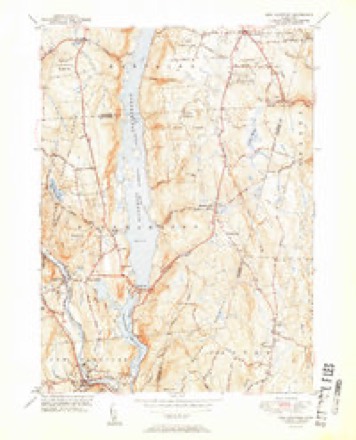
- 1951 USGS New Hartford quadrangle1:31680, 2 printings
- 1956 USGS New Hartford quadrangle1:24000, 6 printings
- 1961 USGS Hartford quadrangle1:250000
- 1962 USGS Hartford quadrangle1:250000, 3 printings
- 1965 USGS Hartford quadrangle1:250000, 2 printings
- 1986 USGS Hartford quadrangle1:100000
- 1994 USGS Hartford quadrangle1:100000, 2 printings








In the county-history sources
25,730 words on this townshipHistory of Litchfield County, Connecticut, published 1881 names this settlement in its chapter on New Hartford Town. These are the passages that mention it, exactly as the scans read.
In November, 1849, Rev. J. H. Betts was sent by Bishop Brownell to take charge of a Protestant Episcopal mission in Pine Meadow. For lack of a suitable place of meeting, services were not held on the Sabbath until June 9, 1850, after which time they were regularly held in Chapin's Hall until the completion of the church. St. John's parish was organized Nov. 20, 1850. The corner-stone of a house of worship was laid the following day, and the finished edifice consecrated as St. John's church, by Bishop Brownell, June 4, 1851. This church, which stood at the southern extremity of Church Street, was destroyed by fire Dec. 23, 1859, and with it a valuable pipe-organ, the gift of Herman Chapin, Esq. Services were again held in Chapin's Hall until the present church, which fronts the triangular park at the northern end of Church Street, was completed. Divine service was first held in the new edifice Christmas Eve, 1861. The church is of wood, in the Gothic style of architecture, with a bell-tower and spire; the interior is neatly and tastefully furnished. The rectors of the church have been Revs. John H. Betts, from Easter, 1851, to July, 1857 ; Enoch Huntington, from April, 1858, to May, 1860 ; Myron A. Johnson, from November, 1861, to October, 1862 ; T. S. Judd, from November, 1862, to March, 1863 ; De Lancy G. Rice, from May, 1863, to April, 1865; J. C. Heald, from 1866 to July, 1868; John H. Betts, recalled April, 1869, to May, 1880 ; Theodore Porter, ordained December, 1880, now pastor of the church.
Passage source: History of Litchfield County, Connecticut, published 1881.
The places of meeting were first at private houses, thenatthebrickmachine-shop and Chapin's Hall, Pine Meadow, and then in the upper village, at the schoolhouse now occupied by Miss Chloe Lankton, and at Academy Hall. The " Church of the Immaculate Conception," at the North village, was commenced in 1868, during the pastorate of Rev. John Fagan, and finished during the pastorate of Rev. Lawrence Walsh. It is the largest church edifice in town. There has never been a priest resident in New Hartford, but mass is celebrated every Sunday morning by one of the reverend fathers from Collinsville. The Roman Catholic population in town is estimated by the present pastor at one thousand souls.
Passage source: History of Litchfield County, Connecticut, published 1881.
There are now three public libraries in town, largely composed of works of fiction, from which books may be drawn on yearly subscription or by payment of a small fee at each drawing. The Pine Meadow Library Association has a collection of some six hundred volumes, the Circenwoods Company Library hiia four hundred and fifty volumes in constant circulation, and the Roman Catholic society also sustains a small but well-selected library.
Passage source: History of Litchfield County, Connecticut, published 1881.
Machine-read from a century-old scan, so expect the errors a machine makes: misspelled names, dropped words, stray characters.
Read the whole chapter on New Hartford Town - it names this place 19 more 19 times.
Fires near this place
169 since 1997Regional context, not property-specific evidence. The federal wildfire occurrence database lists 169 fires within 5 miles of Pine Meadow between 1997 and 2020, burning about 144 acres in total. None started naturally. 6 were recorded as arson. Distance is straight-line from the map coordinates, so a fire counted here may appear on a neighbouring settlement's page as well.
| Reported cause | Fires |
|---|---|
| Missing data/not specified/undetermined | 134 |
| Debris and open burning | 13 |
| Recreation and ceremony | 11 |
| Arson/incendiarism | 6 |
| Smoking | 2 |
| Other causes | 1 |
| Railroad operations and maintenance | 1 |
| Misuse of fire by a minor | 1 |
The most recent of them, most recent first, with the day each was reported and the service that recorded it.
| Date | Cause | Size | Reported by | Name on the report |
|---|---|---|---|---|
| 4 September 2017 | Missing data/not specified/undetermined | under an acre | Connecticut Division of Forestry | 332 NILES RD |
| 4 September 2017 | Missing data/not specified/undetermined | under an acre | Connecticut Division of Forestry | 21 COTTAGE ST |
| 30 September 2006 | Missing data/not specified/undetermined | under an acre | Connecticut Division of Forestry | not named |
| 25 September 2011 | Missing data/not specified/undetermined | under an acre | Connecticut Division of Forestry | NEW HARTFORD |
| 23 September 2020 | Missing data/not specified/undetermined | 1.0 acres | Connecticut Division of Forestry | 2 INDIAN HILL ROAD |
| 19 September 2020 | Recreation and ceremony | under an acre | Connecticut Division of Forestry | 124 LAIR ROAD |
| 18 September 2010 | Recreation and ceremony | under an acre | Connecticut Division of Forestry | not named |
| 12 September 2019 | Missing data/not specified/undetermined | under an acre | Connecticut Division of Forestry | not named |
Settlements close enough to share some of these fires:
Mines and quarries near this place
10 of 14 shownRegional context, not property-specific evidence. The federal mineral resources record lists 14 workings within 5 miles of Pine Meadow: 11 past producers, 2 producers, 1 prospect. 2 still produce. What was taken out: Stone, Dimension, Sand and Gravel, Construction, Mica, Feldspar. Distance is straight-line from the map coordinates, so a quarry counted here may appear on a neighbouring settlement's page as well.
| Where | Site | Commodity | Status | Recorded |
|---|---|---|---|---|
| Asbestos Mine | Asbestos | Past Producer | ||
| Copper Mine No. Di-008 | Sulfur, Copper | Past Producer | Metamorphosed Sedimentary | |
| Gneiss Rock Quarry No. Ei-003 | Stone | Past Producer | Gneiss | |
| Knapp Mica Prospect | Mica, Feldspar | Past Producer | Muscovite, Plagioclase, Quartz | |
| Knapp Mica Prospect | Feldspar, Mica | Prospect | ||
| Lead Mine | Lead | Past Producer | ||
| Soapstone Mine | Talc-Soapstone | Past Producer | ||
| Blc Pit | Sand and Gravel, Construction | Producer | ||
| Hart's Pit | Sand and Gravel, Construction | Producer | ||
| Gneiss Rock Quarry No. Ei-003 | Stone, Dimension | Past Producer |
Storms near this place
2 since 2017Regional context, not property-specific evidence. The National Weather Service names Pine Meadow in 2 storm reports between 2017 and 2018: 2 thunderstorm wind. No death or injury is recorded in these reports. Each account below is quoted exactly as the forecast office filed it, from the NOAA Storm Events Database, and each date opens the federal record of that event.
| When | Event | Place named | Harm | What the report says |
|---|---|---|---|---|
| August 2018 | Thunderstorm Wind | Pine Meadow | - | Wires and trees downed. |
| August 2017 | Thunderstorm Wind | Pine Meadow | - | A tree was downed onto a car. |
Nearest settlements
The eight closest, with where each one stands in the county. Distances are straight-line, computed from the Geographic Names Information System coordinates.
| Map | Place | Distance | Sheets |
|---|---|---|---|
| New Hartford | 0.7 miles | 31 | |
| Puddle Town | 0.8 miles | 30 | |
| Town Hill | 2.3 miles | 30 | |
| Pleasant Valley | 2.7 miles | 31 | |
| Browns Corner | 3.4 miles | 30 | |
| Barkhampsted Center | 3.6 miles | 31 | |
| Nepaug | 3.6 miles | 30 | |
| Maple Hollow | 3.9 miles | 33 |
Provenance
This settlement is recorded in the Geographic Names Information System as feature 209789. The sheet list is computed by point-in-boundary test against the United States Geological Survey's historical topographic inventory. Both are works of the United States government and carry no copyright under 17 U.S.C. 105.
Wildfire. Short, Karen C. 2022. Spatial wildfire occurrence data for the United States, 1992-2020 [FPA_FOD_20221014]. 6th Edition. Fort Collins, CO: Forest Service Research Data Archive. https://doi.org/10.2737/RDS-2013-0009.6 Collected with United States Government funding and usable without additional permissions or fees.
Mines and quarries. USGS Mineral Resources Data System (MRDS) https://mrdata.usgs.gov/mrds/ A work of the United States government, no copyright under 17 U.S.C. 105.
Storms. NOAA National Centers for Environmental Information, Storm Events Database https://www.ncei.noaa.gov/stormevents/ A work of the United States government, no copyright under 17 U.S.C. 105. Narratives are quoted verbatim from the National Weather Service report and are not edited or summarised.