 Block
Waterbury, Connecticut
33 topographic sheets cover this place, the earliest surveyed in 1893 and the latest in 1993. It stands in Waterbury town. It lies in ZIP code area 06702. It lies near Westside Hill. The Survey maps it on the Waterbury quadrangle. 114,403 people lived here at the 2020 count. It stands 262 feet above sea level.
Research this city
On record in Waterbury
Buildings and businesses the archive holds for this place. Each opens its own page, with the source record it came from.
On the National Register 12 of 25 shown
 George S. Abbott Buildinglisted 1982
 Bank Street Historic Districtlisted 1983
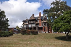 Benedict-Miller Houselisted 1981
 Beth El Synagoguelisted 1995
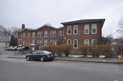 Bishop Schoollisted 1982
 City Halllisted 1978
 Downtown Waterbury Historic Districtlisted 1983
 Elton Hotellisted 1983
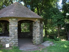 Lewis Fulton Memorial Parklisted 1990
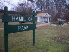 Hamilton Parklisted 1996
 Hibbard, Enoch, House and Grannis, George, Houselisted 1979
 Hillside Historic Districtlisted 1987
Population over time
2 figuresWaterbury grew from 110,366 to 114,403 between 2010 and 2020. These are the recorded population figures Wikidata holds for this place, reached through the Geographic Names Information System number this page is keyed on rather than by name, so they belong to this place and not to another of the same name. Most are census counts, but not all are: an early figure may be a founding or settlement estimate, and an estimate published within five years of a census is left out. The change column is computed, and is left blank where more than 20 years separate a figure from the one before it, because a gap that long is not a change between two counts.
| Year | People | Change |
|---|---|---|
| 2010 | 110,366 | |
| 2020 | 114,403 | +4,037 (+4%) |
Topographic sheets covering this place
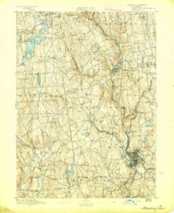
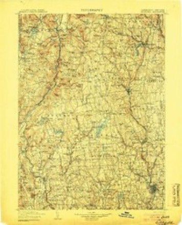
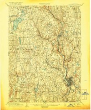
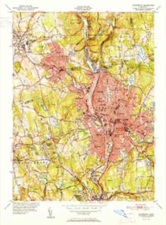
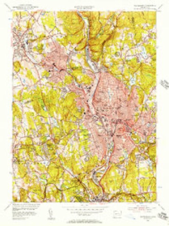
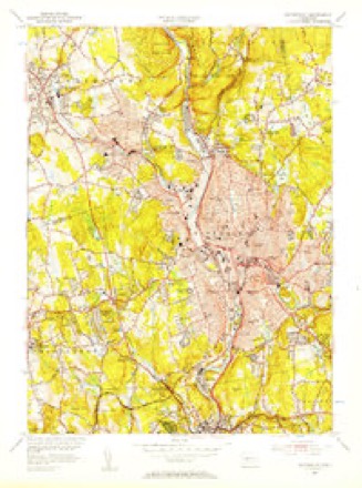
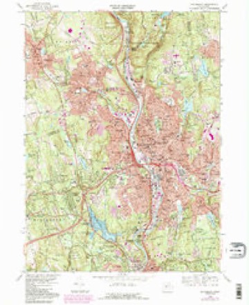
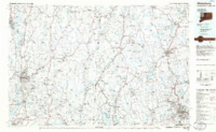
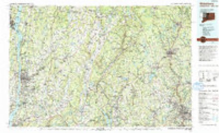
14 surveys from 33 printed sheetsMatched by testing this settlement's coordinate against the published boundary of every sheet in the United States Geological Survey's historical collection. Each opens the scanned sheet at the Survey.
- 1893 USGS Waterbury quadrangle1:62500, 2 printings
- 1904 USGS Litchfield quadrangle1:125000, 3 printings
- 1904 USGS Waterbury quadrangle1:62500, 8 printings
- 1947 USGS Hartford quadrangle1:250000, 2 printings
- 1948 USGS Hartford quadrangle1:250000, 2 printings
- 1951 USGS Waterbury quadrangle1:31680, 2 printings
- 1955 USGS Waterbury quadrangle1:24000
- 1955 USGS Waterbury quadrangle1:31680
- 1961 USGS Hartford quadrangle1:250000
- 1962 USGS Hartford quadrangle1:250000, 3 printings
- 1965 USGS Hartford quadrangle1:250000, 2 printings
- 1968 USGS Waterbury quadrangle1:24000, 4 printings
- 1985 USGS Waterbury quadrangle1:100000
- 1993 USGS Waterbury quadrangle1:100000





Fires near this place
486 since 1992Regional context, not property-specific evidence. The federal wildfire occurrence database lists 486 fires within 5 miles of Waterbury between 1992 and 2020, burning about 1,186 acres in total. None started naturally. 142 were recorded as arson. Distance is straight-line from the map coordinates, so a fire counted here may appear on a neighbouring settlement's page as well.
| Reported cause | Fires |
|---|---|
| Missing data/not specified/undetermined | 179 |
| Arson/incendiarism | 142 |
| Misuse of fire by a minor | 60 |
| Recreation and ceremony | 45 |
| Debris and open burning | 34 |
| Smoking | 10 |
| Railroad operations and maintenance | 10 |
| Equipment and vehicle use | 6 |
The most recent of them, most recent first, with the day each was reported and the service that recorded it.
| Date | Cause | Size | Reported by | Name on the report |
|---|---|---|---|---|
| 8 September 2000 | Arson/incendiarism | under an acre | Connecticut Division of Forestry | not named |
| 6 September 1995 | Arson/incendiarism | 3.0 acres | Connecticut Division of Forestry | not named |
| 3 September 2012 | Missing data/not specified/undetermined | under an acre | Connecticut Division of Forestry | MIDDLEBURY |
| 23 September 2007 | Missing data/not specified/undetermined | under an acre | Connecticut Division of Forestry | not named |
| 2 September 2005 | Missing data/not specified/undetermined | under an acre | Connecticut Division of Forestry | not named |
| 2 September 1994 | Recreation and ceremony | under an acre | Connecticut Division of Forestry | not named |
| 19 September 2011 | Missing data/not specified/undetermined | 1.0 acres | Connecticut Division of Forestry | MIDDLEBURY |
| 12 September 2005 | Misuse of fire by a minor | 3.0 acres | Connecticut Division of Forestry | not named |
Settlements close enough to share some of these fires:
Mines and quarries near this place
9 within 5 milesRegional context, not property-specific evidence. The federal mineral resources record lists 9 workings within 5 miles of Waterbury: 4 producers, 3 past producers, 1 plant, 1 unknown. 5 still produce. What was taken out: Sand and Gravel, Construction, Iodine, Stone, Crushed/Broken. Distance is straight-line from the map coordinates, so a quarry counted here may appear on a neighbouring settlement's page as well.
| Where | Site | Commodity | Status | Recorded |
|---|---|---|---|---|
| Bogue Mill | Stone, Crushed/Broken | Unknown | Surface | |
| Naugatuck Plant | Iodine | Plant | ||
| C & C Pit | Sand and Gravel, Construction | Producer | ||
| Colonial Sand & Gravel Co. Pit | Sand and Gravel, Construction | Producer | ||
| Colonial Sand and Gravel Co. Pit | Sand and Gravel, Construction | Past Producer | Sedimentary | |
| Pearl Lake Road Pit | Sand and Gravel, Construction | Past Producer | Sedimentary | |
| Pearl Lake Road Pit | Sand and Gravel, Construction | Producer | ||
| Prospect Plant | Sand and Gravel, Construction | Past Producer | Sedimentary | |
| Prospect Quarry & Plant | Sand and Gravel, Construction | Producer |
Storms near this place
50 since 1996Regional context, not property-specific evidence. The National Weather Service names Waterbury in 50 storm reports between 1996 and 2025: 24 thunderstorm wind, 9 hail, 8 flash flood, 6 lightning. The reports record 3 injuries. Each account below is quoted exactly as the forecast office filed it, from the NOAA Storm Events Database, and each date opens the federal record of that event.
| When | Event | Place named | Harm | What the report says |
|---|---|---|---|---|
| November 2009 | Lightning | Waterbury | 1 hurt | Lightning struck a large tree in the back yard of 92 Grassy Hill Road around 4:30 am EST. It traveled through the ground, blasted a hole through the basement wall, and displaced wooden panels in the interior portions of the house. The sound was so loud that it damaged the hearing of a woman living in the house. |
| May 2005 | Lightning | Waterbury | 1 hurt | no account filed |
| January 1999 | Lightning | Waterbury | 1 hurt | no account filed |
| July 1996 | Tornado (F1) | Waterbury | $2,000,000 | no account filed |
| May 2008 | Flash Flood | Waterbury | $600,000 | A newly renovated Burger King was flooded on Thomaston Avenue in Waterbury causing $600,000 in property damage. |
| June 2010 | Thunderstorm Wind | Waterbury | $50,000 | Numerous trees and wires were reported down throughout Waterbury, damaging at least one car, and several fences. In addition there was some minor roof damage reported in the area around Dallas and Monroe Avenues and Newbury and Gates Streets. |
| July 2025 | Thunderstorm Wind | Waterbury | $20,000 | Tree down on house on Greenwood Avenue. Power lines to the house also brought down. |
| August 2011 | Lightning | Waterbury | $10,000 | At least two homes in Waterbury were struck by lightning, one at 25 Olympia Lane, causing a deck to catch fire and the other on Farrell Road. |
| June 2011 | Thunderstorm Wind | Waterbury | $7,500 | Numerous trees were reported down in Waterbury. |
| June 2017 | Thunderstorm Wind | Waterbury | $5,000 | Numerous trees and power lines were reported down throughout Waterbury. |
| May 2013 | Thunderstorm Wind | Waterbury | $5,000 | Several trees were reported down on wires along Hamilton Avenue. |
| November 2009 | Heavy Rain | Waterbury | $5,000 | Heavy rain caused a vehicle to hydroplane on Piedmont Street, causing it to lose control and crash into two parked cars. The driver was taken to Saint Mary's Hospital to treat head injuries. |
| June 2009 | Lightning | Waterbury | $5,000 | Lightning struck a tree at 387 Robinwood Road, causing a large limb to fall on a car. |
| August 2020 | Thunderstorm Wind | Waterbury | $4,000 | Large tree uprooted on Lounsbury Street. |
| July 2014 | Thunderstorm Wind | Waterbury | $4,000 | A tree fell through the roof of a garage on Baldwin Street. |
| July 2025 | Thunderstorm Wind | Waterbury | $3,000 | Tree down on wires on Ludlow Street at Lincoln Avenue. |
| July 2025 | Thunderstorm Wind | Waterbury | $3,000 | Tree down on wires on Crescent Street in Waterbury. |
| July 2025 | Thunderstorm Wind | Waterbury | $3,000 | Tree down on primary wires on Willow Street at Calumet Street. |
| May 2018 | Thunderstorm Wind | Waterbury | $3,000 | Trees down on I-84 West, just west of Waterbury. |
| June 2008 | Thunderstorm Wind | Waterbury | $2,500 | Two vehicles were damaged by a downed tree in a church parking lot. |
| June 2021 | Thunderstorm Wind | Waterbury | $2,000 | Waterbury police reports a couple of trees down. |
| June 2024 | Thunderstorm Wind | Waterbury | $1,000 | Tree down on Willow Street. |
| June 2009 | Thunderstorm Wind | Waterbury | $1,000 | A tree was reported down across Baldwin Street. |
| June 2008 | Thunderstorm Wind | Waterbury | $1,000 | Trees and wires were reported down in Waterbury. |
| June 2008 | Thunderstorm Wind | Waterbury | $1,000 | Trees and wires were downed in Waterbury. |
| July 2025 | Flash Flood | Waterbury | - | Freight Street closed due to flooding at the intersection of Jackson Street in Waterbury, CT. |
| July 2023 | Flash Flood | Waterbury | - | Flooding with closures at Watertown Ave and Southbound Route 8 connection. |
| August 2022 | Flash Flood | Waterbury | - | Multiple road closures across Waterbury due to flooding. |
| August 2011 | Hail | Waterbury | - | Nickel to quarter size hail was reported. |
| June 2010 | Funnel Cloud | Waterbury | - | A funnel cloud was reported over Waterbury. |
| July 2009 | Flash Flood | Waterbury | - | In Waterbury, the intersection of Long Hill Rd. and Wolcott St. was closed due to flooding. |
| July 2009 | Flash Flood | Waterbury | - | In Waterbury, 4 to 5 inches of rainfall fell over a 3 hour period. Many cars were stranded in high water approximately 3 ft. deep on Wolcott St. and at the Route 8 underpass on Watertown Ave. Portions of Freight St. was under 4 ft. of water and the intersection of Woodtick Rd. at Upson Rd. was closed due to flooding. Large chunks of pavement were torn up on Wall St. and the House of Joy and Praise sustained water damage in the basement from ravaging runoff from a hill nearby. A section of Long Hill Rd. near Wolcott St. was also closed from damage to the street from flooding. |
| June 2009 | Hail | Waterbury | - | Dime to penny size hail was reported. |
| June 2006 | Flash Flood | Waterbury | - | Torrential rainfall from slow-moving thunderstorms caused flash flooding across almost all of Northern New Haven County during the late afternoon and early evening of June 2nd. Up to 8 inches of rainfall occurred in less than 6 hours time in Waterbury. This caused numerous roads to be washed out and many water rescues to take place. The extent of the flooding prompted the Waterbury Mayor to declare a state of emergency. The hardest hit areas in Waterbury were Bristol Street, Highland Avenue, Watertown Avenue, South Main Street, and Charles Street. A rain gage measured 7.40 inches of rainfall in Waterbury. |
| August 2004 | Hail | Waterbury | - | An intense severe thunderstorm produced golfball size hail and very strong wind gusts, which downed several trees, some of which fell on cars and blocked roads. |
| August 2004 | Thunderstorm Wind | Waterbury | - | Trees and wires were downed in Waterbury and Cheshire between 12:30 EST and 12:40 EST. In Cheshire, power lines fell on a house. Three miles northeast of Waterbury, a tree was downed on a truck. |
| August 2002 | Thunderstorm Wind | Waterbury | - | Local police reported several trees knocked over from the storm. |
| July 2012 | Hail | Waterbury | - | no account filed |
| July 2012 | Hail | Waterbury | - | no account filed |
| August 2011 | Hail | Waterbury | - | no account filed |
| June 2007 | Hail | Waterbury | - | no account filed |
| August 2006 | Thunderstorm Wind | Waterbury | - | no account filed |
| May 2003 | Hail | Waterbury | - | no account filed |
| June 2002 | Hail | Waterbury | - | no account filed |
| May 2000 | Thunderstorm Wind | Waterbury | - | no account filed |
| January 1999 | Flash Flood | Waterbury | - | no account filed |
| July 1999 | Thunderstorm Wind | Waterbury | - | no account filed |
| March 1999 | Lightning | Waterbury | - | no account filed |
| May 1996 | Thunderstorm Wind | Waterbury | - | no account filed |
| May 1996 | Thunderstorm Wind | Waterbury | - | no account filed |
Nearest settlements
The eight closest, with where each one stands in the county. Distances are straight-line, computed from the Geographic Names Information System coordinates.
| Map | Place | Distance | Sheets |
|---|---|---|---|
| West Side Hill | 0.6 miles | 33 | |
| Overlook | 0.6 miles | 33 | |
| Bunker Hill | 1.1 miles | 33 | |
| Town Plot Hill | 1.3 miles | 33 | |
| Burnt Hill | 1.4 miles | 33 | |
| Long Hill | 1.6 miles | 33 | |
| Lakewood | 1.9 miles | 33 | |
| Fairmount | 1.9 miles | 33 |
Elsewhere
Matched on this settlement's Geographic Names Information System number rather than its name, so it cannot be a different place of the same name in another state.
| Wikipedia article on Waterbury | An encyclopaedic summary. Its text is share-alike, so it is linked here rather than copied. |
| Wikidata item Q49178 | The structured record the population and elevation above come from. Public domain (CC0). |
Provenance
This settlement is recorded in the Geographic Names Information System as feature 211851. The sheet list is computed by point-in-boundary test against the United States Geological Survey's historical topographic inventory. Both are works of the United States government and carry no copyright under 17 U.S.C. 105.
Wildfire. Short, Karen C. 2022. Spatial wildfire occurrence data for the United States, 1992-2020 [FPA_FOD_20221014]. 6th Edition. Fort Collins, CO: Forest Service Research Data Archive. https://doi.org/10.2737/RDS-2013-0009.6 Collected with United States Government funding and usable without additional permissions or fees.
Mines and quarries. USGS Mineral Resources Data System (MRDS) https://mrdata.usgs.gov/mrds/ A work of the United States government, no copyright under 17 U.S.C. 105.
Storms. NOAA National Centers for Environmental Information, Storm Events Database https://www.ncei.noaa.gov/stormevents/ A work of the United States government, no copyright under 17 U.S.C. 105. Narratives are quoted verbatim from the National Weather Service report and are not edited or summarised.