 Block
West Suffield, Connecticut
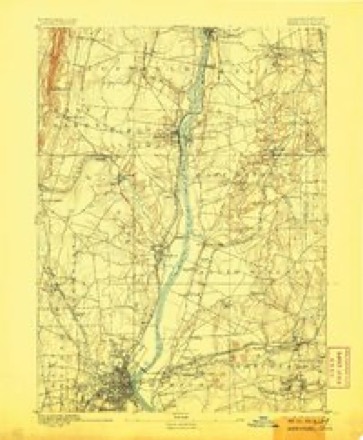
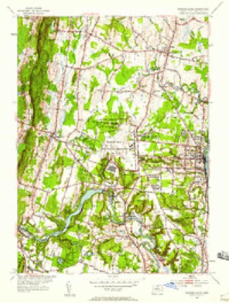
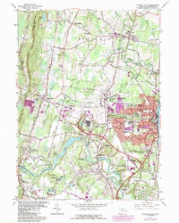
32 topographic sheets cover this place, the earliest surveyed in 1892 and the latest in 1994. It stands in Suffield town. It lies in ZIP code area 06093. It stands on Rattlesnake Brook. The Survey maps it on the Windsor Locks quadrangle. It stands 197 feet above sea level.
Topographic sheets covering this place
14 surveys from 32 printed sheetsMatched by testing this settlement's coordinate against the published boundary of every sheet in the United States Geological Survey's historical collection. Each opens the scanned sheet at the Survey.
- 1892 USGS Hartford quadrangle1:62500, 8 printings
- 1906 USGS Farmington quadrangle1:125000, 2 printings
- 1928 USGS Windsor Locks quadrangle1:24000
- 1946 USGS Windsor Locks quadrangle1:31680, 2 printings
- 1947 USGS Hartford quadrangle1:250000, 2 printings
- 1948 USGS Hartford quadrangle1:250000, 2 printings
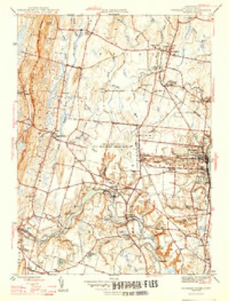
- 1953 USGS Windsor Locks quadrangle1:31680, 2 printings
- 1953 USGS Windsor Locks quadrangle1:24000
- 1961 USGS Hartford quadrangle1:250000
- 1962 USGS Hartford quadrangle1:250000, 3 printings
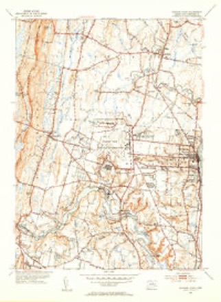
- 1964 USGS Windsor Locks quadrangle1:24000, 3 printings
- 1965 USGS Hartford quadrangle1:250000, 2 printings
- 1986 USGS Hartford quadrangle1:100000
- 1994 USGS Hartford quadrangle1:100000, 2 printings








In the county-history sources
13,636 words on this townshipThe Memorial History of Hartford County, Connecticut, 1633-1884;, published 1886 names this settlement in its chapter on Suffield Town. These are the passages that mention it, exactly as the scans read.
Before 1830, itinerant Methodist exhorters occasionally visited the town, but gained no apparent foothold. The Methodist Society of West Suffield dates its beginning from a Quarterly Meeting service held by courtesy at the Congregational church there. Meetings were held in school-houses, private dwellings, and barns. In 1833 the Rev. Charles Chittendon, a revivalist, was placed here by the Conference with much success, and since that time (except 1854) the Conference has supplied its ministers. In 1839 the society built and dedicated their meetinghouse, with the present bell in its tower. The leading men in this work were Gustavus Austin, Charles Denison, David Hastings, Horace Tuller, Curtis Warner, Warren Case, John Johnson. A parsonage was built in 185(3, mainly through the efforts of the Rev. Frederick Brown. Olin L. Warner the sculptor was born here, April 9, 1844, his father, the Rev. Levi Warner, being minister in charge. The father of the Rev. Dr. Burton, of Hartford, was the minister here in 1857.
Passage source: The Memorial History of Hartford County, Connecticut, 1633-1884;, published 1886.
The first Roman Catholic service held in Suffield was at the house of John Gillio-an, June 18, 1882 : and the second was in the school-house hall, in West Suffield, July 30, 1882, conducted by the Rev. Father Michael Kelly, of Windsor Locks. Services have been continued regularly since, and the members have bought a site midway between the villages, and are al^out to erect a church thereon. The ground was broken for it, with proper ceremonies, April 20, 1885.
Passage source: The Memorial History of Hartford County, Connecticut, 1633-1884;, published 1886.
A post-office was first opened in Suffield in 1796, with Hezekiah Huntington postmaster. William Gay succeeded him, from 1798 to 1835. His salary for the year 1800 was -i'80.52. In 1830 the amount of postage received was ''^256.36. A l)ureau-drawer at the Gay mansion afforded ample room for the town's tri-weekl\- mail. The West Suffield post-office was opened in 1839, with Erastus H. Weed postmaster, and a tri-weekly mail between Hartford and Westfield. In 1861 a daily mail-route to Springfield was established. In 1884 a semidaily mail-route to Sufheld, connecting with the branch road, was opened.
Passage source: The Memorial History of Hartford County, Connecticut, 1633-1884;, published 1886.
Machine-read from a century-old scan, so expect the errors a machine makes: misspelled names, dropped words, stray characters.
Read the whole chapter on Suffield Town - it names this place 2 more 2 times.
Fires near this place
27 since 2003Regional context, not property-specific evidence. The federal wildfire occurrence database lists 27 fires within 5 miles of West Suffield between 2003 and 2020, burning about 27 acres in total. 3 started naturally. None was recorded as arson. Distance is straight-line from the map coordinates, so a fire counted here may appear on a neighbouring settlement's page as well.
| Reported cause | Fires |
|---|---|
| Missing data/not specified/undetermined | 15 |
| Debris and open burning | 3 |
| Recreation and ceremony | 3 |
| Natural | 3 |
| Equipment and vehicle use | 2 |
| Smoking | 1 |
The most recent of them, most recent first, with the day each was reported and the service that recorded it.
| Date | Cause | Size | Reported by | Name on the report |
|---|---|---|---|---|
| 6 September 2015 | Missing data/not specified/undetermined | under an acre | Massachusetts Bureau of Forest Fire Control | not named |
| 28 September 2020 | Missing data/not specified/undetermined | 1.0 acres | Massachusetts Bureau of Forest Fire Control | not named |
| 3 August 2016 | Missing data/not specified/undetermined | under an acre | Massachusetts Bureau of Forest Fire Control | not named |
| 14 August 2010 | Recreation and ceremony | under an acre | Connecticut Division of Forestry | not named |
| 22 July 2020 | Recreation and ceremony | under an acre | Connecticut Division of Forestry | KINGS ISLAND |
| 27 June 2016 | Missing data/not specified/undetermined | 1.0 acres | Massachusetts Bureau of Forest Fire Control | not named |
| 2 June 2011 | Debris and open burning | 1.0 acres | Connecticut Division of Forestry | WINDSOR LOCKS |
| 7 May 2003 | Recreation and ceremony | 2.0 acres | Connecticut Division of Forestry | not named |
Settlements close enough to share some of these fires:
Mines and quarries near this place
10 of 23 shownRegional context, not property-specific evidence. The federal mineral resources record lists 23 workings within 5 miles of West Suffield: 17 past producers, 6 producers. 6 still produce. What was taken out: Copper, Stone, Crushed/Broken, Stone, Dimension, Sulfur. Distance is straight-line from the map coordinates, so a quarry counted here may appear on a neighbouring settlement's page as well.
| Where | Site | Commodity | Status | Recorded |
|---|---|---|---|---|
| Sandstone Quarry | Flagstone | Past Producer | ||
| Sandstone Quarry | Flagstone | Past Producer | ||
| Higley Copper Mine | Copper, Sulfur | Past Producer | Breccia Filling And Replacement | |
| Johns Pit | Sand and Gravel, Construction | Producer | ||
| Notch Pit | Sand and Gravel, Construction | Past Producer | Sedimentary | |
| Notch Pit | Sand and Gravel, Construction | Producer | ||
| Simsbury Copper Mine | Copper, Sulfur | Past Producer | Void Filling And Replacement | |
| Simsbury Newgate Prison Copper Mine | Copper, Sulfur | Past Producer | 1707 | |
| East Granby Traprock Quarry | Stone, Dimension | Past Producer | ||
| Quarry | Stone, Dimension | Past Producer |
Storms near this place
5 since 2002Regional context, not property-specific evidence. The National Weather Service names West Suffield in 5 storm reports between 2002 and 2023: 3 thunderstorm wind, 1 hail, 1 flash flood. No death or injury is recorded in these reports. Each account below is quoted exactly as the forecast office filed it, from the NOAA Storm Events Database, and each date opens the federal record of that event.
| When | Event | Place named | Harm | What the report says |
|---|---|---|---|---|
| April 2021 | Thunderstorm Wind | West Suffield | $7,500 | Three miles northwest of Suffield, power poles were snapped and 3 inch tree limbs were down. |
| August 2002 | Thunderstorm Wind | West Suffield | $5,000 | no account filed |
| May 2008 | Thunderstorm Wind | West Suffield | $4,000 | Trees and wires on South Stone Street were downed by thunderstorm winds. |
| July 2023 | Flash Flood | West Suffield | - | In Suffield, Hale St at Taintor St was closed due to flooding. |
| July 2017 | Hail | West Suffield | - | At 1203 PM EST, broadcast media reported one inch diameter hail falling at Suffield. |
Nearest settlements
The eight closest, with where each one stands in the county. Distances are straight-line, computed from the Geographic Names Information System coordinates.
| Map | Place | Distance | Sheets |
|---|---|---|---|
| Suffield | 2.2 miles | 32 | |
| Suffield Depot | 2.3 miles | 32 | |
| Halladay Corner | 3.1 miles | 48 | |
| Rising Corner | 3.4 miles | 48 | |
| Ebbs Corner | 3.6 miles | 48 | |
| East Granby | 3.8 miles | 32 | |
| Green Manor Village | 4.0 miles | 32 | |
| Higley Village | 4.0 miles | 32 |
Elsewhere
Matched on this settlement's Geographic Names Information System number rather than its name, so it cannot be a different place of the same name in another state.
| Wikidata item Q135815554 | The structured record the population and elevation above come from. Public domain (CC0). |
Provenance
This settlement is recorded in the Geographic Names Information System as feature 211996. The sheet list is computed by point-in-boundary test against the United States Geological Survey's historical topographic inventory. Both are works of the United States government and carry no copyright under 17 U.S.C. 105.
Wildfire. Short, Karen C. 2022. Spatial wildfire occurrence data for the United States, 1992-2020 [FPA_FOD_20221014]. 6th Edition. Fort Collins, CO: Forest Service Research Data Archive. https://doi.org/10.2737/RDS-2013-0009.6 Collected with United States Government funding and usable without additional permissions or fees.
Mines and quarries. USGS Mineral Resources Data System (MRDS) https://mrdata.usgs.gov/mrds/ A work of the United States government, no copyright under 17 U.S.C. 105.
Storms. NOAA National Centers for Environmental Information, Storm Events Database https://www.ncei.noaa.gov/stormevents/ A work of the United States government, no copyright under 17 U.S.C. 105. Narratives are quoted verbatim from the National Weather Service report and are not edited or summarised.