 Block
Wethersfield, Connecticut
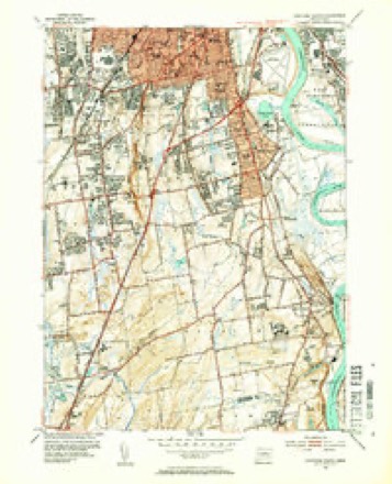
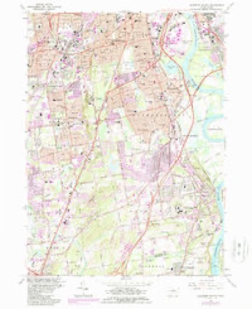
37 topographic sheets cover this place, the earliest surveyed in 1893 and the latest in 1994. It stands in Wethersfield town. It lies in ZIP code area 06109. It stands on Folly Brook. The Survey maps it on the Hartford South quadrangle.
On record in Wethersfield
Buildings and businesses the archive holds for this place. Each opens its own page, with the source record it came from.
On the National Register 5 records
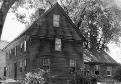 Buttolph-Williams HouseNational Historic Landmark · listed 1968
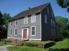 Silas Deane HouseNational Historic Landmark · listed 1970
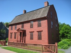 Joseph Webb HouseNational Historic Landmark · listed 1966
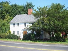 Roger Butler Houselisted 1996
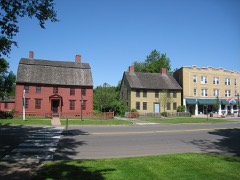 Old Wethersfield Historic Districtlisted 1970
Topographic sheets covering this place
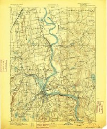
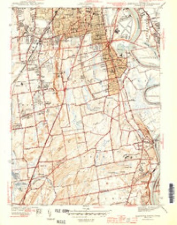
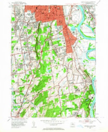
13 surveys from 37 printed sheetsMatched by testing this settlement's coordinate against the published boundary of every sheet in the United States Geological Survey's historical collection. Each opens the scanned sheet at the Survey.
- 1893 USGS Middletown quadrangle1:62500, 10 printings
- 1906 USGS Farmington quadrangle1:125000, 2 printings
- 1944 USGS Hartford South quadrangle1:31680, 3 printings
- 1947 USGS Hartford quadrangle1:250000, 2 printings
- 1948 USGS Hartford quadrangle1:250000, 2 printings
- 1952 USGS Hartford South quadrangle1:24000, 2 printings
- 1952 USGS Hartford South quadrangle1:31680, 2 printings
- 1961 USGS Hartford quadrangle1:250000
- 1962 USGS Hartford quadrangle1:250000, 3 printings
- 1964 USGS Hartford South quadrangle1:24000, 5 printings
- 1965 USGS Hartford quadrangle1:250000, 2 printings
- 1986 USGS Hartford quadrangle1:100000
- 1994 USGS Hartford quadrangle1:100000, 2 printings








In the county-history sources
24,425 words on this townshipThe Memorial History of Hartford County, Connecticut, 1633-1884;, published 1886 names this settlement in its chapter on Wethersfield Town. These are the passages that mention it, exactly as the scans read.
Wethersfield has become almost denuded of its old forests. There is evidence, indeed, that some species had become extinct before the settlement of the town. Trunks and roots of what appear to have been the white cedar (Cupresms thyoides) work upward through the soil of the swale along the east side of the plain east of Broad Street ; but it is not known that this tree has existed here since the advent of white people, and these relics appear to have been submerged for ages. The moon-weed, or thorn-apple (^Datura Stramonium}, which is now quite rarely found, was in 1724 so common as to be a nuisance ; and a bylaw of the town was then passed requiring its annual destruction for the term of four years then next ensuing.
Passage source: The Memorial History of Hartford County, Connecticut, 1633-1884;, published 1886.
When the original settlers of Wethersfield arrived, not only Pyquaug, but a very much larger section, which included it, was under the dominion of Sowheag. He has been called the sachem, or chief, of the Wongunks. This tribe was in possession of a domain whose bounds were not precisely defined. The " Wongum " region included a considerable part of what is now Chatham and South Glastonbury, taking its name from the great bend in the river at Middletown. But members of the tribe in question inhabited the Mattabesett region, which included the southwestern part of Wethersfield ; and there seems to have l3een a sub-tribe, or clan, known as the Mattabesetts.
Passage source: The Memorial History of Hartford County, Connecticut, 1633-1884;, published 1886.
It has been assumed, perhaps correctly, that Sowheag was living at Pyquaug when the white settlers first planted it. De Forest, in his " History of the Indians of Connecticut," assumes this from an expression of the General Court, in April, 1638, which mentions " Soheage, an Indian, the sachem of Pyquaagg ; " but it is not certain that this reference is to liis place of residence at all. He was sachem of Mattabesett at the same time. The writer's belief is that Sowheag lived not at Pyquaug, but in that section of Mattabesett then within Wethersfield limits; to wit, in or near what is now Beckley Quarter, in the great curve of the Mattabesett River. A tract of three hundred acres at this point was bought by Sergeant Richard Beckley from Turramuggus (successor of Sowheag) in 1670 ; and this is the only instance, so far as the writer knows, where land within Wethersfield bounds, and on the west side of the river, was sold by Indians to an individual. There is a plain of several square miles in area lying partly in Rocky Hill and partly in Cromwell (formerly Wethersfield and Middletown), known as Bishop's Plain. In old records of lands it was usually called Beset's Plain ; and in one instance which the writer has seen it was called Amobeset, a name still remembered in that vicinity. It may be that here, or on the Beckley purchase above mentioned, was the part of the township reserved for the Indians in the original agreement of the planters with Sowheag ; and it may be remarked that this ruler, who is sometimes called Sequin, is, wherever his title is given, called " Sachem of Mattabeseck." It was at " Mattabeseck," said the General Court in August, 1639, that he harbored the " guilty persons," members of his tribe, and called down upon him the wrath of that body. But that Indians either dwelt at or frequented Pyquaug is equally evident. Their remains have sometimes been found on the plot which the settlers selected for their biirying-groimd. Their implements of stone are often turned up by the plough. In the south part of Wethersfield, in the vicinity of the grist-mill, many arrow-heads of flint are found, and some of quartz. They are of at least half a dozen different patterns. Hatchets or tomahawks of greenstone trap are not rare among the relics of the stone age of this vicinity. Sowheag's demise was prior to 1664 ; probably some years before. His successor seems to have been Turramuggus ; but he left other children, among whom was Sepanamaw (" squaw ") ; and in the deed of 1671 to Wethersfield, Speunuo, Nabowhee, Weesumpshie, and Waphanke are called his " heirs." A sister of his was mother of Mantowese, and it was in her right that the latter, in 1638, conveyed a part of the Quinnipiac region
Passage source: The Memorial History of Hartford County, Connecticut, 1633-1884;, published 1886.
Machine-read from a century-old scan, so expect the errors a machine makes: misspelled names, dropped words, stray characters.
Read the whole chapter on Wethersfield Town - it names this place 126 more 126 times.
Fires near this place
14 since 1992Regional context, not property-specific evidence. The federal wildfire occurrence database lists 14 fires within 5 miles of Wethersfield between 1992 and 2020, burning about 213 acres in total. None started naturally. 4 were recorded as arson. Distance is straight-line from the map coordinates, so a fire counted here may appear on a neighbouring settlement's page as well.
| Reported cause | Fires |
|---|---|
| Missing data/not specified/undetermined | 4 |
| Arson/incendiarism | 4 |
| Smoking | 2 |
| Debris and open burning | 2 |
| Recreation and ceremony | 1 |
| Power generation/transmission/distribution | 1 |
The most recent of them, most recent first, with the day each was reported and the service that recorded it.
| Date | Cause | Size | Reported by | Name on the report |
|---|---|---|---|---|
| 9 August 2020 | Power generation/transmission/distribution | under an acre | Connecticut Division of Forestry | NAUBUC AVENUE |
| 9 May 2007 | Smoking | under an acre | Connecticut Division of Forestry | not named |
| 7 May 1992 | Arson/incendiarism | 1.5 acres | Connecticut Division of Forestry | not named |
| 4 May 1993 | Missing data/not specified/undetermined | 25 acres | Connecticut Division of Forestry | not named |
| 1 May 1999 | Arson/incendiarism | 44 acres | Connecticut Division of Forestry | not named |
| 30 April 1992 | Arson/incendiarism | 50 acres | Connecticut Division of Forestry | not named |
| 3 April 2011 | Missing data/not specified/undetermined | 2.0 acres | Connecticut Division of Forestry | NEWINGTON |
| 23 April 2016 | Smoking | under an acre | Connecticut Division of Forestry | 175 LOWREY PL, NEWINGTON, CT 06111 |
Settlements close enough to share some of these fires:
Mines and quarries near this place
10 of 26 shownRegional context, not property-specific evidence. The federal mineral resources record lists 26 workings within 5 miles of Wethersfield: 20 past producers, 4 producers, 2 plants. 6 still produce. What was taken out: Stone, Crushed/Broken, Stone, Dimension, Sand and Gravel, Construction, Stone. Distance is straight-line from the map coordinates, so a quarry counted here may appear on a neighbouring settlement's page as well.
| Where | Site | Commodity | Status | Recorded |
|---|---|---|---|---|
| Abbott Ball Co/ Hartford, Ct. | Corundum | Plant | ||
| American Steel & Aluminum/Hartford | Iron | Plant | ||
| Amphibolite Gneiss Rock Quarries No. Cj-014 | Stone | Past Producer | ||
| Feldspar Pegmatite Quarries No. Cj-015 | Feldspar | Past Producer | Feldspar, Quartz | |
| Granite Gneiss Rock Quarries No. Cj-030 | Stone | Past Producer | ||
| Wiarda Quarries | Feldspar | Past Producer | ||
| Dividend Road Pit | Sand and Gravel, Construction | Past Producer | ||
| Glastonbury Town Pit | Sand and Gravel, Construction | Past Producer | ||
| Industrial Park Pit | Sand and Gravel, Construction | Past Producer | ||
| Rocky Hill Pit | Sand and Gravel, Construction | Producer |
Storms near this place
15 since 1994Regional context, not property-specific evidence. The National Weather Service names Wethersfield in 15 storm reports between 1994 and 2025: 9 thunderstorm wind, 3 hail, 1 lightning, 1 tornado. No death or injury is recorded in these reports. Each account below is quoted exactly as the forecast office filed it, from the NOAA Storm Events Database, and each date opens the federal record of that event.
| When | Event | Place named | Harm | What the report says |
|---|---|---|---|---|
| June 2009 | Tornado (EF1) | Wethersfield | $750,000 | A narrow tornado moved through Wethersfield. The NWS storm survey team found damage beginning near the intersection of Nott Street and Park Avenue and continuing southeast into a cornfield along Elm Street, between Maple Street and Interstate 91. ||Along this track, numerous trees were downed. One of these trees fell onto a car on Park Avenue, trapping a person. Another fallen tree blocked the exit ramp of Exit 24 on Interstate 91. Many of these trees were large, healthy oak trees that were sliced in half, sheared off at their bases, or uprooted. One tree fell onto a house with such force it split the house in half. Two of the residents were inside the house at the time, but escaped without injury. One injury indirectly occurred as a result of this tornado, when a split branch high up in a tree fell the following day, striking a person.||In the cornfield at the end of the tornado track, cornstalks were found flattened in a criss-cross pattern. Farther into the cornfield, cornstalks were found to have not been impacted at all by the winds. ||At a sporting goods store along the tornado track, a kayak inside the store was sucked out onto the road through a front window. |
| July 2016 | Thunderstorm Wind | Wethersfield | $15,000 | Trees and wires on Broad Street were downed by thunderstorm winds. |
| July 2023 | Thunderstorm Wind | South Wethersfield | $8,000 | In Wethersfield, several small trees were uprooted, flashing was ripped off a building, and a large bronze landscaping piece was tipped over on Silas Deane Highway. |
| July 2025 | Thunderstorm Wind | Wethersfield | $5,000 | In Wethersfield, a tree fell onto a home on Brimfield Rd. |
| July 2022 | Thunderstorm Wind | Wethersfield | $5,000 | In Wethersfield, multiple wires were down on Olney Road; large branches were down in a backyard on Clearfield Road; wires were down on Harold Street; multiple wires and a branch were down on Olney Road; a branch was down on wires on Church Street; and a branch was on top of the roof of a house on Prospect Street. |
| June 2008 | Lightning | Wethersfield | $2,000 | Lightning struck a transformer on Griswold Avenue setting it on fire. |
| June 2024 | Thunderstorm Wind | Wethersfield | $1,000 | In Wethersfield, a utility pole and power lines were downed. |
| June 2024 | Thunderstorm Wind | Wethersfield | $1,000 | In Wethersfield, trees and wires were down. |
| May 2010 | Thunderstorm Wind | Wethersfield | $1,000 | A tree on Wright Road was downed by thunderstorm winds. |
| July 2021 | Flash Flood | Wethersfield | - | In Wethersfield, urban flash flooding was reported on Crystal, Harding, Greenfield, and Nott Streets, which were impassable. |
| May 2010 | Hail | Wethersfield | - | Quarter to golfball size hail fell on Ridge Road. |
| June 2009 | Hail | Wethersfield | - | Golfball hail fell on Greenwood Street. |
| August 1994 | Thunderstorm Wind | Wethersfield | - | Trees were reported blown down. |
| May 2004 | Hail | Wethersfield | - | no account filed |
| July 1996 | Thunderstorm Wind | Wethersfield | - | no account filed |
Nearest settlements
The eight closest, with where each one stands in the county. Distances are straight-line, computed from the Geographic Names Information System coordinates.
| Map | Place | Distance | Sheets |
|---|---|---|---|
| South Wethersfield | 1.7 miles | 37 | |
| Griswoldville | 1.7 miles | 37 | |
| Hockanum | 2.1 miles | 37 | |
| Naubuc (historical) | 2.3 miles | 37 | |
| Glastonbury | 2.4 miles | 37 | |
| East Hartford Gardens | 2.6 miles | 37 | |
| Glastonbury Center | 3.0 miles | 37 | |
| Welles Village | 3.0 miles | 37 |
Provenance
This settlement is recorded in the Geographic Names Information System as feature 212042. The sheet list is computed by point-in-boundary test against the United States Geological Survey's historical topographic inventory. Both are works of the United States government and carry no copyright under 17 U.S.C. 105.
Wildfire. Short, Karen C. 2022. Spatial wildfire occurrence data for the United States, 1992-2020 [FPA_FOD_20221014]. 6th Edition. Fort Collins, CO: Forest Service Research Data Archive. https://doi.org/10.2737/RDS-2013-0009.6 Collected with United States Government funding and usable without additional permissions or fees.
Mines and quarries. USGS Mineral Resources Data System (MRDS) https://mrdata.usgs.gov/mrds/ A work of the United States government, no copyright under 17 U.S.C. 105.
Storms. NOAA National Centers for Environmental Information, Storm Events Database https://www.ncei.noaa.gov/stormevents/ A work of the United States government, no copyright under 17 U.S.C. 105. Narratives are quoted verbatim from the National Weather Service report and are not edited or summarised.