 Block
Burnside, Connecticut
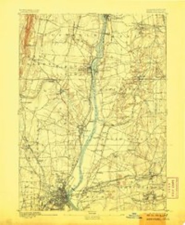
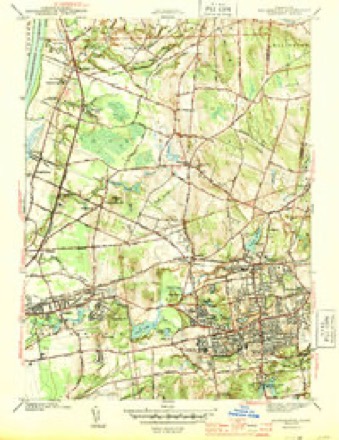
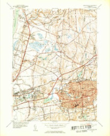
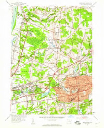
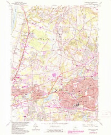
35 topographic sheets cover this place, the earliest surveyed in 1892 and the latest in 1994. It stands in East Hartford town. It lies in ZIP code area 06108. It lies near Wickham Hill. The Survey maps it on the Manchester quadrangle.
On record in Burnside
Buildings and businesses the archive holds for this place. Each opens its own page, with the source record it came from.
On the National Register within a mile 1 record
The National Register names another town for these. They stand within one mile of this settlement's coordinate.
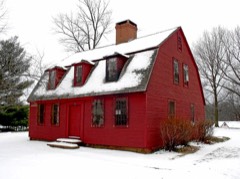 Makens Bemont Houselisted 1982 · 1.0 miles away
Topographic sheets covering this place
14 surveys from 35 printed sheetsMatched by testing this settlement's coordinate against the published boundary of every sheet in the United States Geological Survey's historical collection. Each opens the scanned sheet at the Survey.
- 1892 USGS Hartford quadrangle1:62500, 8 printings
- 1906 USGS Farmington quadrangle1:125000, 2 printings
- 1928 USGS Manchester quadrangle1:24000
- 1944 USGS Manchester quadrangle1:31680, 3 printings
- 1947 USGS Hartford quadrangle1:250000, 2 printings
- 1948 USGS Hartford quadrangle1:250000, 2 printings
- 1952 USGS Manchester quadrangle1:31680, 2 printings
- 1952 USGS Manchester quadrangle1:24000
- 1961 USGS Hartford quadrangle1:250000
- 1962 USGS Hartford quadrangle1:250000, 3 printings
- 1963 USGS Manchester quadrangle1:24000, 5 printings
- 1965 USGS Hartford quadrangle1:250000, 2 printings
- 1986 USGS Hartford quadrangle1:100000
- 1994 USGS Hartford quadrangle1:100000, 2 printings








In the county-history sources
8,320 words on this townshipThe Memorial History of Hartford County, Connecticut, 1633-1884;, published 1886 names this settlement in its chapter on East Hartford Town. These are the passages that mention it, exactly as the scans read.
One of the first roads laid out through the toAvn ran along the edge of the meadow hill, fording the Hockanum at a convenient point not far from the mouth of the present Gulf. Part only of this road is in use to-day. The meadow hill commands a view of Hartford, and was the site of most of the earlier houses. A road from the Connecticut River crossed the meadows to the above-described road, and is the present north-meadow road. From the earliest settlement a road extended northward through the meadows to Podunk and Windsor. Main Street was laid out in 1670. It had no bridge over the Hockanum until the year 1700. Others of our principal roads were not formally made town roads until a later date, though many of them were early used. The road eastward to the mills (now Burnside Avenue) was not laid out until 1722, but was used from the first settlement. Silver Lane was laid out in 1728, but was a thoroughfare earlier. The
Passage source: The Memorial History of Hartford County, Connecticut, 1633-1884;, published 1886.
Grace Church was organized in Burnside in 1854 as a Protestant Episcopal Society. A little chapel south of Mr. Agis Easton's house was fitted up and used. Meetings were afterward held in Elm Hall, on Main Street, and the society was reorganized as St. John's Parish. The stone church on Main Street was begun in 1867, and completed under the fostering care of Mr. John J. McCook, its present rector.
Passage source: The Memorial History of Hartford County, Connecticut, 1633-1884;, published 1886.
The second school-house, in what is now the Centre District, was built near the meeting-house in 1748. This year it was also voted that the schools on Main Street be divided into three parts as nearly as miffht be. A school was granted at the north end of tlie town between Giiman s Brook and John Gilnian's house in 1750 ; and the following year one near the Olcotts and Simonses on Hop Brook, in the Five Miles. On this last date (1751) changes were made in the sites of the schools heretofore established, and four were ordered on Main Street, as follows: one at Hockanum, north of Pewter-Pot Brook on the west road (Hockanum District) ; one near Silver Lane (Second South District) ; one near Bidwell's Lane (now Burnside Avenue) ; one north of Gilman's Brook. The two divisions north of the river were each to take one half of the old school-house on that side, and the two divisions south of the river Avere to divide the old school-house there between them. At the same meeting four additional places for schools w^ere designated in the eastern part of the town and in the Five Miles. The society was divided under the new law of 1766 into districts, - four on Main Street and one in Burnside, - which, under a committee appointed by the society, managed their own affairs. A distinct district was formed of the southeast part of the present town in 1768. This was divided into the Southeast and South Middle Districts in 1857. In 1779 the society divided the two districts north of the Hockanum into three districts, - now the North, Second North, and Centre, - the latter until 1795 including the present Meadow District. Long Hill District, in the northeast corner of the town, was set off in 1819. In 1837 it was made a union district with District No. 6 of South Windsor.
Passage source: The Memorial History of Hartford County, Connecticut, 1633-1884;, published 1886.
Machine-read from a century-old scan, so expect the errors a machine makes: misspelled names, dropped words, stray characters.
Read the whole chapter on East Hartford Town - it names this place 9 more 9 times.
Fires near this place
14 since 1992Regional context, not property-specific evidence. The federal wildfire occurrence database lists 14 fires within 5 miles of Burnside between 1992 and 2020, burning about 214 acres in total. None started naturally. 4 were recorded as arson. Distance is straight-line from the map coordinates, so a fire counted here may appear on a neighbouring settlement's page as well.
| Reported cause | Fires |
|---|---|
| Missing data/not specified/undetermined | 5 |
| Arson/incendiarism | 4 |
| Debris and open burning | 2 |
| Recreation and ceremony | 1 |
| Smoking | 1 |
| Power generation/transmission/distribution | 1 |
The most recent of them, most recent first, with the day each was reported and the service that recorded it.
| Date | Cause | Size | Reported by | Name on the report |
|---|---|---|---|---|
| 9 August 2020 | Power generation/transmission/distribution | under an acre | Connecticut Division of Forestry | NAUBUC AVENUE |
| 20 August 2020 | Missing data/not specified/undetermined | under an acre | Connecticut Division of Forestry | 311 OLCOTT STREET (LANDFILL) |
| 9 May 2007 | Smoking | under an acre | Connecticut Division of Forestry | not named |
| 7 May 1992 | Arson/incendiarism | 1.5 acres | Connecticut Division of Forestry | not named |
| 4 May 1993 | Missing data/not specified/undetermined | 25 acres | Connecticut Division of Forestry | not named |
| 1 May 1999 | Arson/incendiarism | 44 acres | Connecticut Division of Forestry | not named |
| 30 April 1992 | Arson/incendiarism | 50 acres | Connecticut Division of Forestry | not named |
| 23 April 2017 | Missing data/not specified/undetermined | under an acre | Connecticut Division of Forestry | OFF THE RAIL TRAIL BEHIND BOULDER'S CONCRETE |
Settlements close enough to share some of these fires:
Mines and quarries near this place
10 of 24 shownRegional context, not property-specific evidence. The federal mineral resources record lists 24 workings within 5 miles of Burnside: 14 past producers, 8 producers, 1 plant, 1 unknown. 9 still produce. What was taken out: Sand and Gravel, Construction, Clay, Stone, Dimension, Flagstone. Distance is straight-line from the map coordinates, so a quarry counted here may appear on a neighbouring settlement's page as well.
| Where | Site | Commodity | Status | Recorded |
|---|---|---|---|---|
| Abbott Ball Co/ Hartford, Ct. | Corundum | Plant | ||
| K-F Pit | Clay, Stone, Crushed/Broken | Producer | ||
| South Windsor | Bloating Material | Past Producer | Sedimentary | |
| Buckland Sandstone Quarries | Flagstone | Past Producer | ||
| Sandstone Quarry #Ci-009 | Flagstone | Past Producer | ||
| Clay Pits No. Ci-007 | Clay | Producer | Clay | |
| Claypits No. Ci-008 | Clay | Producer | Clay | |
| K-F Pit | Clay | Past Producer | Sedimentary | |
| Sandstone Rock Quarry No. Ci-009 | Stone, Dimension | Past Producer | Conglomerate, Sandstone | |
| Sandstone Rock Quarry No. Ci-010 | Stone, Dimension | Past Producer | Conglomerate, Sandstone |
Storms near this place
1 since 2018Regional context, not property-specific evidence. The National Weather Service names Burnside in 1 storm report in 2018: 1 flood. No death or injury is recorded in these reports. Each account below is quoted exactly as the forecast office filed it, from the NOAA Storm Events Database, and each date opens the federal record of that event.
| When | Event | Place named | Harm | What the report says |
|---|---|---|---|---|
| December 2018 | Flood | Burnside | - | At 2:05 PM EST, multiple cars were trapped in eighteen inches of flood waters at junction of School Street and Prestige Park Road in East Hartford. |
Nearest settlements
The eight closest, with where each one stands in the county. Distances are straight-line, computed from the Geographic Names Information System coordinates.
| Map | Place | Distance | Sheets |
|---|---|---|---|
| East Hartford | 0.3 miles | 35 | |
| Coachlight Village | 0.4 miles | 35 | |
| Mayberry Village | 1.1 miles | 35 | |
| Burnham | 1.5 miles | 35 | |
| Tudor Village | 2.0 miles | 35 | |
| Forest Village | 2.3 miles | 37 | |
| Oxford Village | 2.5 miles | 35 | |
| Hilliardville | 2.8 miles | 35 |
Provenance
This settlement is recorded in the Geographic Names Information System as feature 205856. The sheet list is computed by point-in-boundary test against the United States Geological Survey's historical topographic inventory. Both are works of the United States government and carry no copyright under 17 U.S.C. 105.
Wildfire. Short, Karen C. 2022. Spatial wildfire occurrence data for the United States, 1992-2020 [FPA_FOD_20221014]. 6th Edition. Fort Collins, CO: Forest Service Research Data Archive. https://doi.org/10.2737/RDS-2013-0009.6 Collected with United States Government funding and usable without additional permissions or fees.
Mines and quarries. USGS Mineral Resources Data System (MRDS) https://mrdata.usgs.gov/mrds/ A work of the United States government, no copyright under 17 U.S.C. 105.
Storms. NOAA National Centers for Environmental Information, Storm Events Database https://www.ncei.noaa.gov/stormevents/ A work of the United States government, no copyright under 17 U.S.C. 105. Narratives are quoted verbatim from the National Weather Service report and are not edited or summarised.