 Block
Wolcott, Connecticut
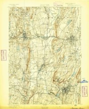
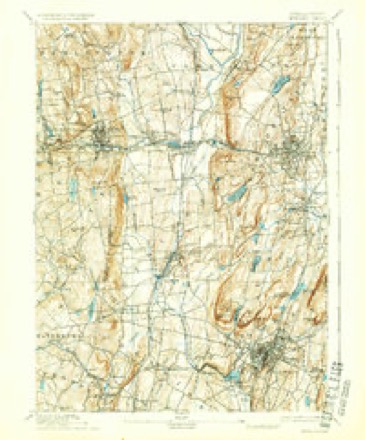
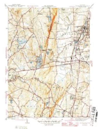
34 topographic sheets cover this place, the earliest surveyed in 1892 and the latest in 1994. It stands in Wolcott town. It lies in ZIP code area 06716. It stands on Break Hill Brook. The Survey maps it on the Southington quadrangle.
On record in Wolcott
Buildings and businesses the archive holds for this place. Each opens its own page, with the source record it came from.
On the National Register 2 records
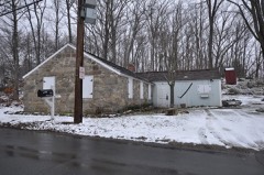 Southwest District Schoollisted 1982
 Wolcott Green Historic Districtlisted 2000
Topographic sheets covering this place
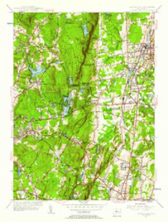
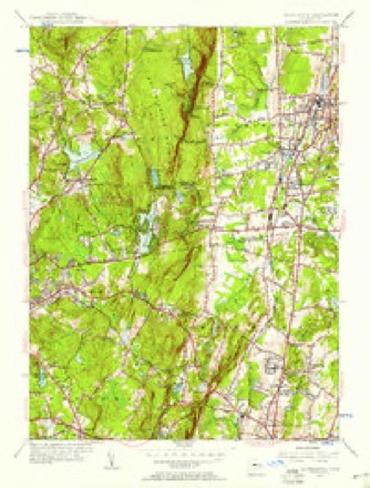
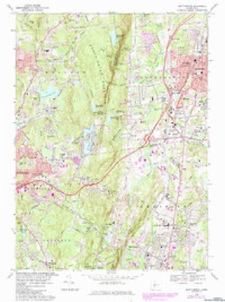
14 surveys from 34 printed sheetsMatched by testing this settlement's coordinate against the published boundary of every sheet in the United States Geological Survey's historical collection. Each opens the scanned sheet at the Survey.
- 1892 USGS Meriden quadrangle1:62500
- 1893 USGS Meriden quadrangle1:62500, 10 printings
- 1906 USGS Farmington quadrangle1:125000, 2 printings
- 1946 USGS Southington quadrangle1:31680
- 1947 USGS Hartford quadrangle1:250000, 2 printings
- 1948 USGS Hartford quadrangle1:250000, 2 printings
- 1955 USGS Southington quadrangle1:31680
- 1955 USGS Southington quadrangle1:24000
- 1961 USGS Hartford quadrangle1:250000
- 1962 USGS Hartford quadrangle1:250000, 3 printings
- 1965 USGS Hartford quadrangle1:250000, 2 printings
- 1968 USGS Southington quadrangle1:24000, 5 printings
- 1986 USGS Hartford quadrangle1:100000
- 1994 USGS Hartford quadrangle1:100000, 2 printings








What happened here
An account from the chapter on Wolcott town. The inset identifies its exact source book and publication year.
Biographical Sketches
Samuel M. Bailey, born in Wolcott, in 1831, is a son of Luther and grandson of James Bailey, who served in the war of the revolution and held a lieutenant's commission. He was twice married, his second wife being Phebe Pomeroy. Their son, Luther, married for his first wife, Henrietta Brockett. They had three children: Samuel M., Sarah and Hobart L., who enlisted in the 7th Connecticut Volunteers and was killed at the battle of the Wilderness.
In the county-history sources
9,291 words on this townshipHistory of New Haven County, Connecticut, published 1892 names this settlement in its chapter on Wolcott Town. These are the passages that mention it, exactly as the scans read.
THE town of Wolcott is in the extreme northern part of the county and on the line separating New Haven county from the towns of Bristol and Southington in Hartford county, and the town of Plymouth, in Litchfield county. South and west is the town of Waterbury. The average length of Wolcott, from north to south, is about six miles; the breadth is a little more than three miles. The general surface is hilly and mountainous. In all the territory there is only one distinct valley - the one extending from Waterbury, on the west, along Mad river. Along that stream and in the northwestern part of the town, is the elevation called Spindle hill, whose highest point is known as Clinton hill. It is claimed that this is one of the highest points of land in this part of the state. From its summit may be seen Long Island, some parts of Massachusetts, and nearly a dozen villages and cities in the surrounding towns. Many other hills in the town approximate Clinton hill in height. Pike's hill in the northeastern part, a point on the Southington mountain, is but a little lower. The Southington mountain extends from the southeastern part of the town along the east line, northward for more than two miles. On the summit the land is comparatively level and some good farms had been opened, but most of them have been abandoned. It takes its name from its location relative to Southington. Some of the other hills were named for those who first lived upon them.
Passage source: History of New Haven County, Connecticut, published 1892.
The land in Wolcott, being originally in the towns of Waterbury and Farmington, was " taken up " or owned by the people of those towns a number of years before any one came here to live as an actual settler. The Waterbury part, by reason of its greater accessibility, the old Farmington path leading through the upper part, was first settled. In 1731 John Alcock or Alcox,* at that time an energetic young man of 26 years, came from New Haven and settled on a tract of land, of 117^ acres, in the western part of Wolcott. He increased his purchase until he owned more than 1,000 acres, and was for a number of years the principal as well as the first settler of the town. At the time of his removal here he had been married about 15 months to Deborah Blakeslee, of North Haven, who thus became the queen bride of Wolcott. Their eldest son, Captain John Alcox, was born December 28th, 1731, and was the first child born in the limits of the town. Eleven more children came to bless their home, and their descendants became numerous and influential. In direct line of descent were Amos Bronson Alcott and Doctor William A. Alcott, who were honored beyond the measure allotted to most men on account of the useful lives they led. The daughters of Bronson Alcott, Louisa A. and May, have been among the most beloved of American women. John Alcox died January 6th, 1777, nearly 72 years of age, but his wife survived him until January 7th, 1789.
Passage source: History of New Haven County, Connecticut, published 1892.
In 1732 Isaac Hopkins settled in the valley east of Chestnut hill, residing on his farm until his death. At Wolcott Center Benjamin Harrison lived as early as 1739, his land adjoining that of Isaac Hopkins. Their neighbors later in the valley southwest of Wolcott Center were: Elijah Frisbie, Howard Pritchard and Eldad Mix, before 1760; Joseph Parker, Joseph Sutliff, Gehulah Grilley and Timothy Scott, before 1770. Thomas Welton, Eliakim Welton and Shadrach Benham settled on Spindle hill some time after 1732. In the neighborhood of Woodtick were as early settlers Judah Frisbie, Amos Seward and the Upsons. Joseph Atkins came to the Mad River valley in 1758; Wait Hotchkiss, Abel Curtiss, Isaac Twitchell and Joseph Beach came to
Passage source: History of New Haven County, Connecticut, published 1892.
Machine-read from a century-old scan, so expect the errors a machine makes: misspelled names, dropped words, stray characters.
Read the whole chapter on Wolcott Town - it names this place 36 more 36 times.
Fires near this place
81 since 1992Regional context, not property-specific evidence. The federal wildfire occurrence database lists 81 fires within 5 miles of Wolcott between 1992 and 2020, burning about 322 acres in total. None started naturally. 23 were recorded as arson. Distance is straight-line from the map coordinates, so a fire counted here may appear on a neighbouring settlement's page as well.
| Reported cause | Fires |
|---|---|
| Missing data/not specified/undetermined | 28 |
| Arson/incendiarism | 23 |
| Debris and open burning | 10 |
| Misuse of fire by a minor | 9 |
| Recreation and ceremony | 8 |
| Smoking | 2 |
| Equipment and vehicle use | 1 |
The most recent of them, most recent first, with the day each was reported and the service that recorded it.
| Date | Cause | Size | Reported by | Name on the report |
|---|---|---|---|---|
| 8 August 2001 | Missing data/not specified/undetermined | under an acre | Connecticut Division of Forestry | not named |
| 7 August 2001 | Missing data/not specified/undetermined | under an acre | Connecticut Division of Forestry | not named |
| 7 August 2001 | Debris and open burning | 1.0 acres | Connecticut Division of Forestry | not named |
| 21 August 2020 | Missing data/not specified/undetermined | 1.4 acres | Connecticut Division of Forestry | FROST BRIDGE ROAD |
| 8 July 2010 | Missing data/not specified/undetermined | under an acre | Connecticut Division of Forestry | not named |
| 7 July 2010 | Recreation and ceremony | 7.5 acres | Connecticut Division of Forestry | not named |
| 11 July 1993 | Misuse of fire by a minor | 2.0 acres | Connecticut Division of Forestry | not named |
| 9 May 1995 | Misuse of fire by a minor | 1.0 acres | Connecticut Division of Forestry | not named |
Settlements close enough to share some of these fires:
Mines and quarries near this place
10 of 20 shownRegional context, not property-specific evidence. The federal mineral resources record lists 20 workings within 5 miles of Wolcott: 11 past producers, 7 producers, 2 unknowns. 7 still produce. What was taken out: Sand and Gravel, Construction, Stone, Dimension, Granite. Distance is straight-line from the map coordinates, so a quarry counted here may appear on a neighbouring settlement's page as well.
| Where | Site | Commodity | Status | Recorded |
|---|---|---|---|---|
| Dunn Granite Gneiss Rock Quarry | Stone, Dimension | Past Producer | Unknown | |
| Dunn Quarry | Granite | Past Producer | ||
| C & C Pit | Sand and Gravel, Construction | Producer | ||
| Colonial Sand & Gravel Co. Pit | Sand and Gravel, Construction | Producer | ||
| Colonial Sand and Gravel Co. Pit | Sand and Gravel, Construction | Past Producer | Sedimentary | |
| Da Pa Pit | Sand and Gravel, Construction | Producer | ||
| F & F Pit | Sand and Gravel, Construction | Producer | ||
| Lucian Pit | Sand and Gravel, Construction | Past Producer | ||
| Mullin Pit | Sand and Gravel, Construction | Past Producer | ||
| New Haven Trap Rock | Sand and Gravel, Construction | Producer |
Storms near this place
22 since 1995Regional context, not property-specific evidence. The National Weather Service names Wolcott in 22 storm reports between 1995 and 2023: 9 thunderstorm wind, 6 flash flood, 3 hail, 3 lightning. No death or injury is recorded in these reports. Each account below is quoted exactly as the forecast office filed it, from the NOAA Storm Events Database, and each date opens the federal record of that event.
| When | Event | Place named | Harm | What the report says |
|---|---|---|---|---|
| May 2010 | Thunderstorm Wind | Wolcott | $35,000 | Four oak trees fell on a home in Wolcott, resulting in extensive damage to the home but no injuries. |
| July 2014 | Tornado (EF0) | Wolcott | $25,000 | A weak EF-0 tornado touched down in Wolcott CT Sunday morning. The path began near the intersection of Minor Road and Center Street where a tree was uprooted and facing west. Convergent, intermittent tree damage continued along a path to the northeast to Wolcott High School. Large fixed sports equipment was thrown across a field and a fence line was blown down to the west. Several trees were also topped. Further to the northeast on Kalko Drive several trees were downed by the tornado and a large tree fell on a trailer. The tornado lifted around Stagecoach Lane where a tree was uprooted and fell to the west onto a home. |
| August 2009 | Lightning | Wolcott | $15,000 | Lightning struck a tree at 84 Greystone Road, passed through rock and stone retaining wall, then struck the home at 92 Greystone Road in Waterbury, causing a minor fire, electrical damage, and some cosmetic damage to the exterior. The force of the strike also caused the dishes to come out of a cabinet at 85 Greystone Road. |
| July 2022 | Thunderstorm Wind | Wolcott | $10,000 | Tree down on house on Averyll Avenue in Wolcott CT. |
| July 2022 | Thunderstorm Wind | Wolcott | $10,000 | Tree down on a house on Hickory Lane in Wolcott CT. |
| July 2009 | Lightning | Wolcott | $8,000 | Lightning struck an apartment complex which started a fire lasting about one hour. No injuries were reported. |
| May 2010 | Thunderstorm Wind | Wolcott | $500 | A tree was downed by strong winds. |
| May 2010 | Thunderstorm Wind | Wolcott | $500 | A tree was downed by strong winds. |
| May 2010 | Thunderstorm Wind | Wolcott | $500 | A tree was downed by strong winds. |
| July 2023 | Flash Flood | Wolcott | - | Spindle Hill Road closed due to flood waters washing out portion of the road. |
| September 2023 | Flash Flood | Wolcott | - | Law enforcement reports that Longmeadow Drive is closed due to flooding. |
| September 2023 | Flash Flood | Wolcott | - | Law enforcement reports that Saddle Road is closed due to flooding. |
| September 2023 | Flash Flood | Wolcott | - | Law enforcement reports that Route 69 in Wolcott closed due to flooding. |
| July 2009 | Flash Flood | Wolcott | - | Many roads were flooded in the Wolcott Township. |
| April 1995 | Thunderstorm Wind | Wolcott | - | A roof was reported blown off a building. |
| July 2012 | Hail | Wolcott | - | no account filed |
| August 2003 | Flash Flood | Wolcott | - | no account filed |
| August 2001 | Thunderstorm Wind | Wolcott | - | no account filed |
| June 1998 | Hail | Wolcott | - | no account filed |
| July 1998 | Lightning | Wolcott | - | no account filed |
| April 1995 | Thunderstorm Wind | Wolcott | - | no account filed |
| May 1995 | Hail | Wolcott | - | no account filed |
Nearest settlements
The eight closest, with where each one stands in the county. Distances are straight-line, computed from the Geographic Names Information System coordinates.
| Map | Place | Distance | Sheets |
|---|---|---|---|
| Woodtick | 1.7 miles | 34 | |
| Lakewood | 2.8 miles | 33 | |
| Burnt Hill | 3.2 miles | 33 | |
| Long Hill | 3.2 miles | 33 | |
| Waterville | 3.5 miles | 33 | |
| Mill Plain | 3.5 miles | 33 | |
| Fairmount | 3.8 miles | 33 | |
| East Farms | 3.9 miles | 34 |
Provenance
This settlement is recorded in the Geographic Names Information System as feature 212212. The sheet list is computed by point-in-boundary test against the United States Geological Survey's historical topographic inventory. Both are works of the United States government and carry no copyright under 17 U.S.C. 105.
Wildfire. Short, Karen C. 2022. Spatial wildfire occurrence data for the United States, 1992-2020 [FPA_FOD_20221014]. 6th Edition. Fort Collins, CO: Forest Service Research Data Archive. https://doi.org/10.2737/RDS-2013-0009.6 Collected with United States Government funding and usable without additional permissions or fees.
Mines and quarries. USGS Mineral Resources Data System (MRDS) https://mrdata.usgs.gov/mrds/ A work of the United States government, no copyright under 17 U.S.C. 105.
Storms. NOAA National Centers for Environmental Information, Storm Events Database https://www.ncei.noaa.gov/stormevents/ A work of the United States government, no copyright under 17 U.S.C. 105. Narratives are quoted verbatim from the National Weather Service report and are not edited or summarised.