BlockBefore
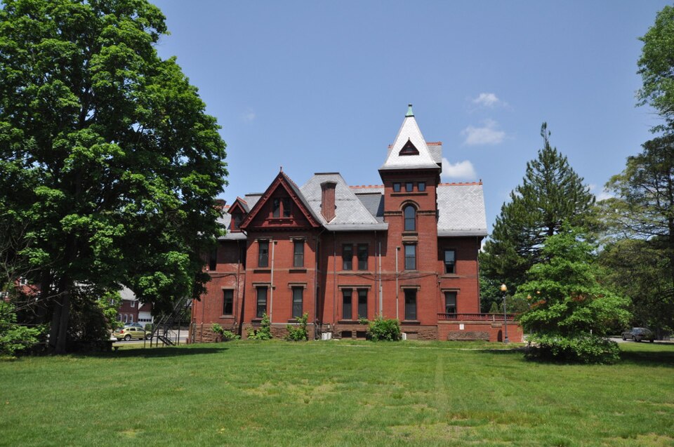
Photograph of Bronson B. Tuttle House
Photograph by Magicpiano, CC BY-SA 4.0. Via Wikimedia Commons.

Bronson B. Tuttle House

Listed on the National Register of Historic Places in 1990.

From the record

“Tuttle House is a historic house at 380 Church Street in Naugatuck, Connecticut. Built in 1879 for a prominent local industrialist, it is a fine example of Queen Anne architecture in brick, and a well-preserved reminder of its 19th century industrial past.”

Wikipedia article Bronson B. Tuttle House, CC BY-SA 4.0.

One of 272 National Register listings published here for New Haven County · listed in 1990 · category: Building.

Sources: the Wikipedia article · the case file at the National Archives · the National Register database, National Park Service


The listing

  • What is counted as historic. The nomination lists 2 buildingss as contributing to the listing.
  • Listed as. Tuttle, Bronson B., House - the National Register files a house under its owner's surname.
  • Address. 380 Church St., Naugatuck, 06770
  • When was it listed? November 1990
  • Category. building
  • Town. Naugatuck town
  • Architectural style. Queen Anne style
  • Architect. Robert W. Hill
  • National Register reference number. 90001803 - the number the National Park Service assigned this property when it was listed, and the key its nomination file is catalogued under at the National Archives.

The ground it stands on

28,216 words

The chapter on Naugatuck Town in History of New Haven County, Connecticut, published 1892 names Naugatuck. This is what it says, exactly as the scans read.

The principal affluents are Hop brook, in the northern part, flowing from Middlebury; Fulling Mill brook, in the northeastern part, flowing from Prospect; Beacon Hill brook, in the southeastern part and south of Hopkins' hill; Spruce brook, in the southwest; and a large brook, flowing from the southern part of Middlebury, bisecting the western half of the town and emptying into the Naugatuck river

Passage source: History of New Haven County, Connecticut, published 1892.

The town was organized in 1844 and took its name from the valley in which it lies. Doctor Anderson says that the term "Naugatuck was originally attached not to the river, but to a place on the river;" and that there was plenty of evidence to show that Naugatuck, or the fishing place, was at Rimmon Falls, where Seymour now stands. The name being applied to the river, at that particular place, was soon given to the entire length, then to the valley and finally to the town.

Passage source: History of New Haven County, Connecticut, published 1892.

Machine-read from a century-old scan, so expect the errors a machine makes: misspelled names, dropped words, stray characters.

Read the whole chapter on Naugatuck Town - 28,216 words on its settlement, mills, schools and churches.

Fires near this property

516 since 1992

Regional context, not property-specific evidence. The federal wildfire occurrence database lists 516 fires within 5 miles of Bronson B. Tuttle House between 1992 and 2020, burning about 1,172 acres in total. None started naturally. 147 were recorded as arson. Distance is straight-line from the map coordinates, so a fire counted here may appear on a neighbouring settlement's page as well.

Reported cause Fires
Missing data/not specified/undetermined220
Arson/incendiarism147
Recreation and ceremony51
Misuse of fire by a minor48
Debris and open burning25
Smoking10
Railroad operations and maintenance8
Equipment and vehicle use6
Power generation/transmission/distribution1

The most recent of them, most recent first, with the day each was reported and the service that recorded it.

DateCause SizeReported by Name on the report
8 September 2000Arson/incendiarismunder an acreConnecticut Division of Forestrynot named
7 September 2004Missing data/not specified/undeterminedunder an acreConnecticut Division of Forestrynot named
6 September 1995Arson/incendiarism3.0 acresConnecticut Division of Forestrynot named
4 September 2017Missing data/not specified/undeterminedunder an acreConnecticut Division of ForestryCHRISTIAN ST
4 September 2009Missing data/not specified/undeterminedunder an acreConnecticut Division of Forestrynot named
3 September 2012Missing data/not specified/undeterminedunder an acreConnecticut Division of ForestryMIDDLEBURY
3 September 2005Debris and open burningunder an acreConnecticut Division of Forestrynot named

Every fire recorded in New Haven County

Mines and quarries near this property

10 of 16 shown

Regional context, not property-specific evidence. The federal mineral resources record lists 16 workings within 5 miles of Bronson B. Tuttle House: 8 producers, 4 past producers, 2 unknowns, 1 occurrence. 9 still produce. What was taken out: Sand and Gravel, Construction, Copper, Iron, Iodine. Distance is straight-line from the map coordinates, so a quarry counted here may appear on a neighbouring settlement's page as well.

Where SiteCommodity StatusRecorded
Bogue MillStone, Crushed/BrokenUnknownSurface
Copper Prospect No. Ek-002Copper, IronOccurrenceDisseminations In Metamor
D & J QuarryStoneProducer
Mariano PitSand and Gravel, Construction, Stone, Crushed/BrokenProducer
Naugatuck PlantIodinePlant
Colonial Sand & Gravel Co. PitSand and Gravel, ConstructionProducer
Colonial Sand and Gravel Co. PitSand and Gravel, ConstructionPast ProducerSedimentary
Falls Road PitSand and Gravel, ConstructionProducer
Finco MineSand and Gravel, ConstructionProducer
Hamden Sand and Gravel Co. PitSand and Gravel, ConstructionPast ProducerSedimentary

Every working recorded in New Haven County

Storms near this property

20 since 1995

Regional context, not property-specific evidence. The National Weather Service names Naugatuck, the town this property stands in, in 20 storm reports between 1995 and 2024: 12 thunderstorm wind, 4 flash flood, 2 lightning, 2 hail. The reports record 2 injuries. Each account below is quoted exactly as the forecast office filed it, from the NOAA Storm Events Database, and each date opens the federal record of that event.

WhenEvent Place namedHarm What the report says
August 1998Thunderstorm WindNaugatuck2 hurtno account filed
June 2011Thunderstorm WindNaugatuck$12,500Numerous trees were reported down in Naugatuck, including a large tree into a house at 384 Hillside Avenue, and another tree on a house at 151 New Street.
July 2009Thunderstorm WindNaugatuck$10,000Numerous trees were downed in Naugatuck. These trees fell on cars, power lines and houses. Power was lost for over eight hours in some locations.
July 2009Thunderstorm WindNaugatuck$10,000Spotter reports indicate downed trees near the off/on ramps of exit 25 on Route 8 North, extending east for about 200 yards to near a commuter parking lot on Cross Street and onto Andrasko Road. Downed trees near the Route 8 ramps were facing toward the north and northwest, while those near the parking lot and on Andrasko Road were oriented east and southeast. Some healthy trees in the damage area were snapped about one-third of the way down from the top. This damage is indicative of a microburst with estimated maximum winds of about 95 mph.
August 2011Thunderstorm WindNaugatuck$7,500Multiple trees and wires were reported down in Naugatuck.
June 2012Thunderstorm WindNaugatuck$1,500A tree and large branches were reported down in Naugatuck.
May 2010Thunderstorm WindNaugatuck$600A 70 foot tall oak tree was downed in Naugatuck.
April 1995Thunderstorm WindNaugatuck$250A roof was blown off one house and two others were damaged.
August 2024Flash FloodNaugatuck-Four buildings along the Naugatuck River are compromised by flooding and are being evacuated.
October 2017Flash FloodNaugatuck-Running flood waters over 6 inches deep were reported flowing across a gas station parking lot and onto a roadway off of Route 63 in Naugatuck.
August 2011HailNaugatuck-Penny to quarter size hail was reported across Naugatuck, including along Route 63.
July 2008HailNaugatuck-Penny size hail was reported covering the ground.
June 2007Thunderstorm WindNaugatuck-Trees downed.
June 2007Flash FloodNaugatuck-Flash flooding also resulted in lane closures on Prospect Street.
July 2007Flash FloodNaugatuck-Thunderstorms produced torrential rain that closed Old Firehouse Road in Naugatuck.
June 2002Thunderstorm WindNaugatuck-no account filed
June 2001Thunderstorm WindNaugatuck-no account filed
January 1999LightningNaugatuck-no account filed
June 1998LightningNaugatuck-no account filed
May 1995Thunderstorm WindNaugatuck-no account filed

Every storm recorded in New Haven County

Map coverage status

No historic map-sheet match is published for this property yet. That does not mean no map exists. This record needs a coordinate-quality review before it can be joined to a sheet boundary. Browse the county's mapped places while that work is pending.

Listed places nearby

6 within 8 miles

Other National Register properties close enough to walk or drive between, ordered by distance from this one. Both positions come from the same geocoding pass that matched these properties to their map sheets.

Photograph PropertyDistance Listed
US Post Office-Naugatuck Main0.2 miles1986
Naugatuck Center Historic District0.2 miles1999
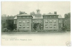
Salem School0.3 miles1983
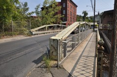
Washington Avenue Bridge3.5 miles2001
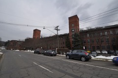
Home Woolen Company3.6 miles1984
Riverside Cemetery3.6 miles1988

Sources for this property

National Archives recordThe nomination case file for reference 90001803 in Record Group 79.
Wikipedia articleCommunity-written account of this property, licensed CC BY-SA.
New Haven CountyAll 272 listed properties in this county.

Provenance

  • Listing record. National Park Service National Register of Historic Places, listed-properties dataset, current to 2026-05-22.
  • Map join. Address geocoded through the United States Census geocoder, then tested against the published boundary of every sheet in the USGS Historical Topographic Map Collection.
  • How this page is made. Listing fields come from federal records; map-sheet coverage is a labelled coordinate-to-boundary calculation, not a source-field claim.
  • Wildfire. Short, Karen C. 2022. Spatial wildfire occurrence data for the United States, 1992-2020 [FPA_FOD_20221014]. 6th Edition. Fort Collins, CO: Forest Service Research Data Archive. https://doi.org/10.2737/RDS-2013-0009.6 Collected with United States Government funding and usable without additional permissions or fees.
  • Mines and quarries. USGS Mineral Resources Data System (MRDS) https://mrdata.usgs.gov/mrds/ A work of the United States government, no copyright under 17 U.S.C. 105.
  • Storms. NOAA National Centers for Environmental Information, Storm Events Database https://www.ncei.noaa.gov/stormevents/ A work of the United States government, no copyright under 17 U.S.C. 105. Narratives are quoted verbatim from the National Weather Service report and are not edited or summarised.