Block
BlockFrom the record
One of 50 National Register listings published here for Lee County · listed in 1995 · category: Building.
Sources: the case file at the National Archives · the National Register database, National Park Service
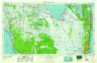
Listed on the National Register of Historic Places in 1995. 7 historic topographic surveys show this location, the earliest from 1956.
One of 50 National Register listings published here for Lee County · listed in 1995 · category: Building.
Sources: the case file at the National Archives · the National Register database, National Park Service
Regional context, not property-specific evidence. The federal wildfire occurrence database lists 279 fires within 5 miles of Olga School between 1992 and 2020, burning about 2,585 acres in total. 85 started naturally. 18 were recorded as arson. Distance is straight-line from the map coordinates, so a fire counted here may appear on a neighbouring settlement's page as well.
| Reported cause | Fires |
|---|---|
| Natural | 85 |
| Railroad operations and maintenance | 52 |
| Missing data/not specified/undetermined | 50 |
| Debris and open burning | 28 |
| Equipment and vehicle use | 22 |
| Arson/incendiarism | 18 |
| Misuse of fire by a minor | 10 |
| Recreation and ceremony | 7 |
| Power generation/transmission/distribution | 4 |
| Fireworks | 2 |
| Smoking | 1 |
The most recent of them, most recent first, with the day each was reported and the service that recorded it.
| Date | Cause | Size | Reported by | Name on the report |
|---|---|---|---|---|
| 9 September 1994 | Natural | under an acre | Florida Forest Service | not named |
| 27 September 2006 | Debris and open burning | under an acre | Florida Forest Service | 36/0506-NOV |
| 25 September 1993 | Railroad operations and maintenance | under an acre | Florida Forest Service | not named |
| 20 September 1996 | Natural | under an acre | Florida Forest Service | not named |
| 12 September 1992 | Natural | 6.0 acres | Florida Forest Service | not named |
| 10 September 1992 | Natural | under an acre | Florida Forest Service | not named |
| 6 August 1992 | Natural | 1.0 acres | Florida Forest Service | not named |
| 31 August 2003 | Missing data/not specified/undetermined | 2.0 acres | Florida Forest Service | 2003-17-1102 |
Regional context, not property-specific evidence. The National Weather Service names Olga, the town this property stands in, in 2 storm reports between 2016 and 2026: 1 thunderstorm wind, 1 funnel cloud. No death or injury is recorded in these reports. Each account below is quoted exactly as the forecast office filed it, from the NOAA Storm Events Database, and each date opens the federal record of that event.
| When | Event | Place named | Harm | What the report says |
|---|---|---|---|---|
| January 2016 | Thunderstorm Wind | Olga | $10,000 | Local law enforcement reported numerous large trees down on West Court Place in Buckingham. |
| April 2026 | Funnel Cloud | Olga | - | Broadcast media relayed video of a funnel cloud near Fort Myers Shores taken from the River Hall Community. |
United States Geological Survey topographic sheets whose coverage includes this point. Matched by taking the coordinate the National Park Service records for this property, then testing that coordinate against the published boundary of every sheet.
Other National Register properties close enough to walk or drive between, ordered by distance from this one. Both positions come from the same geocoding pass that matched these properties to their map sheets.
| Photograph | Property | Distance | Listed |
|---|---|---|---|
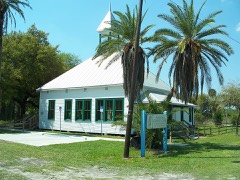 | Buckingham School | 3.4 miles | 1989 |
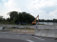 | Menge-Hansen Marine Ways | 5.5 miles | 2009 |
 | Alva Consolidated Schools | 6.4 miles | 1999 |
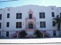 | Tice Grammer School | 7.4 miles | 1999 |
| National Archives record | The nomination case file for reference 95000509 in Record Group 79. |
| Lee County | All 50 listed properties in this county. |