 Block
Dresden, Georgia
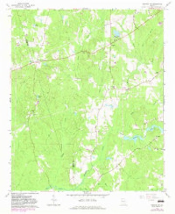
9 topographic sheets cover this place, the earliest surveyed in 1953 and the latest in 1979. It stands in the Newnan census division. It lies in ZIP code area 30263. The Survey maps it on the Newnan SW quadrangle.
Topographic sheets covering this place
5 surveys from 9 printed sheetsMatched by testing this settlement's coordinate against the published boundary of every sheet in the United States Geological Survey's historical collection. Each opens the scanned sheet at the Survey.
- 1953 USGS Atlanta quadrangle1:250000, 2 printings
- 1957 USGS Atlanta quadrangle1:250000
- 1958 USGS Atlanta quadrangle1:250000
- 1965 USGS Newnan SW quadrangle1:24000, 2 printings
- 1979 USGS Griffin quadrangle1:100000, 3 printings




Fires near this place
245 since 1992Regional context, not property-specific evidence. The federal wildfire occurrence database lists 245 fires within 5 miles of Dresden between 1992 and 2019, burning about 1,179 acres in total. 4 started naturally. 24 were recorded as arson. Distance is straight-line from the map coordinates, so a fire counted here may appear on a neighbouring settlement's page as well.
| Reported cause | Fires |
|---|---|
| Debris and open burning | 168 |
| Arson/incendiarism | 24 |
| Missing data/not specified/undetermined | 13 |
| Smoking | 12 |
| Misuse of fire by a minor | 9 |
| Equipment and vehicle use | 8 |
| Recreation and ceremony | 7 |
| Natural | 4 |
The most recent of them, most recent first, with the day each was reported and the service that recorded it.
| Date | Cause | Size | Reported by | Name on the report |
|---|---|---|---|---|
| 7 September 1995 | Smoking | 2.4 acres | Georgia Forestry Commission | not named |
| 29 September 1993 | Debris and open burning | 1.3 acres | Georgia Forestry Commission | not named |
| 25 September 1993 | Debris and open burning | under an acre | Georgia Forestry Commission | not named |
| 23 September 1997 | Debris and open burning | under an acre | Georgia Forestry Commission | not named |
| 18 September 2019 | Debris and open burning | 1.0 acres | Georgia Forestry Commission | FY2020COWETA006 |
| 18 September 2003 | Debris and open burning | under an acre | Georgia Forestry Commission | not named |
| 17 September 2019 | Debris and open burning | 1.0 acres | Georgia Forestry Commission | FY2020COWETA005 |
| 15 September 2019 | Debris and open burning | under an acre | Georgia Forestry Commission | FY2020COWETA003 |
Settlements close enough to share some of these fires:
Mines and quarries near this place
1 within 5 milesRegional context, not property-specific evidence. The federal mineral resources record lists 1 working within 5 miles of Dresden: 1 past producer. None of them still produces. What was taken out: Granite. Distance is straight-line from the map coordinates, so a quarry counted here may appear on a neighbouring settlement's page as well.
| Where | Site | Commodity | Status | Recorded |
|---|---|---|---|---|
| Sam Hill Quarry | Granite | Past Producer |
Storms near this place
22 since 1998Regional context, not property-specific evidence. The National Weather Service names Dresden in 22 storm reports between 1998 and 2026: 16 thunderstorm wind, 2 hail, 2 tornado, 2 flash flood. The reports record 1 injury. Each account below is quoted exactly as the forecast office filed it, from the NOAA Storm Events Database, and each date opens the federal record of that event.
| When | Event | Place named | Harm | What the report says |
|---|---|---|---|---|
| June 1999 | Thunderstorm Wind | Dresden | 1 hurt, $25,000 | A gust front associated with a severe thunderstorm knocked trees and power lines down across Coweta county. At least 3 homes were damaged by falling limbs or trees. One had considerable damage, according to a newspaper report. One tree also fell on a vehicle, with 1 injury reported by the Coweta county EMA. |
| June 2013 | Thunderstorm Wind | Dresden | $60,000 | The Coweta County Emergency Manager reported that around a dozen trees were down across the county. This included Highway 29 North, Payton Road, Griffin Street, Greison Trail, Highway 34 West, Bridgewater Place, Swint Place, Highway 29 South, and Donald Lamb Road. One tree was also reported on a house on Johnson Avenue. |
| October 2020 | Tornado (EF0) | Dresden | $50,000 | A National Weather Service survey team found that an EF0 tornado with maximum wind speeds of 73 mph and a maximum path width of 65 yards travelled 1 mile across the north side of Newnan. The tornado touched down near The Village Center along Highway 29 and moved north causing extensive tree damage before ending in a residential area along Howard Hughes Road. The most extensive damage occurred in the residential area along Howard Hughes Road where some softwood trees were fully uprooted. No injuries were reported. [10/10/20: Tornado #3, County #1/1, EF-0, Coweta, 2020:030]. |
| October 2020 | Thunderstorm Wind | Dresden | $15,000 | The public reported a couple of trees blown down in the 800 block of Happy Valley Circle. One of the trees damaged the porch and roof of a home. |
| April 2016 | Thunderstorm Wind | Dresden | $12,000 | The Coweta County Emergency Manager reported a large tree blown down on a home off of Country Club Road. |
| August 2023 | Thunderstorm Wind | Dresden | $10,000 | Numerous trees and powerlines down along roadways just north of Newnan. |
| May 2003 | Thunderstorm Wind | Dresden | $10,000 | Several reports were received from the public of trees down, some quite large from just west of Newnan to just east of Newnan. The Times-Herald of Newnan reported that trees were down at five major intersections in Newnan. Minor structural damage was also reported. The Times-Herald Building sustained roof damage from the strong winds and the roof was blown off a storage building in Newnan. |
| March 2026 | Thunderstorm Wind | Dresden | $5,000 | Em reports multiple trees down in the area along happy valley cir west to roscoe rd and garden view terrace. |
| January 2026 | Thunderstorm Wind | Dresden | $5,000 | EM reports multiple trees down along howard hughes rd. |
| June 2003 | Flash Flood | Dresden | $5,000 | The Coweta county 911 center reported that there was considerable flooding of roads and bridges across the western and northern portions of the county. Water was flowing over the bridges on Boy Scout Road, Georgia Highway 34, and Robert's Road at Caney Creek. Georgia Highway 34 and Robert's Road were both closed as a result. In the northern portion of the county, Roscoe Road was flooded and closed at Wahoo Creek. One vehicle was swept by flood waters into Yellow Jacket Creek. Rainfall totals in excess of 10 inches were reported from areas north and west of Newnan between Newnan and Roscoe. |
| January 2020 | Thunderstorm Wind | Dresden | $4,000 | The public reported trees and power lines blown down near Happy Valley Estates Drive. |
| July 2010 | Flash Flood | Dresden | $3,000 | A cluster of thunderstorms developed across central Coweta county shortly just after midnight on July 25th and persisted around Newnan for two to three hours. Three to four inches of rain fell in this area during this time frame resulting in flash flooding and flooding of streets and property. Flash flooding was observed along several roads around Newnan, including McCullom-Sharpsburg Road/Georgia Highway 154, Thomason Road, East Broad Street, Jefferson Street, and Postal Parkway. Walt Sanders Road, just off Georgia Highway 34, was closed with one to two feet of water over it as well. Damage was confined to minor debris removal in the flooded areas. |
| August 2024 | Thunderstorm Wind | Dresden | $1,000 | Tree downed at sherwood dr and roscoe rd . |
| December 2024 | Thunderstorm Wind | Dresden | $1,000 | Powerline down on Jackson St in Woodtrail apartment complex. |
| June 2023 | Thunderstorm Wind | Dresden | $1,000 | Emergency manager reported powerlines down at Azalea Dr and Windsor Rd. |
| August 2023 | Thunderstorm Wind | Dresden | $1,000 | A tree was reported down in the vicinity of hwy 29 and The Crescent. |
| June 2019 | Thunderstorm Wind | Dresden | $1,000 | The Coweta County Emergency Manager reported a power line blown down along Country Club Road. |
| April 2002 | Thunderstorm Wind | Dresden | $1,000 | The Coweta county 911 center reported trees down on Smokey Road and Belk Road in the southwest part of the county. |
| May 2003 | Tornado (F0) | Dresden | $500 | An off duty Peachtree City, Georgia National Weather Service employee, along with a survey done by another employee of the National Weather Service Office in Peachtree City, Georgia, and numerous articles and pictures from the Newnan Times Herald, as well as eyewitness accounts from the public, indicated that an F0 tornado touched down very briefly in extreme southwest Coweta county near Powers Crossroads. This was a continuation of the tornado that touched down in Heard county near Whispering Pines. Damage was limited to just a couple of downed trees in the area. National Weather Service doppler radar clearly indicated a tornadic signature in the area. Damage attributable to the tornado was generally limited to several downed trees. |
| July 1999 | Thunderstorm Wind | Dresden | $500 | Coweta county 911 reported trees down west of Newnan. |
| January 2006 | Hail | Dresden | - | The Coweta County 911 Center reported quarter-sized hail in Dresden and the public reported quarter-sized hail just southwest of Newnan. Further east, an off duty National Weather Service employee reported pea-sized hail just east of Thomas Crossroads. |
| April 1998 | Hail | Dresden | - | Several reports were received from the public of hail ranging from dime to golfball size. |
Nearest settlements
The eight closest, with where each one stands in the county. Distances are straight-line, computed from the Geographic Names Information System coordinates.
| Map | Place | Distance | Sheets |
|---|---|---|---|
| Handy | 3.2 miles | 10 | |
| Cedar Trace | 3.3 miles | 10 | |
| Woodsmoke | 3.4 miles | 10 | |
| Stallings Crossroad | 3.4 miles | 9 | |
| Welcome | 3.9 miles | 10 | |
| Pine Hills | 4.5 miles | 10 | |
| Smokey Acres | 5.0 miles | 10 | |
| Wedgewood | 5.0 miles | 10 |
Provenance
This settlement is recorded in the Geographic Names Information System as feature 331588. The sheet list is computed by point-in-boundary test against the United States Geological Survey's historical topographic inventory. Both are works of the United States government and carry no copyright under 17 U.S.C. 105.
Wildfire. Short, Karen C. 2022. Spatial wildfire occurrence data for the United States, 1992-2020 [FPA_FOD_20221014]. 6th Edition. Fort Collins, CO: Forest Service Research Data Archive. https://doi.org/10.2737/RDS-2013-0009.6 Collected with United States Government funding and usable without additional permissions or fees.
Mines and quarries. USGS Mineral Resources Data System (MRDS) https://mrdata.usgs.gov/mrds/ A work of the United States government, no copyright under 17 U.S.C. 105.
Storms. NOAA National Centers for Environmental Information, Storm Events Database https://www.ncei.noaa.gov/stormevents/ A work of the United States government, no copyright under 17 U.S.C. 105. Narratives are quoted verbatim from the National Weather Service report and are not edited or summarised.