 Block
Handy, Georgia
10 topographic sheets cover this place, the earliest surveyed in 1953 and the latest in 1979. It stands in the Newnan census division. It lies in ZIP code area 30263. The Survey maps it on the Whitesburg quadrangle. It stands 850 feet above sea level.
On record in Handy
Buildings and businesses the archive holds for this place. Each opens its own page, with the source record it came from.
On the National Register within a mile 1 record
The National Register names another town for these. They stand within one mile of this settlement's coordinate.
 William Leonard Crowder Home Placelisted 1986 · 0.2 miles away
Topographic sheets covering this place
5 surveys from 10 printed sheetsMatched by testing this settlement's coordinate against the published boundary of every sheet in the United States Geological Survey's historical collection. Each opens the scanned sheet at the Survey.
- 1953 USGS Atlanta quadrangle1:250000, 2 printings
- 1957 USGS Atlanta quadrangle1:250000
- 1958 USGS Atlanta quadrangle1:250000
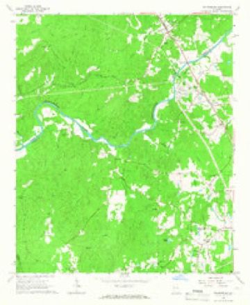
- 1965 USGS Whitesburg quadrangle1:24000, 3 printings
- 1979 USGS Griffin quadrangle1:100000, 3 printings




Fires near this place
194 since 1992Regional context, not property-specific evidence. The federal wildfire occurrence database lists 194 fires within 5 miles of Handy between 1992 and 2019, burning about 1,028 acres in total. 8 started naturally. 22 were recorded as arson. Distance is straight-line from the map coordinates, so a fire counted here may appear on a neighbouring settlement's page as well.
| Reported cause | Fires |
|---|---|
| Debris and open burning | 120 |
| Arson/incendiarism | 22 |
| Smoking | 12 |
| Missing data/not specified/undetermined | 9 |
| Recreation and ceremony | 9 |
| Natural | 8 |
| Equipment and vehicle use | 7 |
| Misuse of fire by a minor | 7 |
The most recent of them, most recent first, with the day each was reported and the service that recorded it.
| Date | Cause | Size | Reported by | Name on the report |
|---|---|---|---|---|
| 7 September 1995 | Smoking | 2.4 acres | Georgia Forestry Commission | not named |
| 29 September 1993 | Debris and open burning | 1.3 acres | Georgia Forestry Commission | not named |
| 23 September 1997 | Debris and open burning | under an acre | Georgia Forestry Commission | not named |
| 17 September 2019 | Debris and open burning | 1.0 acres | Georgia Forestry Commission | FY2020COWETA005 |
| 15 September 2019 | Debris and open burning | under an acre | Georgia Forestry Commission | FY2020COWETA003 |
| 14 September 2019 | Recreation and ceremony | 1.5 acres | Georgia Forestry Commission | FY2020COWETA002 |
| 12 September 1993 | Debris and open burning | under an acre | Georgia Forestry Commission | not named |
| 12 September 1993 | Debris and open burning | under an acre | Georgia Forestry Commission | not named |
Settlements close enough to share some of these fires:
Mines and quarries near this place
1 within 5 milesRegional context, not property-specific evidence. The federal mineral resources record lists 1 working within 5 miles of Handy: 1 past producer. None of them still produces. What was taken out: Gold. Distance is straight-line from the map coordinates, so a quarry counted here may appear on a neighbouring settlement's page as well.
| Where | Site | Commodity | Status | Recorded |
|---|---|---|---|---|
| Hardagree Property | Gold | Past Producer | Stream Placer |
Storms near this place
19 since 1998Regional context, not property-specific evidence. The National Weather Service names Handy in 19 storm reports between 1998 and 2026: 13 thunderstorm wind, 3 hail, 2 tornado, 1 flood. No death or injury is recorded in these reports. Each account below is quoted exactly as the forecast office filed it, from the NOAA Storm Events Database, and each date opens the federal record of that event.
| When | Event | Place named | Harm | What the report says |
|---|---|---|---|---|
| March 2021 | Tornado (EF4) | Handy | $20,000,000 | A National Weather Service survey determined that an EF4 tornado with maximum wind speeds 170 MPH and a maximum path width of 1850 yards occurred in Coweta County. The Heard County tornado crossed into Coweta County along Bob Wilson Road and gained strength as it moved east-northeast crossing JD Walton Road and travelled up Smokey Road with trees falling on some homes. Wind speeds quickly increased to over 150 MPH, EF3 intensity, near Timberland Trail on the southwest side of Newnan. Many homes had major damage and one home had all but the back wall collapse. The family survived with no injuries by taking shelter in their bathtub. The tornado continued east-northeast crossing Smokey Road and Belk Road where it reached its maximum intensity of 170 MPH, EF4 intensity, as it entered the western city limits of Newnan. One home at the end of Fairview Drive had all exterior and interior walls removed. Four homes along Arlington Court north of Lagrange St were destroyed with one having all exterior and interior walls removed, but leaving a vehicle nearly untouched in what was the garage. |As the tornado moved east of Boone Drive, it directly struck Newnan High School and the surrounding athletics fields causing broken windows and doors and extensive roof and structural damage. A portion of the second-story brick wall near the front of the main campus building collapsed. One man died after he suffered a heart attack while trying to reach his daughter's home in a heavily damaged neighborhood after the storm had passed and first responders were unable to reach him due to the large amounts of debris in the area. The tornado weaken from this point onward continuing into the southern part of downtown Newnan, passing directly over the county Justice Center and adjacent administrative building which houses the 911 facility. Extensive roof and window damage along with some interior wind and water damage occurred at the facility. Numerous homes continued to receive damage from winds and falling trees as the tornado moved east-northeast crossing E Broad Street and Greison Trail with 120 to 135 MPH wind speeds. The tornado weakened further as it crossed I-85, causing only minor damage to trees and businesses on the southern end of the Ashley Park shopping center and a hospital. The tornado did re-intensify near the Windsong and White Oak neighborhoods around Shenandoah Boulevard and White Oak Drive east of the Newnan city limits, with max winds of 120 MPH. The tornado continued east-northeast weakening again but still producing damage to trees and power lines, some falling on homes as it crossed Sullivan Road and Lora Smith Road before passing over the Thomas Crossroads area. In neighborhoods south of Andrew Baily Road and north of Highway 34, several homes received damage from falling trees. The tornado continued weakening with more sporadic damage to several trees as it continued east-northeast crossing Fisher Road and Minix Road and moving into Fayette County. [3/25/21: Tornado #2, County #2/3, EF-4, Heard, Coweta, Fayette, 2021:007]. |
| March 2020 | Thunderstorm Wind | Handy | $250,000 | The Coweta County Emergency Manager and several National Weather Service employees reported hundreds of trees and numerous power lines blown down across the county. Dozens of vehicles, homes and other structures were damaged. Over 20,000 customers were without electricity for much of the day with many not seeing power restored until late in the evening or early the next morning. |
| May 2009 | Thunderstorm Wind | Handy | $100,000 | The Coweta County Emergency Management Director reported that more than 100 trees were down across the county. More than a dozen power lines were also down. The majority of the damage was observed across the western and northern part of the county from Handy to north of Madras to near Palmetto, along the Fulton county line. One resident reported that a downburst had occurred in the Handy area where several dozen trees were down at a private residence. Trees down included large pine and oak trees. Some trees were also down in the eastern and southern parts of the county near Newnan, Sharpsburg, and Senoia. No structural damage was reported. Approximately 3000 residents of the county were left without power for a few hours following the storms. |
| April 2006 | Hail | Handy | $100,000 | A large hail storm traveled along the Heard-County line affecting much of far western Coweta county. A storm spotter and the public reported baseball-sized hail in the Powers Crossroads area of southwest Coweta county. Another storm spotter reported quarter-sized hail in Handy north of Powers Crossroads. |
| June 2018 | Thunderstorm Wind | Handy | $25,000 | The Coweta County Emergency Manager reported numerous trees and power lines blown down across the county from the Powers Crossroads and Welcome areas across Newnan and Moreland to the Sharpsburg and Senoia areas. |
| September 2009 | Flood | Handy | $10,000 | USGS stream gages along the Chattahoochee River in the far western portion of the county near the Heard and Carroll county borders indicated that major to record flooding was occurring. Property adjacent to the river was flooded for several days, but no significant damage to roads or property was suffered in Coweta county. Major flooding continued through the early morning hours of the 23rd. Monetary damage was confined to minor debris removal near the river. |
| January 2026 | Thunderstorm Wind | Handy | $5,000 | Multiple trees and powerlines down in the area from smokey rd to franklin rd west of doctor bruce jackson rd and east of the county line. |
| June 2018 | Thunderstorm Wind | Handy | $4,000 | The Coweta County 911 center reported trees blown down around the intersection of Hewlette South Road and Bud Davis Road. The trees fell onto a power line and pole causing a fire on the pole. |
| March 2026 | Thunderstorm Wind | Handy | $3,000 | Em reports several trees down in the area near ga34 and bruce jackson rd. |
| January 2013 | Thunderstorm Wind | Handy | $2,500 | The Coweta County Emergency Manager reported that several trees were blown down, many blocking roads, across the northwest portion of the county. |
| March 2026 | Thunderstorm Wind | Handy | $2,000 | Em reports 2 trees down at bud davis rd and martin girl rd near hewlette south rd. |
| December 2011 | Thunderstorm Wind | Handy | $2,000 | The Coweta County 911 Center reported that several power lines were down on Mount Carmel Road between Arnco-Sargent and Plant Yates. WSR-88D radar data suggests that strong winds or perhaps a mesoscale circulation impacted this area and northeast toward Dunaway Gardens and Roscoe. |
| August 2023 | Thunderstorm Wind | Handy | $1,000 | A tree was reported down near the intersection of Bud Davis Rd and Mount Carmel Rd. |
| June 2023 | Thunderstorm Wind | Handy | $1,000 | Emergency manager reported a tree down at the intersection of Handy Rd and Boy Scout Rd. |
| April 2020 | Thunderstorm Wind | Handy | $1,000 | Report of tree down at the intersection of Sanders-Davis Road and Pierce Chapel Road. |
| May 2024 | Tornado (EF1) | Handy | - | A brief tornado began near Payton Rd and Boone Rd in northwest|Coweta County just east of Chattahoochee Bend State Park, downing|trees, several falling on homes. The tornado traveled east-|southeast along Boone Rd downing additional trees with the most|intense damage with maximum winds estimated at 90 mph occurred|near the 100 block of Boone Rd where dozens of trees were blown|down, some on homes. Fortunately, the tornado lifted shortly|after this time. |
| November 2022 | Thunderstorm Wind | Handy | - | Report of a tree down along Handy Rd near Boy Scout Rd. |
| March 2011 | Hail | Handy | - | The public observed quarter-sized hail in extreme western Coweta county, east of Powers Crossroads and well west of Newnan. |
| May 1998 | Hail | Handy | - | no account filed |
Nearest settlements
The eight closest, with where each one stands in the county. Distances are straight-line, computed from the Geographic Names Information System coordinates.
| Map | Place | Distance | Sheets |
|---|---|---|---|
| Stallings Crossroad | 2.7 miles | 9 | |
| Dresden | 3.2 miles | 9 | |
| Welcome | 5.2 miles | 10 | |
| Woodsmoke | 6.3 miles | 10 | |
| Cedar Trace | 6.4 miles | 10 | |
| Sargent | 6.5 miles | 10 | |
| Arnco Mills | 6.7 miles | 10 | |
| Wedgewood | 7.1 miles | 10 |
Elsewhere
Matched on this settlement's Geographic Names Information System number rather than its name, so it cannot be a different place of the same name in another state.
| Wikipedia article on Handy | An encyclopaedic summary. Its text is share-alike, so it is linked here rather than copied. |
| Wikidata item Q28912735 | The structured record the population and elevation above come from. Public domain (CC0). |
Provenance
This settlement is recorded in the Geographic Names Information System as feature 331904. The sheet list is computed by point-in-boundary test against the United States Geological Survey's historical topographic inventory. Both are works of the United States government and carry no copyright under 17 U.S.C. 105.
Wildfire. Short, Karen C. 2022. Spatial wildfire occurrence data for the United States, 1992-2020 [FPA_FOD_20221014]. 6th Edition. Fort Collins, CO: Forest Service Research Data Archive. https://doi.org/10.2737/RDS-2013-0009.6 Collected with United States Government funding and usable without additional permissions or fees.
Mines and quarries. USGS Mineral Resources Data System (MRDS) https://mrdata.usgs.gov/mrds/ A work of the United States government, no copyright under 17 U.S.C. 105.
Storms. NOAA National Centers for Environmental Information, Storm Events Database https://www.ncei.noaa.gov/stormevents/ A work of the United States government, no copyright under 17 U.S.C. 105. Narratives are quoted verbatim from the National Weather Service report and are not edited or summarised.