 Block
Greenwood, Georgia
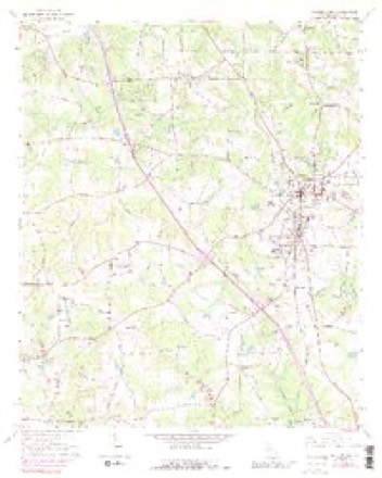
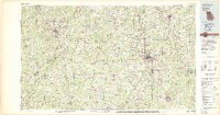
11 topographic sheets cover this place, the earliest surveyed in 1953 and the latest in 1979. It stands in the Locust Grove census division. It lies in ZIP code area 30253. The Survey maps it on the McDonough quadrangle.
Topographic sheets covering this place
5 surveys from 11 printed sheetsMatched by testing this settlement's coordinate against the published boundary of every sheet in the United States Geological Survey's historical collection. Each opens the scanned sheet at the Survey.
- 1953 USGS Atlanta quadrangle1:250000, 2 printings
- 1957 USGS Atlanta quadrangle1:250000
- 1958 USGS Atlanta quadrangle1:250000
- 1964 USGS Mc Donough quadrangle1:24000, 4 printings
- 1979 USGS Griffin quadrangle1:100000, 3 printings



Fires near this place
203 since 1992Regional context, not property-specific evidence. The federal wildfire occurrence database lists 203 fires within 5 miles of Greenwood between 1992 and 2019, burning about 540 acres in total. 5 started naturally. 31 were recorded as arson. Distance is straight-line from the map coordinates, so a fire counted here may appear on a neighbouring settlement's page as well.
| Reported cause | Fires |
|---|---|
| Debris and open burning | 79 |
| Arson/incendiarism | 31 |
| Misuse of fire by a minor | 30 |
| Equipment and vehicle use | 18 |
| Smoking | 18 |
| Missing data/not specified/undetermined | 13 |
| Recreation and ceremony | 5 |
| Natural | 5 |
| Railroad operations and maintenance | 4 |
The most recent of them, most recent first, with the day each was reported and the service that recorded it.
| Date | Cause | Size | Reported by | Name on the report |
|---|---|---|---|---|
| 9 September 1995 | Arson/incendiarism | under an acre | Georgia Forestry Commission | not named |
| 8 September 1997 | Misuse of fire by a minor | under an acre | Georgia Forestry Commission | not named |
| 7 September 2002 | Missing data/not specified/undetermined | 58 acres | Georgia Forestry Commission | FY2003-HENRY-006 |
| 24 September 2011 | Missing data/not specified/undetermined | 5.2 acres | Georgia Forestry Commission | FY2012-HENRY-007 |
| 16 September 1997 | Equipment and vehicle use | under an acre | Georgia Forestry Commission | not named |
| 15 September 2011 | Arson/incendiarism | under an acre | Georgia Forestry Commission | FY2012-HENRY-005 |
| 10 September 1998 | Missing data/not specified/undetermined | under an acre | Georgia Forestry Commission | not named |
| 6 August 1998 | Equipment and vehicle use | 2.1 acres | Georgia Forestry Commission | not named |
Settlements close enough to share some of these fires:
Storms near this place
1 since 2025Regional context, not property-specific evidence. The National Weather Service names Greenwood in 1 storm report in 2025: 1 tornado. The reports record 2 injuries. Each account below is quoted exactly as the forecast office filed it, from the NOAA Storm Events Database, and each date opens the federal record of that event.
| When | Event | Place named | Harm | What the report says |
|---|---|---|---|---|
| May 2025 | Tornado (EF2) | Greenwood | 2 hurt | An EF2 tornado with maximum winds of 135 mph quickly developed|during the afternoon hours of May 29, 2025 in Henry County. A storm which had a|history of very weak and broad rotation moved into the southern part of the county (Henry) and quickly spawned a tornado as it crossed Bethlehem Road|at approximately 3:31pm EDT. Just north of Bethlehem Road, a few|trees were downed to indicate where the tornado first touched|down. As the tornado tracked northeast, it quickly intensified to|EF1 strength, snapping and uprooting trees in a wooded region|behind several homes along Curry Ridge in the Laurel Creek|Subdivision. The tornado reached maximum intensity as it reached|Fresh Laurel Lane in the subdivision. Several homes sustained EF1|damage near the end of the road including significant loss of|siding and shingles, windows blown out, and in one instance,|partial collapse of the roof/wall structure. The last home along|the street is where the tornado reached maximum intensity of EF2.|The home was completely destroyed with the exception of a small|interior closet on the first floor where the clothes were still|hanging. Both occupants of the home were injured, one critically|when he was thrown 287 feet from the house into the nearby woods|according to Henry County EMA. The home demonstrated strength in|the construction with attached baseboards including the use of|clips, however the failure point was in the wall attachment where|the wall studs were only nailed into the baseplate. While a high|end EF2 tornado is determined for this point, there was not enough|evidence to support a higher rating of EF3. Debris was thrown|hundreds of yards to the east and the northeast from the home|including significant portions of the roof, clothing, and a metal|pipe used in A/C unit. To the northeast of the destroyed home, all|the trees that remained in a field being cleared were snapped and|uprooted consistent with high end EF1 and low end EF2 damage. The|tornado continued to the Northeast crossing Academic Parkway|through an apartment complex where EF0 to low end EF1 damage was|noted to the trees and buildings in the area. The tornado then|crossed Interstate 75 at approximately 3:34PM per numerous cell|phone video of the tornado. Trees were downed on the southbound|lane of I75. As the tornado approached Hwy 42, there were several|uprooted trees on the back of an industrial building and a few|trees snapped in the front. The tornado crossed Hwy 42 and began |to weaken with only minor tree damage noted in and around a large |industrial building. The tornado lifted as it crossed Distribution|Drive where small branches and leaf debris was noted. Both radar |and ground truth confirm that the tornado had significantly |weakened as it reached Distribution Drive. The tornado was very |short lived and only on the ground for 1.8 miles and 5 minutes, |but demonstrated how quickly a strong tornado can develop. |
Nearest settlements
The eight closest, with where each one stands in the county. Distances are straight-line, computed from the Geographic Names Information System coordinates.
| Map | Place | Distance | Sheets |
|---|---|---|---|
| Luella | 2.9 miles | 10 | |
| Blacksville | 3.0 miles | 11 | |
| McDonough | 3.9 miles | 11 | |
| Locust Grove | 4.5 miles | 10 | |
| Unity Grove | 5.3 miles | 10 | |
| Mount Carmel Estates | 5.9 miles | 11 | |
| Hampton | 6.1 miles | 11 | |
| Flippen | 6.3 miles | 11 |
Provenance
This settlement is recorded in the Geographic Names Information System as feature 326311. The sheet list is computed by point-in-boundary test against the United States Geological Survey's historical topographic inventory. Both are works of the United States government and carry no copyright under 17 U.S.C. 105.
Wildfire. Short, Karen C. 2022. Spatial wildfire occurrence data for the United States, 1992-2020 [FPA_FOD_20221014]. 6th Edition. Fort Collins, CO: Forest Service Research Data Archive. https://doi.org/10.2737/RDS-2013-0009.6 Collected with United States Government funding and usable without additional permissions or fees.
Storms. NOAA National Centers for Environmental Information, Storm Events Database https://www.ncei.noaa.gov/stormevents/ A work of the United States government, no copyright under 17 U.S.C. 105. Narratives are quoted verbatim from the National Weather Service report and are not edited or summarised.