 Block
Luella, Georgia
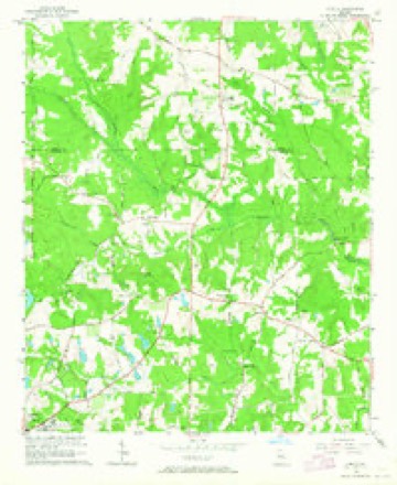
10 topographic sheets cover this place, the earliest surveyed in 1953 and the latest in 1979. It stands in the Hampton census division. It lies in ZIP code area 30248. The Survey maps it on the Luella quadrangle.
Topographic sheets covering this place
5 surveys from 10 printed sheetsMatched by testing this settlement's coordinate against the published boundary of every sheet in the United States Geological Survey's historical collection. Each opens the scanned sheet at the Survey.
- 1953 USGS Atlanta quadrangle1:250000, 2 printings
- 1957 USGS Atlanta quadrangle1:250000
- 1958 USGS Atlanta quadrangle1:250000
- 1964 USGS Luella quadrangle1:24000, 3 printings
- 1979 USGS Griffin quadrangle1:100000, 3 printings



Fires near this place
248 since 1992Regional context, not property-specific evidence. The federal wildfire occurrence database lists 248 fires within 5 miles of Luella between 1992 and 2020, burning about 848 acres in total. 6 started naturally. 42 were recorded as arson. Distance is straight-line from the map coordinates, so a fire counted here may appear on a neighbouring settlement's page as well.
| Reported cause | Fires |
|---|---|
| Debris and open burning | 118 |
| Arson/incendiarism | 42 |
| Misuse of fire by a minor | 20 |
| Smoking | 20 |
| Equipment and vehicle use | 17 |
| Missing data/not specified/undetermined | 14 |
| Recreation and ceremony | 6 |
| Natural | 6 |
| Railroad operations and maintenance | 5 |
The most recent of them, most recent first, with the day each was reported and the service that recorded it.
| Date | Cause | Size | Reported by | Name on the report |
|---|---|---|---|---|
| 7 September 2016 | Debris and open burning | 1.0 acres | Georgia Forestry Commission | FY2017-SPALDING-001 |
| 7 September 2002 | Missing data/not specified/undetermined | 58 acres | Georgia Forestry Commission | FY2003-HENRY-006 |
| 24 September 1993 | Debris and open burning | under an acre | Georgia Forestry Commission | not named |
| 18 September 2011 | Debris and open burning | under an acre | Georgia Forestry Commission | FY2012-SPALDING-010 |
| 14 September 1993 | Arson/incendiarism | 46 acres | Georgia Forestry Commission | not named |
| 13 September 1993 | Arson/incendiarism | 8.0 acres | Georgia Forestry Commission | not named |
| 10 September 1998 | Missing data/not specified/undetermined | under an acre | Georgia Forestry Commission | not named |
| 6 August 1998 | Equipment and vehicle use | 2.1 acres | Georgia Forestry Commission | not named |
Settlements close enough to share some of these fires:
Storms near this place
5 since 1997Regional context, not property-specific evidence. The National Weather Service names Luella in 5 storm reports between 1997 and 2023: 3 hail, 1 tornado, 1 thunderstorm wind. The reports record 18 injuries. Each account below is quoted exactly as the forecast office filed it, from the NOAA Storm Events Database, and each date opens the federal record of that event.
| When | Event | Place named | Harm | What the report says |
|---|---|---|---|---|
| January 2023 | Tornado (EF3) | Luella | 18 hurt | New high-resolution areal imagery in concert with a reanalysis of radar data, areal surveys and ground surveys it has been determined that there were multiple tornadoes on the ground simultaneously in southwest Spalding and Northwestern Pike Counties as well as crossing tornado paths. The tornadoes were part of a larger mesocyclone which can be traced west all the way back to the Selma Alabama tornado. Our analysis determined that this tornado would become the dominant circulation which impacted Griffin and much of Spalding County and Southern Henry County. The tornado first touched down in Northwest Pike County along HWY 362 west of Irish Hill Drive where a few trees were snapped and uprooted and quickly increased in intensity to EF1 as it crossed Kings Bridge Road, Huff Creek Rd and Scott Road where numerous trees were snapped and uprooted. As the storm crossed Blanton Mill Road more severe damage was noted both on the ground and areal survey and it was determined that EF2 damage was present in the area around Nunnally Rd and Bethany Road where widespread snapping of trees occurred and a few structures were severely damaged. However, the updated analysis shows that this area also experienced crossing tornado paths both from this tornado and another which struck the area approximately 2 minutes later. The combination of the 2 paths likely resulted in more intense damage indicators. As the storm continued north into southern Spalding County, the circulation briefly weakened causing only sporadic low end EF0 damage northward along Scott Barch Road. It should also be noted that this circulation would pass into southern Spalding County along Scott Barch Road just 2 minutes ahead of another EF1 tornado to cross its path coming in from the west. The tornado continued north crossing Scott Barch Road and uprooting trees in an area south of Blanton Mill Road. Per both radar data and damage on the ground the tornado would pivot within the larger mesocyclone in an area north of Blanton Mill and begin its track east crossing Rover Zetlla Road destroying a barn. It was near this point the tornado and the wind damage would significantly increase as the tornado was intensifying rapidly. The tornado would quickly reach peak intensity of 150-155 mph and several homes were completely destroyed along Kendall Drive and West Road. 2 homes in particular were noted to be completely destroyed down to the foundation however further inspection of the homes revealed that the walls were not anchored fully anchored into the concrete thus a higher rating could not be determined from those homes. The resident of one of those homes rode out the storm in his bathtub, however the bathtub and all plumbing fixtures were torn away from the slab and tossed into the nearby woods. The survivor of the home was miraculously uninjured and got out to help neighbors. Further west along Kendall Drive several homes were also completely destroyed with several others suffering major damage thus the EF3 rating. The damage along West Road in particular garnered a slight upgrade in the wind speed to high end EF3 damage per a reanalysis. Major to severe damage was also noted along Maloy Road, Hwy 16, areas around Griffin High School, The club at Shoal Creek and North Pine Hill Road. As the tornado approached Hwy 19, per UGA faculty, the UGA facility at Dempsey Farm recorded a wind speed of 81.1 mph before the anemometer/wind combo instrument blew off the tower. The tornado continued ENE through the community of Experiment to the NW of the town of Griffin crossing HWY 92 where numerous business and homes suffered damage either from wind or fallen trees consistent with EF0 through EF1 damage. A weather instrument on the south end of the tornado swath at the UGA Griffin Campus recorded a 73.9 mph wind gust as the storm passed by. Damage in the area was consistent with EF0 type wind damage. The tornado struck a Hobby Lobby building in an around Experiment St and Hwy 92 which suffered severe damage to the roof, and exterior walls on the northeast side. Damage to the building was consistent with EF2 winds of approximately 130 mph. The tornado continued Northeast through the northside of Griffin with mostly EF0-EF1 type wind damage. Pockets of more severe damage were noted along Northside Drive and McIntosh Road consistent with high end EF1 damage. The tornado continued northeast crossing Smoak Road and N. McDonough road where it was noted both on the ground and from the air that the circulation weakened and the damage become more sporadic in nature particularly the area from Amelia rd eastward to I75 in southern Henry County. Once the circulation crossed I75 intensity of the tornado increased to a mid to high end EF1 with damage in the city of Locust Grove. The tornado crossed LG Griffin Road where it impacted numerous homes in a subdivision and snapped or uprooted trees. The storm crossed Stanley K Tanger Road and through another neighborhood affecting several homes including some high end EF1 damage. As the storm crossed Hwy 23 numerous trees were snapped or uprooted and a new TDS appeared on radar. The tornado continued NE across Jackson St, Grove Park Drive, Skyland Dr, S. Unity Grove Road and S Ola grove road snapping and uprooting trees as well as causing EF0 or in some cases EF1 damage to homes. The storm continued ENE snapping and uprooting trees through Peaksville Road where it shortly thereafter become less defined and eventually merged with the circulation/tornado ongoing to the south in the Jenkinsburg area. |
| June 2023 | Thunderstorm Wind | Luella | $1,000 | Tree down on the road near the intersection of Nutt Dr and Hunter Rd. |
| June 2010 | Hail | Luella | - | The public observed hail near quarter-size approximately six miles south of McDonough between Luella and Locust Grove. |
| September 2006 | Hail | Luella | - | The public reported nickel to quarter-sized hail in the southern part of the county, mostly in the Locust Grove area. |
| May 1997 | Hail | Luella | - | no account filed |
Nearest settlements
The eight closest, with where each one stands in the county. Distances are straight-line, computed from the Geographic Names Information System coordinates.
| Map | Place | Distance | Sheets |
|---|---|---|---|
| Greenwood | 2.9 miles | 11 | |
| Locust Grove | 3.7 miles | 10 | |
| Blacksville | 5.9 miles | 11 | |
| Unity Grove | 6.0 miles | 10 | |
| Hampton | 6.0 miles | 11 | |
| Fortson | 6.1 miles | 11 | |
| West Hampton | 6.6 miles | 11 | |
| Woodlawn | 6.6 miles | 11 |
Provenance
This settlement is recorded in the Geographic Names Information System as feature 317476. The sheet list is computed by point-in-boundary test against the United States Geological Survey's historical topographic inventory. Both are works of the United States government and carry no copyright under 17 U.S.C. 105.
Wildfire. Short, Karen C. 2022. Spatial wildfire occurrence data for the United States, 1992-2020 [FPA_FOD_20221014]. 6th Edition. Fort Collins, CO: Forest Service Research Data Archive. https://doi.org/10.2737/RDS-2013-0009.6 Collected with United States Government funding and usable without additional permissions or fees.
Storms. NOAA National Centers for Environmental Information, Storm Events Database https://www.ncei.noaa.gov/stormevents/ A work of the United States government, no copyright under 17 U.S.C. 105. Narratives are quoted verbatim from the National Weather Service report and are not edited or summarised.