 Block
Locust Grove, Georgia
10 topographic sheets cover this place, the earliest surveyed in 1953 and the latest in 1979. It stands in the Locust Grove census division. It lies in ZIP code area 30248. The Survey maps it on the Locust Grove quadrangle. 8,947 people lived here at the 2020 count. It stands 837 feet above sea level.
On record in Locust Grove
Buildings and businesses the archive holds for this place. Each opens its own page, with the source record it came from.
On the National Register 2 records
 Locust Grove Historic Districtlisted 2016
 Locust Grove Institute Academic Buildinglisted 1986
Population over time
2 figuresLocust Grove grew from 5,402 to 8,947 between 2010 and 2020. These are the recorded population figures Wikidata holds for this place, reached through the Geographic Names Information System number this page is keyed on rather than by name, so they belong to this place and not to another of the same name. Most are census counts, but not all are: an early figure may be a founding or settlement estimate, and an estimate published within five years of a census is left out. The change column is computed, and is left blank where more than 20 years separate a figure from the one before it, because a gap that long is not a change between two counts.
| Year | People | Change |
|---|---|---|
| 2010 | 5,402 | |
| 2020 | 8,947 | +3,545 (+66%) |
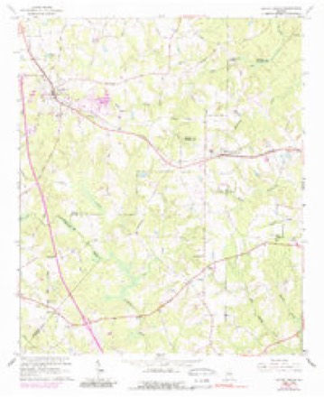
Topographic sheets covering this place
5 surveys from 10 printed sheetsMatched by testing this settlement's coordinate against the published boundary of every sheet in the United States Geological Survey's historical collection. Each opens the scanned sheet at the Survey.
- 1953 USGS Atlanta quadrangle1:250000, 2 printings
- 1957 USGS Atlanta quadrangle1:250000
- 1958 USGS Atlanta quadrangle1:250000
- 1964 USGS Locust Grove quadrangle1:24000, 3 printings
- 1979 USGS Griffin quadrangle1:100000, 3 printings



Fires near this place
248 since 1992Regional context, not property-specific evidence. The federal wildfire occurrence database lists 248 fires within 5 miles of Locust Grove between 1992 and 2020, burning about 594 acres in total. 8 started naturally. 37 were recorded as arson. Distance is straight-line from the map coordinates, so a fire counted here may appear on a neighbouring settlement's page as well.
| Reported cause | Fires |
|---|---|
| Debris and open burning | 117 |
| Arson/incendiarism | 37 |
| Smoking | 20 |
| Misuse of fire by a minor | 19 |
| Missing data/not specified/undetermined | 18 |
| Equipment and vehicle use | 17 |
| Natural | 8 |
| Railroad operations and maintenance | 7 |
| Recreation and ceremony | 5 |
The most recent of them, most recent first, with the day each was reported and the service that recorded it.
| Date | Cause | Size | Reported by | Name on the report |
|---|---|---|---|---|
| 9 September 1995 | Arson/incendiarism | under an acre | Georgia Forestry Commission | not named |
| 6 September 1997 | Debris and open burning | under an acre | Georgia Forestry Commission | not named |
| 24 September 2011 | Missing data/not specified/undetermined | 5.2 acres | Georgia Forestry Commission | FY2012-HENRY-007 |
| 24 September 1993 | Debris and open burning | under an acre | Georgia Forestry Commission | not named |
| 23 September 2005 | Debris and open burning | under an acre | Georgia Forestry Commission | not named |
| 22 September 1993 | Arson/incendiarism | 1.6 acres | Georgia Forestry Commission | not named |
| 20 September 1997 | Debris and open burning | under an acre | Georgia Forestry Commission | not named |
| 15 September 2011 | Arson/incendiarism | under an acre | Georgia Forestry Commission | FY2012-HENRY-005 |
Settlements close enough to share some of these fires:
Storms near this place
28 since 1997Regional context, not property-specific evidence. The National Weather Service names Locust Grove in 28 storm reports between 1997 and 2025: 11 thunderstorm wind, 10 hail, 6 tornado, 1 heavy rain. The reports record 1 injury. Each account below is quoted exactly as the forecast office filed it, from the NOAA Storm Events Database, and each date opens the federal record of that event.
| When | Event | Place named | Harm | What the report says |
|---|---|---|---|---|
| April 1998 | Tornado (F0) | Locust Grove | 1 hurt, $100,000 | The tornado in Spalding county continued into Henry county, but apparently weakened. Sight survey by NWS employees showed numerous trees were downed. Some were pointing toward the west while others were toward the south indicating rotation of the storm. Eight mobile homes in the Indian Creek mobile home park were damaged, mainly from falling trees. The tornado seemed to skirt the southern edge of the mobile home park before lifting. Only one minor injury was reported. |
| March 2009 | Hail | Locust Grove | $1,000,000 | Several reports of large hail were received from the public across southeast Henry county. This was one of two severe thunderstorms to track across the county in the 400 pm to 430 pm EDT time frame. Penny to golf ball-sized hail was reported near Locust Grove with quarter-sized hail near Ola as the storm moved further northeast. |
| November 2002 | Thunderstorm Wind | Locust Grove | $75,000 | The Henry county Emergency Management Director and the Daily Herald of McDonough reported that numerous trees and power lines were blown down across the county, particularly in the central areas east of McDonough and in the Locust Grove area. This was confirmed by a National Weather Service disaster survey. Georgia Highway 42 in Locust Grove and East Knight Road northeast of McDonough were both blocked for several hours because of downed trees. Several roads were blocked in the Lake Dow area, where a tree also fell on a home, damaging the front porch, and crushing two vehicles. |
| April 2017 | Tornado (EF0) | Locust Grove | $50,000 | A National Weather Service survey team found that an EF0 tornado with maximum wind speeds of 85 MPH and a maximum path width of 250 yards touched down in southern Henry County, just south of the Locust Grove community near the intersection of LG Griffin Road and Hartwell Road. The tornado traveled east for less than 2 miles, mainly snapping or uprooting trees. In a neighborhood off Jayley|Parkway, numerous shingles were pulled off of the roof of one residence. Just south of this location, a large tree fell on the corner of a home resulting in significant roof and exterior wall damage. The tornado lifted along Grove Pointe Circle just east of Locust Road. This tornado was associated with the same thunderstorm that produced an EF0 |tornado in Griffin about 20 minutes earlier. No injuries were reported. [04/03/17: Tornado #14, County #1/1, EF-0, Henry, 2017:046]. |
| June 2008 | Thunderstorm Wind | Locust Grove | $30,000 | The Henry County Emergency Management Director reported that several trees were down in the Locust Grove area. A garage was destroyed when a portion of the structure was blown onto an adjacent vehicle on East Harris Drive. The roof was also ripped off a well house and one 30 foot oak tree was blown down. |
| February 2019 | Tornado (EF0) | Locust Grove | $15,000 | A National Weather Service survey team found that an EF0 tornado with a maximum wind speed of 75 mph and a maximum path width of 100 yards touched down in the Locust Grove area of southern Henry County. The tornado snapped or uprooted trees as it moved southeast along the north side of Highway 42 between Barnes Drive and Davis Road. Just before the tornado lifted, the front and side porches of a house were lifted and then collapsed. No injuries were reported. [02/12/19: Tornado #3, County #1/1, EF-0, Henry, 2019:003]. |
| September 2019 | Thunderstorm Wind | Locust Grove | $10,000 | Photos were shared on social media showing wind damage at the Noah's Ark Animal Sanctuary. Some fences and a livestock shelter were damaged and several trees were toppled by the wind. No injuries were reported to any of the animals or people at the sanctuary. |
| June 2025 | Thunderstorm Wind | Locust Grove | $5,000 | A tree was blown onto a shed on Navaho Road near Shawnee Rd. |
| November 2010 | Tornado (EF0) | Locust Grove | $5,000 | A damage survey conducted by the National Weather Service Forecast office in Peachtree City, Georgia confirmed that a second, weaker EF0 tornado touched down within the same quasi-linear convective system that spawned the EF2 tornado in Gwinnett county. This tornado originated in extreme western Butts county approximately four miles southwest of Jenkinsburg, crossed very briefly into extreme eastern Henry county, before crossing back into extreme western Butts county and then lifting immediately thereafter. The tornado literally was only 30 feet or so within the Henry county line. The tornado had a total path length of 2.5 miles, mostly in Butts county. The maximum path width was determined to be 50 yards with maximum wind gusts estimated at 80 mph. Damage in Henry county was confined to a gas station/convenience store, which lost part of its awning. |
| August 2005 | Thunderstorm Wind | Locust Grove | $5,000 | The Henry County Emergency Management Director reported that strong thunderstorm winds caused damage to a rollup door on a warehouse just north of Locust Grove. |
| June 2025 | Thunderstorm Wind | Locust Grove | $3,000 | Three trees on homes in the area near Skyland Lake on the east side of Locust Grove. Including along Jackson St, Grove Park Dr, and Woodridge Rd. |
| July 2017 | Thunderstorm Wind | Locust Grove | $2,000 | Henry County 911 Center reported a tree down at the intersection of L G Griffin Road and Hartwell Road. Time estimated from radar. |
| August 2005 | Thunderstorm Wind | Locust Grove | $2,000 | The public reported that from 8 to 10 trees were blown down at a private residence. No damage was reported to any structures, however. |
| July 2012 | Thunderstorm Wind | Locust Grove | $1,500 | The Henry County 911 Center relayed reports of several downed trees in the Locust Grove area. |
| July 2024 | Thunderstorm Wind | Locust Grove | $1,000 | Tree and branches down near Club Drive and hwy 23. |
| July 2000 | Thunderstorm Wind | Locust Grove | $500 | The public reported a 50 foot pine tree was broken off about 20 feet above the ground. A dogwood tree was also blown down and several other tree limbs were reported down on the same property. |
| May 2025 | Tornado (EF0) | Locust Grove | - | The tornado briefly re entered Henry county before quickly returning to Butts county. |
| May 2025 | Tornado (EF1) | Locust Grove | - | The tornado|continued east crossing Amelia Drive snapping trees before|crossing into Henry County along Collins Drive snapping and|uprooting a few trees. The storm continued ESE crossing Lester|Mill Road snapping a few trees before crossing I75 near LG|Griffin Road. Several trees were snapped along Hossannah Road|which runs along the east side of I75. The storm continued east|within a largely uninhabited area before reaching a neighborhood|along Locust Road, in the community of Locust Grove. Numerous|trees were downed along Locust Road, Grove Pointe Ct, Grove Point|Way, and Grove Point Dr, including several onto homes in that|area. The tornado briefly entered Butts county before re-entering Henry county and returning back to Butts. |
| March 2023 | Hail | Locust Grove | - | Report of Ping Pong size hail near intersection of MLK Jr Blvd and Hwy 23. |
| December 2014 | Heavy Rain | Locust Grove | - | COCORAHS observer reported a 24-hour rainfall total of 3.18 inches. |
| April 2005 | Hail | Locust Grove | - | The public reported penny-sized hail. The hail lasted for a period up to 10 minutes. |
| May 2003 | Hail | Locust Grove | - | A storm spotter reported quarter-sized hail in the southeast side of Locust Grove, while the public reported nickel-sized hail in Locust Grove. |
| April 2002 | Hail | Locust Grove | - | The Henry county 911 center reported dime size hail. |
| May 1999 | Hail | Locust Grove | - | The public reported quarter and dime size hail. |
| May 1999 | Hail | Locust Grove | - | The public reported quarter size hail. |
| November 1997 | Hail | Locust Grove | - | An isolated severe thunderstorm produced dime to quarter size hail from just north of Locust Grove to McDonough. The public reported enough hail to cover the road on I-75 near Locust Grove. |
| June 1998 | Hail | Locust Grove | - | no account filed |
| May 1998 | Hail | Locust Grove | - | no account filed |
Nearest settlements
The eight closest, with where each one stands in the county. Distances are straight-line, computed from the Geographic Names Information System coordinates.
| Map | Place | Distance | Sheets |
|---|---|---|---|
| Unity Grove | 2.9 miles | 10 | |
| Luella | 3.7 miles | 10 | |
| Greenwood | 4.5 miles | 11 | |
| Peeksville | 6.0 miles | 10 | |
| Blacksville | 6.4 miles | 11 | |
| Ola | 7.2 miles | 10 | |
| McDonough | 7.3 miles | 11 | |
| Union | 8.2 miles | 11 |
Elsewhere
Matched on this settlement's Geographic Names Information System number rather than its name, so it cannot be a different place of the same name in another state.
| Wikipedia article on Locust Grove | An encyclopaedic summary. Its text is share-alike, so it is linked here rather than copied. |
| Wikidata item Q2721225 | The structured record the population and elevation above come from. Public domain (CC0). |
Provenance
This settlement is recorded in the Geographic Names Information System as feature 332253. The sheet list is computed by point-in-boundary test against the United States Geological Survey's historical topographic inventory. Both are works of the United States government and carry no copyright under 17 U.S.C. 105.
Wildfire. Short, Karen C. 2022. Spatial wildfire occurrence data for the United States, 1992-2020 [FPA_FOD_20221014]. 6th Edition. Fort Collins, CO: Forest Service Research Data Archive. https://doi.org/10.2737/RDS-2013-0009.6 Collected with United States Government funding and usable without additional permissions or fees.
Storms. NOAA National Centers for Environmental Information, Storm Events Database https://www.ncei.noaa.gov/stormevents/ A work of the United States government, no copyright under 17 U.S.C. 105. Narratives are quoted verbatim from the National Weather Service report and are not edited or summarised.