 Block
North Canton, Georgia
20 topographic sheets cover this place, the earliest surveyed in 1890 and the latest in 1992. It stands in the Canton census division. It lies in ZIP code area 30114. It stands on Puckett Creek. The Survey maps it on the Canton quadrangle.
On record in North Canton
Buildings and businesses the archive holds for this place. Each opens its own page, with the source record it came from.
On the National Register within a mile 6 records
The National Register names another town for these. They stand within one mile of this settlement's coordinate.
 Cherokee County Courthouselisted 1981 · 0.5 miles away
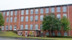 Canton Cotton Mills No. 2listed 2002 · 0.5 miles away
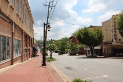 Canton Commercial Historic Districtlisted 1984 · 0.5 miles away
 Canton Wholesale Company Buildinglisted 1997 · 0.6 miles away
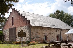 Crescent Farmlisted 1989 · 0.6 miles away
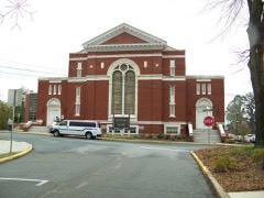 Canton Historic Districtlisted 2010 · 0.8 miles away
Topographic sheets covering this place
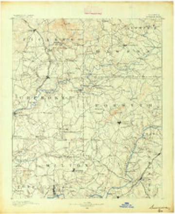
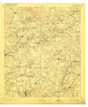
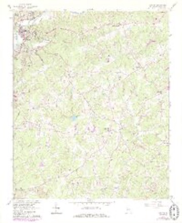
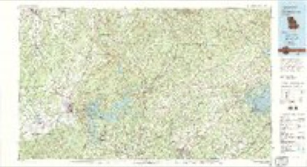
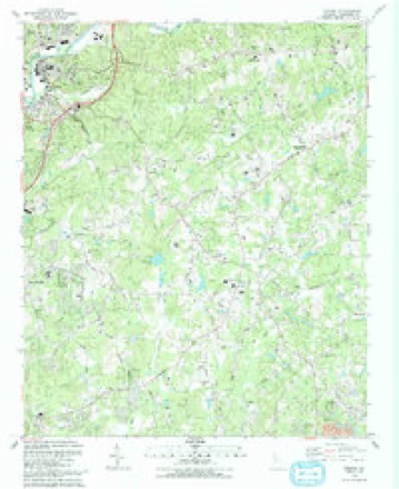
9 surveys from 20 printed sheetsMatched by testing this settlement's coordinate against the published boundary of every sheet in the United States Geological Survey's historical collection. Each opens the scanned sheet at the Survey.
- 1890 USGS Suwanee quadrangle1:125000
- 1894 USGS Suwanee quadrangle1:125000, 6 printings
- 1955 USGS Rome quadrangle1:250000
- 1958 USGS Rome quadrangle1:250000, 3 printings
- 1961 USGS Canton quadrangle1:24000, 4 printings
- 1961 USGS Rome quadrangle1:250000
- 1963 USGS Rome quadrangle1:250000
- 1981 USGS Cartersville quadrangle1:100000, 2 printings
- 1992 USGS Canton quadrangle1:24000




Fires near this place
378 since 1992Regional context, not property-specific evidence. The federal wildfire occurrence database lists 378 fires within 5 miles of North Canton between 1992 and 2020, burning about 868 acres in total. 5 started naturally. 91 were recorded as arson. Distance is straight-line from the map coordinates, so a fire counted here may appear on a neighbouring settlement's page as well.
| Reported cause | Fires |
|---|---|
| Debris and open burning | 144 |
| Arson/incendiarism | 91 |
| Railroad operations and maintenance | 40 |
| Missing data/not specified/undetermined | 28 |
| Misuse of fire by a minor | 25 |
| Equipment and vehicle use | 19 |
| Smoking | 14 |
| Recreation and ceremony | 12 |
| Natural | 5 |
The most recent of them, most recent first, with the day each was reported and the service that recorded it.
| Date | Cause | Size | Reported by | Name on the report |
|---|---|---|---|---|
| 7 September 2016 | Debris and open burning | under an acre | Georgia Forestry Commission | FY2017-CHEROKEE-003 |
| 6 September 2016 | Debris and open burning | 9.6 acres | Georgia Forestry Commission | FY2017-CHEROKEE-002 |
| 6 September 1997 | Missing data/not specified/undetermined | 1.7 acres | Georgia Forestry Commission | not named |
| 5 September 1999 | Equipment and vehicle use | under an acre | Georgia Forestry Commission | not named |
| 4 September 1998 | Arson/incendiarism | 1.0 acres | Georgia Forestry Commission | not named |
| 4 September 1997 | Arson/incendiarism | 50 acres | Georgia Forestry Commission | not named |
| 30 September 2016 | Debris and open burning | 2.0 acres | Georgia Forestry Commission | FY2017-CHEROKEE-004 |
| 29 September 2003 | Misuse of fire by a minor | under an acre | Georgia Forestry Commission | not named |
Settlements close enough to share some of these fires:
Mines and quarries near this place
10 of 23 shownRegional context, not property-specific evidence. The federal mineral resources record lists 23 workings within 5 miles of North Canton: 13 past producers, 4 prospects, 4 occurrences, 2 producers. 2 still produce. What was taken out: Gold, Iron, Sand and Gravel, Construction, Mica. Distance is straight-line from the map coordinates, so a quarry counted here may appear on a neighbouring settlement's page as well.
| Where | Site | Commodity | Status | Recorded |
|---|---|---|---|---|
| Brady Mine | Talc-Soapstone | Past Producer | ||
| Rich Mine | Sulfur-Pyrite, Lead, Zinc | Past Producer | ||
| Rich Mine (Canton Mine) | Copper, Iron-Pyrite | Occurrence | Chalcopyrite | |
| White Property | Barium-Barite | Occurrence | ||
| J B Wheeler Prospect | Mica | Prospect | ||
| R M Reece Prospect | Mica | Prospect | ||
| Blankenship Sand Dredge | Sand and Gravel, Construction | Past Producer | ||
| Blankenship Sand Dredge | Sand and Gravel, Construction | Producer | ||
| Lawson & Quarles Sand | Sand and Gravel, Construction | Producer | ||
| Sand & Gravel Division | Sand and Gravel, Construction | Past Producer |
Storms near this place
18 since 2005Regional context, not property-specific evidence. The National Weather Service names North Canton in 18 storm reports between 2005 and 2024: 15 thunderstorm wind, 2 hail, 1 flash flood. No death or injury is recorded in these reports. Each account below is quoted exactly as the forecast office filed it, from the NOAA Storm Events Database, and each date opens the federal record of that event.
| When | Event | Place named | Harm | What the report says |
|---|---|---|---|---|
| June 2015 | Hail | North Canton | $2,300,000 | The Cherokee County Emergency Manager reported golf ball sized hail at Reinhardt College Parkway and North Etowah Drive. |
| June 2013 | Thunderstorm Wind | North Canton | $75,000 | The Cherokee County Emergency Manager reported that a tree fell on a house on Kennett Street. A tree also fell on a vehicle nearby. |
| March 2013 | Thunderstorm Wind | North Canton | $55,000 | The Cherokee County Emergency Manager reported that a couple of trees were blown along Dr. John T Petit Street in Canton. One tree fell on a house. |
| July 2015 | Thunderstorm Wind | North Canton | $50,000 | The Cherokee County Emergency Manager and numerous members of the public reported a large number of trees blown down across Cherokee County. The hardest hit area was in and around the Orange Shoals subdivision, but damage was reported from North Etowah Drive in Canton to Trenton Lane in Lathemtown. |
| June 2013 | Thunderstorm Wind | North Canton | $30,000 | The Cherokee County Emergency Manager reported that a tree fell on a house on McClain Street in Canton. |
| July 2005 | Flash Flood | North Canton | $25,000 | The Cherokee County Emergency Management Director reported that heavy rain caused flash flooding on Sope and Shoal Creeks, which washed out a couple of county roads. One vehicle was washed away into Shoal Creek. The occupant had to be rescued, but no injuries were reported. |
| July 2024 | Thunderstorm Wind | North Canton | $5,000 | Multiple trees down in the canton area . |
| July 2017 | Thunderstorm Wind | North Canton | $5,000 | The Cherokee County Emergency Manager reported a tree blown down onto a building near the intersection of Shoal Creek Road and Waleska Road. |
| February 2024 | Thunderstorm Wind | North Canton | $4,000 | Several reports of trees down around Canton Ga. Pearidge Rd and Pine Grove Rd, Marietta Rd and Bells Ferry Rd, York Dr, N Brooke Dr and River Estates Pkwy, and Scott Rd and Spring Rd. |
| July 2020 | Thunderstorm Wind | North Canton | $4,000 | The public reported trees blown down from Matthew Drive on the northeast side of Canton to Tom Hulsey Drive and Sweetbriar Court southeast of Canton. |
| August 2024 | Thunderstorm Wind | North Canton | $3,000 | Several trees down in city of canton, including on structure along 300 block of shoals creek rd. |
| May 2024 | Thunderstorm Wind | North Canton | $3,000 | A tree was downed on a house in the 600 block of Waleska Rd. Additional trees were also downed along the 500 block of Waleska Rd and Lakeview Dr. |
| June 2019 | Thunderstorm Wind | North Canton | $3,000 | The Cherokee County Emergency Manager reported trees and power lines blown down across the northern half of the county, including around Lucky Street and Waleska Road in Canton and along Pleasant Union Road. |
| February 2024 | Thunderstorm Wind | North Canton | $2,000 | Trees down at the intersection of Pearidge Rd and Pine Grove Road. |
| February 2024 | Thunderstorm Wind | North Canton | $1,000 | Large tree limbs and branches down greater than 2 inches in diameter near intersection of sr-140 and Waleska Road. Estimated wind gusts to 50 mph. |
| August 2018 | Thunderstorm Wind | North Canton | $1,000 | The Cherokee County Emergency Manager reported a tree blown down blocking all lanes along Puckett Creek Road. |
| August 2012 | Thunderstorm Wind | North Canton | $500 | The Cherokee County Emergency Manager reported a couple of trees were blown down on the east side of Canton along Georgia Highway 20. |
| May 2012 | Hail | North Canton | - | The Cherokee County Emergency Manager reported dime sized hail in East Canton. |
Nearest settlements
The eight closest, with where each one stands in the county. Distances are straight-line, computed from the Geographic Names Information System coordinates.
| Map | Place | Distance | Sheets |
|---|---|---|---|
| Canton | 0.5 miles | 20 | |
| South Canton | 2.0 miles | 22 | |
| Keithsburg | 3.1 miles | 22 | |
| Univeter | 3.3 miles | 22 | |
| Buffington | 3.9 miles | 20 | |
| Harmony | 4.6 miles | 20 | |
| Holly Springs | 4.8 miles | 22 | |
| Avery | 5.0 miles | 20 |
Provenance
This settlement is recorded in the Geographic Names Information System as feature 332513. The sheet list is computed by point-in-boundary test against the United States Geological Survey's historical topographic inventory. Both are works of the United States government and carry no copyright under 17 U.S.C. 105.
Wildfire. Short, Karen C. 2022. Spatial wildfire occurrence data for the United States, 1992-2020 [FPA_FOD_20221014]. 6th Edition. Fort Collins, CO: Forest Service Research Data Archive. https://doi.org/10.2737/RDS-2013-0009.6 Collected with United States Government funding and usable without additional permissions or fees.
Mines and quarries. USGS Mineral Resources Data System (MRDS) https://mrdata.usgs.gov/mrds/ A work of the United States government, no copyright under 17 U.S.C. 105.
Storms. NOAA National Centers for Environmental Information, Storm Events Database https://www.ncei.noaa.gov/stormevents/ A work of the United States government, no copyright under 17 U.S.C. 105. Narratives are quoted verbatim from the National Weather Service report and are not edited or summarised.