 Block
Pasco, Georgia
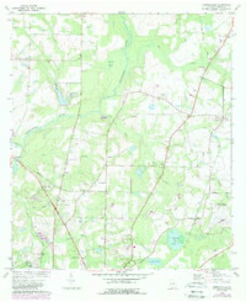
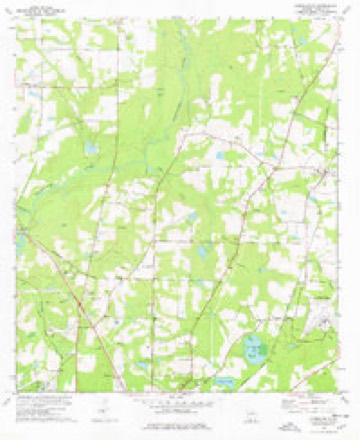
8 topographic sheets cover this place, the earliest surveyed in 1954 and the latest in 1981. It stands in the Thomasville census division. It lies in ZIP code area 31792. It stands on Oquina Creek. The Survey maps it on the Merrillville quadrangle.
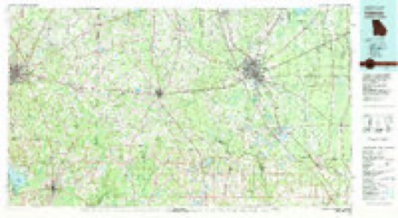
Topographic sheets covering this place
7 surveys from 8 printed sheetsMatched by testing this settlement's coordinate against the published boundary of every sheet in the United States Geological Survey's historical collection. Each opens the scanned sheet at the Survey.
- 1954 USGS Valdosta quadrangle1:250000, 2 printings
- 1957 USGS Thomasville quadrangle1:62500
- 1958 USGS Valdosta quadrangle1:250000
- 1959 USGS Valdosta quadrangle1:250000
- 1975 USGS Merrillville quadrangle1:24000
- 1978 USGS Merrillville quadrangle1:24000
- 1981 USGS Valdosta quadrangle1:100000
Fires near this place
433 since 1992Regional context, not property-specific evidence. The federal wildfire occurrence database lists 433 fires within 5 miles of Pasco between 1992 and 2020, burning about 1,334 acres in total. 6 started naturally. 45 were recorded as arson. Distance is straight-line from the map coordinates, so a fire counted here may appear on a neighbouring settlement's page as well.
| Reported cause | Fires |
|---|---|
| Debris and open burning | 256 |
| Railroad operations and maintenance | 51 |
| Arson/incendiarism | 45 |
| Equipment and vehicle use | 35 |
| Misuse of fire by a minor | 16 |
| Recreation and ceremony | 12 |
| Smoking | 7 |
| Natural | 6 |
| Missing data/not specified/undetermined | 5 |
The most recent of them, most recent first, with the day each was reported and the service that recorded it.
| Date | Cause | Size | Reported by | Name on the report |
|---|---|---|---|---|
| 8 September 1997 | Railroad operations and maintenance | 2.4 acres | Georgia Forestry Commission | not named |
| 8 September 1997 | Railroad operations and maintenance | under an acre | Georgia Forestry Commission | not named |
| 8 September 1997 | Railroad operations and maintenance | under an acre | Georgia Forestry Commission | not named |
| 8 September 1997 | Railroad operations and maintenance | under an acre | Georgia Forestry Commission | not named |
| 6 September 2009 | Equipment and vehicle use | under an acre | Georgia Forestry Commission | not named |
| 5 September 1997 | Debris and open burning | 2.7 acres | Georgia Forestry Commission | not named |
| 4 September 1999 | Debris and open burning | under an acre | Georgia Forestry Commission | not named |
| 30 September 2019 | Debris and open burning | under an acre | Georgia Forestry Commission | FY2020THOMAS010 |
Settlements close enough to share some of these fires:
Mines and quarries near this place
2 within 5 milesRegional context, not property-specific evidence. The federal mineral resources record lists 2 workings within 5 miles of Pasco: 1 past producer, 1 producer. 1 still produces. What was taken out: Sand and Gravel, Construction, Feldspar. Distance is straight-line from the map coordinates, so a quarry counted here may appear on a neighbouring settlement's page as well.
| Where | Site | Commodity | Status | Recorded |
|---|---|---|---|---|
| Thomasville Mine | Sand and Gravel, Construction | Past Producer | ||
| Thomasville Mine & Plant | Feldspar | Producer |
Storms near this place
8 since 2012Regional context, not property-specific evidence. The National Weather Service names Pasco in 8 storm reports between 2012 and 2025: 4 thunderstorm wind, 2 tornado, 1 flash flood, 1 flood. The reports record 3 injuries. Each account below is quoted exactly as the forecast office filed it, from the NOAA Storm Events Database, and each date opens the federal record of that event.
| When | Event | Place named | Harm | What the report says |
|---|---|---|---|---|
| January 2017 | Tornado (EF2) | Pasco | 3 hurt, $250,000 | This tornado was the first of two produced by the same thunderstorm that moved across South Georgia early Sunday morning. The tornado initially touched down just west of US-19 in Thomas County and then moved NE across mainly rural areas of the county. Damage was initially limited in the vicinity of US-19 to snapped and uprooted pine trees. The tornado began to strengthen and produced more significant damage near the vicinity of Crowley and Hall Roads where a home lost a significant amount of roof deck and numerous large trees were snapped and uprooted. Damage in this area was consistent with higher end EF-1 to lower end EF-2 intensity. As the tornado neared US-319 north of Thomasville, extensive areas of snapped pine trees were found along the damage path in some areas several hundred yards wide. Also in the vicinity was a mobile home that was completely destroyed. Damage in this area was consistent with lower end EF-2 intensity. The tornado continued across mainly rural NE Thomas County crossing Centennial Road where a double-wide mobile home was completely destroyed. Damage in this area was consistent with a EF-2 tornado. After this point, damage was mainly limited to significant tree damage along the path, though some structural damage occurred to the NW of Pavo before the tornado crossed into NW Brooks County. Damage along this section of the tornado was rated EF-1. Max winds for the tornado were estimated near 120 mph. Damage cost was estimated. |
| March 2012 | Flash Flood | Pasco | $10,000 | McDonald Road from U.S. Highway 319 North across to Hall Road was washed out and closed due to excessive rainfall of several inches in a short period of time. This was reported initially by the public on the WCTV web page and later verified by Thomas county dispatch. Monetary damage was estimated. |
| April 2023 | Tornado (EF1) | Pasco | $5,000 | The same parent circulation that produced the tornado near Greenwood Plantation produced a second tornado which appears to have first touched down in the Holly Springs neighborhood. Damage was minimal with minor impacts to trees. The tornado remained very weak as it moved northeastward before intensifying near Egg and Butter Road. Numerous trees were snapped and uprooted at this location consistent with an EF-1 tornado with winds of approximately 90 mph. Damage to a barn was caused by falling trees. The tornado dissipated as it crossed Fredonia Road. Thanks to Thomas County EMA for assistance with the damage survey. |
| June 2015 | Thunderstorm Wind | Pasco | $5,000 | Several trees were blown down just north of Thomasville with numerous power lines also down. |
| January 2017 | Thunderstorm Wind | Pasco | $3,000 | Power lines were blown down on Fredonia Road. |
| June 2025 | Thunderstorm Wind | Pasco | - | A tree was down near the intersection of Highway 19 and Hebron Lane. |
| June 2025 | Thunderstorm Wind | Pasco | - | A tree was down near the intersection of Highway 202 and Lillie Lane. |
| March 2024 | Flood | Pasco | - | Minor flooding was reported in the Thomasville area. |
Nearest settlements
The eight closest, with where each one stands in the county. Distances are straight-line, computed from the Geographic Names Information System coordinates.
| Map | Place | Distance | Sheets |
|---|---|---|---|
| Dawesville | 1.0 miles | 12 | |
| Fredonia | 2.6 miles | 8 | |
| Booker Heights | 4.5 miles | 8 | |
| Homestead Park | 4.9 miles | 8 | |
| Dewey City | 5.1 miles | 8 | |
| Thomasville | 5.3 miles | 8 | |
| Ochlocknee | 5.3 miles | 12 | |
| McLoughlin Heights | 5.4 miles | 8 |
Provenance
This settlement is recorded in the Geographic Names Information System as feature 332616. The sheet list is computed by point-in-boundary test against the United States Geological Survey's historical topographic inventory. Both are works of the United States government and carry no copyright under 17 U.S.C. 105.
Wildfire. Short, Karen C. 2022. Spatial wildfire occurrence data for the United States, 1992-2020 [FPA_FOD_20221014]. 6th Edition. Fort Collins, CO: Forest Service Research Data Archive. https://doi.org/10.2737/RDS-2013-0009.6 Collected with United States Government funding and usable without additional permissions or fees.
Mines and quarries. USGS Mineral Resources Data System (MRDS) https://mrdata.usgs.gov/mrds/ A work of the United States government, no copyright under 17 U.S.C. 105.
Storms. NOAA National Centers for Environmental Information, Storm Events Database https://www.ncei.noaa.gov/stormevents/ A work of the United States government, no copyright under 17 U.S.C. 105. Narratives are quoted verbatim from the National Weather Service report and are not edited or summarised.