 Block
Waleska, Georgia
20 topographic sheets cover this place, the earliest surveyed in 1890 and the latest in 1997. It stands in the Waleska census division. It lies in ZIP code area 30183. It stands on Moore Creek. The Survey maps it on the Waleska quadrangle. 921 people lived here at the 2020 count. It stands 2,113 feet above sea level.
Population over time
2 figuresWaleska grew from 644 to 921 between 2010 and 2020. These are the recorded population figures Wikidata holds for this place, reached through the Geographic Names Information System number this page is keyed on rather than by name, so they belong to this place and not to another of the same name. Most are census counts, but not all are: an early figure may be a founding or settlement estimate, and an estimate published within five years of a census is left out. The change column is computed, and is left blank where more than 20 years separate a figure from the one before it, because a gap that long is not a change between two counts.
| Year | People | Change |
|---|---|---|
| 2010 | 644 | |
| 2020 | 921 | +277 (+43%) |
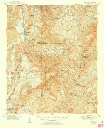
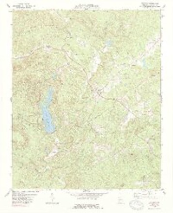
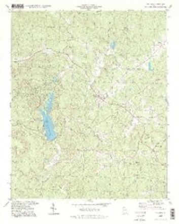
Topographic sheets covering this place
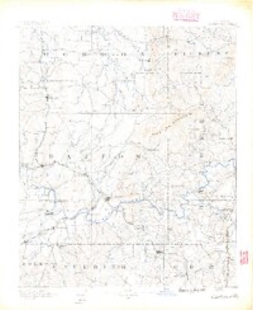
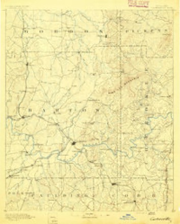
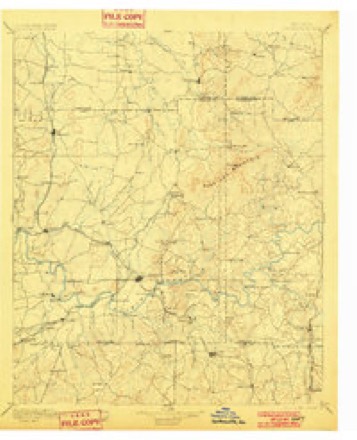
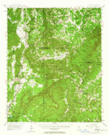
12 surveys from 20 printed sheetsMatched by testing this settlement's coordinate against the published boundary of every sheet in the United States Geological Survey's historical collection. Each opens the scanned sheet at the Survey.
- 1890 USGS Cartersville quadrangle1:125000
- 1891 USGS Cartersville quadrangle1:125000
- 1896 USGS Cartersville quadrangle1:125000, 4 printings
- 1947 USGS Waleska quadrangle1:62500
- 1950 USGS Waleska quadrangle1:62500, 2 printings
- 1955 USGS Rome quadrangle1:250000
- 1958 USGS Rome quadrangle1:250000, 3 printings
- 1961 USGS Rome quadrangle1:250000
- 1963 USGS Rome quadrangle1:250000
- 1974 USGS Waleska quadrangle1:24000, 2 printings
- 1981 USGS Cartersville quadrangle1:100000, 2 printings
- 1997 USGS Waleska quadrangle1:24000




Fires near this place
218 since 1992Regional context, not property-specific evidence. The federal wildfire occurrence database lists 218 fires within 5 miles of Waleska between 1992 and 2020, burning about 776 acres in total. 8 started naturally. 43 were recorded as arson. Distance is straight-line from the map coordinates, so a fire counted here may appear on a neighbouring settlement's page as well.
| Reported cause | Fires |
|---|---|
| Debris and open burning | 114 |
| Arson/incendiarism | 43 |
| Missing data/not specified/undetermined | 17 |
| Equipment and vehicle use | 11 |
| Smoking | 10 |
| Misuse of fire by a minor | 9 |
| Natural | 8 |
| Recreation and ceremony | 6 |
The most recent of them, most recent first, with the day each was reported and the service that recorded it.
| Date | Cause | Size | Reported by | Name on the report |
|---|---|---|---|---|
| 8 September 1997 | Debris and open burning | under an acre | Georgia Forestry Commission | not named |
| 6 September 1993 | Arson/incendiarism | under an acre | Georgia Forestry Commission | not named |
| 4 September 1998 | Arson/incendiarism | 1.0 acres | Georgia Forestry Commission | not named |
| 30 September 2016 | Debris and open burning | 2.0 acres | Georgia Forestry Commission | FY2017-CHEROKEE-004 |
| 30 September 1997 | Arson/incendiarism | under an acre | Georgia Forestry Commission | not named |
| 30 September 1994 | Debris and open burning | under an acre | Georgia Forestry Commission | not named |
| 22 September 1997 | Arson/incendiarism | under an acre | Georgia Forestry Commission | not named |
| 22 September 1997 | Arson/incendiarism | under an acre | Georgia Forestry Commission | not named |
Settlements close enough to share some of these fires:
Mines and quarries near this place
6 within 5 milesRegional context, not property-specific evidence. The federal mineral resources record lists 6 workings within 5 miles of Waleska: 5 past producers, 1 occurrence. None of them still produces. What was taken out: Iron, Talc-Soapstone, Barium-Barite. Distance is straight-line from the map coordinates, so a quarry counted here may appear on a neighbouring settlement's page as well.
| Where | Site | Commodity | Status | Recorded |
|---|---|---|---|---|
| Brady Mine | Talc-Soapstone | Past Producer | ||
| White Property | Barium-Barite | Occurrence | ||
| Chattahoochee Iron Property | Iron | Past Producer | ||
| Cherokee Iron Mine | Iron | Past Producer | Residual | |
| Cherokee Iron Mine | Iron | Past Producer | ||
| Unnamed, Chattahoochee Fe Property | Iron | Past Producer | Residual |
Storms near this place
60 of 82 shownRegional context, not property-specific evidence. The National Weather Service names Waleska in 82 storm reports between 1994 and 2025: 48 thunderstorm wind, 24 hail, 4 tornado, 3 lightning. The reports record 4 injuries. Each account below is quoted exactly as the forecast office filed it, from the NOAA Storm Events Database, and each date opens the federal record of that event.
| When | Event | Place named | Harm | What the report says |
|---|---|---|---|---|
| June 2013 | Tornado (EF1) | Waleska | 2 hurt, $60,000 | A National Weather Service storm survey team determined that an EF-1 tornado touched down near the intersection of Patriot Trail and Rampley Trail, causing mainly tree damage as it headed southeast toward Canton. Along Marietta Road and Hickory Flat Highway, a Chevron gas station sustained roof damage, and a gas pump was blown over. Dozens of trees were snapped or uprooted. The tornado then headed south-southeast causing additional tree damage, lifting near the intersection of New Light Road and Hickory Road. Two minor injuries occurred in Canton as a result of trees falling.|[06/13/13: Tornado #1, County #1-1, EF1, Cherokee, 2013:011]. |
| February 2011 | Thunderstorm Wind | Waleska | 1 hurt, $500,000 | The Cherokee County Emergency Management Director reported that dozens of trees were down across the county from strong straight-line thunderstorm winds, including areas around Waleska, Ball Ground, Canton, and Woodstock. A total of 15 homes across the county were damaged from downed trees, including two with major damage and four others with moderate damage. A middle-aged female was injured at one of the badly damaged homes when a large pine tree fell on her home. Amateur radio operators reported that the back wall of a building on Cherokee Drive in Ball Ground was blown down. Widespread power outages were also observed, especially in the Woodstock area. |
| August 2002 | Lightning | Waleska | 1 hurt | The Cherokee county 911 center reported that lightning struck near a security guard. While it was not a direct hit, the lightning was in close enough proximity to cause the man to become weak, have a rapid heart beat, and have difficulty breathing. |
| November 2002 | Tornado (F2) | Waleska | $1,800,000 | A National Weather Service disaster survey team and the Cherokee county Emergency Manager Director observed a 6-mile long path of damage, beginning near Beasley Gap in northwest Cherokee county, then continuing east-northeast toward the town of Worley Crossroads on the Pickens county border. While much of the damage along the path was determined as straight line wind damage with speeds of at least 70 mph, there was definite indication of a multi-segmented tornado. The most significant tornado damage occurred on Salacoa Road near Beasley Gap, where the tornado damage was classified as F2. The damage path was approximately 627 yards wide at its widest point, but the tornadic portion of this damage was limited to around 100 yards wide. Two homes were completely destroyed, three were severely damaged, and six were moderately damaged. Numerous trees and power lines were down along and near the damage path as well. Some livestock was also killed during the event. Cherokee county was one of five counties declared in a state of emergency by the governor. |
| June 2007 | Hail | Waleska | $1,400,000 | The Cherokee County Emergency Management Director reported golf ball-sized hail. |
| August 2008 | Hail | Waleska | $1,000,000 | WSB TV of Atlanta relayed a report of golf ball-sized hail from northwest Cherokee county, northwest of Waleska. The Waleska Fire and Rescue Department as well as the public observed penny, nickel, and quarter-sized hail across northwest and west central Cherokee county, from northwest to southwest of Waleska and west of Canton. Multiple thunderstorm cells tracked across the western two-thirds of the county during this time frame. |
| February 2008 | Thunderstorm Wind | Waleska | $400,000 | The Cherokee County Emergency Management Director reported that thunderstorm straight-line winds of 58 to 65 mph caused extensive damage across many parts of Cherokee county, but especially the central and southern sections of the county. Numerous trees and power lines were down, especially in the central and southern areas of the county. One home was destroyed when a large pine tree crashed through the home, three other homes had moderate damage, and five sustained minor damage. A barn also suffered moderate damage and two automobiles were destroyed when trees fell on the vehicles. |
| June 2005 | Lightning | Waleska | $250,000 | The Cherokee Tribune reported that a two-story home on Little Refuge Road near Lake Arrowhead in northwest Cherokee county was completely destroyed as a result of a fire started by a lightning strike. |
| April 2007 | Thunderstorm Wind | Waleska | $200,000 | The Cherokee Tribune reported that strong straight-line winds caused considerable damage in the Clayton Estates Community off Lower Burris road in north central Cherokee county. A chicken house was destroyed and another was damaged. A county school bus was destroyed when a large tree fell on the vehicle crushing the bus parked in the driver's yard. Several other large trees were down in the area. |
| June 2011 | Thunderstorm Wind | Waleska | $150,000 | The Cherokee County Emergency Management Director reported that nearly three dozen trees were down across the county from northwest of Waleska to south of Canton. Several power lines were down as a result of downed trees as well. At least two homes sustained damage from downed trees and at least three vehicles were damaged, also from downed trees. This included one truck, which while being driven, had a tree and adjacent power line fall on it. No injuries were reported from this event. Some roads were blocked from downed trees and power lines, including Riverston Pkwy., Gault Road and N. Victoria Rd. |
| July 2017 | Thunderstorm Wind | Waleska | $30,000 | The Cherokee County Emergency Manager reported numerous trees and some power lines blown down from south of Waleska to Free Home. Locations include Sam Nelson Road between Nelson trail and Rampley Trail where one tree fell on a house, Reinhardt College Parkway where a tree fell on a house, Shoal Creek Road at Whispering Woods Drive, Upper Union Hill Road at Henson Way, and Wyatt Road at Smithwick Road. No injuries were reported. |
| July 2012 | Thunderstorm Wind | Waleska | $15,000 | The Cherokee County Emergency Manager reported that over 50 trees were blown down along with at least four power lines in an area northeast of Waleska. |
| August 2010 | Flash Flood | Waleska | $15,000 | The Cherokee County Emergency Management Director reported flash flooding along Byrd Creek, five miles north-northwest of Canton, and along Shoal Creek, one mile west-northwest of Waleska. At least three feet of water from Byrd Creek was overflowing Sardis Circle north-northwest of Canton, and approximately a foot of water was flowing over George Gray Lane, just west-northwest of Waleska. Minor erosion to the roads was observed, along with subsequent debris removal. |
| August 1996 | Thunderstorm Wind | Waleska | $8,000 | no account filed |
| June 2020 | Thunderstorm Wind | Waleska | $7,000 | The Cherokee County Emergency Manager reported trees and power lines blown down along Old Mill Lane. |
| April 2011 | Thunderstorm Wind | Waleska | $7,000 | The Cherokee County Emergency Management Director reported that several trees were down in the far northwest part of the county, especially around the Salacoa Valley area. |
| July 2015 | Thunderstorm Wind | Waleska | $6,000 | The Cherokee County Emergency Manager and the 911 Center reported trees blown down from around Little Refuge Road and Highway 140 to Ball Ground. |
| May 2025 | Thunderstorm Wind | Waleska | $5,000 | Emergency manager reported several trees down near the intersection of Hwy 140 and Garland Mountain Trail. |
| May 2025 | Thunderstorm Wind | Waleska | $5,000 | Multiple trees down along rockhouse road near salacoa road. |
| June 2025 | Thunderstorm Wind | Waleska | $5,000 | The Emergency Manager relayed reports of downed trees along Fincher Road near Lost Town Trail and Ruff White Road. |
| May 2024 | Thunderstorm Wind | Waleska | $5,000 | Multiple trees were downed in northern cherokee county, including in the 2000 block of pleasant Union rd, on Fincher Rd at Upper Burris Rd, on Upper Bethany Rd at Stancil Rd, and in the 300 block of Dixon Rd. |
| July 2018 | Thunderstorm Wind | Waleska | $5,000 | A portion of a roof was damaged in the 1000 block of Ammons Road. Time estimated from radar. |
| July 2017 | Thunderstorm Wind | Waleska | $5,000 | The Cherokee County Emergency Manager reported trees and power lines blown down across the far northern portion of the county from northwest of Waleska to northwest of Ball Ground. Locations include along Reinhardt College Parkway near Garland Mountain Trail, Upper Dowda Road at Lower Dowda Road, and Arnold Spence Road. |
| August 2015 | Thunderstorm Wind | Waleska | $5,000 | The Cherokee County Emergency Manager reported several trees blown down in the Waleska and Ball Ground areas. |
| January 2013 | Thunderstorm Wind | Waleska | $5,000 | The Cherokee County Emergency Manager reported that numerous trees were blown down near Burris and Sardis Roads. |
| March 2008 | Thunderstorm Wind | Waleska | $5,000 | The Cherokee County Emergency Management Director reported that several trees and power lines were down across the county from the northwest part of the county, west-northwest of Waleska, to the southeast part of the county, just southeast of Canton. No structures were damaged. |
| June 2007 | Lightning | Waleska | $5,000 | The Cherokee County Emergency Management Director reported that lightning struck a home and set it on fire. |
| November 2004 | Thunderstorm Wind | Waleska | $5,000 | A damage survey conducted by the Cherokee County Emergency Management Director reported that dozens of trees were blown down in a rural area near Pine Log Mountain in northwest Cherokee county. The damage was a result of strong straight-lined winds. |
| May 2003 | Thunderstorm Wind | Waleska | $5,000 | The Cherokee county Emergency Management Director reported that a number of trees had been blown down by strong straight line winds from Waleska to Ball Ground. |
| May 1998 | Hail | Waleska | $5,000 | Spotter and public reports indicated nickel to quarter size hail from Waleska to near Canton. Golf ball to baseball size hail was reported 10 miles east of Canton. |
| February 2024 | Thunderstorm Wind | Waleska | $4,000 | Four reports of trees down along Fincher Rd between Broad Water Bay Rd and Reinhardt College Parkway. |
| August 2019 | Thunderstorm Wind | Waleska | $4,000 | The Cherokee County Emergency Manager reported several trees down just south of Waleska, between Little Refuge Road and Lower Burris Road. |
| March 2025 | Thunderstorm Wind | Waleska | $3,000 | Report of trees and powerlines down along hwy 140 leading to a closure of the highway between canton and waleska for several hours. |
| May 2024 | Thunderstorm Wind | Waleska | $3,000 | Trees were downed on Land Rd at Friendship Rd. Wires were also downed on Land Rd at Ammons Rd. |
| January 2014 | Tornado (EF0) | Waleska | $3,000 | A National Weather Service Storm Survey determined that a brief EF-0 tornado touched down in Cherokee County. Although the total path length was three miles, the tornado skipped along the ground with sporadic damage. Several trees were downed along a path that stretched from 1.75 miles northeast of Waleska to 4.5 miles northeast of Waleska. In addition to the downed trees, a fence near the starting point of the tornado was damaged when a tree fell on it.|[01/11/14: Tornado #1, County #1-1, EF0, Cherokee, 2014:001]. |
| May 2014 | Thunderstorm Wind | Waleska | $3,000 | The Cherokee County Emergency Manager reported that numerous trees and powerlines were down. State Highway 108 was closed due to down trees between Waleska and State Highway 20. |
| June 2010 | Thunderstorm Wind | Waleska | $3,000 | The Cherokee County Emergency Management Director reported that several trees were down from the northwest to the southeast part of the county. Two trees were down on Hightower Road at Hightower Trail, two trees were down on Mineral Springs Road at Ballground Highway, two to three trees were down on Franklin Goalmine Road at Lower Creighton Road and Edwards Mill Road and two trees were down on Salacoa Road in the far northwest part of the county. |
| July 2010 | Thunderstorm Wind | Waleska | $3,000 | The Cherokee County Emergency Management Director reported that at least five trees and one power line were down from the north central part of the county near Waleska to Canton in the central part of the county. The power line was down southwest of Canton along Bells Ferry Road. A wind gust of 59 mph was measured on weather equipment located at the Emergency Operations Center in Canton. |
| July 2003 | Thunderstorm Wind | Waleska | $3,000 | The Cherokee county Emergency Management Director reported that several trees and a few power lines were down in the Salacoa community. |
| July 2022 | Thunderstorm Wind | Waleska | $2,000 | Tree down on Lower Burris Road. |
| July 2022 | Thunderstorm Wind | Waleska | $2,000 | Tree down at Hulsey Trail. |
| September 2010 | Thunderstorm Wind | Waleska | $2,000 | The Cherokee County Emergency Management Director reported that eight to nine trees were down between Waleska and Ball Ground in the far northern portion of the county near the Pickens county line. |
| August 2005 | Thunderstorm Wind | Waleska | $2,000 | A storm spotter measured a wind gust of 60 mph during a thunderstorm. The wind gust was recorded on home weather equipment. Several trees were blown down in the area. |
| March 2025 | Thunderstorm Wind | Waleska | $1,000 | Tree down near the intersection of upper burris road and fields mcghee drive. |
| March 2025 | Thunderstorm Wind | Waleska | $1,000 | Tree down near the intersection of sam nelson road and talcmine drive. |
| July 2024 | Thunderstorm Wind | Waleska | $1,000 | Tree down on roadway on Grady Street near Old RM Moore School. |
| August 2024 | Thunderstorm Wind | Waleska | $1,000 | A tree was downed on fincher rd at reinhardt college pkwy. |
| June 2019 | Thunderstorm Wind | Waleska | $1,000 | Multiple reports of trees down between Waleska and Canton. One tree down blocked the intersection of Reinhardt College Parkway and Sam Nelson Road. |
| April 2017 | Thunderstorm Wind | Waleska | $1,000 | The Cherokee County Emergency Manager reported a tree blown down at the intersection of Reinhardt College Parkway and Salacoa Road. |
| June 2007 | Thunderstorm Wind | Waleska | $1,000 | The Cherokee County Emergency Management Director reported that two large trees were down on Georgia Highway 108 blocking the highway. Another large tree was down eight miles west of Canton, also on Georgia Highway 108. |
| May 2002 | Thunderstorm Wind | Waleska | $1,000 | The Cherokee county Emergency Management Director reported that several trees were blown down. |
| August 2008 | Thunderstorm Wind | Waleska | $500 | The Cherokee County Emergency Management Director reported that a couple of large trees were down across a highway. |
| July 1995 | Thunderstorm Wind | Waleska | $300 | Thunderstorm winds blew several trees down on power lines. |
| May 2025 | Tornado (EF0) | Waleska | - | An EF0 tornado with maximum winds of 75mph touched down just to|the northwest of Waleska late Tuesday night and Early Wednesday just|after midnight at 12:09 EDT. The tornado touched down just|west of Reinhardt College Parkway where a few trees were uprooted|or snapped including Grady Street in Waleska. The tornado|continued ESE paralleling parkway snapping several trees near|houses along the hwy and several across the hwy. The tornado|continued ESE crossing the intersection of Land Road and Darby|Roads continuing to down several trees along the hwy near homes. |The last point of damage discovered was behind a home on|Reinhardt College parkway before Hobart Smith Road. While|limited, radar data suggests that this tornado evolved as a|bookend vortex as a result of a strong surge in wind just to the|southwest of the area in a rural portion of NW Cherokee County. |
| January 2023 | Thunderstorm Wind | Waleska | - | Multiple trees down, including a tree down on a structure near intersection of Reinhardt College Pkwy and Salacoa Rd. |
| April 2023 | Thunderstorm Wind | Waleska | - | Report of Trees down at Lower Burris Rd and Land Rd. |
| July 2023 | Thunderstorm Wind | Waleska | - | A survey of northern Cherokee County was done to assess whether|or not a tornado occurred. The NWS assessment concluded that|widespread significant wind damage occurred and that a tornado|path within the large scale wind damage was not discernible. The|particular area of focus started along Fincher Road east along|Dixon Road, crossing Upper Burris Road south to Land Road. |Significant tree damage and pockets of more significant tree|damage was noted in and around Dixon Road east to Upper Burris|Road. Roof damage to homes in the area was also noted and used|to help estimate overall max wind speeds. Tree fall patterns|along Dixon Road east across Upper Burris south to Land Road were|suggestive of a downburst in the region with a fanning out|pattern observed on on the ground. It should be noted that damage|was observed across an area over 3.5 miles wide. Tree damage|extended north along Upper Bethany road over 1.5 miles north of|Land Road. The survey concluded that maximum wind speeds within|the more significant pockets of damage likely reached 90 mph. |
| July 2022 | Thunderstorm Wind | Waleska | - | Tree down at Land Road and Hobart Smith Road. Other trees reported down in same area at this time. |
| March 2012 | Hail | Waleska | - | Cherokee County Emergency Management reported quarter-sized hail northeast of Waleska. |
| March 2011 | Hail | Waleska | - | The Cherokee County Emergency Management Director observed quarter-sized hail approximately five miles northeast of Waleska. |
Nearest settlements
The eight closest, with where each one stands in the county. Distances are straight-line, computed from the Geographic Names Information System coordinates.
| Map | Place | Distance | Sheets |
|---|---|---|---|
| Beasley Gap | 3.3 miles | 20 | |
| Burris Crossroads | 3.6 miles | 22 | |
| Sharp Top | 4.9 miles | 22 | |
| North Canton | 5.9 miles | 20 | |
| Salacoa | 6.0 miles | 19 | |
| Keithsburg | 6.1 miles | 22 | |
| Worley Crossroads | 6.3 miles | 21 | |
| Canton | 6.4 miles | 20 |
Elsewhere
Matched on this settlement's Geographic Names Information System number rather than its name, so it cannot be a different place of the same name in another state.
| Wikipedia article on Waleska | An encyclopaedic summary. Its text is share-alike, so it is linked here rather than copied. |
| Wikidata item Q1221063 | The structured record the population and elevation above come from. Public domain (CC0). |
Provenance
This settlement is recorded in the Geographic Names Information System as feature 333342. The sheet list is computed by point-in-boundary test against the United States Geological Survey's historical topographic inventory. Both are works of the United States government and carry no copyright under 17 U.S.C. 105.
Wildfire. Short, Karen C. 2022. Spatial wildfire occurrence data for the United States, 1992-2020 [FPA_FOD_20221014]. 6th Edition. Fort Collins, CO: Forest Service Research Data Archive. https://doi.org/10.2737/RDS-2013-0009.6 Collected with United States Government funding and usable without additional permissions or fees.
Mines and quarries. USGS Mineral Resources Data System (MRDS) https://mrdata.usgs.gov/mrds/ A work of the United States government, no copyright under 17 U.S.C. 105.
Storms. NOAA National Centers for Environmental Information, Storm Events Database https://www.ncei.noaa.gov/stormevents/ A work of the United States government, no copyright under 17 U.S.C. 105. Narratives are quoted verbatim from the National Weather Service report and are not edited or summarised.