 Block
From the record
One of 6 National Register listings published here for Crawford County · listed in 2013 · category: Building.
Sources: the National Register database, National Park Service
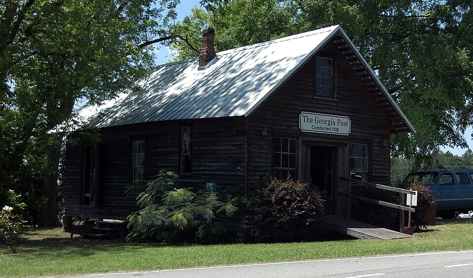
Listed on the National Register of Historic Places in 2013.
One of 6 National Register listings published here for Crawford County · listed in 2013 · category: Building.
Sources: the National Register database, National Park Service
Regional context, not property-specific evidence. The federal wildfire occurrence database lists 397 fires within 5 miles of The Georgia Post Building between 1992 and 2020, burning about 1,050 acres in total. 19 started naturally. 43 were recorded as arson. Distance is straight-line from the map coordinates, so a fire counted here may appear on a neighbouring settlement's page as well.
| Reported cause | Fires |
|---|---|
| Debris and open burning | 231 |
| Arson/incendiarism | 43 |
| Equipment and vehicle use | 39 |
| Missing data/not specified/undetermined | 26 |
| Natural | 19 |
| Recreation and ceremony | 15 |
| Misuse of fire by a minor | 13 |
| Smoking | 11 |
The most recent of them, most recent first, with the day each was reported and the service that recorded it.
| Date | Cause | Size | Reported by | Name on the report |
|---|---|---|---|---|
| 8 September 2001 | Debris and open burning | 4.9 acres | Georgia Forestry Commission | FY2002-CRAWFORD-003 |
| 30 September 2019 | Debris and open burning | under an acre | Georgia Forestry Commission | FY2020CRAWFORD007 |
| 28 September 1994 | Debris and open burning | under an acre | Georgia Forestry Commission | not named |
| 26 September 2005 | Debris and open burning | under an acre | Georgia Forestry Commission | not named |
| 23 September 2010 | Misuse of fire by a minor | 12 acres | Georgia Forestry Commission | FY2011-CRAWFORD-014 |
| 22 September 2019 | Debris and open burning | under an acre | Georgia Forestry Commission | FY2020CRAWFORD006 |
| 21 September 2018 | Debris and open burning | 3.3 acres | Georgia Forestry Commission | FY2019CRAWFORD001 |
| 21 September 2010 | Debris and open burning | 4.1 acres | Georgia Forestry Commission | FY2011-CRAWFORD-013 |
Regional context, not property-specific evidence. The federal mineral resources record lists 1 working within 5 miles of The Georgia Post Building: 1 occurrence. None of them still produces. What was taken out: Sand and Gravel, Construction. Distance is straight-line from the map coordinates, so a quarry counted here may appear on a neighbouring settlement's page as well.
| Where | Site | Commodity | Status | Recorded |
|---|---|---|---|---|
| Knoxville Pit | Sand and Gravel, Construction | Occurrence |
Regional context, not property-specific evidence. The National Weather Service names Knoxville, the town this property stands in, in 21 storm reports between 1997 and 2018: 11 thunderstorm wind, 8 hail, 1 tornado, 1 lightning. The reports record 9 injuries. Each account below is quoted exactly as the forecast office filed it, from the NOAA Storm Events Database, and each date opens the federal record of that event.
| When | Event | Place named | Harm | What the report says |
|---|---|---|---|---|
| March 2007 | Tornado (EF3) | Knoxville | 9 hurt, $500,000 | A storm survey conducted by the National Weather Service in Peachtree City, GA concluded that an EF3 tornado touched down approximately four miles east of Knoxville and continued east-northeast into Bibb county ending just southeast of Lizella. The tornado exited Crawford county about 5.5 miles east of Sandy Point or about 9 miles east-northeast of Knoxville. The tornado traveled over six miles in Crawford county, but the path length of the entire track was approximately 8.5 miles long with a maximum path width of one-quarter mile. Significant damage was noted along the path of the tornado, especially along Sandy Point Road in northeast Crawford county. Here, several homes and outbuildings were heavily damaged or destroyed. Numerous trees were either snapped or uprooted. Nine injuries were reported in the area of the damaged homes. |
| August 2009 | Thunderstorm Wind | Knoxville | $25,000 | The public reported that a poultry house collapsed from very localized thunderstorm downburst winds. A very small thunderstorm was noted in the area at the time. The damaged occurred approximately four miles southeast of the county courthouse in Knoxville. |
| January 2014 | Thunderstorm Wind | Knoxville | $4,000 | The Crawford County Emergency Manager reported that a porch was blown off the front of a home on Jackson Road. Several trees were blown down in the county as well. |
| May 2016 | Thunderstorm Wind | Knoxville | $3,000 | The Crawford County 911 center reported three trees blown down on Highway 80 northeast of Knoxville. |
| August 2003 | Thunderstorm Wind | Knoxville | $3,000 | The Flint Electric Membership Cooperative reported that some power lines were down along U.S. Highway 80 between Knoxville and the Bibb county line, near Sandy Point. Several power outages were reported in the area as well. |
| March 2000 | Thunderstorm Wind | Knoxville | $3,000 | Crawford county 911 reported 2 trees knocked down by thunderstorm winds. A newspaper article reported a tree top fell onto a cabin on Hopewell Road West, but caused little damage.The owner reported hearing whistling wind and hail, and suspected a tornado. It was likely a downburst from a severe thunderstorm. Tree damage or uprooting was also reported in other parts of the county. |
| July 2016 | Thunderstorm Wind | Knoxville | $2,000 | The Crawford County 911 center reported trees blown down on manor street in Roberta and on Marshall Mill Road. |
| August 2018 | Lightning | Knoxville | $1,000 | The Crawford County Emergency Manager reported a lightning strike at Crawford County High School. The strike caused considerable damage to an electrical control box and caused a small fire. There was no significant damage to the building structure due to the fire. |
| June 2003 | Thunderstorm Wind | Knoxville | $1,000 | The Crawford county 911 center reported that a few trees were blown down along U.S. 80 between Sandy Point and the Bibb county line. |
| June 2000 | Thunderstorm Wind | Knoxville | $1,000 | Crawford County 911 reported trees were uprooted on Lower Hartley Bridge Road and Macgregor Circle. |
| July 1999 | Thunderstorm Wind | Knoxville | $1,000 | Flint EMC reported trees down on power lines at Sandy Point. |
| August 1999 | Thunderstorm Wind | Knoxville | $500 | The sheriff's office reported trees down. |
| March 1997 | Thunderstorm Wind | Knoxville | $500 | no account filed |
| June 2018 | Hail | Knoxville | - | A trained storm spotter reported quarter size hail at a residence off of Hortman Mill Road southeast of Roberta. |
| February 2008 | Hail | Knoxville | - | The Crawford County 911 Center reported penny-sized hail. |
| March 2003 | Hail | Knoxville | - | Amateur radio operators reported penny size hail. |
| May 2003 | Hail | Knoxville | - | The Knoxville Sheriff's Office reported penny-sized hail in Knoxville, while the county 911 center reported penny-sized hail in Roberta. |
| March 2002 | Hail | Knoxville | - | An amateur radio operator reported dime size hail on U.S. Highway 80/Georgia Highway 22 about 4 miles east-northeast of Sandy Point near the Bibb county line. |
| April 1998 | Hail | Knoxville | - | no account filed |
| April 1998 | Hail | Knoxville | - | no account filed |
| April 1998 | Hail | Knoxville | - | no account filed |
No historic map-sheet match is published for this property yet. That does not mean no map exists. This record needs a coordinate-quality review before it can be joined to a sheet boundary. Browse the county's mapped places while that work is pending.
Other National Register properties close enough to walk or drive between, ordered by distance from this one. Both positions come from the same geocoding pass that matched these properties to their map sheets.
| Photograph | Property | Distance | Listed |
|---|---|---|---|
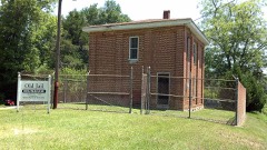 | Crawford County Jail | 0.1 miles | 1989 |
 | Crawford County Courthouse | 0.2 miles | 1980 |
| Roberta Historic District | 1.0 miles | 1989 | |
| Col. Benjamin Hawkins Gravesite | 7.0 miles | 2011 | |
| Williams-Moore-Hillsman House | 8.0 miles | 2001 |
| National Archives record | The nomination case file for reference 13000214 in Record Group 79. |
| Crawford County | All 6 listed properties in this county. |