Block
From the record
20 National Register listings published here.
Sources: the National Register database, National Park Service
43 topographic sheets cover 21 settlements here, and 20 properties are on the National Register of Historic Places.
20 National Register listings published here.
Sources: the National Register database, National Park Service
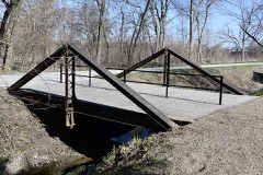
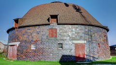
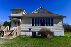
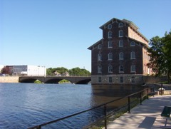
Every property in this county listed on the National Register of Historic Places, with the year it was listed and the federal nomination document.
Every wildfire the federal occurrence database records inside this county: 61 of them, burning about 535 acres. None started naturally and 1 was recorded as arson. Each settlement page carries the fires within five miles of it.
| Reported cause | Fires |
|---|---|
| Debris and open burning | 28 |
| Missing data/not specified/undetermined | 18 |
| Equipment and vehicle use | 10 |
| Smoking | 3 |
| Recreation and ceremony | 1 |
| Arson/incendiarism | 1 |
The five largest, by the area the report gives. None of them was recorded as arson.
| Date | Cause | Size | Reported by | Name on the report |
|---|---|---|---|---|
| 28 April 2015 | Debris and open burning | 65 acres | Iowa Department of Natural Resources | not named |
| 19 October 2015 | Debris and open burning | 65 acres | Iowa Department of Natural Resources | not named |
| 5 April 2015 | Debris and open burning | 50 acres | Iowa Department of Natural Resources | not named |
| 21 March 2015 | Debris and open burning | 50 acres | Iowa Department of Natural Resources | not named |
| 1 April 2015 | Debris and open burning | 30 acres | Iowa Department of Natural Resources | not named |
| 29 April 2018 | Debris and open burning | 30 acres | Iowa Department of Natural Resources | not named |
| 18 October 2015 | Equipment and vehicle use | 25 acres | Iowa Department of Natural Resources | not named |
| 26 March 2006 | Missing data/not specified/undetermined | 20 acres | Iowa Department of Natural Resources | not named |
Every settlement page carries the fires within five miles of it - see the settlement index below.
The NOAA Storm Events Database holds 598 reports for this county, causing 1 death, 12 injuries and about $23,922,000 in recorded property damage. Each settlement page carries the reports that name it.
| Kind of event | Reports |
|---|---|
| Thunderstorm Wind | 275 |
| Hail | 164 |
| Flash Flood | 60 |
| Tornado | 50 |
| Flood | 24 |
| Heavy Rain | 14 |
| Funnel Cloud | 6 |
| Lightning | 5 |
The most serious of them, by death, then injury, then recorded damage. The accounts are quoted exactly as the forecast office filed them.
| When | Event | Place named | Harm | What the report says |
|---|---|---|---|---|
| May 2004 | Flash Flood | Countywide | 1 killed, 1 hurt | Roads flooded and washed out. |
| May 2008 | Tornado (EF3) | Fairbank | 3 hurt, $1,000,000 | A tornado developed just east of the county lines southwest of Fairbank and moved east. The tornado cross the southern part of Hazelton and continued east into Delaware County. Over ten homes, about 50 non-anchored mobile homes at a dealership, and numerous outbuildings were destroyed. Several other homes sustained structural damage. Numerous trees and utility poles were also blown down. An SUV was flipped over in Hazelton injuring the driver and some passengers. |
| April 2001 | Tornado (F1) | Independence | 3 hurt, $1,000,000 | no account filed |
| May 1961 | Tornado (F1) | not stated | 2 hurt, $25,000 | no account filed |
| May 1964 | Tornado (F3) | not stated | 1 hurt, $250,000 | no account filed |
| August 1995 | Thunderstorm Wind | Aurora | 1 hurt, $20,000 | As the storms moved and developed further east, one became severe over Buchanan County. The storm produced high winds in town. At one house a tree fell onto the house injuring a woman. She was trying to close the window when the tree crashed onto the house. She was injured slightly as the plaster fell from the wall resulting in abrasions. Several other trees were also reported down around town. |
| June 1997 | Thunderstorm Wind | Fairbank | 1 hurt | Man struck by falling tree when he went outside to check on his dog during the storm. Numerous trees and power lines were also downed across Fairbank. |
| June 2008 | Flood | Littleton | $3,100,000 | no account filed |
| July 2016 | Flash Flood | Independence | $2,000,000 | A trained spotter reported flash flooding in Independence. The gravel road at the high school complex was washed out and the parking lot was under several inches of water. |
| June 1998 | Thunderstorm Wind | Countywide | $1,800,000 | Severe thunderstorms blasted Buchanan county with 75 to 80 mph straight-line winds. Widespread damage was reported across the county. Three homes were completely destroyed, 75 farmsteads sustained $500 to $10,000 damage, 50 farmsteads had damage in the $10,000 to $100,000 range and 25 farmsteads sustained damages totaling $100,000 to $150,000. These figures included damage to hog houses, barns, grain bins and sheds, and also farm equipment damaged by the storm. Numerous large trees were destroyed including 46 trees at Cedar Crest Cemetery. |
| May 2000 | Tornado (F1) | Hazleton | $1,500,000 | A second tornado touched down 4 miles southwest of Hazelton with a continuous path for 8 miles to a point 4 miles southeast of Hazelton. At it's maximum, it produced F1 damage with a path width of about 1000 feet. This includes damage to major power lines and a couple of farms. This was the strongest tornado in Buchanan County. |
| May 2008 | Flash Flood | Lamont | $1,000,000 | Heavy rains of 4 to 8 inches caused flash flooding in the vicinity of Lamont, IA during the late evening hours of May 25th. The fast moving water washed out a bridge in town. The flood waters damaged 240 of the town's 280 homes. |
| May 2003 | Hail | Hazleton | $1,000,000 | Trained spotter reported at same time |
| May 2003 | Hail | Brandon | $1,000,000 | no account filed |
| May 2003 | Hail | Otterville | $1,000,000 | no account filed |
| July 1995 | Tornado (F3) | Lamont to | $1,000,000 | no account filed |
| June 1998 | Tornado (F2) | Jesup | $800,000 | A farm south of Jesup sustained massive damage from a tornado and severe thunderstorm winds which passed across Buchanan County. Most of the out buildings were damaged or destroyed and every tree on the farm was lost. A double car garage was blown into a cornfield, the tool shed was pushed off it's foundation, gas barrels were gone, and a Morton Building was destroyed. There was also serious damage to the the barn roof. In the home glass was driven into the woodwork. Closet doors and the access door to the attic were blown off, and attic insulation was driven down into the house. At another farm three grain wagons were lifted off the ground. One landed vertically across the road in a ditch and another landed in a ditch near the farmhouse. Shingles and shutters were blown off this house, and 60 feet of roof was torn off the cattle shed. At the Cedar Crest and St Athansius Cemetaries east of Jesup 46 trees were destroyed. |
| August 2016 | Lightning | Otterville | $500,000 | The Emergency Manager reported that Lightning struck a barn on Henley Avenue about 2 miles northwest of Independence and caused it to burn down. There was also some loss of livestock during the fire. |
| July 2016 | Flash Flood | Independence | $500,000 | A trained spotter reported small streams are out of their banks with localized flash flooding in some parts of the town. Received over 2.5 inches of rain in 40 minutes. |
| July 2010 | Flood | Fairbank | $500,000 | Due to intense mitigation efforts over the last decade, the impact of flooding along the Wapsipinicon River was minimal, limited primarily to parks in Independence. |
| July 2010 | Flash Flood | Fontana County Park | $500,000 | Heavy rains of 2 to 4 inches resulted in flash flooding in Independence, IA during the early morning of July 24. The flood waters were 1 to 2 feet deep on 6th Avenue. This report was relayed by KWWL TV. |
| July 2010 | Flood | Fairbank | $500,000 | Meanwhile, In Lamont the South Fork Maquoketa River and Lamont Creek flooded for the second time in 2 days, affecting several businesses and up to 200 homes (primarily with basement flooding).||About 20 other homes around Buchanan County were also affected, including some in Winthrop along Buffalo Creek. |
| September 2001 | Tornado (F2) | Aurora | $300,000 | Tornado reported by emergency manager |
| July 1995 | Thunderstorm Wind | Lamont | $300,000 | no account filed |
| June 2009 | Thunderstorm Wind | Quasqueton | $250,000 | Wind gusts estimated to be around 80 mph caused widespread tree damage with tree limbs over 8 inches in diameter and trees over 3 feet in diameter blown down along a path from 2 miles south of Quasqueton, IA in Buchanan County, to Walker, IA in Linn County, along Highway W35 and Highway W6E to Center Point, IA in Linn County between 745 am and 830 am June 19. Some houses and many out buildings were damaged by falling trees. Power lines were also knocked down across much of the area. The end time of the damage was around 830 am. |
| May 2003 | Flash Flood | Independence | $250,000 | Cars abandoned on street |
| June 1990 | Tornado (F2) | not stated | $250,000 | no account filed |
| May 1988 | Tornado (F1) | not stated | $250,000 | no account filed |
| July 1988 | Tornado (F0) | not stated | $250,000 | no account filed |
| April 1960 | Tornado (F3) | not stated | $250,000 | no account filed |
| August 2009 | Thunderstorm Wind | Rowley | $150,000 | Wind gusts estimated to be 75 mph blew down some two foot diameter trees and several 8 to 12 inch diameter tree limbs, ripped about 10 roofs off of some farm buildings, and blew down power lines in the vicinity of Rowley, IA around 1200 pm August 9. A power outage was also observed. |
| July 1995 | Thunderstorm Wind | Manchester | $150,000 | no account filed |
| June 2001 | Tornado (F1) | Winthrop | $125,000 | no account filed |
| September 2016 | Flood | Fairbank | $100,000 | Heavy rainfall of 4 to over 10 inches over significant areas from 21 to 23 September in extreme North Central and Northeast Iowa moved downstream causing the Wapsipinicon River to rise above major flood stage levels. ||Independence rose above its major flood stage level of 15.0 feet on September 24th, 2016 at approximately 9 AM CST. It crested around 19.4 feet at approximately 11 AM CST on September 25th, 2016. It fell below major flood stage on September 26th around 11 PM CST. |
| July 2010 | Flash Flood | Otterville | $100,000 | Heavy rains of 2 to 3 inches which fell in about 90 minutes resulted in flash flooding in Independence, IA during the morning of July 22. Several streets on the northwest side of town were flooded with some cars stalled out in the flood waters. Numerous streets were closed due to the flooding. |
| July 2010 | Flash Flood | Lamont | $100,000 | Heavy rains resulted in flash flooding in Lamont, IA during the morning of July 23. City crews had to sandbag the lift pump station due to the flood waters. |
| August 2009 | Thunderstorm Wind | Rowley | $100,000 | Wind gusts estimated to be 75 mph damaged the roof of a barn, caused damage at an implement dealer, and blew down some large tree limbs about 2 miles west of Rowley, IA around 1200 pm August 9. |
| May 2004 | Flash Flood | Stanley | $100,000 | Roads and bridges flooded out east of Stanley. Bridge washed out and severely damaged near the intersection of Quinn Street and 100th Street. |
| September 2001 | Tornado (F0) | Aurora | $100,000 | Tornado reported by emergency manager. |
| May 2003 | Hail | Hazleton | $100,000 | no account filed |
| August 2009 | Tornado (EF1) | Stanley | $75,000 | An EF1 tornado touched down about 2.5 miles south of Stanley, IA around 430 pm August 19. It tracked to the northeast for about 2.2 miles before lifting about 2.1 miles east southeast of Stanley, IA around 445 pm. Wind speeds were estimated to be around 95 mph. Two farmsteads sustained damage. Two hog confinements were damaged. A residence lost most of its roof. A silo was damaged. The back wall of a pole building was blown out and trees were blown down. |
| July 2004 | Flash Flood | North Portion | $70,000 | Widespread flash flooding occurring across Northern Buchanan County. Most roads over Buffalo Creek are closed or will close shortly due to high water. Pine and Otter Creeks coming out of their banks and closing many secondary roads due to high water. |
| July 2003 | Thunderstorm Wind | Hazleton | $60,000 | In Stanley, Iowa |
| July 2003 | Thunderstorm Wind | Independence | $60,000 | no account filed |
| July 2017 | Flood | Otterville | $50,000 | Heavy rainfall of 3 to over 9 inches over significant areas from 20 to 22 July in extreme north central and northeast Iowa moved downstream causing the Wapsipinicon River to rise above major flood stage levels. ||Independence rose above its major flood stage level of 15.0 feet on July 23rd, 2017 at approximately 1245 PM CST. It crested around 15.4 feet at approximately 445 PM CST on July 23rd, 2017. It fell below major flood stage on July 23rd around11 pm CST. |
| June 2014 | Tornado (EF1) | Lamont | $50,000 | A tornado formed 4 miles south of Lamont, IA in Buchanan County, tracked about 1 mile to the northeast before crossing into Delaware County. In Delaware County the tornado continued for about 13 miles to the northeast to Edgewood, IA. ||This entry is for the Buchanan County segment of the tornado. ||Numerous trees were snapped along the path. |
| July 2010 | Flash Flood | Fairbank | $50,000 | Heavy rains resulted in flash flooding over parts of northern Buchanan County during the morning and early afternoon hours of July 7. Water was over a road about 1 mile south of Hazleton, IA. Highway 150 was closed due to the flood waters near 110th Street near the Buchanan-Fayette county line. In addition, the Little Wapsipinicon River was out of its banks and flooding Siggelkov Park in Fairbank, IA. |
| August 2010 | Thunderstorm Wind | Monti | $50,000 | Wind gusts estimated to be 70 mph blew a tree down onto a house about 5 miles southwest of Masonville, IA at 215 pm CDT August 13. |
| June 2010 | Thunderstorm Wind | Jesup | $50,000 | Wind gusts estimated to be 70 mph snapped or uprooted several large trees in Jesup, IA at 245 am CDT June 23. The local fire department assessed a swath of damage about 2 miles long and 200 feet wide. Some of the trees landed on outbuildings, fences, and houses. In addition, some buildings in an industrial park were damaged and some houses lost shingles. |
| July 2009 | Thunderstorm Wind | Independence | $50,000 | Wind gusts estimated to be 75 mph blew a 50 foot tall grain bin over and snapped off some 5 to 8 inch diameter tree limbs about 3 miles north northeast of Independence, IA around 730 pm July 24. |
| July 2009 | Thunderstorm Wind | Independence | $50,000 | Wind gusts estimated to be 60 to 80 mph blew down several 2 to 3 foot diameter trees in Independence, IA around 745 pm July 24. One tree fell onto a house on Terrace Drive. |
| June 2009 | Thunderstorm Wind | Troy Mills Carson Ar | $50,000 | Wind gusts estimated to be 70 mph blew a 100 year old water pumping wind mill over about 2 miles north of Walker, IA around 745 am June 19. A corn bin and dryer were also blown off of their foundations. |
| May 2008 | Tornado (EF1) | Lamont | $50,000 | A brief tornado enhanced by the rear-flank downdraft (RFD) winds moved east about 3.5 miles and lifted. Location and time estimated. Some outbuildings and trees along the path were damaged. |
| July 2008 | Thunderstorm Wind | Independence | $50,000 | Wind gusts estimated to be 70 mph destroyed a barn about 5 miles northeast of Independence, IA at 822 pm July 19. |
| May 2004 | Flash Flood | Countywide | $50,000 | Fontana State Park evacuated; numerous roads and bridges closed by high water. Road and bridge washed out near the intersection of Quinn Street and 100 Street east of Stanley. |
| July 2003 | Thunderstorm Wind | Fairbank | $50,000 | Also reported by law enforcement |
| July 2003 | Thunderstorm Wind | Fairbank | $50,000 | 4 to 5 inch branches down |
| May 2000 | Tornado (F0) | Hazleton | $50,000 | The fourth and last tornado, which was part of a family which includes the F1 event south of Hazelton, touched down 8 miles east southeast of Hazelton to 4 miles south southeast of Aurora. It was rated an F0 with a path length of 5 1/2 miles and width of about 1/8 mile. |
| June 1997 | Thunderstorm Wind | Fairbank | $50,000 | Considerable damage was done to area football grandstands, a baseball batting cage, and a pressbox. Damage also reported to several roofs and cars. |
| July 2003 | Hail | Jesup | $50,000 | no account filed |
The Survey's mineral resources record lists 53 workings inside this county. 13 still produce and 40 are closed or unrecorded. Each settlement page carries the workings within five miles of it.
| Commodity | Workings |
|---|---|
| Sand and Gravel, Construction | 29 |
| Stone, Crushed/Broken | 24 |
The least common of them first, because a county's hundredth gravel pit says nothing its first ten did not.
| Where | Site | Commodity | Status | Recorded |
|---|---|---|---|---|
| Aurora Quarry | Stone, Crushed/Broken | Producer | ||
| Aurora Quarry | Stone, Crushed/Broken | Producer | ||
| Bloom Quarry | Stone, Crushed/Broken | Producer | ||
| Brandon Quarry | Stone, Crushed/Broken | Past Producer | ||
| Brooks Quarry | Stone, Crushed/Broken | Producer | ||
| Bunker Hill Quarry | Stone, Crushed/Broken | Past Producer | ||
| Chesmore Quarry | Stone, Crushed/Broken | Past Producer | ||
| Hazleton Quarry | Stone, Crushed/Broken | Producer | ||
| Hertzberg Quarry | Stone, Crushed/Broken | Producer | ||
| Jacobsen Farm | Stone, Crushed/Broken | Past Producer | ||
| Levendusky Quarry | Stone, Crushed/Broken | Past Producer | ||
| Miller Quarry | Stone, Crushed/Broken | Producer | ||
| Mishler Quarry | Stone, Crushed/Broken | Past Producer | ||
| Mulneaux Quarry | Stone, Crushed/Broken | Producer | ||
| Oelwein Quarry | Stone, Crushed/Broken | Producer | ||
| Rasmussen Quarry | Stone, Crushed/Broken | Producer | ||
| Sells Quarry | Stone, Crushed/Broken | Past Producer | ||
| Unknown | Stone, Crushed/Broken | Past Producer | ||
| Unknown | Stone, Crushed/Broken | Past Producer | ||
| Unknown | Stone, Crushed/Broken | Past Producer | ||
| Unknown | Stone, Crushed/Broken | Past Producer | ||
| Unknown | Stone, Crushed/Broken | Past Producer | ||
| Unknown | Stone, Crushed/Broken | Past Producer | ||
| Wards Quarry | Stone, Crushed/Broken | Producer | ||
| Burns Pit | Sand and Gravel, Construction | Past Producer | ||
| Cook Pit | Sand and Gravel, Construction | Past Producer | ||
| Crain Pit | Sand and Gravel, Construction | Past Producer | ||
| Greenley Pit | Sand and Gravel, Construction | Producer | ||
| Hertzberg Pit | Sand and Gravel, Construction | Past Producer | ||
| Hollerman Pit | Sand and Gravel, Construction | Past Producer | ||
| Huffman Pit | Sand and Gravel, Construction | Past Producer | ||
| Kress Farm | Sand and Gravel, Construction | Past Producer | ||
| Miller Sand Pit | Sand and Gravel, Construction | Producer | ||
| Quality P M Pit | Sand and Gravel, Construction | Past Producer | ||
| Sullivan Pit | Sand and Gravel, Construction | Past Producer | ||
| Unknown | Sand and Gravel, Construction | Past Producer | ||
| Unknown | Sand and Gravel, Construction | Past Producer | ||
| Unknown | Sand and Gravel, Construction | Past Producer | ||
| Unknown | Sand and Gravel, Construction | Past Producer | ||
| Unknown | Sand and Gravel, Construction | Past Producer | ||
| Unknown | Sand and Gravel, Construction | Past Producer | ||
| Unknown | Sand and Gravel, Construction | Past Producer | ||
| Unknown | Sand and Gravel, Construction | Past Producer | ||
| Unknown | Sand and Gravel, Construction | Past Producer | ||
| Unknown | Sand and Gravel, Construction | Past Producer | ||
| Unknown | Sand and Gravel, Construction | Past Producer | ||
| Unknown | Sand and Gravel, Construction | Past Producer | ||
| Unknown | Sand and Gravel, Construction | Past Producer | ||
| Unknown | Sand and Gravel, Construction | Past Producer | ||
| Unknown | Sand and Gravel, Construction | Past Producer | ||
| Unknown | Sand and Gravel, Construction | Past Producer | ||
| Unknown | Sand and Gravel, Construction | Past Producer | ||
| Ward Farm Pit | Sand and Gravel, Construction | Past Producer |
Named settlements recorded in the Geographic Names Information System, each with the topographic sheets covering it. Villages, hamlets and abandoned places alike. Each is shown with the nearest named watercourse or landform and the survey quadrangle it falls on.
Hazleton township · 50641 · On Hazelton Creek · Hazleton quadrangle
12 sheets, 1901 to 1984
Washington township · 50644 · On Malone Creek · Independence quadrangle
11 sheets, 1903 to 1984
Perry township · 50644 · On Little Wapsipinicon River · Littleton quadrangle
9 sheets, 1954 to 1984
Washington township · 50644 · On Otter Creek · Hazleton quadrangle
12 sheets, 1901 to 1984