 Block
From the record
19 National Register listings published here, 1 of them a National Historic Landmark.
Sources: the county history on the Internet Archive · the National Register database, National Park Service
54 topographic sheets cover 25 settlements here, and 19 properties are on the National Register of Historic Places.
19 National Register listings published here, 1 of them a National Historic Landmark.
Sources: the county history on the Internet Archive · the National Register database, National Park Service
Every property in this county listed on the National Register of Historic Places, with the year it was listed and the federal nomination document.
| Photograph | Property | Type | Listed | Reference |
|---|---|---|---|---|
 | Charles Brainerd House | building | 1998 | 98000065 |
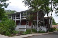 | Elsah Historic District | district | 1973 | 73000706 |
 | Fisher-Chapman Farmstead | district | 2012 | 12000028 |
 | Col. William H. Fulkerson Farmstead | building | 1998 | 98000977 |
 | Grafton Bank | building | 1994 | 94000016 |
| Grafton Boat Works | building | 2022 | 100007582 | |
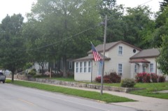 | Grafton Historic District | district | 1994 | 94000020 |
 | Hamilton Primary School | building | 1998 | 98000975 |
 | Jersey County Courthouse | building | 1986 | 86001008 |
 | Jerseyville Downtown Historic District | district | 1986 | 86003528 |
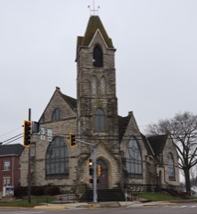 | Jerseyville First Presbyterian Church | building | 2021 | 100005968 |
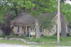 | Paris Mason Building | building | 1994 | 94000017 |
 | John and Amelia McClintock House | building | 1994 | 94000019 |
| New Piasa Chautauqua Historic District | district | 1982 | 82002541 | |
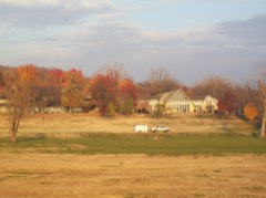 | Pere Marquette State Park Lodge and Cabins | building | 1985 | 85002405 |
 | Principia College Historic District | district | 1993 | 93001605 |
 | Ruebel Hotel | building | 1994 | 94000015 |
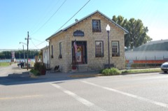 | Slaten-LaMarsh House | building | 1994 | 94000018 |
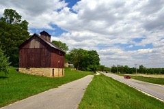 | Smith-Duncan, House and Eastman Barn | building | 1999 | 99001379 |
Every wildfire the federal occurrence database records inside this county: 34 of them, burning about 1,661 acres. None started naturally and none was recorded as arson. Each settlement page carries the fires within five miles of it.
| Reported cause | Fires |
|---|---|
| Missing data/not specified/undetermined | 23 |
| Debris and open burning | 6 |
| Equipment and vehicle use | 3 |
| Power generation/transmission/distribution | 2 |
The five largest, by the area the report gives. None of them was recorded as arson.
| Date | Cause | Size | Reported by | Name on the report |
|---|---|---|---|---|
| 17 November 2011 | Missing data/not specified/undetermined | 1,475 acres | Illinois Division of Forestry Resources | PERE MARQUETTE |
| 1 October 2007 | Equipment and vehicle use | 80 acres | Illinois Division of Forestry Resources | not named |
| 6 April 2011 | Missing data/not specified/undetermined | 35 acres | Illinois Division of Forestry Resources | 11406001 |
| 12 November 2009 | Missing data/not specified/undetermined | 10 acres | Illinois Division of Forestry Resources | 91116 |
| 27 April 2007 | Equipment and vehicle use | 10 acres | Illinois Division of Forestry Resources | not named |
| 12 October 2010 | Power generation/transmission/distribution | 6.0 acres | Illinois Division of Forestry Resources | 102001 |
| 9 February 2007 | Missing data/not specified/undetermined | 5.0 acres | Illinois Division of Forestry Resources | not named |
| 4 September 2007 | Missing data/not specified/undetermined | 5.0 acres | Illinois Division of Forestry Resources | not named |
Every settlement page carries the fires within five miles of it - see the settlement index below.
The NOAA Storm Events Database holds 253 reports for this county, causing 3 deaths, 2 injuries and about $5,906,500 in recorded property damage. Each settlement page carries the reports that name it.
| Kind of event | Reports |
|---|---|
| Thunderstorm Wind | 115 |
| Hail | 85 |
| Tornado | 22 |
| Flash Flood | 18 |
| Flood | 10 |
| Heavy Rain | 2 |
| Lightning | 1 |
The most serious of them, by death, then injury, then recorded damage. The accounts are quoted exactly as the forecast office filed them.
| When | Event | Place named | Harm | What the report says |
|---|---|---|---|---|
| September 1961 | Tornado (F1) | not stated | 1 killed, $25,000 | no account filed |
| December 2015 | Flash Flood | Grafton | 1 killed | Up to four inches of rain fell causing flash flooding. Numerous roads were flooded. In Grafton, a 42 year old woman was walking home, possibly intoxicated. She was last seen on North Cedar Street at about 11 pm on December 26th, 2015. Authorities suspected she tried to cross a flooded roadway near a creek and was swept out to the Mississippi River and drowned. Her body was finally located March 10th, 2016 about 6 miles downstream. Cause of death was accidental drowning. |
| May 2003 | Flash Flood | Fieldon | 1 killed | Heavy rain caused flash flooding in parts of north Jersey County. A 79 year old man was swept off a bridge and killed in his truck when he tried to cross a flooded Sugar Creek. |
| May 1983 | Tornado (F2) | not stated | 1 hurt, $2,500,000 | no account filed |
| May 1983 | Tornado (F2) | not stated | 1 hurt, $2,500,000 | no account filed |
| November 1990 | Tornado (F1) | not stated | $250,000 | no account filed |
| November 1988 | Tornado (F1) | not stated | $250,000 | no account filed |
| May 2011 | Lightning | Jerseyville | $150,000 | Lightning struck a house causing a fire that destroyed the house. Fortunately the owners were not home at the time, so no injuries were reported. |
| April 2026 | Flash Flood | Jerseyville | $50,000 | Heavy rain washed out a culvert and a portion of West County Road was washed out. |
| April 2026 | Flash Flood | Newbern | $50,000 | Heavy rain washed out a culvert and damaged Green Acres Road near Elsah. |
| May 2007 | Flash Flood | Jerseyville | $45,000 | Local law enforcement reported flash flooding across Jerseyville. On the west side of town, Maple Summit Road was covered by 3 feet of water, and by 2 1/2 feet by the hospital. |
| June 1970 | Tornado (F1) | not stated | $25,000 | no account filed |
| December 1967 | Tornado (F1) | not stated | $25,000 | no account filed |
| August 2022 | Thunderstorm Wind | Newbern | $5,000 | Thunderstorm winds blew down several large trees. |
| March 2022 | Thunderstorm Wind | Elsah | $5,000 | Thunderstorm winds blew over a large outside play structure that was anchored. Also, numerous large tree limbs were blown down in the area. |
| December 2021 | Thunderstorm Wind | Jerseyville | $5,000 | Thunderstorm winds blew down a metal sign and numerous tree limbs on the east side of town along Illinois Route 16. |
| April 2013 | Flood | Nutwood | $5,000 | The Illinois River hit major flood levels along the border of Jersey County. The river crested around the 27th, but remained at major flood levels into May. |
| April 2013 | Flood | Grafton | $5,000 | The Mississippi River reached major flood levels along the border of Jersey County. The river crested on April 25th, but remained above flood stage into May. Damage was limited to a few closed roads. |
| March 1961 | Tornado (F1) | not stated | $2,500 | no account filed |
| May 2013 | Flood | Nutwood | $2,000 | The Illinois River along the border of Jersey County remained at major flood levels in early May, dropped below major levels for a while, then rose to major levels again at the end of May. Damage was limited to some closed roads and flooded farmland. |
| November 1994 | Thunderstorm Wind | New Delhi | $2,000 | Several large trees were blown down along the Great River Road east of Grafton. The Illinois State Police later reported large trees down over the southern part of the county with one roof blown off near New Delhi. |
| June 2022 | Thunderstorm Wind | Otterville | $1,000 | A large tree was blown over onto a road in town. |
| June 2013 | Flood | Nutwood | $1,000 | The Illinois River started June in flood and hit major flood levels cresting on the 4th. The river remained in flood into July. |
| June 2013 | Flood | Grafton | $1,000 | The Mississippi River bordering Jersey County started June in flood and rose to major flood levels cresting on the 4th. The river remained in flood into July. Damage was limited to a few closed roads. |
| May 2008 | Flash Flood | Grafton | $1,000 | Several rounds of thunderstorms over the course of the day produced flash flooding across much of the county. Local law enforcement reported water on many roads some of which were impassable. |
| June 1995 | Thunderstorm Wind | Jerseyville | $200 | Power lines and large tree limbs were blown down. A satellite antenna was also knocked over. |
| November 1994 | Thunderstorm Wind | New Delhi | $200 | The county sheriff reported large trees down across the southeast part of the county. |
| November 1994 | Thunderstorm Wind | Grafton | $200 | Several large trees were blown down along the Great River Road east of Grafton. The Illinois State Police later reported large trees down over the southern part of the county with one roof blown off near New Delhi. |
| November 1994 | Thunderstorm Wind | Jerseyville | $200 | The county sheriff reported large trees down or damaged west and north of Jerseyville. Ham radio spotters also reported two utility poles snapped and down along Highway 267 north of Jerseryville. |
| November 1994 | Thunderstorm Wind | Jerseyville | $200 | The county sheriff reported large trees down or damaged west and north of Jerseyville. Ham radio spotters also reported two utility poles snapped and down along Highway 267 north of Jerseryville. |
| March 2026 | Tornado (EF1) | Grafton | - | A brief tornado was confirmed both with radar data and detailed photographs of damage. This tornado cause significant roof damage to a local restaurant, along with other miscellaneous to a local hotel and residence. |
| March 2025 | Thunderstorm Wind | Delhi | - | Thunderstorm winds downed trees in the area. |
| April 2025 | Thunderstorm Wind | Grafton | - | Thunderstorm winds knocked down trees in Grafton. |
| July 2025 | Thunderstorm Wind | Jerseyville | - | A HAM radio operator reported 60 mph wind gusts and up to 8 inch tree limbs down near Bluebird Lane and Illinois Route 109. |
| March 2024 | Tornado (EF0) | Fieldon | - | A tornado touched down 2.8 miles southeast of Fieldon, on Richey Hollow Road, snapping off several large tree branches. As it moved to the southeast it crossed County Road 1100N. In this area numerous trees and tree limbs were snapped off. Also, an open sided barn had the majority of its roof ripped off and a large barn had around a quarter of its roof ripped off and thrown east into a nearby field. Before it crossed Beaty Mound Road it snapped off several large trees as well as numerous tree limbs. A nearby house sustained minor shingle damage. As it crossed Lodi Road it snapped off several more trees and tree limbs and began to move in a more easterly direction. As it crossed Illinois Route 109, around 3.8 miles south of Jerseyville, it snapped off a few more trees. Before lifting and dissipating 4 miles south southeast of Jerseyville, it caused a very old open sided barn to lean and minor damage to a large machine shed and roof of a chicken coop. Overall, the tornado was rated EF0 with a path length of 8.65 miles and a max path width of 100 yards. No deaths or injuries were reported. |
| March 2024 | Thunderstorm Wind | Monument | - | There was extensive tree damage at Pere Marquette State Park. Dozens of trees were blown over or snapped off as well as widespread tree limbs blown down. |
| March 2024 | Tornado (EF0) | Fidelity | - | A weak tornado touched down 1.7 miles southwest of Fidelity in Jersey County, on Bowman Station Road. In this location is destroyed a small shed, snapped off several trees and tree limbs and damaged a power pole. It then tracked east northeast. As it crossed Fidelity Road it tore a carport off of a house and threw it into a nearby field. A bit further east it caused minor roof damage to a farm house, uprooted a large tree and caused damage to two older brick grain silos. Then the tornado tracked east into Macoupin County. The tornado was rated EF0 in Jersey County with a path length of 2.28 miles and a max path width of 75 yards. No deaths or injuries were reported. |
| March 2024 | Tornado (EF0) | Delhi | - | A weak tornado touched down 2.3 miles north northwest of Brighton in Jersey County, on W. Miles Station Road. In this area it destroyed a small outbuilding and damaged a pickup truck that was parked in it. It also caused minor to moderate roof damage to at least 4 other outbuildings, destroyed another small outbuilding and snapped off a couple of trees. As it tracked to the northeast, it crossed into Macoupin County. In Jersey County, the tornado was rated EF0 with a path length of 0.39 miles and a max path width of 200 yards. |
| April 2024 | Tornado (EFU) | Kemper | - | No damage was found but there was a trained spotter report of a brief tornado touchdown approximately nine tenths of a mile west of Kemper, just north of Appletree Road N. The approximate path length is 0.02 miles. |
| July 2023 | Thunderstorm Wind | Nutwood | - | Thunderstorm winds blew down several large trees along Illinois Route 16 just west of Fieldon. |
| July 2023 | Thunderstorm Wind | Mc Clusky | - | Thunderstorm winds blew down several large trees near the intersection of Lodi Road and Illinois Route 109. Further east some power lines were blown down along Crystal Lake Road just west of Range Line Road. |
| June 2023 | Thunderstorm Wind | Mc Clusky | - | Thunderstorm winds blew down several trees on Hagen Road south of Jerseyville and Beltrees Road just east of Elsah. |
| May 2019 | Thunderstorm Wind | Fidelity | - | A wide swath of damaging winds moved through the Jerseyville and Fidelity areas. Numerous trees, tree limbs and power lines were blown down. |
| August 2019 | Flash Flood | Grafton | - | Up to 4 inches of rain fell in less than 5 hours causing flash flooding. Numerous roads were flooded and several cars were stuck in high water. No injuries were reported. |
| June 2019 | Flood | Elsah | - | The Mississippi River at Grafton, IL remained at it's highest levels between the morning of June 2nd and the morning of June 12th. In Grafton, a number of homes and businesses on the west side of Illinois Route 100 were flooded during this event. |
| June 2018 | Thunderstorm Wind | Fieldon | - | Thunderstorm winds blew down a tree across Illinois Route 16 just east northeast of Fieldon. |
| June 2018 | Tornado (EF0) | Chautauqua | - | A NWS Damage Survey Team surveyed multiple areas across southern Jersey County. The survey team did find one area of concentrated damage just northwest of Elsah which it determined was caused by a brief EF-0 tornado. The tornado touched down about one quarter mile SSW of the Green Acres Road and Elsah Road intersection here 3 pine trees were blown over. The tornado then removed part of the roof from an out building on the west side of Elsah Road. Portions of the roof were found blown across Elsah Road to the southeast. The tornado then crossed Lake Drive just west of Red Bud Court where it twisted a road sign 180 degrees and snapped a number of trees near their base. The tornado continued southeast crossing Elsah Road near Joywood Drive where several trees were again snapped. The tornado dissipated shortly thereafter. The tornado was rated EF0 with max wind speeds of 80 MPH. The path length was 1.40 miles and a max path width of 50 yards. No injuries or deaths were reported with this tornado. |
| June 2018 | Thunderstorm Wind | Delhi | - | Thunderstorm winds blew down a tree onto Illinois Route 111 just southwest of Brighton. |
| April 2017 | Tornado (EF1) | Delhi | - | A weak tornado developed in east central Jersey County, about two tenths of a mile north of Oak Rest Lane, just west of intersection with Oak Rest Road. It travelled to the northeast, crossing Crystal Lake Road just south of Lards Road. Most of the damage to this point was minimal. As it crossed Oak Rest Road, it caused extensive tree damage with numerous trees uprooted, snapped and twisted. The tornado then moved across a field and caused EF1 damage to a property on Gun Club Road, just west of Stonebrooke Drive. Here at least a dozen mature trees were snapped and twisted. The detached garage was destroyed and the single family home had minor damage including windows broken out of the house. The tornado continued northeast for about half a mile before crossing into Macoupin County, 3 miles north of Brighton. |
| April 2017 | Thunderstorm Wind | Beltrees | - | A damaging microburst caused extensive damage to the Piasa Marina. One large boat dock was destroyed. An unoccupied building sustained moderate roof damage. Several trees were snapped off in an area extending from the marina northward along Lockhaven Road for about half a mile. |
| May 2016 | Thunderstorm Wind | Jerseyville | - | Thunderstorm winds blew down several large trees and numerous large tree limbs. |
| July 2016 | Thunderstorm Wind | Grafton | - | Thunderstorm winds blew down several trees onto Illinois Route 100 in Grafton. Also, in Dow, several trees were blown down. |
| April 2015 | Hail | Otterville | - | Large hail fell in a swath from Otterville to Jerseyville. The largest stones were 2.25 inches in diameter. |
| April 2015 | Thunderstorm Wind | Jerseyville | - | Sixty mile per hour winds caused large hail to break a window on a house 3 miles south of Jerseyville. |
| May 2015 | Thunderstorm Wind | Rosedale | - | Thunderstorm winds blew down a large tree across Illinois Route 100 on the west side of Pere Marquette State Park. Also, a tree was blown down across Illinois Route 16 about 2 miles east of Fieldon. In Jerseyville, several trees were blown down. |
| October 2014 | Flash Flood | Monument | - | Between 5 and 6 inches of rain fell in a short amount of time causing flash flooding. Numerous roads were flooded throughout the county. |
| June 2014 | Tornado (EF0) | Jerseyville | - | The tornado first touched down just south of Owl Branch Road west of the intersection with Cherry Lane. Several large tree branches were snapped off in this location and several tree tops were broken. The tornado travelled to the southeast. On the west side of Cherry Lane, a wall of a garage on the north side of the home was pushed in about 6 inches and some shingles were removed. Also, several large tree limbs were snapped off. The tornado crossed Cherry Lane and damaged a few more trees before lifting and dissipating. The tornado was rated EF0. It was on the ground for 1.44 miles and the max path width was 30 yards. |
| April 2014 | Thunderstorm Wind | Dow | - | Thunderstorm winds blew down a large tree and numerous large tree limbs just east of Dow. |
| May 2014 | Thunderstorm Wind | Dow | - | Several 8 to 10 inch diameter trees were blown down in Dow. |
| August 2012 | Tornado (EF0) | Fieldon | - | A tornado touched down just north of Illinois Route 16 between St. Marys Road and Washington School Road. As it travelled to the north northwest it caused some minor crop damage. It then hit a residence and caused minor damage. Several trees around the house were snapped off. The tornado continued to the north northwest for a little bit more before lifting and dissipating. The damage was rated EF-0. |
The Survey's mineral resources record lists 9 workings inside this county. 2 still produce and 7 are closed or unrecorded. Each settlement page carries the workings within five miles of it.
| Commodity | Workings |
|---|---|
| Stone, Crushed/Broken | 7 |
| Sand and Gravel, Construction | 1 |
| Stone | 1 |
The least common of them first, because a county's hundredth gravel pit says nothing its first ten did not.
| Where | Site | Commodity | Status | Recorded |
|---|---|---|---|---|
| Jersey Cty Hwy Dept Pit | Stone | Past Producer | ||
| Twin Rivers Sand Pit No. 2 | Sand and Gravel, Construction | Past Producer | ||
| Columbia Quarry Company | Stone, Crushed/Broken | Past Producer | ||
| Grafton Quarry | Stone, Crushed/Broken | Past Producer | ||
| Limestone Prospect | Stone, Crushed/Broken | Occurrence | ||
| Sievers Quarry | Stone, Crushed/Broken | Producer | ||
| Unnamed Limestone Quarry | Stone, Crushed/Broken | Past Producer | ||
| Valstad Quarry No. 3 | Stone, Crushed/Broken | Producer | ||
| Western Whiting Company Quarry | Stone, Crushed/Broken | Past Producer |
History of Greene and Jersey Counties, Illinois : Together with Sketches of the Towns, Villages and Townships, Educational, Civil, Military, and Political History; Portraits of Prominent Individuals, and Biographies of Representative Men, History of Illinois .. devotes a chapter to each township: its boundaries and streams, who settled it and when, the mills, the schools and the churches. The one chapter is reproduced here in full. Each row shows the township's own shape and where it lies in the county, drawn from the Census Bureau's boundary. Which settlements belong to which township is computed from that same boundary, not taken from the book.
| Shape and position in the county | Township | Settlements in it | Length | Sections |
|---|---|---|---|---|
| Elsah Township | Beltrees, Elsah, Lockhaven | 2,092 words | 7 |
2 books written about this county, cut here where the book itself is cut, at its printed chapters: 57 chapters in all. Every chapter is public domain, machine-read from the scan and reproduced complete. A chapter already given under one of the county's towns is not repeated in this list.
| Chapter | Length |
|---|---|
| Chapter 2: Geography, Topography and Resources | 1,077 words |
| Chapter 3: Geology | 20,140 words in 2 parts |
| Judicial | 13,903 words |
| Chapter 10: The Bar | 3,085 words |
| Chapter 11: The Medical Profession | 7,804 words |
| Chapter 12: County Societies | 2,205 words |
| Chapter 13: Ecclesiastical | 10,558 words |
| Chapter 14: National, State and County Representation | 28,901 words in 2 parts |
| Chapter 17: Elsah Township | 8,986 words |
| Chapter 18: Otter Creek Township | 13,666 words |
| Chapter 19: Quarry Township | 11,236 words |
| Chapter 20: Piasa Township | 5,997 words |
| Chapter 21: English Township | 30,095 words in 2 parts |
| Rosed Ale | 38,943 words in 3 parts |
| Jersey Township | 40,002 words in 3 parts |
Named settlements recorded in the Geographic Names Information System, each with the topographic sheets covering it. Villages, hamlets and abandoned places alike. Each is shown with the nearest named watercourse or landform and the survey quadrangle it falls on.
Rosedale township · 62031 · Near Schaaf Hollow · Otterville quadrangle
12 sheets, 1930 to 1985
Mississippi township · 62022 · On Askew Branch · Jerseyville South quadrangle
12 sheets, 1930 to 1985
Otter Creek township · 62052 · Near Shiloh Hollow · Otterville quadrangle
12 sheets, 1930 to 1985
The vanished settlements of Jersey County: the places named above that are no longer on the map.