 Block
From the record
6 National Register listings published here.
Sources: the National Register database, National Park Service
100 topographic sheets cover 31 settlements here, and 6 properties are on the National Register of Historic Places.
6 National Register listings published here.
Sources: the National Register database, National Park Service
Every property in this county listed on the National Register of Historic Places, with the year it was listed and the federal nomination document.
| Photograph | Property | Type | Listed | Reference |
|---|---|---|---|---|
 | Campground Church and Cemetery Site | site | 2017 | 100000965 |
| Rendleman Orchards | district | 2025 | 100012200 | |
 | St. Anne's Episcopal Church | building | 2003 | 02001758 |
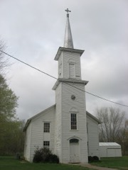 | St. Paulus Evangelisch Lutherischen Gemeinde | building | 1980 | 80001413 |
 | Stinson Memorial Library | building | 1978 | 78001193 |
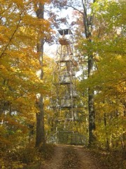 | Union Lookout | structure | 2003 | 02001759 |
Every wildfire the federal occurrence database records inside this county: 102 of them, burning about 602 acres. 2 started naturally and 28 were recorded as arson. Each settlement page carries the fires within five miles of it.
| Reported cause | Fires |
|---|---|
| Debris and open burning | 33 |
| Arson/incendiarism | 28 |
| Missing data/not specified/undetermined | 17 |
| Recreation and ceremony | 11 |
| Equipment and vehicle use | 3 |
| Power generation/transmission/distribution | 3 |
| Other causes | 2 |
| Fireworks | 2 |
| Natural | 2 |
| Smoking | 1 |
The five largest, by the area the report gives. One of them was set deliberately.
| Date | Cause | Size | Reported by | Name on the report |
|---|---|---|---|---|
| 1 April 2001 | Missing data/not specified/undetermined | 79 acres | Shawnee National Forest | BROWDER #1 |
| 5 March 2017 | Missing data/not specified/undetermined | 47 acres | Shawnee National Forest | GODWIN |
| 2 April 2001 | Missing data/not specified/undetermined | 35 acres | Shawnee National Forest | BROWDER #2 |
| 18 November 1999 | Other causes | 34 acres | Shawnee National Forest | OLD HOUSE |
| 19 January 2009 | Missing data/not specified/undetermined | 34 acres | Shawnee National Forest | WAGON WHEEL |
| 2 March 2020 | Debris and open burning | 30 acres | Illinois Division of Forestry Resources | 82020 |
| 24 January 2004 | Arson/incendiarism | 30 acres | Shawnee National Forest | BROWDER |
| 15 April 2003 | Missing data/not specified/undetermined | 28 acres | Shawnee National Forest | STRAIGHT UP |
Every settlement page carries the fires within five miles of it - see the settlement index below.
The NOAA Storm Events Database holds 231 reports for this county, causing 4 deaths, 35 injuries and about $12,166,500 in recorded property damage. Each settlement page carries the reports that name it.
| Kind of event | Reports |
|---|---|
| Thunderstorm Wind | 94 |
| Hail | 55 |
| Flash Flood | 26 |
| Tornado | 24 |
| Flood | 22 |
| Heavy Rain | 6 |
| Funnel Cloud | 2 |
| Lightning | 2 |
The most serious of them, by death, then injury, then recorded damage. The accounts are quoted exactly as the forecast office filed them.
| When | Event | Place named | Harm | What the report says |
|---|---|---|---|---|
| April 2002 | Tornado (F3) | Dongola | 1 killed, 8 hurt, $5,000,000 | The tornado first touched down in very hilly terrain in the Shawnee National Forest and then tracked east, crossing Route 127 just north of Mill Creek. The tornado then directly struck the community of Dongola, where most of the damage and casualties occurred. A 69-year-old woman was killed as she was attempting to flee her mobile home. The woman had just gotten into her car, started the engine, and turned the lights on when the tornado struck. She was blown away from the car and found dead under a structure across the road from where the vehicle was parked and still running. Elsewhere in the Dongola area, a train was blown off the tracks. Several wood houses were demolished, and seven double-wide trailers were destroyed. Approximately 75 homes were damaged. A recreational vehicle was tossed across Lake Dongola and impaled into the ground. |
| June 2019 | Flash Flood | Cobden | 1 killed, $30,000 | Severe flash flooding impacted Union County. There were two water rescues in the county. One car stalled in high water on Mount Glen Road near Cobden. First responders were able to rescue the driver, a young female. The second water rescue involved a vehicle in the Trail of Tears State Forest near Ware. The vehicle was swept off State Forest Road where it crosses Clear Creek. Two people were in the vehicle at the time it was swept off the road. The male involved was able to escape. The body of the other person in the vehicle, a female in her late 50's, was found deceased the following morning less than a mile downstream from the vehicle. Elsewhere in the area, one lane of Highway 146 near the intersection of Highway 3 was flooded. A trained spotter reported 4.0 inches of rainfall in 24 hours three miles east of Ware. The public reported 4.5 inches of rain in 24 hours at Cobden. |
| January 2002 | Flash Flood | Anna | 1 killed | A 3-year-old child was killed when her grandmother attempted to carry her across a flooded creek on foot. The grandmother was unable to cross the creek in her vehicle, so she attempted to cross on foot. The grandmother lost her footing in the creek, and the child was swept away and drowned. The flooding was caused by a large area of moderate to heavy rain falling on ground that was still moist from flooding rains a week earlier. An observer in Anna measured about 1.7 inches of rain. |
| July 1987 | Thunderstorm Wind | not stated | 1 killed | no account filed |
| May 1995 | Hail | Jonesboro | 20 hurt | About ten damage claims were filed with insurance companies as a result of the hailstorm. Enough hail fell to clog storm drains and turn the ground white. Undetermined damage was done to apple orchards. |
| April 1972 | Tornado (F2) | not stated | 4 hurt, $25,000 | no account filed |
| May 1996 | Thunderstorm Wind | Anna | 2 hurt, $50,000 | no account filed |
| February 1976 | Tornado (F2) | not stated | 1 hurt, $25,000 | no account filed |
| March 2008 | Flood | Ware | $1,300,000 | Historic flooding inundated the county after close to 12 inches of rain fell in 48 hours. Levees were overtopped along the Clear Creek drainage district, essentially cutting the county in two. All east-west roads were impassable or closed. Between 30 and 35 people were rescued or evacuated by emergency personnel using boats. About 12 houses were flooded. Highway 146 was closed near Ware. Evacuations were concentrated near Clear Creek, Ware, and west of Jonesboro. On secondary roads and side streets, creeks rose over bridges. Damage was reported to roads all over the county. A couple of bridges were severely damaged. Flooding affected a telephone company building in Anna, knocking out communications to much of the county. A house trailer was reportedly floated onto a road in a rural southwest part of the county. The Red Cross opened a shelter for evacuees. Flooding occurred in the Mill Creek area, where evacuations were conducted. Illinois Route 127 was flooded. In Anna, several streets were closed. |
| January 2016 | Flood | Wolf Lake | $700,000 | Mississippi River levels continued their climb from December, and record or near-record flooding occurred early in the month. There are no river gages in Union County, but there is a gage at Thebes in nearby Alexander County. At the Thebes river gage, the river crested at a new record of 47.74 feet on the 2nd. Backwater from the Mississippi River contributed to flooding of Clear Creek and other tributaries, which affected isolated homes. Some residents were isolated by the floodwaters. Sandbagging operations were conducted to protect water wells and to reinforce levees. The National Guard was activated to assist with the sandbagging. A number of residents voluntarily evacuated. Most of the monetary flood damage was to public infrastructure, such as roads and levees. All access roads to the Mississippi River levees were closed. |
| June 2019 | Flood | Ware | $500,000 | Major flooding of the Mississippi River continued through the month of June. A disaster proclamation was issued by the governor. There was extensive flooding of low-lying farmland and woods. Numerous county roads were inundated. Levees began to show signs of stress due to the extended duration of the flood, which began in March. The Union County sheriff advised residents in the Wolf Lake and Ware areas that storm sirens would be used in the event of a levee breach. |
| May 2011 | Flood | Aldridge | $500,000 | no account filed |
| April 2011 | Flash Flood | Wolf Lake | $250,000 | Three small bridges were washed out. The bridges were on secondary roads off Highway 127, Highway 146, and Highway 51. Numerous roads were underwater or impassable across the county, including Illinois Route 146 near Ware. Several families were evacuated from their houses. Flash flooding of Clear Creek closed a local road. The Jonesboro community center was damaged by water. |
| May 2009 | Thunderstorm Wind | Wolf Lake | $250,000 | Northwest parts of the county were struck hardest by very strong winds associated with the comma head of a bow echo. Widespread tree and power line damage occurred. The most intense destruction was in the Wolf Lake and Alto Pass areas. About 25 homes sustained damage in the county. Power outages were widespread. Numerous trees were snapped along Illinois Route 127, mainly north of Anna. The highway was closed while fire and highway personnel worked to clear it. A large tree fell in Anna, taking down power lines and a couple utility poles. |
| May 1999 | Thunderstorm Wind | Countywide | $250,000 | High winds from a line of thunderstorms caused widespread damage across Union County. Hundreds of downed trees and power lines were reported. In Cobden, community officials estimated 100,000 dollars damage occurred. Children escaped injury at an elementary school in McClure when storms blew off the gymnasium's roof. Damaging winds caused extensive damage in Anna, where numerous trees and limbs were blown down. A one-story frame house in Anna was flattened by a falling tree. In Jonesboro, there were small trees down and 10-inch diameter limbs. Two houses in Jonesboro sustained some of the worst storm-related damage due to trees smashing into them. Power was out for more than 12 hours in some areas, prompting the cancellation of some schools the following day. In East Cape Girardeau, grain bins were heavily damaged. |
| May 1957 | Tornado (F3) | not stated | $250,000 | no account filed |
| November 1955 | Tornado (F2) | not stated | $250,000 | no account filed |
| June 2013 | Thunderstorm Wind | Alto Pass | $200,000 | At least 15 trees, some of which were very large, were blown down. About ten houses were damaged by falling trees. Some of these houses sustained major damage. There were also vehicles damaged by falling trees. |
| May 2011 | Tornado (EF1) | Anna | $150,000 | Several dozen trees were uprooted or snapped. A vehicle was destroyed by a falling tree. At least a couple of buildings and houses sustained mostly minor roof damage, including the loss of some shingles. Peak winds were estimated near 90 mph. The average path width was 100 yards. |
| June 2020 | Flash Flood | Anna | $100,000 | Numerous roads were closed or washed out in rural areas near Anna and Jonesboro. Near Ware, water covered both lanes of Highway 146. |
| February 2012 | Tornado (EF2) | Aldridge | $100,000 | The tornado crossed the Mississippi River from Cape Girardeau County into northwestern Union County. After exiting cropland in the Mississippi River floodplain, the tornado tracked through the Shawnee National Forest. The damage path extended just north of Bald Knob, then directly across Alto Pass. Thousands of trees were snapped or uprooted, and several houses were damaged. The houses that were damaged suffered primarily partial roof loss. The houses were located in Alto Pass, where EF-2 damage occurred. Numerous barns and grain bins were destroyed. Many power lines were blown down. Peak winds were estimated near 115 mph. The average path width was 250 yards. The tornado path crossed into Giant City State Park and into the southeast corner of Jackson County. |
| May 2009 | Thunderstorm Wind | Dongola | $100,000 | Three residences were damaged. One of the residences was a mobile home that was moved two feet off its foundation. The home was tied down, which prevented it from rolling. The frame of a neighboring mobile home was bent, its windows were blown out, and the porch was destroyed. Shingles and siding were blown off a house. A large garage sustained extensive damage, mainly to the roof. An outbuilding was blown over. A barn and a shed were destroyed. A calf was killed inside the barn. An antenna tower was blown over. A satellite dish was blown onto a vehicle. Many large trees, power lines, and a power pole were down. |
| January 2008 | Thunderstorm Wind | Ware | $100,000 | Roofs were blown off, and trees were blown down on U.S. Highway 51 south of Anna. East of Anna in the Mt. Pleasant area, numerous trees were down and structures were damaged. A roof was blown off a house west of Jonesboro. Countywide, a large number of trees and utility lines were blown down. |
| March 2007 | Tornado (EF0) | Jonesboro | $100,000 | The tornado damage path began along a country road, then continued northeast over mostly open land for about one-half to three-quarters of a mile. The path then tracked along or nearly parallel to the same road until reaching the intersection of Highway 146. Several witnesses in the area observed a dark funnel bouncing up and down from the storm to the ground. Many trees were either uprooted or topped. One tree that landed on a house caused heavy damage and trapped a resident inside. The resident was freed from the home uninjured. About 15 to 20 homes received light to moderate roof damage. Several articles of debris were lodged from 20 to 50 feet up in the trees. There was some evidence of convergent damage based on how trees were blown down. Given the rapid storm speed of 50 to 60 MPH, all of the damage occurred in about two minutes. Peak winds were estimated near 75 MPH, resulting in a rating of EF (Enhanced Fujita) 0. |
| April 2011 | Flood | Aldridge | $100,000 | no account filed |
| January 1999 | Flash Flood | Countywide | $100,000 | no account filed |
| May 2011 | Thunderstorm Wind | Anna | $90,000 | Portable garage buildings were rolled over in Anna. A tree fell on a house in Anna, causing heavy damage to the roof. At Jonesboro, an antenna was ripped off the city hall, leaving a hole in the building. Bricks were blown off the Jonesboro city hall building, and there was some roof damage. Trees and power lines were blown down. Tree limbs fell on houses in Jonesboro. |
| May 2025 | Tornado (EF1) | Mt Pleasant | $80,000 | An EF1 tornado touched down along Hwy 146 approximately 6.5 miles northeast of Dongola. It uprooted and snapped several trees along with causing some minor shingle and siding damage to a few homes. Peak winds were 100 mph and max width was 50 yards along its approximately 2 mile long path as it tracked to the east-northeast before lifting just before reaching Mount Pleasant. |
| January 2020 | Tornado (EF1) | Ware | $80,000 | The tornado snapped large tree branches in the town of Ware. Metal roofing was removed from a farm outbuilding. A large open storage building was overturned and destroyed. Shingles were removed from the roof of a hunting club. Another home had its roof lifted slightly by the tornado, causing water damage. The roof of a metal storage building was lofted and overturned. Hundreds of decoy ducks were tossed and broken near the hunting club. Numerous trees were snapped or uprooted along the path of the tornado. Peak winds were estimated near 100 mph. |
| April 2014 | Flash Flood | Cobden | $80,000 | Numerous vehicles were swept off the roadway. A home was flooded, with water as high as the electrical panel. One homeowner was rescued. |
| May 2018 | Tornado (EF1) | Wolf Lake | $70,000 | A storm survey team estimated peak winds up to 95 mph occurred with this tornado, which touched down along the Mississippi River levee. The tornado passed near the community of Wolf Lake before dissipating at the edge of the Shawnee National Forest just east of Route 3. A very large equipment barn collapsed, and another barn was destroyed. A one-story house was partially shifted off its foundation. All structural damage was between Route 3 and the Mississippi River levee. The tornado was witnessed by at least one trained spotter and several other individuals. Prior to spawning this tornado, the parent storm produced a tornado near Trail of Tears State Park in Cape Girardeau County, Missouri about ten minutes earlier. |
| May 2011 | Flood | Wolf Lake | $70,000 | Major flooding continued on the Mississippi River from April. Based on data from a nearby river gage in Alexander County, the flood crest of 2011 was the second highest crest on record. All access roads to the Mississippi River levees were closed. Some residents were isolated by the floodwaters, and one school district cancelled classes. Backwater from the Mississippi River contributed to flooding of Clear Creek, which affected at least one home. Sandbagging operations were conducted to protect water wells in the Clear Creek area, and to reinforce levees. The National Guard was activated to assist with the sandbagging. |
| May 2017 | Thunderstorm Wind | Jonesboro | $60,000 | Widespread wind damage was reported across Jonesboro, including a collapsed garage due to a tree falling on it. Numerous power poles were snapped across town. Numerous trees and power lines were down across the west side of Jonesboro. Some of the trees were up to five feet in diameter. In Anna, a large tree and numerous limbs were down. |
| July 2008 | Thunderstorm Wind | Anna | $60,000 | Numerous large tree limbs were blown down, including some that landed on houses and vehicles. One of the largest tree limbs knocked a chimney off a roof. The chimney smashed through the windshield of a parked car. Power lines were down. |
| August 2009 | Thunderstorm Wind | Cobden | $50,000 | Numerous trees and power lines were down in northern and central Union County, including the communities of Anna, Jonesboro, and Cobden. Winds were estimated up to 70 mph in Cobden. |
| October 2007 | Thunderstorm Wind | Reynoldsville | $50,000 | Trees and power lines were down across a road. |
| April 2006 | Thunderstorm Wind | Cobden | $50,000 | In Cobden, a farmstead was heavily damaged. The chimney of a house fell and smashed through a deck. A carport was destroyed. A boat was blown 75 feet, and a barn was unroofed. On the neighboring property, three outbuildings were destroyed and nine trees were blown down. Other trees and power lines were down in the Cobden area. A house was damaged four miles north of Cobden. |
| May 2000 | Hail | Cobden | $50,000 | Local newspapers showed photos of the hailstones, some of which were nearly the size of golf balls. Strong winds up to 50 MPH accompanied the storm. A large tree was down across a street in Anna, and a large limb was down in Jonesboro. |
| June 1995 | Thunderstorm Wind | Countywide | $50,000 | Numerous trees and power lines were blown down. Power was out for more than a day in some areas. |
| August 2023 | Thunderstorm Wind | Alto Pass | $40,000 | A large tree limb was down just north of Alto Pass. A tree was blown onto a police car just east of Anna. |
| August 2012 | Thunderstorm Wind | Dongola | $40,000 | Trees and power lines were blown down. A couple of homes were damaged. |
| May 2011 | Thunderstorm Wind | Cobden | $40,000 | A mobile home was flipped over. A large maple tree about three feet in diameter was uprooted. A two-foot tree was snapped in half. A small apple tree was uprooted. |
| May 2011 | Thunderstorm Wind | Ware | $40,000 | Trees and power poles were blown down. |
| March 2006 | Thunderstorm Wind | Anna | $40,000 | Two buildings and a pole barn were damaged. A restaurant sustained roof damage. |
| November 1995 | Thunderstorm Wind | Jonesboro | $40,000 | A nursing home was partially unroofed. About 12 residents of the home were relocated until the damage could be repaired. Trees were down and power was out in the area of the nursing home. |
| July 2023 | Thunderstorm Wind | Dongola | $30,000 | Several trees were snapped, and some power lines were down. Some roof damage also occurred. |
| May 2019 | Flood | Ware | $30,000 | The Mississippi River remained above flood stage through the month of May. There was considerable flooding of low-lying farmland and woods. Some county roads were inundated. Due to the extended duration of the flooding, levees began to show signs of stress. There was concern about the stability of the levees, and seepage became a problem. Some roads nearest the levees began to buckle. |
| March 2006 | Flash Flood | Dongola | $30,000 | U.S. Highway 51 was closed in several locations due to water over the road. Water rose over other low-lying roads. A number of washouts occurred on roads throughout the county. Creeks were swollen. Two observers in Anna measured between 4 and 5 inches of rain for the calendar day. |
| June 1998 | Thunderstorm Wind | Anna | $30,000 | A fruit orchard sustained extensive damage. Many apple trees were uprooted or snapped, and a portion of a barn roof was peeled back. |
| May 2024 | Tornado (EF1) | Lick Creek | $28,000 | An EF-1 tornado began just east of I-57 in Union County. A power pole needed replacing near Texas Eastern Rd marking the start of the tornado track. The tornado proceeded southeastward, heavily damaging a few outbuildings and a barn two and a half miles northwest of Elvira, near South Lick Creek Rd. The tornado continued, damaging trees before crossing into Johnson County. Peak estimated winds for the Union County portion of the tornado, and the tornado as a whole, were 100 mph. |
| October 2017 | Thunderstorm Wind | Jonesboro | $25,000 | An area of scattered wind damage extended from a few miles south of Jonesboro east to the Johnson County line. Numerous large tree limbs were blown down. A few trees were down. One garage not anchored down was moved off its foundation. Some of the most concentrated tree damage was between Anna and Dongola, especially near the community of Balcom. The width of the damage area averaged about one-half mile, but it peaked near one mile. |
| August 2016 | Flash Flood | Wolf Lake | $25,000 | Just north of Alto Pass, a small bridge across Cave Creek was washed out. The bridge was on a dead-end street off Highway 127. Road crews were dispatched to several flooded roads around the area. A 24-hour rainfall amount of 7.9 inches was reported at Cobden, and just over 5 inches fell at Wolf Lake within 8 hours. |
| September 2012 | Thunderstorm Wind | Anna | $25,000 | A few trees were blown down, along with numerous tree limbs. |
| April 2011 | Thunderstorm Wind | Anna | $25,000 | Trees were knocked down on a couple houses and vehicles. |
| April 1972 | Tornado (F2) | not stated | $25,000 | no account filed |
| July 2019 | Flood | Wolf Lake | $20,000 | The extended major flood on the Mississippi River gradually ended by late July. Flood-fighting efforts in the Ware and Wolf Lake areas were completed after water receded away from weakened levees. Low-lying woods, farmland, and county roads remained underwater early in the month. More detailed damage assessments began after the river fell within its banks late in the month. |
| July 2015 | Flood | Ware | $20,000 | Moderate flooding continued on the Mississippi River from June through much of July. Extensive flooding of lowland fields occurred, including many acres of cropland. Most roads leading to riverfront property were cut off by floodwaters. Backwater flooding along tributary creeks such as Clear Creek affected some residents south and west of Jonesboro and Cobden. Several residents were forced to evacuate or use boats to access their homes. |
| April 2011 | Thunderstorm Wind | Cobden | $20,000 | A trained spotter estimated winds gusted to 65 mph. Numerous trees were blown down, knocking out power to Cobden and Alto Pass. Some minor damage was reported to a small number of structures. |
| August 2006 | Lightning | Anna | $20,000 | The steeple of a church was destroyed by lightning. The 25-foot tall steeple was sliced by the lightning strike and fell to the ground. The roof was damaged, allowing water to leak into the interior of the church and cause more damage. |
| October 2001 | Thunderstorm Wind | Countywide | $20,000 | Numerous trees were blown down. The hardest hit areas were Anna and Joneboro, where a number of roads were blocked by downed trees and power lines. An awning was blown off a business. Utility poles were knocked over on the east side of Anna, closing Illinois Route 146. Some minor structural damage was reported. |
The Survey's mineral resources record lists 25 workings inside this county. 2 still produce and 23 are closed or unrecorded. Each settlement page carries the workings within five miles of it.
| Commodity | Workings |
|---|---|
| Stone, Crushed/Broken | 10 |
| Fluorine-Fluorite | 3 |
| Fire Clay (Refractory) | 2 |
| Lead, Zinc | 2 |
| Sand and Gravel, Construction | 2 |
| Lead | 2 |
| Zinc | 2 |
| Limestone, Dimension | 2 |
| Clay | 2 |
| Silica | 1 |
The least common of them first, because a county's hundredth gravel pit says nothing its first ten did not.
| Where | Site | Commodity | Status | Recorded |
|---|---|---|---|---|
| Shawnee Special Use Silica Deposit 1 | Silica | Occurrence | ||
| Alto Pass Lead Prospect No. 1 | Lead, Zinc | Occurrence | ||
| Alto Pass Lead Prospect No. 1 | Lead, Zinc | Occurrence | ||
| Alto Pass Lead Prospect No. 2 | Lead, Zinc | Occurrence | ||
| Alto Pass Lead Prospect No. 2 | Lead, Zinc | Occurrence | ||
| Dug Hill Sand Pit | Sand and Gravel, Construction | Past Producer | ||
| Fluorite and Limestone Mine | Fluorine-Fluorite, Limestone, Dimension | Past Producer | ||
| Jonesboro Pit | Sand and Gravel, Construction | Past Producer | ||
| Limestone Occurrence No.1 | Limestone, Dimension | Occurrence | ||
| New Albany Shale Exposure | Clay | Prospect | ||
| Shawnee High Interest Refractory Clay Deposit | Fire Clay (Refractory) | Occurrence | Sedimentary | |
| Springvale Shale Exposure | Clay | Prospect | ||
| Union County Area-Fireclays | Fire Clay (Refractory) | Past Producer | ||
| Fluorine Occurrence No. 1 | Fluorine-Fluorite | Occurrence | ||
| Fluorine Occurrence No. 1 | Fluorine-Fluorite | Occurrence | ||
| Anna Quarries, Inc. Hartline Qry. | Stone, Crushed/Broken | Producer | ||
| Caseyville Sandstone Deposit | Stone, Crushed/Broken | Prospect | ||
| Cypress Creek Sandstone Deposit | Stone, Crushed/Broken | Prospect | ||
| Jonesboro Quarry & Plant #4 | Stone, Crushed/Broken | Producer | ||
| Lick Creek Sandstone Exposure | Stone, Crushed/Broken | Prospect | ||
| Limestone Prospect | Stone, Crushed/Broken | Occurrence | ||
| Limestone Prospect | Stone, Crushed/Broken | Occurrence | ||
| N.Cobden Sandstone Deposit | Stone, Crushed/Broken | Prospect | ||
| Saratoga Sandstone Exposure | Stone, Crushed/Broken | Prospect | ||
| Union County Highway Department | Stone, Crushed/Broken | Past Producer |
Named settlements recorded in the Geographic Names Information System, each with the topographic sheets covering it. Villages, hamlets and abandoned places alike. Each is shown with the nearest named watercourse or landform and the survey quadrangle it falls on.
Union precinct · 62998 · Near Crawford Towhead · Wolf Lake quadrangle
23 sheets, 1924 to 1994
Jonesboro District 2 precinct · 62952 · Near Kratzinger Hollow · Jonesboro quadrangle
24 sheets, 1920 to 1996
Cobden District 1 precinct · 62920 · Near Tiptop Knob · Cobden quadrangle
23 sheets, 1924 to 1996
Dongola District 2 precinct · 62926 · On Crooked Creek · Dongola quadrangle
22 sheets, 1920 to 1996
Jonesboro District 1 precinct · 62952 · Near Kratzinger Hollow · Jonesboro quadrangle
24 sheets, 1920 to 1996
Cobden District 2 precinct · 62920 · Near Iron Mountain · Cobden quadrangle
23 sheets, 1924 to 1996
Lick Creek precinct · 62912 · Near Buck Knob · Lick Creek quadrangle
21 sheets, 1922 to 1996
Cobden District 1 precinct · 62920 · Near Tiptop Knob · Cobden quadrangle
23 sheets, 1924 to 1996
Mill Creek precinct · 62961 · On Lingle Creek · Mill Creek quadrangle
24 sheets, 1920 to 1996
Stokes precinct · 62912 · On Bradshaw Creek · Mount Pleasant quadrangle
18 sheets, 1920 to 1987
Cobden District 2 precinct · 62920 · Near Iron Mountain · Cobden quadrangle
23 sheets, 1924 to 1996
Union precinct · 62952 · Near Hamburg Hill · Jonesboro quadrangle
24 sheets, 1920 to 1996
Union precinct · 62952 · Near Swiftsure Towhead · McClure quadrangle
25 sheets, 1920 to 1996
Lick Creek precinct · 62912 · Near Buck Knob · Lick Creek quadrangle
21 sheets, 1922 to 1996
Union precinct · 62998 · Near Crawford Towhead · Neelys Landing quadrangle
26 sheets, 1918 to 1993
Union precinct · 62952 · Near Pine Knob · Mill Creek quadrangle
24 sheets, 1920 to 1996