 Block
Armington, Illinois
13 topographic sheets cover this place, the earliest surveyed in 1951 and the latest in 1990. It stands in Hittle Township. It lies in ZIP code area 61721. The Survey maps it on the Armington quadrangle. 310 people lived here at the 2020 count. It stands 627 feet above sea level.
Population over time
2 figuresArmington fell from 343 to 310 between 2010 and 2020. These are the recorded population figures Wikidata holds for this place, reached through the Geographic Names Information System number this page is keyed on rather than by name, so they belong to this place and not to another of the same name. Most are census counts, but not all are: an early figure may be a founding or settlement estimate, and an estimate published within five years of a census is left out. The change column is computed, and is left blank where more than 20 years separate a figure from the one before it, because a gap that long is not a change between two counts.
| Year | People | Change |
|---|---|---|
| 2010 | 343 | |
| 2020 | 310 | -33 (-10%) |
Topographic sheets covering this place
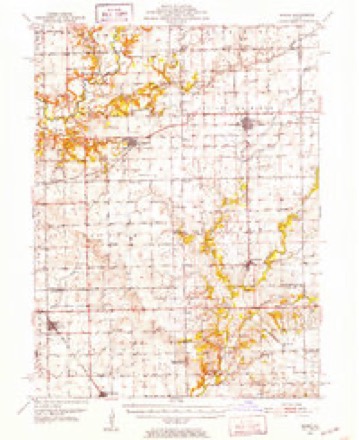
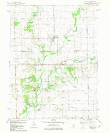
8 surveys from 13 printed sheetsMatched by testing this settlement's coordinate against the published boundary of every sheet in the United States Geological Survey's historical collection. Each opens the scanned sheet at the Survey.
- 1951 USGS Minier quadrangle1:62500, 3 printings
- 1958 USGS Peoria quadrangle1:250000, 4 printings
- 1961 USGS Peoria quadrangle1:250000
- 1963 USGS Peoria quadrangle1:250000
- 1980 USGS Armington quadrangle1:24000
- 1985 USGS Lincoln quadrangle1:100000
- 1989 USGS Lincoln quadrangle1:100000
- 1990 USGS Peoria quadrangle1:250000




In the county-history sources
10,656 words on this townshipHistory of Tazewell County, Illinois ; Together with Sketches of Its Cities, Villages and Townships, Educational, Religious, Civil, Military, and Political History; Portraits of Prominent Persons and Biographies of Representative Citizens. History of Illinois ... Digest of State Laws, published 1879 names this settlement in its chapter on Hittle Township. These are the passages that mention it, exactly as the scans read.
John F. Albrif/hf, farmer, Armington, was born in Lincoln county, Tenn., in 1825. His father, Jacob Albright, came to Hittle in 1829. He was married in Tenn., to Esther Touchstone. His grandfather was from South Carolina, and his grandmother from North Carolina, where his father was born. "When the latter came to this State he settled on land bought of George Hittle. He had a family of 8 children - 6 boys and 2 girls. He lived until May 12, "868, when he died at the age of 72. His wife died in 1855, at the age of about 65 years. John Albright was married June 15, 1848, to Louisa, daughter of John Judy. She was born Jan. 10, 1830. They have seven children, five of whom are now living - Emma, Jerome, Harriet J., Rosa, Alice, Martha and Clara. Mr. Albright now lives on part of the place his father owned, and two brothers live in the same neighborhood. Member of the Christian Church and a Republican.
Passage source: History of Tazewell County, Illinois ; Together with Sketches of Its Cities, Villages and Townships, Educational, Religious, Civil, Military, and Political History; Portraits of Prominent Persons and Biographies of Representative Citizens. History of Illinois ... Digest of State Laws, published 1879.
Michael Albright, farmer, Armington, was born Dec. 19, 1820, in Lincoln county, Tenn., (see John F. Albright). He was married June 4, 1843, to Mary Ann JNIalick, daughter of George Malick, one of the earliest settlers of Mackinaw. She was born Dec. 12, 1820. They have six children - Ann, Homer, Alice, Charles, George and Florence. Mr. Albright is a substantial farmer, a man well informed on all topics of general interest, and one with convictions of his own. He is a Republican.
Passage source: History of Tazewell County, Illinois ; Together with Sketches of Its Cities, Villages and Townships, Educational, Religious, Civil, Military, and Political History; Portraits of Prominent Persons and Biographies of Representative Citizens. History of Illinois ... Digest of State Laws, published 1879.
Charles D. Allen, Armington, was born Sept. 30, 1811, in Tioga county, N. Y. His fatlier's name was Daniel, and his mother's Anna (Dodd), who were natives of New York. In 1837 Mr. Allen left Ohio, where his parents had lived since he was twelve years of age, and settled in Hittle. His parents also came West, and settled just over the line in McLean county. His father died in February, 1848, aged 83 years. He was married Nov. 8, 1839, to Nancy^ daughter of Henry Hainline, one of the first settlers of Hittle. The descendants of Mr. Hainline are very numerous in Hittle townshij), there being five sons and one daughter, with numerous grandchildren. Mr. Allen's wife died in June, 1847; he was married to Hannah, the sister of his former wife, Feb. 14, 1850. She was born Feb. 1, 1826, in Boone county, Ky. Mr. A. has five children, two of them by his first wife. Their names are : Henry, Jessie, John, Massie and Silvia. He is a member of the Christian Church, and Republican in politics.
Passage source: History of Tazewell County, Illinois ; Together with Sketches of Its Cities, Villages and Townships, Educational, Religious, Civil, Military, and Political History; Portraits of Prominent Persons and Biographies of Representative Citizens. History of Illinois ... Digest of State Laws, published 1879.
Machine-read from a century-old scan, so expect the errors a machine makes: misspelled names, dropped words, stray characters.
Read the whole chapter on Hittle Township - it names this place 10 more 10 times.
Storms near this place
16 since 1996Regional context, not property-specific evidence. The National Weather Service names Armington in 16 storm reports between 1996 and 2019: 8 thunderstorm wind, 6 hail, 2 tornado. No death or injury is recorded in these reports. Each account below is quoted exactly as the forecast office filed it, from the NOAA Storm Events Database, and each date opens the federal record of that event.
| When | Event | Place named | Harm | What the report says |
|---|---|---|---|---|
| April 1996 | Tornado (F2) | Armington | $1,000,000 | no account filed |
| June 2010 | Thunderstorm Wind | Armington | $125,000 | Grain bins and machine sheds were damaged. A large tree limb was blown down onto the roof of a house. |
| July 2012 | Thunderstorm Wind | Armington | $42,000 | Numerous trees and tree branches were blown down. Power lines were knocked downed as well, creating a power outage in Armington. In addition, the roof of an old school was damaged. |
| July 2015 | Thunderstorm Wind | Armington | $12,000 | Several trees were blown down in Armington. |
| August 1999 | Thunderstorm Wind | Armington | $10,000 | Several trees were blown down. |
| September 2005 | Thunderstorm Wind | Armington | - | Numerous trees blown down in town. One tree fell on top of a car. |
| May 2003 | Tornado (F0) | Armington | - | A tornado briefly touched down in a field. No damage or injuries were reported. |
| June 1998 | Thunderstorm Wind | Armington | - | Numerous large tree limbs were blown down in Armington. |
| September 2019 | Hail | Armington | - | no account filed |
| November 2013 | Hail | Armington | - | no account filed |
| August 2011 | Hail | Armington | - | no account filed |
| February 2011 | Hail | Armington | - | no account filed |
| June 2011 | Hail | Armington | - | no account filed |
| July 2006 | Thunderstorm Wind | Armington | - | no account filed |
| May 2003 | Hail | Armington | - | no account filed |
| October 1996 | Thunderstorm Wind | Armington | - | no account filed |
Nearest settlements
The eight closest, with where each one stands in the county. Distances are straight-line, computed from the Geographic Names Information System coordinates.
Elsewhere
Matched on this settlement's Geographic Names Information System number rather than its name, so it cannot be a different place of the same name in another state.
| Wikipedia article on Armington | An encyclopaedic summary. Its text is share-alike, so it is linked here rather than copied. |
| Wikidata item Q1906730 | The structured record the population and elevation above come from. Public domain (CC0). |
Provenance
This settlement is recorded in the Geographic Names Information System as feature 403617. The sheet list is computed by point-in-boundary test against the United States Geological Survey's historical topographic inventory. Both are works of the United States government and carry no copyright under 17 U.S.C. 105.
Storms. NOAA National Centers for Environmental Information, Storm Events Database https://www.ncei.noaa.gov/stormevents/ A work of the United States government, no copyright under 17 U.S.C. 105. Narratives are quoted verbatim from the National Weather Service report and are not edited or summarised.