 Block
Minier, Illinois
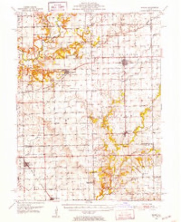
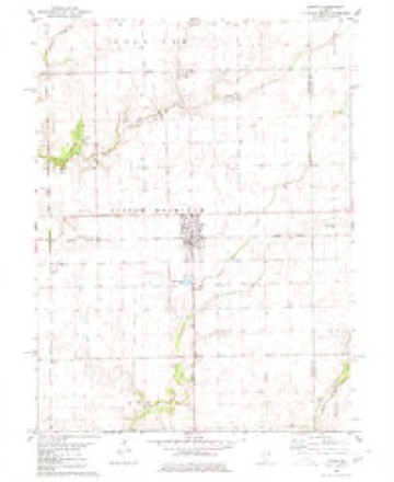
13 topographic sheets cover this place, the earliest surveyed in 1951 and the latest in 1990. It stands in Little Mackinaw Township. It lies in ZIP code area 61759. The Survey maps it on the Minier quadrangle. 1,154 people lived here at the 2020 count. It stands 636 feet above sea level.
Population over time
2 figuresMinier fell from 1,252 to 1,154 between 2010 and 2020. These are the recorded population figures Wikidata holds for this place, reached through the Geographic Names Information System number this page is keyed on rather than by name, so they belong to this place and not to another of the same name. Most are census counts, but not all are: an early figure may be a founding or settlement estimate, and an estimate published within five years of a census is left out. The change column is computed, and is left blank where more than 20 years separate a figure from the one before it, because a gap that long is not a change between two counts.
| Year | People | Change |
|---|---|---|
| 2010 | 1,252 | |
| 2020 | 1,154 | -98 (-8%) |
Topographic sheets covering this place
8 surveys from 13 printed sheetsMatched by testing this settlement's coordinate against the published boundary of every sheet in the United States Geological Survey's historical collection. Each opens the scanned sheet at the Survey.
- 1951 USGS Minier quadrangle1:62500, 3 printings
- 1958 USGS Peoria quadrangle1:250000, 4 printings
- 1961 USGS Peoria quadrangle1:250000
- 1963 USGS Peoria quadrangle1:250000
- 1980 USGS Minier quadrangle1:24000
- 1985 USGS Lincoln quadrangle1:100000
- 1989 USGS Lincoln quadrangle1:100000
- 1990 USGS Peoria quadrangle1:250000




In the county-history sources
5,139 words on this townshipHistory of Tazewell County, Illinois ; Together with Sketches of Its Cities, Villages and Townships, Educational, Religious, Civil, Military, and Political History; Portraits of Prominent Persons and Biographies of Representative Citizens. History of Illinois ... Digest of State Laws, published 1879 names this settlement in its chapter on Little Mackinaw Township. These are the passages that mention it, exactly as the scans read.
In point of agriculture, of the class and kind of improvements, and of the wealth and high standing of her people. Little Mackinaw is second to no township in Tazewell county. It is mostly prairie land, undulating, and well drained by the Little Mackinaw, Whitten branch and Sugar creeks. The Kansas City branch of the C, A. & St. L. Railroad passes through it on a direct east and west line. The village of Minier is located on sec. 22, on the line of this road, and also on the Illinois Midland Railroad. This town was laid out in 1867, Oct. 18th, by Geo. W. Minier, Chas. E. Boyer, and others. It is now a thriving place, and considerable business is done here. We speak more fully of the business men further on in this article. The township is inhabited by a cultured, refined and a religious people. Good churches, neat school-houses, and the fine commodious residences on every hand, are unmistakable evidences of the verity of this statement.
Passage source: History of Tazewell County, Illinois ; Together with Sketches of Its Cities, Villages and Townships, Educational, Religious, Civil, Military, and Political History; Portraits of Prominent Persons and Biographies of Representative Citizens. History of Illinois ... Digest of State Laws, published 1879.
Little Machinaw Christian Church was organized in 1833, in a log building, and was among the first congregation of this people organized north of the Sangamon river. The members at the time were Thomas F. Railsback, Louisa, his wife, A. B. Davis, Catherine Allensworth, Benjamin Herndon, and Nancy, his wife, Elijah Howell, and Maria, his wife. Elder James Lindsey was the first minister. The church edifice is about 36 by 40 feet, and cost $2,100. The first discourse in this structure was preached by Elder Minier, in September, 1863, the year tlie building was erected. It is located near the residence of G. W. Minier. Connected with the building and grounds is a beautiful cemetery, perhaps the finest necropolis in the county. The present pastor of the church is Elder R. D. Cotton. The Sunday-school is superintended by Richard Chapman, and has an average attendance of 75. The Little Mackinaw Church is the parent of four other Christian Churches, viz : The Christian Church of Minier, and those at Mackinaw, Concord and Lilly.
Passage source: History of Tazewell County, Illinois ; Together with Sketches of Its Cities, Villages and Townships, Educational, Religious, Civil, Military, and Political History; Portraits of Prominent Persons and Biographies of Representative Citizens. History of Illinois ... Digest of State Laws, published 1879.
Minier Christian Church. - This church edifice was erected in 1874. It is a frame building, and is located on South Railroad street. The original members of the congregation were W. P. Williams, J. E. Railsback, J. F. Quigg, J. M. Edmiston, and others. The first pastor was Samuel Lowe, who dedicated the church and preached the first sermon. The officers are J. B. Chaplin, R. J. Mitchell, J. E. Railsback, J. M. Edmiston, John F. Quigg, and Asa Hicks. The present membership number about 130. The value of building, $3,000; average salary of pastors, |1,000. The Sunday-school has an average attendance of 75.
Passage source: History of Tazewell County, Illinois ; Together with Sketches of Its Cities, Villages and Townships, Educational, Religious, Civil, Military, and Political History; Portraits of Prominent Persons and Biographies of Representative Citizens. History of Illinois ... Digest of State Laws, published 1879.
Machine-read from a century-old scan, so expect the errors a machine makes: misspelled names, dropped words, stray characters.
Read the whole chapter on Little Mackinaw Township - it names this place 24 more 24 times.
Storms near this place
16 since 1993Regional context, not property-specific evidence. The National Weather Service names Minier in 16 storm reports between 1993 and 2026: 7 hail, 7 thunderstorm wind, 1 tornado, 1 flash flood. No death or injury is recorded in these reports. Each account below is quoted exactly as the forecast office filed it, from the NOAA Storm Events Database, and each date opens the federal record of that event.
| When | Event | Place named | Harm | What the report says |
|---|---|---|---|---|
| January 2026 | Thunderstorm Wind | Minier | - | Four power poles were snapped along Stringtown Road just southwest of Minier. |
| January 2026 | Thunderstorm Wind | Minier | - | A tree was blown onto power lines near the intersection of North Minier Avenue and East Olive Street. |
| July 2020 | Thunderstorm Wind | Minier | - | A 10-inch diameter tree was blown down. |
| June 2019 | Thunderstorm Wind | Minier | - | A power pole was blown down in Minier. |
| August 2017 | Thunderstorm Wind | Minier | - | Several small tree branches were blown down across Minier. |
| April 2006 | Thunderstorm Wind | Minier | - | Power lines blown down. |
| January 2005 | Flash Flood | Minier | - | Stringtown road was closed west of Minier due to water flowing over road. |
| June 1995 | Thunderstorm Wind | Minier | - | Thunderstorm winds estimated at 60 mph blew a trained spotter's truck three feet off the road. |
| August 1993 | Hail | Minier | - | A woman photographed a narrow tornado on the ground in an open field. As it approached it lifted. No damage was reported. |
| August 1993 | Hail | Minier | - | A woman photographed a narrow tornado on the ground in an open field. As it approached it lifted. No damage was reported. |
| August 1993 | Tornado (F1) | Minier | - | A woman photographed a narrow tornado on the ground in an open field. As it approached it lifted. No damage was reported. |
| May 2019 | Hail | Minier | - | no account filed |
| April 2011 | Hail | Minier | - | no account filed |
| February 1996 | Hail | Minier | - | no account filed |
| June 1995 | Hail | Minier | - | no account filed |
| April 1994 | Hail | Minier | - | no account filed |
Nearest settlements
The eight closest, with where each one stands in the county. Distances are straight-line, computed from the Geographic Names Information System coordinates.
Elsewhere
Matched on this settlement's Geographic Names Information System number rather than its name, so it cannot be a different place of the same name in another state.
| Wikipedia article on Minier | An encyclopaedic summary. Its text is share-alike, so it is linked here rather than copied. |
| Wikidata item Q2391104 | The structured record the population and elevation above come from. Public domain (CC0). |
Provenance
This settlement is recorded in the Geographic Names Information System as feature 413652. The sheet list is computed by point-in-boundary test against the United States Geological Survey's historical topographic inventory. Both are works of the United States government and carry no copyright under 17 U.S.C. 105.
Storms. NOAA National Centers for Environmental Information, Storm Events Database https://www.ncei.noaa.gov/stormevents/ A work of the United States government, no copyright under 17 U.S.C. 105. Narratives are quoted verbatim from the National Weather Service report and are not edited or summarised.