 Block
Baileyville, Illinois
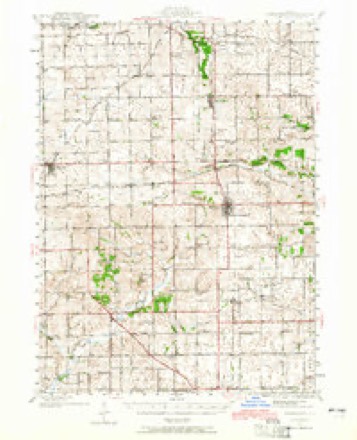
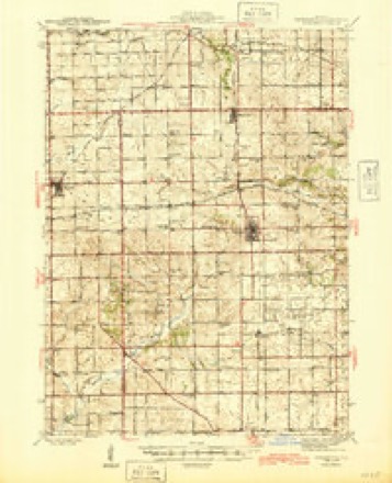
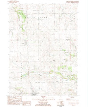
14 topographic sheets cover this place, the earliest surveyed in 1942 and the latest in 1983. It stands in Forreston Township. It lies in ZIP code area 61007. The Survey maps it on the Forreston North quadrangle.
Topographic sheets covering this place
8 surveys from 14 printed sheetsMatched by testing this settlement's coordinate against the published boundary of every sheet in the United States Geological Survey's historical collection. Each opens the scanned sheet at the Survey.
- 1942 USGS Forreston quadrangle1:62500, 2 printings
- 1945 USGS Forreston quadrangle1:62500, 2 printings
- 1954 USGS Rockford quadrangle1:250000
- 1955 USGS Rockford quadrangle1:250000
- 1958 USGS Rockford quadrangle1:250000, 4 printings
- 1963 USGS Rockford quadrangle1:250000
- 1981 USGS Rockford quadrangle1:100000, 2 printings
- 1983 USGS Forreston North quadrangle1:24000





In the county-history sources
8,941 words on this townshipThe History of Ogle County, Illinois, Containing a History of the County, Its Cities, Towns, Etc., a Biographical Directory of Its Citizens, War Record of Its Volunteers in the Late Rebellion, General and Local Statistics ... History of the Northwest, History of Illinois ... Etc, published 1878 names this settlement in its chapter on Forreston Township. These are the passages that mention it, exactly as the scans read.
In the Spring of 1855, Mr. Daniels built and opened a store, near the depot on the west side of the track, where he also kept the first post ofiice. In the same Spring, Samuel Mitchell, who had come from Maryland to Lincoln Township, together with Jonathan Meyers, in 1837, and Matthew Blair, who came to Mount Morris from Pennsylvania in 1845, moved to the new village of Forreston with their families and built their residences. In this year, also, Mr. Hewitt brought his family from Pennsylvania, although he had previously built his residence.
Passage source: The History of Ogle County, Illinois, Containing a History of the County, Its Cities, Towns, Etc., a Biographical Directory of Its Citizens, War Record of Its Volunteers in the Late Rebellion, General and Local Statistics ... History of the Northwest, History of Illinois ... Etc, published 1878.
In the Fall of 1855, Henry Hiller established the first store, of any importance, in the small building still standing just north of the Sherman House. This he sold to Mr. Woodruff, who in turn disposed of his business to David Reinhardt, in 1858. Mr. Reinhardt built the store now occupied by Hewitt & Rosenstiel in the same year, and continued his general store in that building.
Passage source: The History of Ogle County, Illinois, Containing a History of the County, Its Cities, Towns, Etc., a Biographical Directory of Its Citizens, War Record of Its Volunteers in the Late Rebellion, General and Local Statistics ... History of the Northwest, History of Illinois ... Etc, published 1878.
In the Fall of 1856, a meeting was held at Brookville for the purpose of organizing the Township, at which the Baileyville people contended that the Township should be named "Mendora." When the Central Railroad was built, this station had been named " Forreston," and the people of this village succeeded in securing that name for th eTownship. The first officers elected were, Matthew Blair, Supervisor, and M.'B. Geer, Assessor. There were twentyeight names enrolled on Mr. Geer's first tax book. The first school house was built in the*same year.
Passage source: The History of Ogle County, Illinois, Containing a History of the County, Its Cities, Towns, Etc., a Biographical Directory of Its Citizens, War Record of Its Volunteers in the Late Rebellion, General and Local Statistics ... History of the Northwest, History of Illinois ... Etc, published 1878.
Machine-read from a century-old scan, so expect the errors a machine makes: misspelled names, dropped words, stray characters.
Read the whole chapter on Forreston Township - it names this place 4 more 4 times.
Fires near this place
9 since 2010Regional context, not property-specific evidence. The federal wildfire occurrence database lists 9 fires within 5 miles of Baileyville between 2010 and 2020, burning about 8 acres in total. None started naturally. None was recorded as arson. Distance is straight-line from the map coordinates, so a fire counted here may appear on a neighbouring settlement's page as well.
| Reported cause | Fires |
|---|---|
| Missing data/not specified/undetermined | 4 |
| Debris and open burning | 3 |
| Railroad operations and maintenance | 1 |
| Power generation/transmission/distribution | 1 |
The most recent of them, most recent first, with the day each was reported and the service that recorded it.
| Date | Cause | Size | Reported by | Name on the report |
|---|---|---|---|---|
| 5 May 2010 | Missing data/not specified/undetermined | 1.0 acres | Illinois Division of Forestry Resources | 1845 |
| 18 May 2014 | Debris and open burning | 1.0 acres | Illinois Division of Forestry Resources | 14-0000049 |
| 11 May 2020 | Debris and open burning | under an acre | Illinois Division of Forestry Resources | 20-0000054 |
| 4 April 2020 | Railroad operations and maintenance | 2.0 acres | Illinois Division of Forestry Resources | 20-0000039 |
| 4 April 2020 | Missing data/not specified/undetermined | 1.0 acres | Illinois Division of Forestry Resources | 20-0000032 |
| 4 April 2020 | Missing data/not specified/undetermined | 2.0 acres | Illinois Division of Forestry Resources | 20-0000038 |
| 28 April 2010 | Missing data/not specified/undetermined | under an acre | Illinois Division of Forestry Resources | 1032 |
| 12 April 2014 | Power generation/transmission/distribution | 1.0 acres | Illinois Division of Forestry Resources | 14-0000035 |
Settlements close enough to share some of these fires:
Mines and quarries near this place
9 within 5 milesRegional context, not property-specific evidence. The federal mineral resources record lists 9 workings within 5 miles of Baileyville: 6 past producers, 3 producers. 3 still produce. What was taken out: Stone, Crushed/Broken, Sand and Gravel, Construction. Distance is straight-line from the map coordinates, so a quarry counted here may appear on a neighbouring settlement's page as well.
| Where | Site | Commodity | Status | Recorded |
|---|---|---|---|---|
| Bauch Pit | Sand and Gravel, Construction | Producer | ||
| C.J. Kutz Quarry | Stone, Crushed/Broken | Producer | ||
| F. Coffman Quarry | Stone, Crushed/Broken | Past Producer | ||
| Kutz Quarry | Stone, Crushed/Broken | Producer | ||
| Meyers Property | Stone, Crushed/Broken | Past Producer | ||
| Unnamed Limestone Quarry | Stone, Crushed/Broken | Past Producer | ||
| Unnamed Limestone Quarry | Stone, Crushed/Broken | Past Producer | ||
| Unnamed Limestone Quarry | Stone, Crushed/Broken | Past Producer | ||
| Unnamed Limestone Quarry | Stone, Crushed/Broken | Past Producer |
Storms near this place
7 since 1995Regional context, not property-specific evidence. The National Weather Service names Baileyville in 7 storm reports between 1995 and 2022: 3 flash flood, 2 tornado, 2 thunderstorm wind. No death or injury is recorded in these reports. Each account below is quoted exactly as the forecast office filed it, from the NOAA Storm Events Database, and each date opens the federal record of that event.
| When | Event | Place named | Harm | What the report says |
|---|---|---|---|---|
| June 2009 | Flash Flood | Baileyville | $250,000 | Flash flooding occurred in many parts of Ogle County on June 19th. A few days later, heavy rain once again caused flash flooding across many of the same areas. Some of the more significant flash flooding reports included an apartment building that was flooded in Polo. One family was evacuated. The Lost Nation Bridge was washed out which cut off access to 30 homes. Pines Road at White Pines State Park was totally inundated with two homes sustaining major damage. Several trails in White Pines State Park were washed away or damaged. A small area of railroad tracks were washed out between White Pine State Park and Lake LaDonna Family Campgrounds. Flood water came over a bridge on Flagg Road. Parts of Hoosier Road were washed out. Grist Mill at Stone Hill was closed due to a wash out. Flooding was reported on numerous roads across the county. |
| June 2009 | Flash Flood | Baileyville | $100,000 | Ogle County Emergency Management received 40 flash flooding reports during the evening of June 19th. Some of the most significant flooding included a home on Gale Road west of Oregon that was surrounded by fast moving flood waters. A nearby drainage ditch had several feet of fast moving flood water. Thirty campers had to be evacuated through flood waters from the Rock River Marina & Campground on River Road near Oregon where nearly 5 inches of rain was reported. Numerous streets were flooded and closed in Oregon, Polo, and Mt. Morris. Some rural roads between Oregon and Polo were washed out. Damage was reported to several shoulders of rural roads. A restaurant in Oregon had to close due to flooding. The Tracks and Summer Recreation facility on Pines Road was flooded with several feet of water. |
| May 2022 | Tornado (EFU) | Baileyville | - | Based on multiple spotter reports, a brief tornado touched down in a field just south of Coffman Road two miles south of Baileyville. Spotters reported rotating dust underneath a funnel cloud. The tornado was on the ground for approximately 30 seconds. No damage was reported. |
| April 2013 | Flash Flood | Baileyville | - | Flooding was occurring at a nursing home in Oregon. Sandbags were sent to Stillman Valley. Creeks were rising out of their banks near Polo. River Road was closed south of Route 72 near Byron. Also near Byron, the Rock River undercut portions of the shoulder of Route 2 in several spots. Widespread standing water was reported county wide. An observer in Oregon reported a storm total of 5.00 inches or rainfall. |
| October 2010 | Thunderstorm Wind | Baileyville | - | One large tree was blown down about 5 miles north northeast of Forreston, near the Stephenson County border. |
| August 2007 | Thunderstorm Wind | Baileyville | - | A tree was blown down. |
| April 1995 | Tornado (F1) | Baileyville | - | A man standing in a machine shed witnessed a small tornado move across his farm. The eaves were torn off his house and insulation was sucked out of the attic. Trees were damaged. A propane tank was blown into the side of the machine shed. Another nearby farm had nine trees uprooted and several farm outbuildings damaged. A large grain shed was destroyed. |
Nearest settlements
The eight closest, with where each one stands in the county. Distances are straight-line, computed from the Geographic Names Information System coordinates.
| Map | Place | Distance | Sheets |
|---|---|---|---|
| Harper | 4.8 miles | 14 | |
| Forreston | 5.0 miles | 14 | |
| Adeline | 6.6 miles | 14 | |
| Haldane | 9.4 miles | 14 | |
| Maryland | 9.4 miles | 14 | |
| Egan | 10.0 miles | 14 | |
| Lightsville | 10.6 miles | 14 | |
| Leaf River | 11.2 miles | 14 |
Provenance
This settlement is recorded in the Geographic Names Information System as feature 403811. The sheet list is computed by point-in-boundary test against the United States Geological Survey's historical topographic inventory. Both are works of the United States government and carry no copyright under 17 U.S.C. 105.
Wildfire. Short, Karen C. 2022. Spatial wildfire occurrence data for the United States, 1992-2020 [FPA_FOD_20221014]. 6th Edition. Fort Collins, CO: Forest Service Research Data Archive. https://doi.org/10.2737/RDS-2013-0009.6 Collected with United States Government funding and usable without additional permissions or fees.
Mines and quarries. USGS Mineral Resources Data System (MRDS) https://mrdata.usgs.gov/mrds/ A work of the United States government, no copyright under 17 U.S.C. 105.
Storms. NOAA National Centers for Environmental Information, Storm Events Database https://www.ncei.noaa.gov/stormevents/ A work of the United States government, no copyright under 17 U.S.C. 105. Narratives are quoted verbatim from the National Weather Service report and are not edited or summarised.