 Block
Bloomington, Illinois
14 topographic sheets cover this place, the earliest surveyed in 1951 and the latest in 1998. It stands in Bloomington City Township. It lies in ZIP code area 61701. The Survey maps it on the Bloomington East quadrangle. 78,680 people lived here at the 2020 count. It stands 797 feet above sea level.
Research this city
On record in Bloomington
Buildings and businesses the archive holds for this place. Each opens its own page, with the source record it came from.
On the National Register 12 of 19 shown
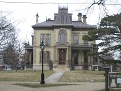 Clover LawnNational Historic Landmark · listed 1972
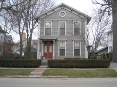 Ruben M. Benjamin Houselisted 1978
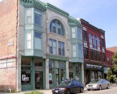 Bloomington Central Business Districtlisted 1985
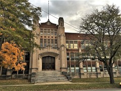 Bloomington High Schoollisted 2018
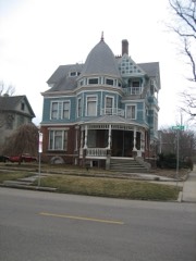 George H. Cox Houselisted 1985
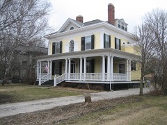 Davis, David, III & IV, Houselisted 1982
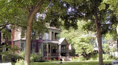 East Grove Street District-Bloomingtonlisted 1987
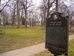 Franklin Squarelisted 1976
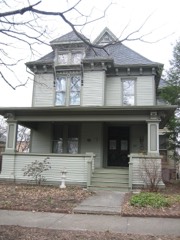 Robert Greenlee Houselisted 1997
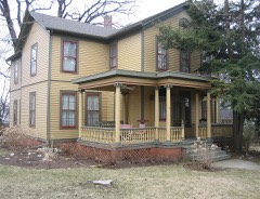 John M. Hamilton Houselisted 1978
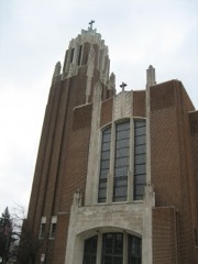 Holy Trinity Church Rectory and Conventlisted 1983
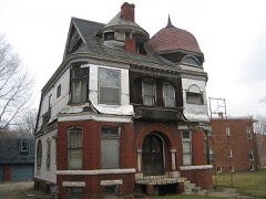 George H. Miller Houselisted 1978
Population over time
3 figuresBloomington grew from 64,808 to 78,680 between 2000 and 2020. These are the recorded population figures Wikidata holds for this place, reached through the Geographic Names Information System number this page is keyed on rather than by name, so they belong to this place and not to another of the same name. Most are census counts, but not all are: an early figure may be a founding or settlement estimate, and an estimate published within five years of a census is left out. The change column is computed, and is left blank where more than 20 years separate a figure from the one before it, because a gap that long is not a change between two counts.
| Year | People | Change |
|---|---|---|
| 2000 | 64,808 | |
| 2010 | 76,610 | +11,802 (+18%) |
| 2020 | 78,680 | +2,070 (+3%) |
Topographic sheets covering this place
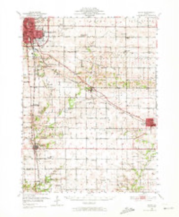
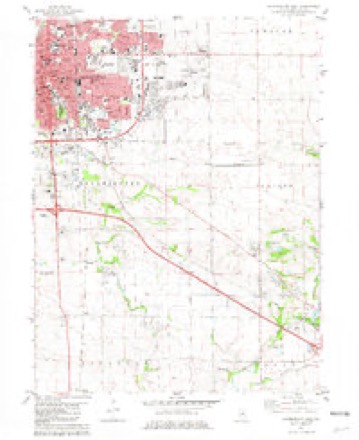
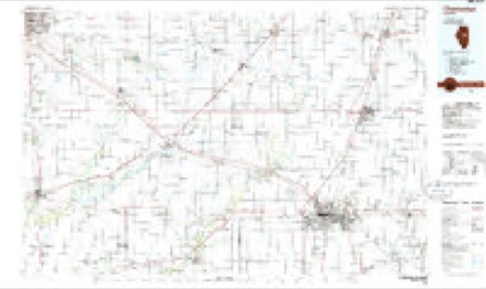
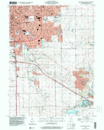
8 surveys from 14 printed sheetsMatched by testing this settlement's coordinate against the published boundary of every sheet in the United States Geological Survey's historical collection. Each opens the scanned sheet at the Survey.
- 1951 USGS Le Roy quadrangle1:62500, 3 printings
- 1958 USGS Peoria quadrangle1:250000, 4 printings
- 1961 USGS Peoria quadrangle1:250000
- 1963 USGS Peoria quadrangle1:250000
- 1981 USGS Bloomington East quadrangle1:24000
- 1985 USGS Champaign quadrangle1:100000, 2 printings
- 1990 USGS Peoria quadrangle1:250000
- 1998 USGS Bloomington East quadrangle1:24000




What happened here
An account from the chapter on Bloomington City township. The inset identifies its exact source book and publication year.
Political History
Our city has always claimed that the great Republican party of the nation had its "birth at Major's Hall in 1856. At the risk of being attacked for our audacity, we will undertake to declare this a spurious claim. In the fall of 1854, the opposition to the Nebraska bill all over the country fought its battles under different names, generally as Free-Soilers, Anti-Nebraska Democrats, the Whig or American party; though in Massa- -chusetts the Free-Soilers and Anti-Nebraska Democrats had declared theoaselves to be Republicans.
In the county-history sources
72,613 words on this townshipHistory of Bloomington and Normal, in McLean County, Illinois, published 1879 names this settlement in its chapter on Bloomington City Township. These are the passages that mention it, exactly as the scans read.
Our township has been situated in allegiance to many different counties. In 1817, Illinois being then a Territory, the county of Crawford was in power here. In 1819, a year after the State of Illinois had been admitted into the Union, Clark County had jurisdiction, while, in 1821, Fayette County was organized, extending northeast as far as the Illinois River, and to Fayette our first settlers owed allegiance. As understood at the time, Fayette reached to the Wisconsin line. This was the meaning of the act incorporating Fayette County, but as, by a previous law, Pike County included all north of the Illinois River, Fayette County could not enforce its claiiu to its most northern territory.
Passage source: History of Bloomington and Normal, in McLean County, Illinois, published 1879.
All this region of country now known as McLean County, east of the Third Principal Meridian, was situated in the county of Fayette, and thus remained until the development of the country several years later rendered it absolutely necessary that this immense tract should be subdivided into several counties. We will attempt to give the names of only a few of the first settlers of this township, mentioning some of the most prominent, but may, through inadvertence, omit others equally deserving. In 1822, John Hendrix and John W. Dawson, with their families, settled in the southern portion of Blooming Grove. There was with them in the same year a single man of the name of Segur, who, however, did not stay long in the settlement, he having sold his claim in 1823 to Mr. William Orendorfi". Mr. Dawson remained four years, when he removed to near the site of the old Indian town in Old Town Timber. During these four years, while his family lived at the Grove, there were no less than fifteen difi"erent families who made their homes here, so that Blooming Grove very soon became a wellsettled community. Mr. Hendrix is entitled to the honor of being the first settler, as Mr. Dawson's family did not arrive till after Mr. H. had been here some weeks. Of the family of John W. Dawson, who came in 1822, we will here remark that two are now living in the city of Bloomington, having moved from Old Town many years ago. The oldest is Mrs. William Paist, whose first husband was Maj. Owen Cheney. She was about eight years old when her father moved to the Indian town. She was a great favorite with the Indian squaws, who often carried her to their homes, keeping her for days at a time, where the little girl was greatly pleased and interested. Mrs. P. does not even yet appear aged - scarcely elderly. She takes a great interest in society, and it seems hardly possible that this active lady has seen the full growth and development of Blooming Grove, of Bloomington City and of McLean County. Her brother, John Dawson, is the next oldest pioneer now living in our city.
Passage source: History of Bloomington and Normal, in McLean County, Illinois, published 1879.
In the year 1823, William Orendorff and wife arrived, with Mr. Thomas Orendorff, then a young man of twenty-three. In 1824, Mr. Goodheart and W. H. Hodge settled at the Grove, and about the same time Mr. William Walker and family, and enough others to bring the whole number of families up to about fifteen by the end of the year 1824. There were no exceptions to the general good character attributed to all of the first families, thus giving illustration to the old saying in regard to " birds of a feather."
Passage source: History of Bloomington and Normal, in McLean County, Illinois, published 1879.
Machine-read from a century-old scan, so expect the errors a machine makes: misspelled names, dropped words, stray characters.
Read the whole chapter on Bloomington City Township - it names this place 9 more 9 times.
Fires near this place
1 since 2013Regional context, not property-specific evidence. The federal wildfire occurrence database lists 1 fire within 5 miles of Bloomington in 2013, burning about 2 acres in total. None started naturally. None was recorded as arson. Distance is straight-line from the map coordinates, so a fire counted here may appear on a neighbouring settlement's page as well.
| Reported cause | Fires |
|---|---|
| Missing data/not specified/undetermined | 1 |
The most recent of them, most recent first, with the day each was reported and the service that recorded it.
| Date | Cause | Size | Reported by | Name on the report |
|---|---|---|---|---|
| 3 April 2013 | Missing data/not specified/undetermined | 2.0 acres | Illinois Division of Forestry Resources | TALASKI |
Settlements close enough to share some of these fires:
Mines and quarries near this place
5 within 5 milesRegional context, not property-specific evidence. The federal mineral resources record lists 5 workings within 5 miles of Bloomington: 3 past producers, 1 plant, 1 producer. 2 still produce. What was taken out: Sand and Gravel, Construction, Stone. Distance is straight-line from the map coordinates, so a quarry counted here may appear on a neighbouring settlement's page as well.
| Where | Site | Commodity | Status | Recorded |
|---|---|---|---|---|
| Normal City Pit | Stone | Past Producer | ||
| Baugh Pit & Mill | Sand and Gravel, Construction | Plant | ||
| Market Street Pit | Sand and Gravel, Construction | Past Producer | ||
| Rowe Pit No. 3 | Sand and Gravel, Construction | Producer | ||
| Rowe Pit No.2 | Sand and Gravel, Construction | Past Producer |
Storms near this place
60 of 102 shownRegional context, not property-specific evidence. The National Weather Service names Bloomington in 102 storm reports between 1993 and 2026: 57 thunderstorm wind, 39 hail, 2 tornado, 2 flash flood. No death or injury is recorded in these reports. Each account below is quoted exactly as the forecast office filed it, from the NOAA Storm Events Database, and each date opens the federal record of that event.
| When | Event | Place named | Harm | What the report says |
|---|---|---|---|---|
| July 2008 | Lightning | Bloomington | $200,000 | Lightning struck the roof of Bent Elementary School in Bloomington causing extensive damage to the roof and chimney. There were no injuries. |
| September 2010 | Lightning | Bloomington | $50,000 | A lightning strike occurred in the 300 block of St. Joseph Drive in Bloomington. The resulting fire caused approximately $50,000 in damages to the roof of a physician's office building. |
| December 2008 | Thunderstorm Wind | Bloomington | $50,000 | Strong winds damaged three to four buildings at a farmstead near Ireland Grove Road and Towanda Barnes Road. A machine shed was also destroyed. |
| December 2008 | Thunderstorm Wind | Bloomington | $40,000 | Four semi trucks were blown over on I-55 and I-74 on the west side of Bloomington. |
| September 2019 | Thunderstorm Wind | Bloomington | $30,000 | Numerous trees and tree branches were blown down across Bloomington including at: Poplar and Linden, Washington and Prospect, Airport and Towanda, and Meadows Trailer Court. |
| July 2008 | Thunderstorm Wind | Bloomington | $30,000 | Numerous tree limbs and power lines were blown down from Bloomington to Lexington. |
| June 2018 | Thunderstorm Wind | Bloomington | $25,000 | Numerous large tree limbs were blown down, including one that damaged a car. |
| September 2010 | Thunderstorm Wind | Bloomington | $25,000 | Numerous powerlines were blown down in the city of Bloomington. |
| June 2011 | Thunderstorm Wind | Bloomington | $21,000 | A large tree was blown down onto a van, severely damaging it. Another large tree fell onto a fence. |
| July 2008 | Thunderstorm Wind | Bloomington | $20,000 | Several trees and tree limbs were blown down. |
| August 2008 | Thunderstorm Wind | Bloomington | $20,000 | Several trees were blown down onto powerlines. |
| June 2011 | Thunderstorm Wind | Bloomington | $2,000 | A 10-inch diameter tree was blown down at Alexander Rd. and Six Points Rd. in Bloomington. |
| July 2025 | Thunderstorm Wind | Bloomington | - | Several large tree limbs were blown down at the corner of West Mulberry Street and North Catherine Street. |
| July 2025 | Thunderstorm Wind | Bloomington | - | A tree was blown down at North Western Avenue near West Seminary Avenue blocking the cul-de-sac to Nicole Court. |
| July 2025 | Thunderstorm Wind | Bloomington | - | A large tree was blown over on Emerson Street. |
| July 2025 | Thunderstorm Wind | Bloomington | - | Several tree branches were blown down at Illinois Wesleyan University. |
| July 2025 | Thunderstorm Wind | Bloomington | - | A few tree branches were blown down on North Mason Street. |
| May 2024 | Thunderstorm Wind | Bloomington | - | A large tree limb was blown onto the roof of a home near the intersection of South Main Street and Hamilton Road. |
| July 2024 | Thunderstorm Wind | Bloomington | - | Several large tree limbs were blown down onto Morris Street a half mile north of Miller Park. |
| July 2024 | Thunderstorm Wind | Bloomington | - | A large tree limb was blown down on South Linden Street near its intersection with Jersey Avenue. |
| July 2024 | Thunderstorm Wind | Bloomington | - | Widespread tree damage occurred at Forrest and Miller Parks, including three large trees (larger than 2 feet in diameter) snapped and numerous large tree limbs downed. |
| March 2023 | Thunderstorm Wind | Bloomington | - | Large trees were blown down on West Olive Street. |
| May 2023 | Thunderstorm Wind | Bloomington | - | A large tree was blown down. |
| June 2023 | Thunderstorm Wind | Bloomington | - | Several large tree branches were blown down. |
| June 2023 | Thunderstorm Wind | Bloomington | - | Several 4 to 5-inch diameter tree branches were blown down. |
| October 2021 | Thunderstorm Wind | Bloomington | - | A large tree was blown onto a metal shed. |
| August 2020 | Thunderstorm Wind | Bloomington | - | A large tree limb was blown down. |
| May 2019 | Thunderstorm Wind | Bloomington | - | A large tree was snapped at the base at Highland Park Golf Course. Several large tree limbs were blown down near Miller Park. |
| May 2019 | Thunderstorm Wind | Bloomington | - | A large tree was blown onto an apartment building. |
| May 2019 | Thunderstorm Wind | Bloomington | - | Several trees and tree branches were blown down. |
| June 2019 | Thunderstorm Wind | Bloomington | - | A tree was blown down at the intersection of Market and Lee Streets. |
| June 2018 | Thunderstorm Wind | Bloomington | - | Several large tree limbs were blown down. |
| July 2016 | Thunderstorm Wind | Bloomington | - | A large tree branch was blown down in Bloomington. |
| March 2007 | Thunderstorm Wind | Bloomington | - | Two trees were blown down. |
| April 2006 | Thunderstorm Wind | Bloomington | - | Mobile homes destroyed on south side of town. |
| June 2006 | Thunderstorm Wind | Bloomington | - | A few trees were blown down at Miller Park. In addition, several power lines were blown down on the south side of town. |
| June 2006 | Thunderstorm Wind | Bloomington | - | A wood frame building under construction was severely damaged when portions of the frame were blown down. |
| May 2006 | Thunderstorm Wind | Bloomington | - | Part of a roof sustained minor damage. An apple tree was uprooted. |
| June 2006 | Thunderstorm Wind | Bloomington | - | Several large tree limbs were blown down in Miller Park. In addition, a large tree was blown down at the Highland Park Golf Course. |
| June 2006 | Hail | Bloomington | - | A farm sustained severe crop damage from hail. Leaves were stripped off corn stalks and soybean plants were cut off near the ground. In addition, six large trees were damaged. |
| July 2006 | Thunderstorm Wind | Bloomington | - | Trees and power lines were blown down all across town. |
| July 2005 | Thunderstorm Wind | Bloomington | - | Power lines blown down. |
| September 2005 | Thunderstorm Wind | Bloomington | - | Several trees and large tree limbs blown down. |
| May 2004 | Tornado (F0) | Bloomington | - | A tornado briefly touched down in a field near the intersection of I-74 and US-51. No damage or injuries were reported. |
| May 2004 | Flash Flood | Bloomington | - | Several roads in Bloomington were flooded due to heavy rains. |
| August 2004 | Flash Flood | Bloomington | - | Several streets were flooded in Bloomington and Normal. |
| May 2001 | Thunderstorm Wind | Bloomington | - | A large tree limb was blown down in town, as well as several power lines. |
| May 2000 | Thunderstorm Wind | Bloomington | - | Several large tree limbs were blown down. |
| June 2000 | Thunderstorm Wind | Bloomington | - | Several large trees, tree limbs and power lines were blown down. |
| February 1999 | Thunderstorm Wind | Bloomington | - | A semi was blown over at the I-55/I-74 interchange on the southwest side of Bloomington. No injuries were reported. Also, a large tree was blown over across Veterans Parkway. |
| June 1999 | Tornado (F0) | Bloomington | - | A tornado briefly touched down on Stringtown Road 4 miles southwest of Bloomington. No injuries or damage were reported. |
| June 1998 | Thunderstorm Wind | Bloomington | - | A large tree was snapped off 4 to 5 feet above the ground one mile west of Bloomington, next to I-55. No structural damage or injuries were reported. |
| May 1998 | Thunderstorm Wind | Bloomington | - | Thunderstorm winds blew down numerous power and cable lines in Bloomington, as well as, numerous tree limbs. No injuries were reported. |
| March 1998 | Thunderstorm Wind | Bloomington | - | Numerous large tree limbs were blown down. One fell down onto an unoccupied car, causing the roof to cave in. No injuries were reported and no damage estimate was available. |
| April 1997 | Thunderstorm Wind | Bloomington | - | Thunderstorm winds blew down a billboard on Veteran's Parkway in Bloomington then knocked down roof trusses of a house under construction 1 mile northwest of Downs. No injuries were reported and no damage estimate was available. |
| June 1995 | Thunderstorm Wind | Bloomington | - | Numerous tree limbs and power lines were blown down with some minor damage to a few roofs. |
| August 1993 | Thunderstorm Wind | Bloomington | - | Wind gusts to 60 mph were measured by Mclean County ESDA officials. |
| March 2026 | Hail | Bloomington | - | no account filed |
| March 2026 | Hail | Bloomington | - | no account filed |
| March 2026 | Hail | Bloomington | - | no account filed |
Nearest settlements
The eight closest, with where each one stands in the county. Distances are straight-line, computed from the Geographic Names Information System coordinates.
| Map | Place | Distance | Sheets |
|---|---|---|---|
| Normal | 2.1 miles | 15 | |
| Bloomington Heights | 2.1 miles | 13 | |
| Cardinal Court | 2.3 miles | 15 | |
| Hedgewood | 3.4 miles | 15 | |
| Greenbriar | 3.5 miles | 15 | |
| North Pointe | 3.6 miles | 15 | |
| Colonial Meadows | 3.7 miles | 14 | |
| Eagle Ridge | 4.1 miles | 15 |
Elsewhere
Matched on this settlement's Geographic Names Information System number rather than its name, so it cannot be a different place of the same name in another state.
| Wikipedia article on Bloomington | An encyclopaedic summary. Its text is share-alike, so it is linked here rather than copied. |
| Wikidata item Q577802 | The structured record the population and elevation above come from. Public domain (CC0). |
Provenance
This settlement is recorded in the Geographic Names Information System as feature 404579. The sheet list is computed by point-in-boundary test against the United States Geological Survey's historical topographic inventory. Both are works of the United States government and carry no copyright under 17 U.S.C. 105.
Wildfire. Short, Karen C. 2022. Spatial wildfire occurrence data for the United States, 1992-2020 [FPA_FOD_20221014]. 6th Edition. Fort Collins, CO: Forest Service Research Data Archive. https://doi.org/10.2737/RDS-2013-0009.6 Collected with United States Government funding and usable without additional permissions or fees.
Mines and quarries. USGS Mineral Resources Data System (MRDS) https://mrdata.usgs.gov/mrds/ A work of the United States government, no copyright under 17 U.S.C. 105.
Storms. NOAA National Centers for Environmental Information, Storm Events Database https://www.ncei.noaa.gov/stormevents/ A work of the United States government, no copyright under 17 U.S.C. 105. Narratives are quoted verbatim from the National Weather Service report and are not edited or summarised.