 Block
Blue Mound, Illinois
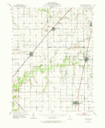
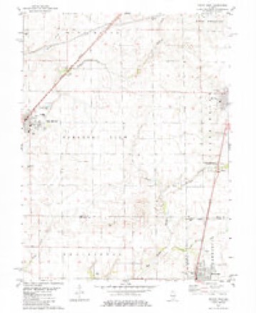
11 topographic sheets cover this place, the earliest surveyed in 1952 and the latest in 1985. It stands in Pleasant View Township. It lies in ZIP code area 62513. It stands on Blue Mound. The Survey maps it on the Macon West quadrangle. 1,133 people lived here at the 2020 count. It stands 616 feet above sea level.
Population over time
2 figuresBlue Mound fell from 1,158 to 1,133 between 2010 and 2020. These are the recorded population figures Wikidata holds for this place, reached through the Geographic Names Information System number this page is keyed on rather than by name, so they belong to this place and not to another of the same name. Most are census counts, but not all are: an early figure may be a founding or settlement estimate, and an estimate published within five years of a census is left out. The change column is computed, and is left blank where more than 20 years separate a figure from the one before it, because a gap that long is not a change between two counts.
| Year | People | Change |
|---|---|---|
| 2010 | 1,158 | |
| 2020 | 1,133 | -25 (-2%) |
Topographic sheets covering this place
5 surveys from 11 printed sheetsMatched by testing this settlement's coordinate against the published boundary of every sheet in the United States Geological Survey's historical collection. Each opens the scanned sheet at the Survey.
- 1952 USGS Assumption quadrangle1:62500, 2 printings
- 1958 USGS Decatur quadrangle1:250000, 3 printings
- 1961 USGS Decatur quadrangle1:250000, 2 printings
- 1982 USGS Macon West quadrangle1:24000, 2 printings
- 1985 USGS Springfield quadrangle1:100000, 2 printings



In the county-history sources
809 words on this townshipHistory of Macon County, Illinois : with Illustrations Descriptive of Its Scenery, and Biographical Sketches of Some of Its Prominent Men and Pioneers, published 1880 names this settlement in its chapter on Pleasant View Township. These are the passages that mention it, exactly as the scans read.
The greater part of the territory embraced within Pleasant View, remained uninhabited in its wild native state for a number of years after the county was organized ; only here and there could be seen the lone cabin of some hardy pioneer who had come to clear the way for the great army of emigrants. The first settlements in this township began in the northern part, and were made by that adventurous class of Kentuckians to whom is due the honor of having done more toward the early settlement and development of Illinois than the natives of any other state in the Union. Some of the men emigrated here prior to 1830. The individual to whom belongs the credit of having first settled in Pleasant View township, was Valentine Claywell, a native of Kentucky, who located in the northern part of the township in 1828. John Reed was also a very early settler in the same locality. John G. Fletcher, at present living near W. W. Auburn in Christian county, settled in this township in the early part of its history. The earliest marriage which occurred in this township was that of William Lewis to Miss Caroline Sprouse, by the Rev. William Ferguson. William Stevens was the first child born. Elder A. D. Xorthcutt, a prominent gentleman, now residing in the adjoining county, has the honor of having delivered the first sermon, in this as well as in other townships of Macon county. It was not until the year 1867, that a regularly located preacher was secured for this township. This gentleman was the Rev. Mr. Hoye, who was located in the town of Blue Mound, and during the following year, the first church in Pleasant View was erected at that place. As most of the early settlements were made near the northern line of the township, the children attended the schools of Blue Mound township, and for this reason, it was not until the year 1862 that a school-house was erected in Pleasant View. During this year a frame school-house was built on section seven of T. 14 X. R. 1 E., and the same year William Sterett taught the same school. In 1865, William Brookshire opened a blacksmith shop on section eight, which was the earliest in the township. There was no mill of any kind here until Mr. James Irwin, a farmer living a short distance south-east from Blue Mound, erected a wind-mill for the purpose of grinding corn. The first land entered in this township was by David Simons, March 15th) 1836, forty acres in section thirteen ; Samuel Widick entered one hundred and sixty acres also in the same section. Both tracts were in T. 14 X. R. 1 E. The following are the supervisors, who have represented Pleasant View, as taken from the record books: - D. D Rowles, elected in 1869, and re-elected in 1870, 1871 ; John Hatfield, elected in 1872 ; E. House, elected in 1873, and by re-election each year has held the office ever since. Prominent among some of the older settlers of the county, now living in the township are : James D. Smith, a native of this state, born in the county in 1845 ; is now residing in section thirteen. E. F. Delbridge, residing on section seventeen, is a native of Prussia, and came to this country in 1858 ; Wm M. Moss, his neighbor, and from the same country, also resides on section seventeen. Wm. F. Brookshire, a native of Kentucky, came here in 1857, having lived twenty-three years in this township. O. T. Crow, living on section three, is an Ohioan, and settled in the county in 1857. During the decade of 1860 there was a large influx of population, and there has continued a steady growth ever since.
Passage source: History of Macon County, Illinois : with Illustrations Descriptive of Its Scenery, and Biographical Sketches of Some of Its Prominent Men and Pioneers, published 1880.
Machine-read from a century-old scan, so expect the errors a machine makes: misspelled names, dropped words, stray characters.
Storms near this place
20 since 1996Regional context, not property-specific evidence. The National Weather Service names Blue Mound in 20 storm reports between 1996 and 2025: 12 thunderstorm wind, 5 hail, 3 tornado. The reports record 1 injury. Each account below is quoted exactly as the forecast office filed it, from the NOAA Storm Events Database, and each date opens the federal record of that event.
| When | Event | Place named | Harm | What the report says |
|---|---|---|---|---|
| June 1999 | Thunderstorm Wind | Blue Mound | 1 hurt | As a line of severe storms moved through Macon County, four sheds, several garages and a barn were destroyed. Also, numerous trees and power lines were blown down in Niantic, Elwin, and Mt. Zion areas. In Niantic, a live power line fell onto a person causing minor injuries. |
| July 2010 | Thunderstorm Wind | Blue Mound | $25,000 | Several trees and tree branches were blown down in Blue Mound. |
| August 2020 | Thunderstorm Wind | Blue Mound | $20,000 | A tree was blown onto a house in Blue Mound. |
| June 2010 | Thunderstorm Wind | Blue Mound | $15,000 | Several trees were uprooted in Blue Mound. |
| May 2013 | Thunderstorm Wind | Blue Mound | $2,000 | A large tree was snapped at the base. |
| December 2025 | Tornado (EF2) | Blue Mound | - | This tornado crossed into far western Macon County from Christian County about 1 mile west-northwest of Blue Mound at 3:00 PM CST. It tracked east-northeastward and remained weak until it crossed US Highway 54 and reached Elwin. Between Elwin and Turpin, several homes sustained roof damage and numerous large trees were snapped. The most significant tornado damage occurred along East Skyline Drive as the roofs of 8 homes were stripped off, a garage was completely destroyed and tossed to the next block, and very large trees were knocked down. As the tornado continued east-northeastward, it caused more roof and tree damage between South Baltimore Avenue and South Mount Zion Road. The tornado then weakened, but continued to snap tree branches and cause shingle damage to a few homes as it passed through the Long Creek area eastward to the Macon/Piatt County line. It then tracked into western Piatt County just north of the intersection of Ocean Trail and NE County Line Road at 3:30 PM CST. |
| July 2024 | Thunderstorm Wind | Blue Mound | - | A tree was blown onto powerlines causing a power outage on the east side of town. Several tree branches were blown down as well. |
| June 2023 | Thunderstorm Wind | Blue Mound | - | Multiple trees were blown down. |
| May 2019 | Tornado (EF0) | Blue Mound | - | A landspout tornado touched down in an open field about 2.1 miles east of Blue Mound at 4:50 PM CDT. The tornado dissipated 6 minutes later with no damage being reported. |
| June 2018 | Thunderstorm Wind | Blue Mound | - | A large tree limb was blown down at the intersection of Lincoln and Boles St. |
| May 2005 | Hail | Blue Mound | - | Hail covered the ground. |
| May 2003 | Thunderstorm Wind | Blue Mound | - | Several trees and power poles were blown down. |
| August 2001 | Thunderstorm Wind | Blue Mound | - | Thunderstorm winds blew down numerous power lines and several power poles in the Blue Mound, Decatur, Mt. Zion, and Long Creek areas. Also, a tree was blown down onto Twin Bridge Road in Long Creek. |
| April 1997 | Tornado (F0) | Blue Mound | - | A tornado briefly touched down in a field 3 miles south of Blue Mound. No damage was reported. |
| March 2025 | Hail | Blue Mound | - | no account filed |
| March 2020 | Hail | Blue Mound | - | no account filed |
| June 2008 | Hail | Blue Mound | - | no account filed |
| May 2005 | Thunderstorm Wind | Blue Mound | - | no account filed |
| April 2002 | Hail | Blue Mound | - | no account filed |
| October 1996 | Thunderstorm Wind | Blue Mound | - | no account filed |
Nearest settlements
The eight closest, with where each one stands in the county. Distances are straight-line, computed from the Geographic Names Information System coordinates.
| Map | Place | Distance | Sheets |
|---|---|---|---|
| Blackland | 4.3 miles | 11 | |
| Boody | 6.0 miles | 11 | |
| Walker | 6.4 miles | 11 | |
| Macon | 6.7 miles | 11 | |
| Bulldog Crossing | 8.8 miles | 11 | |
| Elwin | 9.3 miles | 14 | |
| Harristown | 10.7 miles | 11 | |
| Niantic | 10.8 miles | 11 |
Elsewhere
Matched on this settlement's Geographic Names Information System number rather than its name, so it cannot be a different place of the same name in another state.
| Wikipedia article on Blue Mound | An encyclopaedic summary. Its text is share-alike, so it is linked here rather than copied. |
| Wikidata item Q2389818 | The structured record the population and elevation above come from. Public domain (CC0). |
Provenance
This settlement is recorded in the Geographic Names Information System as feature 404595. The sheet list is computed by point-in-boundary test against the United States Geological Survey's historical topographic inventory. Both are works of the United States government and carry no copyright under 17 U.S.C. 105.
Storms. NOAA National Centers for Environmental Information, Storm Events Database https://www.ncei.noaa.gov/stormevents/ A work of the United States government, no copyright under 17 U.S.C. 105. Narratives are quoted verbatim from the National Weather Service report and are not edited or summarised.