 Block
Brothers, Illinois
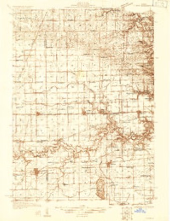
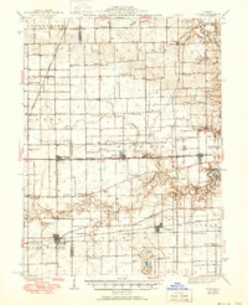
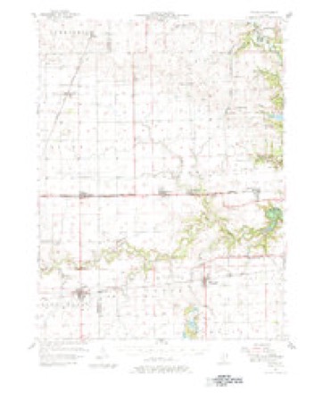
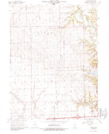
15 topographic sheets cover this place, the earliest surveyed in 1931 and the latest in 1987. It stands in Oakwood Township. It lies in ZIP code area 61858. The Survey maps it on the Collison quadrangle.
Topographic sheets covering this place
9 surveys from 15 printed sheetsMatched by testing this settlement's coordinate against the published boundary of every sheet in the United States Geological Survey's historical collection. Each opens the scanned sheet at the Survey.
- 1931 USGS Fithian quadrangle1:48000
- 1943 USGS Fithian quadrangle1:62500, 2 printings
- 1953 USGS Danville quadrangle1:250000, 3 printings
- 1955 USGS Danville quadrangle1:250000
- 1956 USGS Danville quadrangle1:250000
- 1957 USGS Fithian quadrangle1:62500, 3 printings
- 1968 USGS Collison quadrangle1:24000, 2 printings
- 1984 USGS Danville quadrangle1:100000
- 1987 USGS Danville quadrangle1:100000





In the county-history sources
20,921 words on this townshipHistory of Vermilion County, Together with Historic Notes on the Northwest, Gleaned from Early Authors, Old Maps and Manuscripts, Private and Official Correspondence, and Other Authentic, Though, for the Most Part, Out-of-the-way Sources, published 1879 names this settlement in its chapter on Oakwood Township. These are the passages that mention it, exactly as the scans read.
Although the system of township organization was adopted in 1850, Oakwood, as a distinct township, dates its birth from a much more recent period. What is now included within the limits of this township lay formerly in Pilot, Vance and Catlin. On the 2d day of October, 1867, Geo. A. Fox, supervisor from Vance township, offered a resolution creating a new township from the territory of Vance, Catlin and Pilot, in accordance with the prayer of certain petitioners from said townships. At this time Mr. West was supervisor from Pilot and Mr. Church from Catlin. These gentlemen supported the motion, but the supervisors' court concluded to delay action thereon until the March session of the next year, in order that all persons affected by the proposed change, might have opportunity to approve or disapprove the change. Accordingly, on the 9th of March, 1868, the petition presented in the fall of 186T was again taken np, and Mr. Fox urged the passage of a resolution creating the new township. An effort was made to postpone again the consideration of this resolution, but without success. The prayer of the petitioners was then granted, whereupon the township was declared created, and an election ordered for the purpose of selecting township officers. This first election was held at the Stearns school-house on the 7th of April, 1868 : Geo. A. Fox was elected supervisor ; Henry Sallee, town clerk ; J. A. Littler, assessor ; J. A. Brothers, collector ; Joseph Truax, Levin Vinson, J. C. Jenkins, commissioners of highways ; Samuel Major and Thomas Makemson, constables; Geo. A. Fox and J. H. West, Justices of the peace. The present officers are (elected on the 2d of April, 1879) Henry J. Oakwood, supervisor ; Henry Sallee, town clerk ; W. H. Noble, assessor ; William Craigmile, collector ; Joseph Mullins, commissioner of highways. Elected in 1878 : James Hargan, commissioner of Highwaj-s. Elected in 1877: J. A. Littler and William P. Van Allen, justices of peace ; J. K. Sowards and Charles K. Trimble.
Passage source: History of Vermilion County, Together with Historic Notes on the Northwest, Gleaned from Early Authors, Old Maps and Manuscripts, Private and Official Correspondence, and Other Authentic, Though, for the Most Part, Out-of-the-way Sources, published 1879.
Some years ago there was quite a cluster of houses, and a lively business was done, at what was called Conkey Town. At present it is difficult to find much of the place, but we can find where it was. Here is an instance of the influence that a railroad has on a small country village when it passes to one side a short distance. We have no record of any survey, or any laying off into a town ; but O. M. Conkey came here about 1851, and operated a general country store. He came from Eugene, Indiana. A Mr. Denman set up a blacksmithshop, and Mr. Conkey got a post-office. Conkey sold out to Rowe & Beatty, and they sold to Mattocks & Maters Brothers. These men finally closed out about the time that the I. B. & W. came through. There was also another man, who kept a grocery, beer, etc.; but he, too, closed out and moved away. The first ideas of trade in this part of the country were entertained by Mr. Rhodes Smith. He began business on the State Road, just down close to Stony Creek, at quite an early day. "Why he quit we did not learn, but suppose that this suggested the idea of Conke}7 Town, as well as the fact of a successful mill which had been operating from the earliest days. During the palmiest days of this little village Dr. Wilkins was their physician. He has left the reputation of being a good practitioner, and an upright man. But its days are over. The place reminds one of Goldsmith's words as he sings of the deserted village. "W". R. Jones now owns the site of the village. He has a farm of two hundred acres here, and that includes the town.
Passage source: History of Vermilion County, Together with Historic Notes on the Northwest, Gleaned from Early Authors, Old Maps and Manuscripts, Private and Official Correspondence, and Other Authentic, Though, for the Most Part, Out-of-the-way Sources, published 1879.
It is with pleasure we record the facts in regard to a man's history whose life presents a record of services rendered for the public good. George W. Graham was born in Monongalia county, Virginia, now Marion county, West Virginia, on the 25th of October, 1835. His father's name was Ebenezer Graham. George W. was brought up on a farm, where he remained until his fourteenth year. The ten years succeeding this date found him in various parts of Marion and Wirt counties. At the expiration of this time he came to Henry county, Indiana, where he remained nearly two years. When the spring of 1861 came it found him wending his way to his native state. The war cloud was threatening, and he proposed to be on the scene of action. He entered the service immediately as a scout and guide, being employed by Gen. George B. McClellan on the recommendation of Gov. Pierpoint. He continued in this service about three months, until the 7th of August, when he enlisted in the three years' service of the Union army. He remained in the 6th Va. Inf. nine months under Capt. Maulsby. The company was then transferred to the Independent Battery Light Artillery. During 1862 they served in various parts of West Virginia, keeping the front line of the rebels back till they were sent into the valley, in the winter of 1862. The first fight of importance in which the}7 were engaged was at Martinsburg, on the 15th of June, 1863, where Capt. Maulsby was wounded and Mr. Graham took command. He led the batterv from this time on. They were at Winchester on the 22d and 24th of July, and followed the illustrious Sheridan through his valley campaign. Mr. Graham's career was marked with success from the beginning. As a scout and guide, he rendered important service in directing the movements of the army, on account of his acquaintance with the country. When he enlisted he entered as a private. He held all the noncommissioned offices in the company, and then went through the commissions to the head of the list. He received his first commission in the spring of 1862; was afterward first lieutenant, and then took command of the company in June, 1863. He was mustered out at Harper's Ferry in the fall of 1864. He staid in Virginia about one year afterward, and then came to Vermilion county, Illinois, in summer of 1865. He first stopped on Salt Fork, near old Major Vance's salt works, bought forty acres of coal land, and worked a good part of the time in the coal busi- ness. He came to Fithian in the spring of 1871 ; here he united with his brother, and formed the firm of Graham Brothers, and has continned in the mercantile business ever since. These gentlemen have been quite successful in life, and by their industry have gained a considerable portion of this world's goods.
Passage source: History of Vermilion County, Together with Historic Notes on the Northwest, Gleaned from Early Authors, Old Maps and Manuscripts, Private and Official Correspondence, and Other Authentic, Though, for the Most Part, Out-of-the-way Sources, published 1879.
Machine-read from a century-old scan, so expect the errors a machine makes: misspelled names, dropped words, stray characters.
Read the whole chapter on Oakwood Township - it names this place 3 more 3 times.
Fires near this place
1 since 2008Regional context, not property-specific evidence. The federal wildfire occurrence database lists 1 fire within 5 miles of Brothers in 2008, burning about 2 acres in total. None started naturally. None was recorded as arson. Distance is straight-line from the map coordinates, so a fire counted here may appear on a neighbouring settlement's page as well.
| Reported cause | Fires |
|---|---|
| Missing data/not specified/undetermined | 1 |
The most recent of them, most recent first, with the day each was reported and the service that recorded it.
| Date | Cause | Size | Reported by | Name on the report |
|---|---|---|---|---|
| 12 March 2008 | Missing data/not specified/undetermined | 2.0 acres | Illinois Division of Forestry Resources | KIME |
Settlements close enough to share some of these fires:
Mines and quarries near this place
2 within 5 milesRegional context, not property-specific evidence. The federal mineral resources record lists 2 workings within 5 miles of Brothers: 1 past producer, 1 occurrence. None of them still produces. What was taken out: Sand and Gravel, Construction, Fire Clay (Refractory). Distance is straight-line from the map coordinates, so a quarry counted here may appear on a neighbouring settlement's page as well.
| Where | Site | Commodity | Status | Recorded |
|---|---|---|---|---|
| Harmattan Mine Shale Exposure | Fire Clay (Refractory) | Occurrence | ||
| Seymour Gravel Pit | Sand and Gravel, Construction | Past Producer |
Storms near this place
2 since 1998Regional context, not property-specific evidence. The National Weather Service names Brothers in 2 storm reports between 1998 and 2008: 1 thunderstorm wind, 1 flash flood. No death or injury is recorded in these reports. Each account below is quoted exactly as the forecast office filed it, from the NOAA Storm Events Database, and each date opens the federal record of that event.
| When | Event | Place named | Harm | What the report says |
|---|---|---|---|---|
| February 2008 | Flash Flood | Brothers | - | Several roads were flooded near the Middle Fork of the Vermilion River and severe flooding occurred near the North Fork of the Vermilion River. A few homes near Danville were evacuated due to the rising water near the river. Two vehicles were swept off the road by flood waters into a ditch. |
| September 1998 | Thunderstorm Wind | Brothers | - | Thunderstorm winds blew off the roof of a barn in Brothers. Some of the debris was blown into a nearby house causing minor damage. No injuries were reported and no damage estimate was available. |
Nearest settlements
The eight closest, with where each one stands in the county. Distances are straight-line, computed from the Geographic Names Information System coordinates.
| Map | Place | Distance | Sheets |
|---|---|---|---|
| Bronson | 2.0 miles | 16 | |
| Glenburn | 2.1 miles | 15 | |
| Oakwood | 2.5 miles | 16 | |
| Newtown | 2.6 miles | 15 | |
| Muncie | 2.8 miles | 16 | |
| Belgium Row | 3.0 miles | 15 | |
| Missionfield | 4.0 miles | 16 | |
| Bucktown | 4.0 miles | 20 |
Provenance
This settlement is recorded in the Geographic Names Information System as feature 422504. The sheet list is computed by point-in-boundary test against the United States Geological Survey's historical topographic inventory. Both are works of the United States government and carry no copyright under 17 U.S.C. 105.
Wildfire. Short, Karen C. 2022. Spatial wildfire occurrence data for the United States, 1992-2020 [FPA_FOD_20221014]. 6th Edition. Fort Collins, CO: Forest Service Research Data Archive. https://doi.org/10.2737/RDS-2013-0009.6 Collected with United States Government funding and usable without additional permissions or fees.
Mines and quarries. USGS Mineral Resources Data System (MRDS) https://mrdata.usgs.gov/mrds/ A work of the United States government, no copyright under 17 U.S.C. 105.
Storms. NOAA National Centers for Environmental Information, Storm Events Database https://www.ncei.noaa.gov/stormevents/ A work of the United States government, no copyright under 17 U.S.C. 105. Narratives are quoted verbatim from the National Weather Service report and are not edited or summarised.