 Block
Muncie, Illinois
16 topographic sheets cover this place, the earliest surveyed in 1931 and the latest in 1987. It stands in Oakwood Township. It lies in ZIP code area 61844. It stands on Feather Creek. The Survey maps it on the Oakwood quadrangle. 157 people lived here at the 2020 count. It stands 646 feet above sea level.
Population over time
3 figuresMuncie grew from 155 to 157 between 2000 and 2020. These are the recorded population figures Wikidata holds for this place, reached through the Geographic Names Information System number this page is keyed on rather than by name, so they belong to this place and not to another of the same name. Most are census counts, but not all are: an early figure may be a founding or settlement estimate, and an estimate published within five years of a census is left out. The change column is computed, and is left blank where more than 20 years separate a figure from the one before it, because a gap that long is not a change between two counts.
| Year | People | Change |
|---|---|---|
| 2000 | 155 | |
| 2010 | 146 | -9 (-6%) |
| 2020 | 157 | +11 (+8%) |
Topographic sheets covering this place
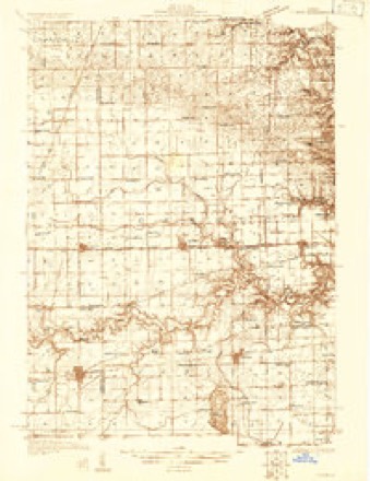
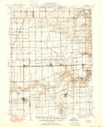
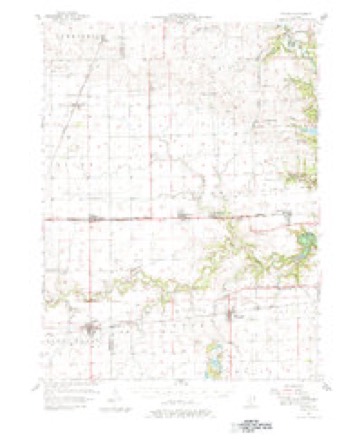
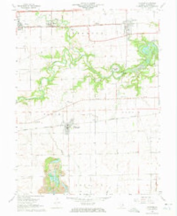
9 surveys from 16 printed sheetsMatched by testing this settlement's coordinate against the published boundary of every sheet in the United States Geological Survey's historical collection. Each opens the scanned sheet at the Survey.
- 1931 USGS Fithian quadrangle1:48000
- 1943 USGS Fithian quadrangle1:62500, 2 printings
- 1953 USGS Danville quadrangle1:250000, 3 printings
- 1955 USGS Danville quadrangle1:250000
- 1956 USGS Danville quadrangle1:250000
- 1957 USGS Fithian quadrangle1:62500, 3 printings
- 1968 USGS Oakwood quadrangle1:24000, 3 printings
- 1984 USGS Danville quadrangle1:100000
- 1987 USGS Danville quadrangle1:100000





In the county-history sources
20,921 words on this townshipHistory of Vermilion County, Together with Historic Notes on the Northwest, Gleaned from Early Authors, Old Maps and Manuscripts, Private and Official Correspondence, and Other Authentic, Though, for the Most Part, Out-of-the-way Sources, published 1879 names this settlement in its chapter on Oakwood Township. These are the passages that mention it, exactly as the scans read.
After the first advent of Captain Blackman, and the building of a residence by Mr. Treat, in November, 1819, we find a Mr. Bailey on Stony Creek. This was probably the first man who settled on that creek. He came in 1821 or 1822, and opened a small piece of ground in the timber. This was in section 16, town 19 north, range 13 west. He sold out his interests to Mr. Harvey Ludington, late of Danville, Illinois. Mr. Ludington has been supposed by many to be the first settler on Stony Creek.
Passage source: History of Vermilion County, Together with Historic Notes on the Northwest, Gleaned from Early Authors, Old Maps and Manuscripts, Private and Official Correspondence, and Other Authentic, Though, for the Most Part, Out-of-the-way Sources, published 1879.
Stony Creek was called for a long time Ludington's Branch. The next man in these parts was a Mr. Walker. He settled near the same place, but a little farther up the creek, near the present site of Muncie. He, too, left his name with us. That point of timber where he dwelt went by the name of Walker's Point. The exact date of his settlement we were unable to learn, but it was after the settlement by Mr. Ludington. The settlements along the Salt Fork, on the south side of the township, were early begun, and here we find the principal population for some time. The exact date of many of these settlements cannot now be ascertained, nor do we conceive it to be of very great importance. It is quite probable that the next family that came in here after those already mentioned was that of the man who built the old watermill on the Salt Fork where the present steam and water mill is located. This mill was in operation as early as 1826; how long it had been running previously we are not quite sure. At this date Mr. Nathaniel Mead traveled over the country, and the only inhabitants that he remembers were those at this mill, and John Vance, at the salt works. Mr. Mead is, perhaps, the oldest person living in Oakwood township who saw this country as early as 1826; in fact, we doubt whether another grown person was here in 1826 and is here now. At that time he was twenty-six years old, having been born in the gray dawn of the nineteenth century. He is from the land of "steady habits," having first seen the light of day seven miles from Hartford, Connecticut. He remained there till he was eighteen years old. His youthful days were spent in the dairy. On his western-bound trip he first stopped at Cincinnati. After a stay here we find him next in Union county, Indiana. Although he came here as early as 1826, "prospecting," he did not permanently locate his family in this county until 1835. At this time he bought land near the site of Conkeytown. Excepting a short stay in Covington, Indiana, he has remained in this township ever since. He has reared a family of children. His sons are well-to-do, important elements in societ}r, and he still lingers on the shores of time, two miles southwest of Oakwood station, enjoying the fruits of seventy-nine years' toil among the children of men. He remembers well the war of 1812, and the rejoicing at its close. During his recollection not only Oakwood township and Vermilion county have been developed from their native wildness to a populous, well-organized community, but industries have sprung up all over the nation. He was seven years old when Robert Fulton made that wonderful experiment on the Hudson ; when Lafayette made his wonderful passage through this country he had reached the age of full manhood; when the first car carried its load of stone from the Quincy quarries, he was verging on the period of middle-life; as Queen Victoria ascended the throne, he was growing old. If all the progress of art and science, which has been made within the memory of such men as he, was written in a book, the world could scarcely contain it. The progress in itself is not so startling as the fact that one man's experience has embraced it all.
Passage source: History of Vermilion County, Together with Historic Notes on the Northwest, Gleaned from Early Authors, Old Maps and Manuscripts, Private and Official Correspondence, and Other Authentic, Though, for the Most Part, Out-of-the-way Sources, published 1879.
Brewer, and close to the present site of old Conkey Town was Stephen Crane. Thomas W. and John Q. Deakin came in 1835. They lived in this same neighborhood, just on the south line of the township. They were important elements in the early settlement of the neighborhood on Salt Fork. On the west side of Stony Creek, Mr. Wright probably followed Mr. Walker. In 1832 Mr. Aaron Dalbey followed the opening made here, and came over from the south side of the Salt Fork, and began a farm one mile south of the present site of Muncie. Mr. Dalbey was a millwright, and rendered important service to the community in building the second mill on Salt Fork. Mr. Shepherd was the proprietor, but Mr. Dalbey was the architect and builder. Mr. Dalbey remained here till his death. His widow married John McFarland, and still resides on the original farm. The farm is a good one, and under the careful management of Mr. McFarland has reached the highest state of cultivation. A little farther north, up Stony Creek, we find John McCarty, about 1836. He settled just above Muncie. Beyond him, and later, came Harrison and Seneca Stearns. They came to the country, young men, though married, in 1836, and have remained in the edge of the timber ever since. In mentioning the early settlers, we would not forget John Shepherd, who came in 1836, and engaged in the milling enterprise, but who died before he saw his work fully completed. These are the principal early settlers in the southwestern part of the township. No doubt there were others that came early, but they soon moved away. Of those who came later we have scarcely time to speak, although such men as Havard and Cast, that came in 1838, would now be considered old settlers.
Passage source: History of Vermilion County, Together with Historic Notes on the Northwest, Gleaned from Early Authors, Old Maps and Manuscripts, Private and Official Correspondence, and Other Authentic, Though, for the Most Part, Out-of-the-way Sources, published 1879.
Machine-read from a century-old scan, so expect the errors a machine makes: misspelled names, dropped words, stray characters.
Read the whole chapter on Oakwood Township - it names this place 14 more 14 times.
Fires near this place
1 since 2008Regional context, not property-specific evidence. The federal wildfire occurrence database lists 1 fire within 5 miles of Muncie in 2008, burning about 2 acres in total. None started naturally. None was recorded as arson. Distance is straight-line from the map coordinates, so a fire counted here may appear on a neighbouring settlement's page as well.
| Reported cause | Fires |
|---|---|
| Missing data/not specified/undetermined | 1 |
The most recent of them, most recent first, with the day each was reported and the service that recorded it.
| Date | Cause | Size | Reported by | Name on the report |
|---|---|---|---|---|
| 12 March 2008 | Missing data/not specified/undetermined | 2.0 acres | Illinois Division of Forestry Resources | KIME |
Settlements close enough to share some of these fires:
Mines and quarries near this place
1 within 5 milesRegional context, not property-specific evidence. The federal mineral resources record lists 1 working within 5 miles of Muncie: 1 past producer. None of them still produces. What was taken out: Sand and Gravel, Construction. Distance is straight-line from the map coordinates, so a quarry counted here may appear on a neighbouring settlement's page as well.
| Where | Site | Commodity | Status | Recorded |
|---|---|---|---|---|
| Seymour Gravel Pit | Sand and Gravel, Construction | Past Producer |
Storms near this place
4 since 2006Regional context, not property-specific evidence. The National Weather Service names Muncie in 4 storm reports between 2006 and 2023: 2 thunderstorm wind, 1 tornado, 1 hail. No death or injury is recorded in these reports. Each account below is quoted exactly as the forecast office filed it, from the NOAA Storm Events Database, and each date opens the federal record of that event.
| When | Event | Place named | Harm | What the report says |
|---|---|---|---|---|
| June 2023 | Thunderstorm Wind | Muncie | - | A farm outbuilding was severely damaged and a tree was snapped. |
| May 2019 | Tornado (EF1) | Muncie | - | A tornado touched down 1 mile east of Fithian at 2:06 AM CDT. The tornado tracked northeastward through the community of Muncie, damaging numerous trees and snapping power poles. A house was damaged when a tree fell onto it, and a semi was blown off I-74. The tornado dissipated 1 mile northeast of Muncie at 2:08 AM CDT. |
| April 2006 | Thunderstorm Wind | Muncie | - | Widespread tree, power pole and power line damage and minor home damage was reported. Part of the roof was blown off the Oakwood Jr High School and Muncie Baptist Church. Windows were blown out of several buildings in downtown Danville. A semi trailer truck was blown over on I-74. No injuries were reported. |
| May 2019 | Hail | Muncie | - | no account filed |
Nearest settlements
The eight closest, with where each one stands in the county. Distances are straight-line, computed from the Geographic Names Information System coordinates.
Elsewhere
Matched on this settlement's Geographic Names Information System number rather than its name, so it cannot be a different place of the same name in another state.
| Wikipedia article on Muncie | An encyclopaedic summary. Its text is share-alike, so it is linked here rather than copied. |
| Wikidata item Q2039265 | The structured record the population and elevation above come from. Public domain (CC0). |
Provenance
This settlement is recorded in the Geographic Names Information System as feature 414231. The sheet list is computed by point-in-boundary test against the United States Geological Survey's historical topographic inventory. Both are works of the United States government and carry no copyright under 17 U.S.C. 105.
Wildfire. Short, Karen C. 2022. Spatial wildfire occurrence data for the United States, 1992-2020 [FPA_FOD_20221014]. 6th Edition. Fort Collins, CO: Forest Service Research Data Archive. https://doi.org/10.2737/RDS-2013-0009.6 Collected with United States Government funding and usable without additional permissions or fees.
Mines and quarries. USGS Mineral Resources Data System (MRDS) https://mrdata.usgs.gov/mrds/ A work of the United States government, no copyright under 17 U.S.C. 105.
Storms. NOAA National Centers for Environmental Information, Storm Events Database https://www.ncei.noaa.gov/stormevents/ A work of the United States government, no copyright under 17 U.S.C. 105. Narratives are quoted verbatim from the National Weather Service report and are not edited or summarised.