 Block
Centralia, Illinois
12 topographic sheets cover this place, the earliest surveyed in 1914 and the latest in 1985. It stands in Centralia Township. It lies in ZIP code area 62801. The Survey maps it on the Centralia West quadrangle. 12,182 people lived here at the 2020 count. It stands 535 feet above sea level.
Research this city
On record in Centralia
Buildings and businesses the archive holds for this place. Each opens its own page, with the source record it came from.
On the National Register 3 records
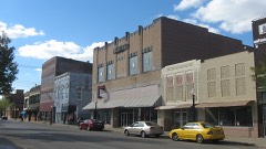 Centralia Commercial Historic Districtlisted 2012
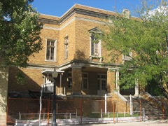 Centralia Elk's Lodge, Thelisted 2011
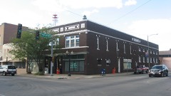 Sentinel Buildinglisted 1978
Population over time
4 figuresCentralia grew from 3,190 to 12,182 between 1870 and 2020. These are the recorded population figures Wikidata holds for this place, reached through the Geographic Names Information System number this page is keyed on rather than by name, so they belong to this place and not to another of the same name. Most are census counts, but not all are: an early figure may be a founding or settlement estimate, and an estimate published within five years of a census is left out. The change column is computed, and is left blank where more than 20 years separate a figure from the one before it, because a gap that long is not a change between two counts.
| Year | People | Change |
|---|---|---|
| 1870 | 3,190 | |
| 2000 | 14,136 | |
| 2010 | 13,032 | -1,104 (-8%) |
| 2020 | 12,182 | -850 (-7%) |
Topographic sheets covering this place
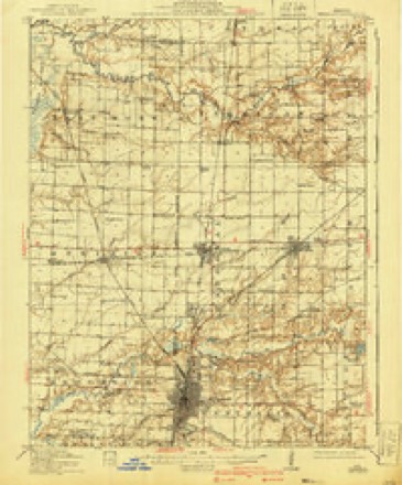
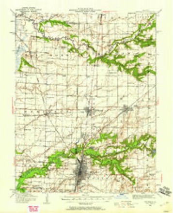
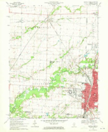
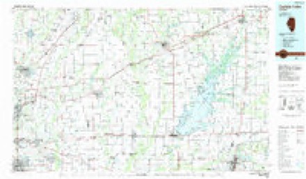
6 surveys from 12 printed sheetsMatched by testing this settlement's coordinate against the published boundary of every sheet in the United States Geological Survey's historical collection. Each opens the scanned sheet at the Survey.
- 1914 USGS Centralia quadrangle1:62500, 3 printings
- 1935 USGS Centralia quadrangle1:62500
- 1958 USGS Belleville quadrangle1:250000, 3 printings
- 1962 USGS Belleville quadrangle1:250000
- 1969 USGS Centralia West quadrangle1:24000, 2 printings
- 1985 USGS Carlyle Lake quadrangle1:100000, 2 printings


In the county-history sources
3,494 words on this townshipBrinkerhoff's History of Marion County, Illinois, published 1909 names this settlement in its chapter on Centralia Township. These are the passages that mention it, exactly as the scans read.
The county of Marion was formed and its boundaries defined by an act of the Legislature of the state of Illinois, which became a law on the 24th of January, 1823. Centralia is situated near the southwest corner of the county, near the center of Seven Mile Prairie. Central City, older by about two years than Centralia, is located at the point where the Illinois Central Railroad enters Seven Mile Prairie from the north, about one mile distant from the northern limits of the corporation. In the year 1850 the inhabitants of Seven Mile Prairie could have been counted on one's fingers. They were located, with the exception of a halfdozen families, at the edge of the wooded land which surrounded the prairie, and all lived, excepting perhaps an equal number of families, in one-story log houses. There is not, so far as the writer knows, a house now standing in Seven Mile Prairie which is a fair sample of the average residence of the time alluded to. The house was one story in height, the open space between the logs being chinked with small blocks of wood and daubed or plastered with clay. The chimney was on the outside at the end of the building and was composed of a framework of logs and sticks, lined in the lower portion with clay and stones and in the upper portion with clay alone. The roof and often the doors were made of clapboards riven from the trees of the forest. The floor was often made of puncheons split from logs and hewed on one side. It need not be stated that this kind of flooring was never tongued and grooved, and the floor was never air-tight, except when the floor was laid on the ground. Usually these houses contained but one room, in which the family performed all the various offices of indoor life. Here they dressed, talked over the family and neighborhood affairs, received company, courted and were given in marriage and married. Here also the women attended to those never neglected duties of the time, knitting, spinning and weaving, duties which have since almost lost their places among the household arts. The ques- tion occurs: Were these people happy amid such rude surroundings and with such privations of the conveniences of life? We may truly answer, yes. So emphatically true is it that life does not consist in the aboundance of our possessions. Ask those who lived at that time and they will tell you they were happy in those days, and will probably add that the good old times were better than the present strenuous period. Their happiness we may not gainsay, but as to those times being better than this present time, that does not follow. This is another question and one open to very serious question.
Passage source: Brinkerhoff's History of Marion County, Illinois, published 1909.
In 1851 the Illinois Central Railroad was sureyed and located, and Seven Mile Prairie, in which they had been no marked improvement, began to exhibit more animation. Unknown faces were less rare than formerly and citizens showed more anxiety to increase their landed possessions. In 1852 the work of grading was begun and many foreigners appeared upon the scene, some of whom remained in the country and were valuable additions to its population. The change wrought in the appearance of the county and the habits and pursuits of the people was wonderful. Where before there had been a sort of Rip Van Winkle sleep, all was life, industry and activity. New industries became available and old ones were stimulated by better prices and a home market. The people began to put the good old times behind them. Central City supplemented Walnut Hill as a commercial metropolis of the region. That part of the city of Centralia known as Jones, Eheninger,Mc- Clelland and Spear's addition was laid out in the summer of 1853. In the autumn of the same year A. P. Crosby's addition was laid out. In 1853 Centralia proper was laid out by the Illinois Central Railroad Company, and some lots were sold, but no deeds were executed until after the passage of the law of January 14, 1855, authorizing the railroad company to lay out towns and sell town lots.
Passage source: Brinkerhoff's History of Marion County, Illinois, published 1909.
The first house built in Centralia was the one-story frame house fronting north on the west side of the last railroad crossing but one in South Centralia, in the east end of which McCord & Davenport sold merchandise ; the west end of the same building was used for a residence ; the next building erected in our city was a one-story frame about ten by twelve feet in extent across the street north from McCord & Davenport's, in which Thomas Douglas, afterward of Sandoval, sold dried herring and liquid refreshments. The first house built in Centralia still stands, but the second and third, which were immediately across the railroad, east from it, being the one-story part of the Hoskins property, built by Joseph Hensley, have long since vanished.
Passage source: Brinkerhoff's History of Marion County, Illinois, published 1909.
Machine-read from a century-old scan, so expect the errors a machine makes: misspelled names, dropped words, stray characters.
Read the whole chapter on Centralia Township - it names this place 13 more 13 times.
Fires near this place
2 since 2004Regional context, not property-specific evidence. The federal wildfire occurrence database lists 2 fires within 5 miles of Centralia between 2004 and 2010, burning about 12 acres in total. None started naturally. None was recorded as arson. Distance is straight-line from the map coordinates, so a fire counted here may appear on a neighbouring settlement's page as well.
| Reported cause | Fires |
|---|---|
| Recreation and ceremony | 1 |
| Missing data/not specified/undetermined | 1 |
The most recent of them, most recent first, with the day each was reported and the service that recorded it.
| Date | Cause | Size | Reported by | Name on the report |
|---|---|---|---|---|
| 19 July 2004 | Recreation and ceremony | under an acre | Illinois State Fire Marshal's Office | not named |
| 7 October 2010 | Missing data/not specified/undetermined | 12 acres | Illinois Division of Forestry Resources | BRINKMANN |
Settlements close enough to share some of these fires:
Mines and quarries near this place
2 within 5 milesRegional context, not property-specific evidence. The federal mineral resources record lists 2 workings within 5 miles of Centralia: 1 prospect, 1 past producer. None of them still produces. What was taken out: Clay, Stone. Distance is straight-line from the map coordinates, so a quarry counted here may appear on a neighbouring settlement's page as well.
| Where | Site | Commodity | Status | Recorded |
|---|---|---|---|---|
| Centralia City Pit | Stone | Past Producer | ||
| Jolliff Shale Exposure | Clay | Prospect |
Storms near this place
60 of 61 shownRegional context, not property-specific evidence. The National Weather Service names Centralia in 61 storm reports between 1993 and 2026: 39 thunderstorm wind, 19 hail, 2 flash flood, 1 tornado. The reports record 2 deaths and 1 injury. Each account below is quoted exactly as the forecast office filed it, from the NOAA Storm Events Database, and each date opens the federal record of that event.
| When | Event | Place named | Harm | What the report says |
|---|---|---|---|---|
| May 2002 | Tornado (F1) | Centralia | 2 killed | A small but deadly tornado struck the south part of Centralia and devastated the Rosewood and Collinsworth Mobile Home Parks. Forming quickly on the leading edge of a squall line, the tornado hit shortly after 200 am, when most residents were asleep. An Illinois Emergency Management Agency damage assessment listed 12 mobile homes as being destroyed, 1 home destroyed, 1 mobile home with major damage, 1 home with minor damage, and 3 mobile homes with minor damage. 2 people were killed, both in mobile homes. |
| June 2003 | Thunderstorm Wind | Centralia | 1 hurt | no account filed |
| April 1994 | Thunderstorm Wind | Centralia | $50,000 | Trees and power lines were blown down damaging several parked cars. |
| June 2022 | Thunderstorm Wind | Centralia | $30,000 | Thunderstorm winds blew down numerous large tree limbs, trees and power lines between Centralia and Salem. Half of Centralia was without power for a few hours due to the downed power lines. |
| March 2025 | Thunderstorm Wind | Centralia | $10,000 | The Centralia emergency manager reported multiple power lines downed due to thunderstorm winds. |
| April 1993 | Thunderstorm Wind | Centralia | $5,000 | The county sheriff's office reported trees and power lines down southwest of Salem. The county ESDA director reported trees and power lines down in Centralia along with numerous mobile homes and a few garages damaged in Central City. |
| May 1995 | Thunderstorm Wind | Centralia | $4,100 | Numerous trees were snapped off and roofs damaged south of Odin while a mobile home south of Salem was completely destroyed. Several stores in Centralia also had broken windows and trees were blown down damaging parked cars. |
| June 1995 | Thunderstorm Wind | Centralia | $300 | Large trees and tree limbs were blown down. Winds gusts in Centralia were estimated at 60 mph. |
| April 2026 | Thunderstorm Wind | Centralia | - | Thunderstorm winds downed power lines all over Centralia. Power poles and trees sustained damage as well. |
| March 2025 | Thunderstorm Wind | Centralia | - | Thunderstorm winds downed one large tree limb in Centralia. |
| April 2025 | Thunderstorm Wind | Centralia | - | Thunderstorm winds snapped several large tree limbs in Centralia. |
| April 2025 | Thunderstorm Wind | Centralia | - | Thunderstorm winds downed power lines and tree limbs near West Kell Road and North Cherry Road in Centralia. |
| March 2021 | Thunderstorm Wind | Centralia | - | Thunderstorm winds blew down several large tree limbs. |
| October 2021 | Thunderstorm Wind | Centralia | - | Thunderstorm winds blew down several large tree limbs on the south side of town. |
| June 2019 | Thunderstorm Wind | Centralia | - | Thunderstorm winds blew down several large trees around town as well as numerous tree limbs. |
| June 2018 | Thunderstorm Wind | Centralia | - | Thunderstorm winds blew down a large tree which knocked down a nearby power pole. |
| July 2017 | Thunderstorm Wind | Centralia | - | Thunderstorm winds snapped off 3 power poles in Centralia and uprooted one large tree. In Salem, several large tree limbs were blown down and broke one telephone pole. |
| May 2016 | Thunderstorm Wind | Centralia | - | Thunderstorm winds blew down numerous trees and power lines. A large tree fell onto a house in Odin and another one fell onto a house in Salem. |
| May 2015 | Thunderstorm Wind | Centralia | - | Several power lines were blown down in Centralia. One of the power lines was knocked down by a fallen tree. |
| July 2014 | Thunderstorm Wind | Centralia | - | Thunderstorm winds blew down a large tree onto a power line. Also, numerous large tree limbs were blown down around town. |
| April 2014 | Flash Flood | Centralia | - | Up to five inches of rain fell in a short amount of time causing flash flooding. Numerous low water crossings were flooded. |
| August 2012 | Thunderstorm Wind | Centralia | - | Thunderstorm winds blew down numerous large tree limbs. One tree was blown down blocking a side road in Centralia. |
| April 2011 | Thunderstorm Wind | Centralia | - | Thunderstorm winds blew down numerous large tree limbs around town. |
| July 2011 | Thunderstorm Wind | Centralia | - | Thunderstorm winds blew down several trees around town. Also, portions of corn fields just east of Centralia Municipal Airport were flattened by the downburst winds. Also, there was some minor road flooding in town after over an inch of rain fell in about 30 minutes. |
| April 2011 | Thunderstorm Wind | Centralia | - | Thunderstorm winds damaged several barns, sheds and mobile homes. Also, numerous trees, tree limbs and power lines were blown down, mainly on the east side of town. A couple of the trees fell onto homes causing moderate damage. Two industrial buildings had significant roof damage. |
| June 2008 | Thunderstorm Wind | Centralia | - | A large maple tree was uprooted in Centralia by thunderstorm winds. |
| February 2008 | Thunderstorm Wind | Centralia | - | Thunderstorm winds caused a wide swath of damage from Centralia to Salem. In Centralia, numerous trees and power lines were blown down. One tree fell onto a mobile home causing moderate damage and one fell onto an unoccupied car destroying it. Five miles south of Salem on Interstate 57 near mile marker 111, a semi tractor trailer was blown over. The driver sustained minor injuries. In Salem, a few trees and power lines were blown down. One tree fell onto a house damaging the front porch. |
| March 2008 | Flash Flood | Centralia | - | Up to two inches of rain fell over a short amount of time on already saturated soils in southwestern Marion county. Several county roads between Centralia and Salem had several inches of water over them and a few secondary roads were closed in the area. |
| July 2006 | Thunderstorm Wind | Centralia | - | Numerous trees were blown down along Illnois Route 161. |
| August 2005 | Thunderstorm Wind | Centralia | - | Thunderstorm wind gusts downed trees, large tree limbs, and power lines in Centralia. Two garages suffered severe damage from downed trees. |
| November 2004 | Thunderstorm Wind | Centralia | - | Thunderstorm winds downed large tree limbs on the east side of town. Power lines were down on Route 161. |
| August 2003 | Hail | Centralia | - | Storm spotters reported nickel size hail in Centralia. |
| June 2002 | Thunderstorm Wind | Centralia | - | Thunderstorm winds caused some damage in a neighborhood east of Centralia. A storage building was destroyed and some power lines downed. |
| October 2001 | Thunderstorm Wind | Centralia | - | The County Emergency Management reported trees down in Centralia. |
| May 2000 | Hail | Centralia | - | Storm spotters reported 1 inch hail. |
| March 2025 | Hail | Centralia | - | no account filed |
| March 2025 | Hail | Centralia | - | no account filed |
| September 2012 | Hail | Centralia | - | no account filed |
| March 2012 | Hail | Centralia | - | no account filed |
| March 2012 | Hail | Centralia | - | no account filed |
| April 2011 | Hail | Centralia | - | no account filed |
| April 2011 | Hail | Centralia | - | no account filed |
| May 2011 | Hail | Centralia | - | no account filed |
| May 2011 | Hail | Centralia | - | no account filed |
| June 2008 | Hail | Centralia | - | no account filed |
| April 2006 | Hail | Centralia | - | no account filed |
| September 2005 | Thunderstorm Wind | Centralia | - | no account filed |
| September 2005 | Thunderstorm Wind | Centralia | - | no account filed |
| August 2004 | Hail | Centralia | - | no account filed |
| August 2004 | Thunderstorm Wind | Centralia | - | no account filed |
| August 2001 | Hail | Centralia | - | no account filed |
| April 2000 | Hail | Centralia | - | no account filed |
| April 2000 | Hail | Centralia | - | no account filed |
| May 2000 | Thunderstorm Wind | Centralia | - | no account filed |
| May 2000 | Hail | Centralia | - | no account filed |
| February 1999 | Thunderstorm Wind | Centralia | - | no account filed |
| June 1999 | Thunderstorm Wind | Centralia | - | no account filed |
| May 1999 | Thunderstorm Wind | Centralia | - | no account filed |
| June 1998 | Thunderstorm Wind | Centralia | - | no account filed |
| June 1998 | Thunderstorm Wind | Centralia | - | no account filed |
Nearest settlements
The eight closest, with where each one stands in the county. Distances are straight-line, computed from the Geographic Names Information System coordinates.
| Map | Place | Distance | Sheets |
|---|---|---|---|
| Central City | 1.7 miles | 12 | |
| Junction City | 3.8 miles | 12 | |
| Walnut Hill | 5.8 miles | 9 | |
| Hubbard Woods | 5.9 miles | 13 | |
| Sandoval | 6.3 miles | 13 | |
| Odin | 7.7 miles | 13 | |
| Selmaville | 9.2 miles | 11 | |
| Fairman | 10.7 miles | 11 |
Elsewhere
Matched on this settlement's Geographic Names Information System number rather than its name, so it cannot be a different place of the same name in another state.
| Wikipedia article on Centralia | An encyclopaedic summary. Its text is share-alike, so it is linked here rather than copied. |
| Wikidata item Q575126 | The structured record the population and elevation above come from. Public domain (CC0). |
Provenance
This settlement is recorded in the Geographic Names Information System as feature 405910. The sheet list is computed by point-in-boundary test against the United States Geological Survey's historical topographic inventory. Both are works of the United States government and carry no copyright under 17 U.S.C. 105.
Wildfire. Short, Karen C. 2022. Spatial wildfire occurrence data for the United States, 1992-2020 [FPA_FOD_20221014]. 6th Edition. Fort Collins, CO: Forest Service Research Data Archive. https://doi.org/10.2737/RDS-2013-0009.6 Collected with United States Government funding and usable without additional permissions or fees.
Mines and quarries. USGS Mineral Resources Data System (MRDS) https://mrdata.usgs.gov/mrds/ A work of the United States government, no copyright under 17 U.S.C. 105.
Storms. NOAA National Centers for Environmental Information, Storm Events Database https://www.ncei.noaa.gov/stormevents/ A work of the United States government, no copyright under 17 U.S.C. 105. Narratives are quoted verbatim from the National Weather Service report and are not edited or summarised.