 Block
Danvers, Illinois
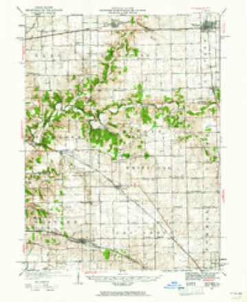
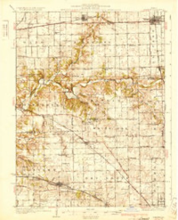
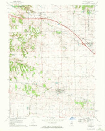
13 topographic sheets cover this place, the earliest surveyed in 1927 and the latest in 1990. It stands in Danvers Township. It lies in ZIP code area 61732. The Survey maps it on the Danvers quadrangle. 1,089 people lived here at the 2020 count. It stands 809 feet above sea level.
Population over time
3 figuresDanvers fell from 1,183 to 1,089 between 2000 and 2020. These are the recorded population figures Wikidata holds for this place, reached through the Geographic Names Information System number this page is keyed on rather than by name, so they belong to this place and not to another of the same name. Most are census counts, but not all are: an early figure may be a founding or settlement estimate, and an estimate published within five years of a census is left out. The change column is computed, and is left blank where more than 20 years separate a figure from the one before it, because a gap that long is not a change between two counts.
| Year | People | Change |
|---|---|---|
| 2000 | 1,183 | |
| 2010 | 1,154 | -29 (-2%) |
| 2020 | 1,089 | -65 (-6%) |
Topographic sheets covering this place
9 surveys from 13 printed sheetsMatched by testing this settlement's coordinate against the published boundary of every sheet in the United States Geological Survey's historical collection. Each opens the scanned sheet at the Survey.
- 1927 USGS Danvers quadrangle1:62500
- 1930 USGS Danvers quadrangle1:62500, 2 printings
- 1958 USGS Peoria quadrangle1:250000, 4 printings
- 1961 USGS Peoria quadrangle1:250000
- 1963 USGS Peoria quadrangle1:250000
- 1970 USGS Danvers quadrangle1:24000
- 1985 USGS Peoria quadrangle1:100000
- 1989 USGS Peoria quadrangle1:100000
- 1990 USGS Peoria quadrangle1:250000






In the county-history sources
18,407 words on this townshipThe Good Old Times in McLean County, Illinois : Containing Two Hundred and Sixty-one Sketches of Old Settlers, a Complete Historical Sketch of the Black Hawk War and Descriptions of All Matters of Interest Relating to McLean County, published 1874 names this settlement in its chapter on Danvers Township. These are the passages that mention it, exactly as the scans read.
In December, 1818, the family of Rev. Mr. Mitchel moved to Sangamon County, Illinois, on Fancy Creek, about eight miles north of Springfield. They traveled in a wagon drawn by four ziorses. At one time the horses started to run and seemed to be unmanageable, when Mrs. Mitchel, who was a woman of remarkable resolution, ran forward, grasped the bridle of one of the lead horses and assisted in stopping them. On the way they met old Billy Hodge, who had come to the country and was returning eastward. The Indians were then numerous and occasionally troublesome. They were the Kickapoos, Pottawatomies, Delawares and others. At one time a band of Indians went to Springfield and became intoxicated, and on their return attempted to go into Mitchel's house, when he was absent ; but Mrs. Mitchel barred the door, and the dogs outside fought them. Mrs. Mitchel told the savages that her husband was sick, and insisted that they should leave ; but they hung around until nearly morning, banging against the door, yelling, whooping and lighting.
Passage source: The Good Old Times in McLean County, Illinois : Containing Two Hundred and Sixty-one Sketches of Old Settlers, a Complete Historical Sketch of the Black Hawk War and Descriptions of All Matters of Interest Relating to McLean County, published 1874.
Rev. Peyton Mitchel was active in the ministry and did good work. He preached the first sermon in Funk's Grove, and wherever he could find an opportunity he engaged in the work of the great Master. Churches were soon organized and schoolhouses were built, and Ebenezer Mitchel thinks the society at that time was much more reliable than it is at present. He thinks the promise of an old settler was much better than most people's bonds.
Passage source: The Good Old Times in McLean County, Illinois : Containing Two Hundred and Sixty-one Sketches of Old Settlers, a Complete Historical Sketch of the Black Hawk War and Descriptions of All Matters of Interest Relating to McLean County, published 1874.
The deep snow fell in 1830 and '31. Mr. Mitchel took repeated measurements of its depth in the timber, where it had not drifted, and it there averaged forty inches. A crust on it was soon formed, and the wolves ran over it; but the sharp footed deer broke through.
Passage source: The Good Old Times in McLean County, Illinois : Containing Two Hundred and Sixty-one Sketches of Old Settlers, a Complete Historical Sketch of the Black Hawk War and Descriptions of All Matters of Interest Relating to McLean County, published 1874.
Machine-read from a century-old scan, so expect the errors a machine makes: misspelled names, dropped words, stray characters.
Read the whole chapter on Danvers Township - it names this place 26 more 26 times.
Fires near this place
2 since 2014Regional context, not property-specific evidence. The federal wildfire occurrence database lists 2 fires within 5 miles of Danvers in 2014, burning about 6 acres in total. None started naturally. None was recorded as arson. Distance is straight-line from the map coordinates, so a fire counted here may appear on a neighbouring settlement's page as well.
| Reported cause | Fires |
|---|---|
| Smoking | 1 |
| Debris and open burning | 1 |
The most recent of them, most recent first, with the day each was reported and the service that recorded it.
| Date | Cause | Size | Reported by | Name on the report |
|---|---|---|---|---|
| 21 March 2014 | Debris and open burning | 5.0 acres | Illinois Division of Forestry Resources | 2014-45 |
| 24 February 2014 | Smoking | under an acre | Illinois Division of Forestry Resources | 2014-033 |
Settlements close enough to share some of these fires:
Storms near this place
23 since 1994Regional context, not property-specific evidence. The National Weather Service names Danvers in 23 storm reports between 1994 and 2026: 11 hail, 10 thunderstorm wind, 1 flash flood, 1 tornado. The reports record 1 injury. Each account below is quoted exactly as the forecast office filed it, from the NOAA Storm Events Database, and each date opens the federal record of that event.
| When | Event | Place named | Harm | What the report says |
|---|---|---|---|---|
| August 2012 | Thunderstorm Wind | Danvers | 1 hurt, $3,500,000 | Downburst winds of 70 to 80 mph produced a wide swath of damage from Danvers southeastward into the southwest side of Bloomington. One of the hardest hit locations along this path was the Apollo Acres subdivision just north of Illinois Route 9, where 159 homes sustained damage. 139 of those homes had awnings or shingles damaged, while 19 suffered minor roof and window damage, and 1 home had one-third of its roof torn off. Total damage in Apollo Acres was around $1 million. Other significant damage occurred along the path of the storm, including numerous downed trees, trailers blown over, and several large metal buildings with doors blown in and roofs torn off. Total damage to 30 businesses along the path was estimated at around $2.5 million. One minor injury was reported, as a car was hit by a wind-blown trailer. |
| August 2012 | Thunderstorm Wind | Danvers | $25,000 | Numerous trees and tree branches were blown down in Danvers. |
| May 2013 | Thunderstorm Wind | Danvers | $18,000 | A tree was blown down onto a house southeast of Danvers. The roof of an old barn was blown off and numerous tree branches were knocked down as well. |
| August 2000 | Thunderstorm Wind | Danvers | $3,000 | From just south of Danvers to Bloomington, sporadic wind damage was observed. Minor crop damage was found, as well as, numerous downed trees. In Bloomington, numerous power lines and large tree limbs were blown down. One large tree limb fell onto a porch damaging it, then landed on a sport utility vehicle causing minor damage. No injuries were reported. |
| June 2010 | Thunderstorm Wind | Danvers | $2,000 | A large tree was uprooted. |
| March 2026 | Thunderstorm Wind | Danvers | - | A grain bin, tree, small sheds, playground set, garage door, and soffit were damaged. |
| April 2023 | Thunderstorm Wind | Danvers | - | A large tree limb was blown down. |
| June 2023 | Thunderstorm Wind | Danvers | - | Numerous tree branches were blown down. |
| June 2006 | Tornado (F0) | Danvers | - | A tornado briefly touched down in a field. No damage was reported. |
| May 2004 | Flash Flood | Danvers | - | Very heavy rain fell in a short amount of time causing numerous roads to become flooded. |
| October 2004 | Thunderstorm Wind | Danvers | - | Large tree blown down. |
| April 2001 | Hail | Danvers | - | Thunderstorm moved out of Tazewell County into McLean County. Dime to walnut size hail was reported in Danvers, with dime to half dollar size hail reported west and north of Bloomington/Normal. |
| April 1997 | Thunderstorm Wind | Danvers | - | Thunderstorm winds damaged two buildings 2 miles south of Danvers. On one of the buildings the barn doors were blown off and up over a two story farm house. Also, at the same time a spotter in Danvers reported a 67 mph wind gust and damage to the grade school (roof flashing was blown off), as well as, a school bus being lifted up onto two wheels. A machine shed was damaged and numerous large tree limbs were blown down. No injuries were reported and no damage estimate was available. |
| January 2008 | Hail | Danvers | - | no account filed |
| April 2006 | Hail | Danvers | - | no account filed |
| April 2006 | Hail | Danvers | - | no account filed |
| May 2006 | Hail | Danvers | - | no account filed |
| May 2006 | Hail | Danvers | - | no account filed |
| May 2004 | Hail | Danvers | - | no account filed |
| May 2003 | Hail | Danvers | - | no account filed |
| March 2002 | Hail | Danvers | - | no account filed |
| June 2002 | Hail | Danvers | - | no account filed |
| April 1994 | Hail | Danvers | - | no account filed |
Nearest settlements
The eight closest, with where each one stands in the county. Distances are straight-line, computed from the Geographic Names Information System coordinates.
| Map | Place | Distance | Sheets |
|---|---|---|---|
| Woodruff | 2.9 miles | 13 | |
| Carlock | 4.4 miles | 13 | |
| Twin Grove | 5.7 miles | 13 | |
| Yuton | 6.2 miles | 15 | |
| Stanford | 6.9 miles | 14 | |
| Covell | 7.0 miles | 13 | |
| Bloomington Heights | 8.3 miles | 13 | |
| Cardinal Court | 9.5 miles | 15 |
Elsewhere
Matched on this settlement's Geographic Names Information System number rather than its name, so it cannot be a different place of the same name in another state.
| Wikipedia article on Danvers | An encyclopaedic summary. Its text is share-alike, so it is linked here rather than copied. |
| Wikidata item Q1376830 | The structured record the population and elevation above come from. Public domain (CC0). |
Provenance
This settlement is recorded in the Geographic Names Information System as feature 406948. The sheet list is computed by point-in-boundary test against the United States Geological Survey's historical topographic inventory. Both are works of the United States government and carry no copyright under 17 U.S.C. 105.
Wildfire. Short, Karen C. 2022. Spatial wildfire occurrence data for the United States, 1992-2020 [FPA_FOD_20221014]. 6th Edition. Fort Collins, CO: Forest Service Research Data Archive. https://doi.org/10.2737/RDS-2013-0009.6 Collected with United States Government funding and usable without additional permissions or fees.
Storms. NOAA National Centers for Environmental Information, Storm Events Database https://www.ncei.noaa.gov/stormevents/ A work of the United States government, no copyright under 17 U.S.C. 105. Narratives are quoted verbatim from the National Weather Service report and are not edited or summarised.