 Block
Divernon, Illinois
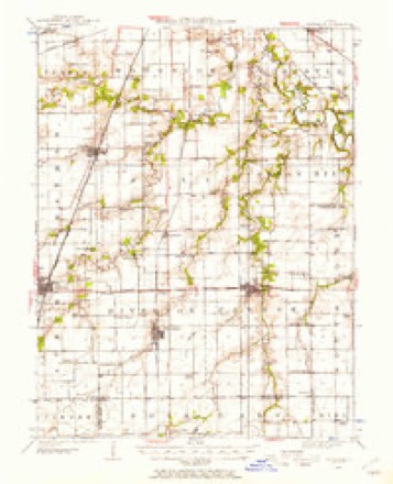
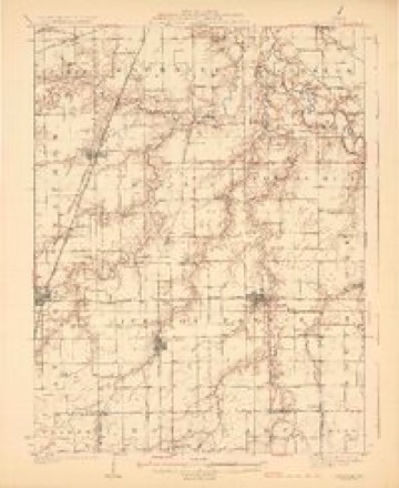
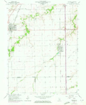
13 topographic sheets cover this place, the earliest surveyed in 1922 and the latest in 1985. It stands in Divernon Township. It lies in ZIP code area 62530. The Survey maps it on the Divernon quadrangle. 1,139 people lived here at the 2020 count. It stands 614 feet above sea level.
Population over time
2 figuresDivernon fell from 1,172 to 1,139 between 2010 and 2020. These are the recorded population figures Wikidata holds for this place, reached through the Geographic Names Information System number this page is keyed on rather than by name, so they belong to this place and not to another of the same name. Most are census counts, but not all are: an early figure may be a founding or settlement estimate, and an estimate published within five years of a census is left out. The change column is computed, and is left blank where more than 20 years separate a figure from the one before it, because a gap that long is not a change between two counts.
| Year | People | Change |
|---|---|---|
| 2010 | 1,172 | |
| 2020 | 1,139 | -33 (-3%) |
Topographic sheets covering this place
6 surveys from 13 printed sheetsMatched by testing this settlement's coordinate against the published boundary of every sheet in the United States Geological Survey's historical collection. Each opens the scanned sheet at the Survey.
- 1922 USGS Divernon quadrangle1:62500
- 1924 USGS Divernon quadrangle1:62500, 2 printings
- 1958 USGS Decatur quadrangle1:250000, 3 printings
- 1961 USGS Decatur quadrangle1:250000, 2 printings
- 1965 USGS Divernon quadrangle1:24000, 3 printings
- 1985 USGS Springfield quadrangle1:100000, 2 printings



In the county-history sources
4,621 words on this townshipHistory of Sangamon County, Illinois; Together with Sketches of Its Cities, Villages and Townships ... Portraits of Prominent Persons, and Biographies of Representative Citizens. History of Illinois, published 1881 names this settlement in its chapter on Divernon Township. These are the passages that mention it, exactly as the scans read.
The village of Riverton was laid out and platted by John Taylor, December 1, 183'7, its location being described as "the south half of the northeavSt quarter of section nine, township sixteen, range four, west." The plat was recorded under the name of Jamestown, so named in honor of James F. Reed, whose adventures are given on a preceding page, in connection with George Donner and a trip across the plains.
Passage source: History of Sangamon County, Illinois; Together with Sketches of Its Cities, Villages and Townships ... Portraits of Prominent Persons, and Biographies of Representative Citizens. History of Illinois, published 1881.
The village grew but slowly for some years, and until Mr. Howlett came and erected the distillery and mill adjoining. Up to this time, the village bore the name of Jamestown, but soon after it was changed to Howlett, which name it retained until 187-, when it w^as changed to Riverton - an appropriate name, it being upon the banks of the Sangamon river, the principal stream in the county.
Passage source: History of Sangamon County, Illinois; Together with Sketches of Its Cities, Villages and Townships ... Portraits of Prominent Persons, and Biographies of Representative Citizens. History of Illinois, published 1881.
There being already one Jamestown post office in the State, another name had to be chosen, and it was called Reed. This was one reason why the name of the village was afterward changed, as it was inconvenient to citizens and correspondents to call the town by one name and the post office by another. When the name of the village was changed to Howlett, the name of the post ofiice was also changed, it taking the name of the village. The same change was made to Riverton. Jesse Sweatman was the first jjostmaster. The large correspondence of the distillery here gives quite a large amount of mail to handle.
Passage source: History of Sangamon County, Illinois; Together with Sketches of Its Cities, Villages and Townships ... Portraits of Prominent Persons, and Biographies of Representative Citizens. History of Illinois, published 1881.
Machine-read from a century-old scan, so expect the errors a machine makes: misspelled names, dropped words, stray characters.
Read the whole chapter on Divernon Township - it names this place 21 more 21 times.
Fires near this place
2 since 2008Regional context, not property-specific evidence. The federal wildfire occurrence database lists 2 fires within 5 miles of Divernon in 2008, burning about 10 acres in total. None started naturally. None was recorded as arson. Distance is straight-line from the map coordinates, so a fire counted here may appear on a neighbouring settlement's page as well.
| Reported cause | Fires |
|---|---|
| Debris and open burning | 1 |
| Missing data/not specified/undetermined | 1 |
The most recent of them, most recent first, with the day each was reported and the service that recorded it.
| Date | Cause | Size | Reported by | Name on the report |
|---|---|---|---|---|
| 23 June 2008 | Missing data/not specified/undetermined | 10 acres | Illinois Division of Forestry Resources | CNRR |
| 25 March 2008 | Debris and open burning | under an acre | Illinois Division of Forestry Resources | MILE 82 |
Settlements close enough to share some of these fires:
Storms near this place
36 since 1993Regional context, not property-specific evidence. The National Weather Service names Divernon in 36 storm reports between 1993 and 2025: 15 thunderstorm wind, 14 hail, 4 tornado, 2 flash flood. No death or injury is recorded in these reports. Each account below is quoted exactly as the forecast office filed it, from the NOAA Storm Events Database, and each date opens the federal record of that event.
| When | Event | Place named | Harm | What the report says |
|---|---|---|---|---|
| June 2001 | Flash Flood | Divernon | $500,000 | Brush Creek, which flows along the west side of Divernon, went out of its banks, resulting in widespread flooding and nearly 30 homes being evacuated around 2 AM CDT. Several people had to be rescued from their homes as the flood waters quickly filled in the natural flood plain of the creek, flooding numerous basements on the east side of town and entire homes on the west side of town, where water was reported to be as high as windows in a few locations. Railroad tracks in the area were washed out. No injuries or fatalities were reported. North and southbound Interstate 55 were closed for several hours south of the Illinois Route 104 junction, near Divernon, as a result of 18 to 24 inches of water over the highway. By 830 AM CDT, no additional flooding was reported. However, flood waters persisted in and around Divernon through 11 AM CDT. Flooding was also reported in Pawnee. Damage was estimated around $500,000. |
| August 2011 | Hail | Divernon | $100,000 | Hail up to 2.00 inches in diameter damaged several vehicles southeast of the town of Auburn. |
| June 2018 | Thunderstorm Wind | Divernon | $25,000 | A tree and numerous tree limbs were blown down in Divernon. |
| May 2010 | Thunderstorm Wind | Divernon | $10,000 | Several trees were knocked down onto powerlines, resulting in a brief power outage in parts of Divernon. |
| May 2007 | Thunderstorm Wind | Divernon | $5,000 | Numerous trees and power lines were blown down. A small stationary construction trailer was blown over on I-55. |
| June 2025 | Thunderstorm Wind | Divernon | - | Corn was nearly flattened between Auburn and I-55. |
| May 2024 | Funnel Cloud | Divernon | - | A bowl shaped funnel cloud was observed between Divernon and Farmersville. |
| June 2022 | Thunderstorm Wind | Divernon | - | Corn crops were flattened by strong winds. |
| July 2020 | Tornado (EF0) | Divernon | - | This is a continuation of a tornado that touched down in the National Weather Service St. Louis County Warning Area (CWA) in Montgomery County at 5:18 PM CDT. The tornado crossed into the National Weather Service Central Illinois CWA in far southern Sangamon County at 5:25 PM CDT. Damage occurred to approximately 15 acres of a cornfield before the tornado dissipated 2.7 miles south of Divernon at 5:26 PM CDT. |
| May 2019 | Thunderstorm Wind | Divernon | - | A large tree was blown down. |
| May 2019 | Thunderstorm Wind | Divernon | - | A power pole and several trees were blown down. |
| May 2019 | Thunderstorm Wind | Divernon | - | Numerous trees and power lines were blown down in Divernon. |
| June 2018 | Thunderstorm Wind | Divernon | - | A 3-inch diameter tree limb was blown down. |
| May 2011 | Thunderstorm Wind | Divernon | - | A tree was blown onto a house on Kenney Street in Divernon. |
| May 2004 | Tornado (F1) | Divernon | - | A tornado briefly touched down in Divernon. It destroyed 5 garages and blew down numerous trees, tree limbs and power lines. Several homes sustained minor damage, while one home sustained moderate damage. No injuries were reported. |
| May 2003 | Tornado (F0) | Divernon | - | A tornado briefly touched down. It blew down several trees and destroyed a barn. |
| May 2003 | Tornado (F0) | Divernon | - | A tornado briefly touched down in a field. No damage or injuries were reported. |
| May 2003 | Flash Flood | Divernon | - | Very heavy rain fell over Sangamon County on already saturated ground. The heavy rain caused Brush creek to leave it's banks and flood several roads in the area. |
| June 1999 | Thunderstorm Wind | Divernon | - | Thunderstorm winds snapped off 12 power poles at ground level two miles east of Divernon. |
| July 1998 | Thunderstorm Wind | Divernon | - | Several large trees were blown down and a grain bin was moved off its foundation in Divernon. |
| June 1995 | Thunderstorm Wind | Divernon | - | Thunderstorm winds blew down numerous large tree limbs. |
| June 1995 | Thunderstorm Wind | Divernon | - | Two large trees were blown down and minor damage to one home was reported by Emergency Service & Disaster Agency. |
| August 1993 | Thunderstorm Wind | Divernon | - | Numerous tree limbs were blown down in Divernon. |
| March 2024 | Hail | Divernon | - | no account filed |
| May 2023 | Hail | Divernon | - | no account filed |
| May 2023 | Hail | Divernon | - | no account filed |
| July 2017 | Hail | Divernon | - | no account filed |
| April 2016 | Hail | Divernon | - | no account filed |
| April 2015 | Hail | Divernon | - | no account filed |
| April 2015 | Hail | Divernon | - | no account filed |
| May 2009 | Hail | Divernon | - | no account filed |
| May 2008 | Hail | Divernon | - | no account filed |
| May 2000 | Hail | Divernon | - | no account filed |
| August 1999 | Hail | Divernon | - | no account filed |
| May 1999 | Hail | Divernon | - | no account filed |
| June 1998 | Hail | Divernon | - | no account filed |
Nearest settlements
The eight closest, with where each one stands in the county. Distances are straight-line, computed from the Geographic Names Information System coordinates.
| Map | Place | Distance | Sheets |
|---|---|---|---|
| Cimic | 1.7 miles | 13 | |
| Pawnee Junction | 1.8 miles | 13 | |
| Commanche Village | 2.6 miles | 14 | |
| Glenarm | 4.0 miles | 13 | |
| Pawnee | 4.5 miles | 14 | |
| Auburn | 5.1 miles | 13 | |
| Irwins Park | 5.5 miles | 14 | |
| Thayer | 5.9 miles | 13 |
Elsewhere
Matched on this settlement's Geographic Names Information System number rather than its name, so it cannot be a different place of the same name in another state.
| Wikipedia article on Divernon | An encyclopaedic summary. Its text is share-alike, so it is linked here rather than copied. |
| Wikidata item Q2672285 | The structured record the population and elevation above come from. Public domain (CC0). |
Provenance
This settlement is recorded in the Geographic Names Information System as feature 407240. The sheet list is computed by point-in-boundary test against the United States Geological Survey's historical topographic inventory. Both are works of the United States government and carry no copyright under 17 U.S.C. 105.
Wildfire. Short, Karen C. 2022. Spatial wildfire occurrence data for the United States, 1992-2020 [FPA_FOD_20221014]. 6th Edition. Fort Collins, CO: Forest Service Research Data Archive. https://doi.org/10.2737/RDS-2013-0009.6 Collected with United States Government funding and usable without additional permissions or fees.
Storms. NOAA National Centers for Environmental Information, Storm Events Database https://www.ncei.noaa.gov/stormevents/ A work of the United States government, no copyright under 17 U.S.C. 105. Narratives are quoted verbatim from the National Weather Service report and are not edited or summarised.