 Block
Auburn, Illinois
13 topographic sheets cover this place, the earliest surveyed in 1922 and the latest in 1985. It stands in Auburn Township. It lies in ZIP code area 62615. It stands on Little Panther Creek. The Survey maps it on the Divernon quadrangle. 4,574 people lived here at the 2020 count. It stands 628 feet above sea level.
On record in Auburn
Buildings and businesses the archive holds for this place. Each opens its own page, with the source record it came from.
On the National Register 1 record
- Illinois Route 4-North of Auburnlisted 1998
Population over time
2 figuresAuburn fell from 4,771 to 4,574 between 2010 and 2020. These are the recorded population figures Wikidata holds for this place, reached through the Geographic Names Information System number this page is keyed on rather than by name, so they belong to this place and not to another of the same name. Most are census counts, but not all are: an early figure may be a founding or settlement estimate, and an estimate published within five years of a census is left out. The change column is computed, and is left blank where more than 20 years separate a figure from the one before it, because a gap that long is not a change between two counts.
| Year | People | Change |
|---|---|---|
| 2010 | 4,771 | |
| 2020 | 4,574 | -197 (-4%) |
Topographic sheets covering this place
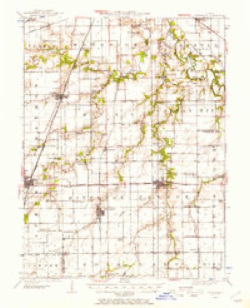
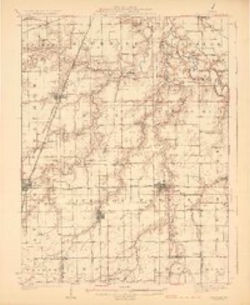
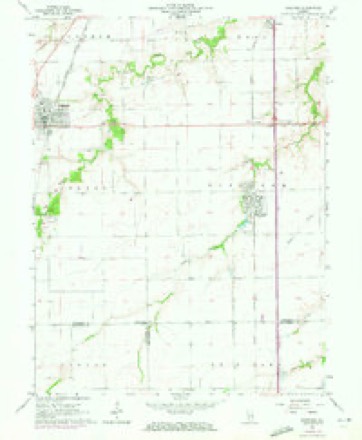
6 surveys from 13 printed sheetsMatched by testing this settlement's coordinate against the published boundary of every sheet in the United States Geological Survey's historical collection. Each opens the scanned sheet at the Survey.
- 1922 USGS Divernon quadrangle1:62500
- 1924 USGS Divernon quadrangle1:62500, 2 printings
- 1958 USGS Decatur quadrangle1:250000, 3 printings
- 1961 USGS Decatur quadrangle1:250000, 2 printings
- 1965 USGS Divernon quadrangle1:24000, 3 printings
- 1985 USGS Springfield quadrangle1:100000, 2 printings



In the county-history sources
22,350 words on this townshipHistory of Sangamon County, Illinois; Together with Sketches of Its Cities, Villages and Townships ... Portraits of Prominent Persons, and Biographies of Representative Citizens. History of Illinois, published 1881 names this settlement in its chapter on Auburn Township. These are the passages that mention it, exactly as the scans read.
On the 24th day of February, 1853, Philip Wineman had platted and recorded a new village, comprising the north part of the east half of the northeast quarter of section ten, township thirteen, range six, west, under the name of Wineman. This village was located about one mile south of the old village of Auburn, and on the line of the Chicago & Alton Railroad. Mr. Wineman subsequently made two additions to the original plat, one on the north end the other on the south. In 1854, John Buck laid out some lots adjoining on the west, and m 1858, made an addition on the north and west of the lattei'. These, with "Wineman," and additions, were incorporated by the legislature at its session of 1864-5, under the name of Auburn, the old village bearing this name having ceased to exist. The first election under this charter was held in the spring of 1865. The records of the village being lost or misplaced, only the officers of the present year are given, as follows: D. Mason, S. F. Goodwin, J. A. Able, Fred Faust, B. F. Hutton and J. K. Harris; William Harris, Village Constable; A. S. Davenport, Police Magistrate; W. H. Gibbins, Clerk.
Passage source: History of Sangamon County, Illinois; Together with Sketches of Its Cities, Villages and Townships ... Portraits of Prominent Persons, and Biographies of Representative Citizens. History of Illinois, published 1881.
A class of this denomination was organized at Harlan's Grove, in Chatham township, previous to 1830, which met for some years at the house of John French. Services were held here with more or less frequency until l84l, when they began to be held in old Auburn, where they were continued until the congregation began to worship in the present village. In 1855, the congregation erected a house of worship, which they continued lo occupy until 1863. They subsequently disposed of it to the Baptist and then to the Catholic brethren, and built a second house, at a cost of about $2,000. At present, the church holds services every other Sunday. For a time Auburn was in the Sangamon circuit, and then in Virden circuit. In 1876, it was placed in Auburn circuit, with Rev. W. S. Matthews as pastor. Mr. Matthews was followed by the following named, in order given : Revs. Johnson, Slater, Beckhart, and Sloan, the present pastor. Abraham Gist, R. McCoy R. W. Savage, and Daniel Wadsworth, are the present trustees. The present membership of the church is quite large. A Sunday School was organized in 1855, which has had regular meetings ever since. R. McCoy is the present Superintendent.
Passage source: History of Sangamon County, Illinois; Together with Sketches of Its Cities, Villages and Townships ... Portraits of Prominent Persons, and Biographies of Representative Citizens. History of Illinois, published 1881.
The Auburn congregation of the Presbyterian Church organized June 3, 1854, in the Baptist Church building, on Sugar creek, by Rev. W. C. Bell, with the following named members : John Wallace, A. S. Orr, James H.Keysler, Benjamin Kessler, Sr., Mary A. Kessler, Elizabeth Organ, Catharine Kessler, Sarah Gates, H. C. A. Yiney, C. Viney, Thomas Black, David F. Kessler, Rebecca A. Kenney, James M. Hart, Evaline Wallace, George W. Wallace, John Hart, Phebe Hart, Joseph Johnson, Wealth Johnson, Martha A. Storia, Rebecca Drennan, Henderson Seals, Levi .lohnson, Harriet Kessler, James T. Kenney, Francis Cassity, Maria Johnson.
Passage source: History of Sangamon County, Illinois; Together with Sketches of Its Cities, Villages and Townships ... Portraits of Prominent Persons, and Biographies of Representative Citizens. History of Illinois, published 1881.
Machine-read from a century-old scan, so expect the errors a machine makes: misspelled names, dropped words, stray characters.
Read the whole chapter on Auburn Township - it names this place 84 more 84 times.
Fires near this place
1 since 2008Regional context, not property-specific evidence. The federal wildfire occurrence database lists 1 fire within 5 miles of Auburn in 2008, burning about 10 acres in total. None started naturally. None was recorded as arson. Distance is straight-line from the map coordinates, so a fire counted here may appear on a neighbouring settlement's page as well.
| Reported cause | Fires |
|---|---|
| Missing data/not specified/undetermined | 1 |
The most recent of them, most recent first, with the day each was reported and the service that recorded it.
| Date | Cause | Size | Reported by | Name on the report |
|---|---|---|---|---|
| 23 June 2008 | Missing data/not specified/undetermined | 10 acres | Illinois Division of Forestry Resources | CNRR |
Settlements close enough to share some of these fires:
Storms near this place
39 since 1999Regional context, not property-specific evidence. The National Weather Service names Auburn in 39 storm reports between 1999 and 2025: 19 thunderstorm wind, 15 hail, 3 flash flood, 2 tornado. No death or injury is recorded in these reports. Each account below is quoted exactly as the forecast office filed it, from the NOAA Storm Events Database, and each date opens the federal record of that event.
| When | Event | Place named | Harm | What the report says |
|---|---|---|---|---|
| May 2002 | Hail | Auburn | $9,000,000 | Hail fell for 20 minutes in Aurburn causing widespread damage. Many cars sustained hail damage, as well as, damage to windows, roofs, and siding on numerous homes. Damage was estimated around 9 million dollars. |
| May 2002 | Flash Flood | Auburn | $400,000 | With the large amounts of hail that fell in addition to 3 inches of rainfall in a short amount of time, several streets in town became flooded. With the storm drains blocked by the hail, the water could not drain fast enough near the Auburn Middle and High School building. The school sustained widespread flood damage totaling around $400,000. |
| July 2020 | Thunderstorm Wind | Auburn | $100,000 | Numerous trees and tree branches were blown down in Auburn. The roofs of two homes were damaged by falling branches. |
| April 2011 | Thunderstorm Wind | Auburn | $100,000 | Several farm buildings were damaged. |
| May 2011 | Thunderstorm Wind | Auburn | $60,000 | Several power poles were blown down along Route 104 between Auburn and I-55. |
| May 2003 | Tornado (F0) | Auburn | $45,000 | A tornado touched down near the intersection of Illinois Route 104 and Interstate 55 east of Auburn. It damaged several businesses, destroyed a couple of sheds and blew down numerous trees and power poles. No injuries were reported. |
| June 2019 | Thunderstorm Wind | Auburn | $30,000 | Several trees and power lines were blown down in Auburn. |
| July 2015 | Thunderstorm Wind | Auburn | $25,000 | A tree split and landed on a house at 2nd Street and Caldwell in Auburn. In addition, a large branch was blown onto a garage across from the high school on 7th Street. |
| June 2018 | Thunderstorm Wind | Auburn | $12,000 | An 18-inch diameter tree was blown over and numerous tree limbs were blown down in Auburn. |
| June 2020 | Thunderstorm Wind | Auburn | $11,000 | A tree was blown onto a house. |
| May 2023 | Flash Flood | Auburn | $5,000 | A vehicle was stalled in high water west of Divernon. |
| May 2013 | Thunderstorm Wind | Auburn | $2,000 | A three-foot diameter tree was blown down at Route 4 and Curran Road. |
| March 2025 | Thunderstorm Wind | Auburn | - | Power poles were blown down. |
| September 2023 | Thunderstorm Wind | Auburn | - | A large tree branch was snapped at a residence. |
| June 2022 | Thunderstorm Wind | Auburn | - | Shingles were stripped off a roof and several 2-inch diameter tree limbs were blown down. |
| June 2022 | Thunderstorm Wind | Auburn | - | Power poles were blown over. |
| June 2019 | Thunderstorm Wind | Auburn | - | A 25 to 30-foot tall 24-inch diameter tree was blown over. |
| January 2006 | Thunderstorm Wind | Auburn | - | A microburst caused an 8 mile long swath of damage from west of Auburn to Chatham. The winds caused damage to pole barns and trees in rural areas, with minor damage to several homes in Chatham. |
| March 2006 | Thunderstorm Wind | Auburn | - | Railroad sign blown down blocking a road. |
| March 2006 | Thunderstorm Wind | Auburn | - | Several power poles blown down. |
| May 2004 | Tornado (F0) | Auburn | - | A tornado briefly touched down near a golf course. No damage or injuries were reported. |
| July 2000 | Thunderstorm Wind | Auburn | - | Several power lines were blown down in Auburn. |
| June 1999 | Thunderstorm Wind | Auburn | - | Thunderstorm winds blew down several large trees, some of which caused major damage to a minivan, a house, and a barn. One power pole was snapped in half. |
| August 1999 | Thunderstorm Wind | Auburn | - | Several trees and tree limbs blown down. |
| May 2023 | Hail | Auburn | - | no account filed |
| May 2023 | Hail | Auburn | - | no account filed |
| July 2023 | Hail | Auburn | - | no account filed |
| July 2023 | Hail | Auburn | - | no account filed |
| April 2020 | Hail | Auburn | - | no account filed |
| April 2017 | Hail | Auburn | - | no account filed |
| July 2017 | Hail | Auburn | - | no account filed |
| July 2017 | Hail | Auburn | - | no account filed |
| April 2015 | Hail | Auburn | - | no account filed |
| April 2014 | Hail | Auburn | - | no account filed |
| April 2006 | Hail | Auburn | - | no account filed |
| March 2003 | Hail | Auburn | - | no account filed |
| May 2002 | Flash Flood | Auburn | - | no account filed |
| May 2002 | Hail | Auburn | - | no account filed |
| May 2000 | Hail | Auburn | - | no account filed |
Nearest settlements
The eight closest, with where each one stands in the county. Distances are straight-line, computed from the Geographic Names Information System coordinates.
| Map | Place | Distance | Sheets |
|---|---|---|---|
| Compro | 1.9 miles | 13 | |
| Irwins Park | 2.6 miles | 14 | |
| Thayer | 3.8 miles | 13 | |
| Tower Heights | 4.8 miles | 13 | |
| Cimic | 4.8 miles | 13 | |
| Lemmon (historical) | 4.9 miles | 13 | |
| Divernon | 5.1 miles | 13 | |
| Pawnee Junction | 5.3 miles | 13 |
Elsewhere
Matched on this settlement's Geographic Names Information System number rather than its name, so it cannot be a different place of the same name in another state.
| Wikipedia article on Auburn | An encyclopaedic summary. Its text is share-alike, so it is linked here rather than copied. |
| Wikidata item Q575537 | The structured record the population and elevation above come from. Public domain (CC0). |
Provenance
This settlement is recorded in the Geographic Names Information System as feature 403716. The sheet list is computed by point-in-boundary test against the United States Geological Survey's historical topographic inventory. Both are works of the United States government and carry no copyright under 17 U.S.C. 105.
Wildfire. Short, Karen C. 2022. Spatial wildfire occurrence data for the United States, 1992-2020 [FPA_FOD_20221014]. 6th Edition. Fort Collins, CO: Forest Service Research Data Archive. https://doi.org/10.2737/RDS-2013-0009.6 Collected with United States Government funding and usable without additional permissions or fees.
Storms. NOAA National Centers for Environmental Information, Storm Events Database https://www.ncei.noaa.gov/stormevents/ A work of the United States government, no copyright under 17 U.S.C. 105. Narratives are quoted verbatim from the National Weather Service report and are not edited or summarised.