 Block
Pawnee, Illinois
14 topographic sheets cover this place, the earliest surveyed in 1922 and the latest in 1985. It stands in Pawnee Township. It lies in ZIP code area 62558. It stands on Henkle Branch. The Survey maps it on the Pawnee quadrangle. 2,678 people lived here at the 2020 count. It stands 604 feet above sea level.
Population over time
2 figuresPawnee fell from 2,739 to 2,678 between 2010 and 2020. These are the recorded population figures Wikidata holds for this place, reached through the Geographic Names Information System number this page is keyed on rather than by name, so they belong to this place and not to another of the same name. Most are census counts, but not all are: an early figure may be a founding or settlement estimate, and an estimate published within five years of a census is left out. The change column is computed, and is left blank where more than 20 years separate a figure from the one before it, because a gap that long is not a change between two counts.
| Year | People | Change |
|---|---|---|
| 2010 | 2,739 | |
| 2020 | 2,678 | -61 (-2%) |
Topographic sheets covering this place
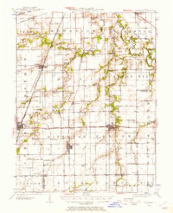
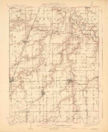
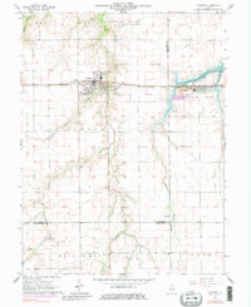
6 surveys from 14 printed sheetsMatched by testing this settlement's coordinate against the published boundary of every sheet in the United States Geological Survey's historical collection. Each opens the scanned sheet at the Survey.
- 1922 USGS Divernon quadrangle1:62500
- 1924 USGS Divernon quadrangle1:62500, 2 printings
- 1958 USGS Decatur quadrangle1:250000, 3 printings
- 1961 USGS Decatur quadrangle1:250000, 2 printings
- 1964 USGS Pawnee quadrangle1:24000, 4 printings
- 1985 USGS Springfield quadrangle1:100000, 2 printings



In the county-history sources
6,653 words on this townshipHistory of Sangamon County, Illinois; Together with Sketches of Its Cities, Villages and Townships ... Portraits of Prominent Persons, and Biographies of Representative Citizens. History of Illinois, published 1881 names this settlement in its chapter on Pawnee Township. These are the passages that mention it, exactly as the scans read.
The village of Pawnee originally comprised, according to the plat, the south part of the northeast quarter of the southeast quarter of section seven, township thirteen, range four west, and is pleasantly situated, and surrounded by a good country. Being several miles from any market, and the country being well settled, Samuel Fullinwider commenced here the sale of merchandise, in 1854, the store being under charge of J. R. Mengel, Mr. Fullinwider residing at Chatham. The neighborhood, at this time, was known as the Horse creek precinct, and its school house as the Horse creek school house. The next thing after starting a store here, was to have a post office. The post office depailmtnt was accordingly pelilioncd for tbe esiablifehment here of an office, to be known as the Horse creek post office. For some cause, the department objected to the name, and wrote to James W. Keyes, tben postmaster at Springfield, asking his opinion as to the advisability of establishing an office here, and asking him to suggest a name. He suggested Pawnee, and thus it Mas named. Isaac Mengel was made postmaster, and held the office until the spring of 1866, when he was succeeded by J. W. Blakey, who continued to serve until October, 1869, when he w^as succeeded by J. F. Smith, who served until 1876, when James A. Abel was appointed, Mr. Abel was succeeded, December 1, 1877, by W. E. Purcell, who discharged the duties of the office to September 1, 1878, when Dr. Charles Kerr was appointed, and served till in February, 1881, and was succeeded by John W. McClure. The office was made a money order office in August, 1881, and Gilbert C. Drennan secured the first order, in favor of the Journal Printing Company, Springfield.
Passage source: History of Sangamon County, Illinois; Together with Sketches of Its Cities, Villages and Townships ... Portraits of Prominent Persons, and Biographies of Representative Citizens. History of Illinois, published 1881.
A log school house was built here at an early day, and succeeded in a few years by a frame building. The school here was known as the Horse creek school. The house was used by the various religious denominations who desired to hold services therein. The district was organized in 1853, since which time free public schools have been held. The present school house was built at a later day, and the school was graded upon opening in the new house, into two grades.
Passage source: History of Sangamon County, Illinois; Together with Sketches of Its Cities, Villages and Townships ... Portraits of Prominent Persons, and Biographies of Representative Citizens. History of Illinois, published 1881.
The post office was established here sbortly after Mr. Fullinwider started his store, and Isaac R. Mengel was appointed postmaster. He was succeeded by J. W. Blakey, who served from the spring of 1866 to October, 1869. J. F. Smith was then appointed, and served until 1876, and was succeeded by James A. Able, who performed the duties of the office until the appointment of W. E. Purcell, December 1, 1877. Mr. Purcell retained the office until September 1, 1878, when Dr. Charles Kerr, the incumbent.
Passage source: History of Sangamon County, Illinois; Together with Sketches of Its Cities, Villages and Townships ... Portraits of Prominent Persons, and Biographies of Representative Citizens. History of Illinois, published 1881.
Machine-read from a century-old scan, so expect the errors a machine makes: misspelled names, dropped words, stray characters.
Read the whole chapter on Pawnee Township - it names this place 35 more 35 times.
Fires near this place
2 since 2008Regional context, not property-specific evidence. The federal wildfire occurrence database lists 2 fires within 5 miles of Pawnee in 2008, burning about 10 acres in total. None started naturally. None was recorded as arson. Distance is straight-line from the map coordinates, so a fire counted here may appear on a neighbouring settlement's page as well.
| Reported cause | Fires |
|---|---|
| Debris and open burning | 1 |
| Missing data/not specified/undetermined | 1 |
The most recent of them, most recent first, with the day each was reported and the service that recorded it.
| Date | Cause | Size | Reported by | Name on the report |
|---|---|---|---|---|
| 23 June 2008 | Missing data/not specified/undetermined | 10 acres | Illinois Division of Forestry Resources | CNRR |
| 25 March 2008 | Debris and open burning | under an acre | Illinois Division of Forestry Resources | MILE 82 |
Settlements close enough to share some of these fires:
Storms near this place
35 since 1994Regional context, not property-specific evidence. The National Weather Service names Pawnee in 35 storm reports between 1994 and 2024: 19 thunderstorm wind, 12 hail, 3 tornado, 1 flash flood. No death or injury is recorded in these reports. Each account below is quoted exactly as the forecast office filed it, from the NOAA Storm Events Database, and each date opens the federal record of that event.
| When | Event | Place named | Harm | What the report says |
|---|---|---|---|---|
| June 1998 | Tornado (F0) | Pawnee | $130,000 | As a tornado touched down on the north side of Pawnee, it blew the roof off of a house and twisted it on its foundation. Some debris (2x6s) from the house were driven into the roof of the garage on the house next door. The tornado continued for about half a mile before lifting and dissipating knocking down several trees. Damage to the two homes was estimated around $130,000. No injuries or deaths were reported. |
| July 2020 | Thunderstorm Wind | Pawnee | $70,000 | Power poles were blown down. |
| June 2019 | Thunderstorm Wind | Pawnee | $50,000 | Numerous trees and power lines were blown down in Pawnee. One tree fell onto a house. |
| April 2011 | Thunderstorm Wind | Pawnee | $50,000 | Numerous trees and power poles were snapped. |
| May 2015 | Thunderstorm Wind | Pawnee | $45,000 | Multiple power poles were blown down east of Pawnee. |
| July 2020 | Thunderstorm Wind | Pawnee | $40,000 | Numerous trees were blown down throughout Pawnee. |
| July 2015 | Thunderstorm Wind | Pawnee | $25,000 | Several large tree branches were blown down and a few homes had minor shingle damage on the south side of Pawnee. |
| May 2018 | Thunderstorm Wind | Pawnee | $15,000 | Numerous large tree branches were blown down and an empty enclosed car trailer was pushed 75 feet across a lot within a 3-block radius in Pawnee just north of Route 140. |
| April 2016 | Thunderstorm Wind | Pawnee | $12,000 | A 50-foot tall, 30-inch diameter tree was blown over at Dickee Road and Horse Creek Drive just west of Pawnee. Another large tree split down the middle and fell onto a house on 6th Street north of Route 104 in Pawnee. |
| July 2016 | Thunderstorm Wind | Pawnee | $7,000 | Two 2-foot diameter trees were blown onto power lines in Pawnee. |
| August 2012 | Thunderstorm Wind | Pawnee | $4,000 | Two power poles were snapped along 4th Street in Pawnee. |
| May 2024 | Thunderstorm Wind | Pawnee | - | Thunderstorms produced an estimated 60 mph wind gust. |
| May 2024 | Thunderstorm Wind | Pawnee | - | Approximately 15 trees were snapped. This was report was from social media. |
| August 2023 | Thunderstorm Wind | Pawnee | - | A farmstead was damaged near the intersection of Cotton Hill Road and Galloway Road. The roof was damaged and a few trees were blown over. |
| May 2023 | Thunderstorm Wind | Pawnee | - | A few tree branches were blown down and two power poles were leaning to the south. |
| May 2023 | Thunderstorm Wind | Pawnee | - | A couple large power poles were leaning on Route 104 near Pawnee. |
| June 2022 | Flash Flood | Pawnee | - | Water was flowing across Davis Road northeast of Pawnee. |
| May 2017 | Thunderstorm Wind | Pawnee | - | Several tree branches were blown down across Pawnee, including some that blocked IL Route 014. |
| April 2017 | Thunderstorm Wind | Pawnee | - | Six empty train coal cars were derailed due to high winds. |
| March 2006 | Thunderstorm Wind | Pawnee | - | Several power poles broken and a metal shed was damaged. In addition, nickel size hail was reported. |
| April 2006 | Tornado (F0) | Pawnee | - | The tornado destroyed 3 grain bins and blew them a quarter mile away. It also damaged 3 barns and blew down a number of trees. |
| March 2003 | Tornado (F0) | Pawnee | - | A tornado briefly touched down in a field one mile south of Pawnee. No damage or injuries were reported. |
| April 1994 | Thunderstorm Wind | Pawnee | - | Thunderstorm winds blew out several windows and damaged a front door on a residence in Pawnee. |
| March 2024 | Hail | Pawnee | - | no account filed |
| January 2023 | Hail | Pawnee | - | no account filed |
| May 2023 | Hail | Pawnee | - | no account filed |
| May 2023 | Hail | Pawnee | - | no account filed |
| May 2023 | Hail | Pawnee | - | no account filed |
| March 2021 | Hail | Pawnee | - | no account filed |
| May 2019 | Hail | Pawnee | - | no account filed |
| December 2018 | Hail | Pawnee | - | no account filed |
| April 2016 | Hail | Pawnee | - | no account filed |
| April 2011 | Hail | Pawnee | - | no account filed |
| May 2008 | Hail | Pawnee | - | no account filed |
| April 1998 | Hail | Pawnee | - | no account filed |
Nearest settlements
The eight closest, with where each one stands in the county. Distances are straight-line, computed from the Geographic Names Information System coordinates.
| Map | Place | Distance | Sheets |
|---|---|---|---|
| Commanche Village | 2.2 miles | 14 | |
| Pawnee Junction | 3.5 miles | 13 | |
| Cimic | 4.0 miles | 13 | |
| Glenarm | 4.3 miles | 13 | |
| Divernon | 4.5 miles | 13 | |
| Zenobia | 5.0 miles | 14 | |
| Beamington | 5.5 miles | 14 | |
| New City | 5.9 miles | 14 |
Elsewhere
Matched on this settlement's Geographic Names Information System number rather than its name, so it cannot be a different place of the same name in another state.
| Wikipedia article on Pawnee | An encyclopaedic summary. Its text is share-alike, so it is linked here rather than copied. |
| Wikidata item Q2296341 | The structured record the population and elevation above come from. Public domain (CC0). |
Provenance
This settlement is recorded in the Geographic Names Information System as feature 415465. The sheet list is computed by point-in-boundary test against the United States Geological Survey's historical topographic inventory. Both are works of the United States government and carry no copyright under 17 U.S.C. 105.
Wildfire. Short, Karen C. 2022. Spatial wildfire occurrence data for the United States, 1992-2020 [FPA_FOD_20221014]. 6th Edition. Fort Collins, CO: Forest Service Research Data Archive. https://doi.org/10.2737/RDS-2013-0009.6 Collected with United States Government funding and usable without additional permissions or fees.
Storms. NOAA National Centers for Environmental Information, Storm Events Database https://www.ncei.noaa.gov/stormevents/ A work of the United States government, no copyright under 17 U.S.C. 105. Narratives are quoted verbatim from the National Weather Service report and are not edited or summarised.