 Block
Dix, Illinois
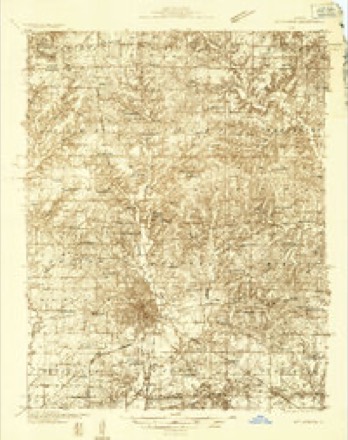
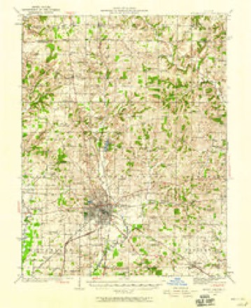
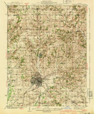
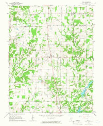
12 topographic sheets cover this place, the earliest surveyed in 1933 and the latest in 1982. It stands in Rome Township. It lies in ZIP code area 62830. The Survey maps it on the Kell quadrangle. 469 people lived here at the 2020 count. It stands 570 feet above sea level.
Research this city
Population over time
2 figuresDix grew from 461 to 469 between 2010 and 2020. These are the recorded population figures Wikidata holds for this place, reached through the Geographic Names Information System number this page is keyed on rather than by name, so they belong to this place and not to another of the same name. Most are census counts, but not all are: an early figure may be a founding or settlement estimate, and an estimate published within five years of a census is left out. The change column is computed, and is left blank where more than 20 years separate a figure from the one before it, because a gap that long is not a change between two counts.
| Year | People | Change |
|---|---|---|
| 2010 | 461 | |
| 2020 | 469 | +8 (+2%) |
Topographic sheets covering this place
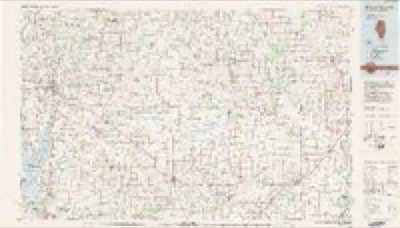
7 surveys from 12 printed sheetsMatched by testing this settlement's coordinate against the published boundary of every sheet in the United States Geological Survey's historical collection. Each opens the scanned sheet at the Survey.
- 1933 USGS Mount Vernon quadrangle1:48000
- 1933 USGS Mount Vernon quadrangle1:62500, 2 printings
- 1940 USGS Mount Vernon quadrangle1:62500, 2 printings
- 1958 USGS Belleville quadrangle1:250000, 3 printings
- 1962 USGS Belleville quadrangle1:250000
- 1965 USGS Kell quadrangle1:24000, 2 printings
- 1982 USGS Mount Vernon quadrangle1:100000


In the county-history sources
5,016 words on this townshipHistory of Jefferson County, Illinois, published 1883 names this settlement in its chapter on Rome Township. These are the passages that mention it, exactly as the scans read.
Hill, was born in Indiana September 27, 1841, to Hugh and Lethe (Reed) Boles. He was of Irish parentage, and was either born in Ireland or soon after his parents came to America. She was of English parents, and is still living. He died in this count}'. Of their family of children, five are still living, and by her second marriage she has one child. Our subject was reared on a farm and mostly in this count}', and also educated here. In 1861, he enlisted in Company F, Forty-ninth Illinois Volunteer Infantry, Capt. Jones, Col. Morrison, but served only for about eighteen months, when he was discharged on account of disability, he having contracted rheumatism in the service. In the spring of 1865, he was married to Miss Harriet Breeze, daughter of Owen Breeze, of Centralia, a retired farmer. This union has been blest with six children, viz.; Alice, Owen, Otto, Emmet, and the twins, Maud and Mabel. In 18G7, they moved to their present farm, which contains 336 acres, and in high state of cultivation, and on which he raises stock and grain. He is a member of Walnut Hill Lodge, I. 0. 0. F., No. 710. In politics, he is a Republican. He and wife are members of the Christian Church. M. D. BRUCE, farmer, P. O. Dix, was born in Wilson County, Tenn., March 19, 1812, to Azariah and Patsy (Keeling) Bruce, natives of Virginia, he the son of Michael Bruce, a native of Scotland. In Virginia, Azariah Bruce was married to the mother of our subject, and in 1801 emigrated to Tennessee. During his residence in Tennessee, he enlisted in the army, serving in the war of 1812, being at the battle of New Orleans. In 1823, he emigrated to Jefferson County, 111., and continued to follow his chosen profession of farming, taking quite a pride in keeping his farm in perfect order. He died in this county about 1854, his wife having died a short time before. He had passed his seventy-seventh year of age, and had served a number of terms as County Commissioner. He was the father of thirteen children, eight of whom still survive, six residing in this county. Our subject has resided in this county since 1823, and received his education in the early schools of the county. He served during tlie Black Hawk war, and also in the Mexican war. During the latter, he was engaged in the battles of Cerro Gordo and Vera Cruz. January 12, 1838, he settled on his present farm of 1 00 acres. He entered land from the Government at $1.25 per acre. February 13, 1834. he was married to Jane Brown, a native of Smith County, Tenn., and daughter of James and Sally (Clayborn) Brown, natives of South Carolina. He died in Tennessee a short time before the birth of Mrs. Bruce. About 1828 or 1830, Mrs. Brown moved to this county, and died about 1854. Mr. and Mrs. Bruce have had ten children, six of whom are still living - Francis M. (deceased), Charlotte, Sally (deceased), Martha A., James D., Malissa, Mary (deceased), Samantha (deceased), Alice and Azariah. For many years he and wife have been members of the Christian order. He is a i 394, and has represented his. lodge in the Grand Lodge. In politics, he is a Democrat, and takes an active part toward securing the success of his party.
Passage source: History of Jefferson County, Illinois, published 1883.
Machine-read from a century-old scan, so expect the errors a machine makes: misspelled names, dropped words, stray characters.
Read the whole chapter on Rome Township - it names this place 7 more 7 times.
Mines and quarries near this place
1 within 5 milesRegional context, not property-specific evidence. The federal mineral resources record lists 1 working within 5 miles of Dix: 1 occurrence. None of them still produces. What was taken out: Stone, Crushed/Broken. Distance is straight-line from the map coordinates, so a quarry counted here may appear on a neighbouring settlement's page as well.
| Where | Site | Commodity | Status | Recorded |
|---|---|---|---|---|
| Limestone Prospect | Stone, Crushed/Broken | Occurrence |
Storms near this place
30 since 1995Regional context, not property-specific evidence. The National Weather Service names Dix in 30 storm reports between 1995 and 2025: 13 thunderstorm wind, 6 hail, 3 flash flood, 3 heavy rain. The reports record 2 deaths and 1 injury. Each account below is quoted exactly as the forecast office filed it, from the NOAA Storm Events Database, and each date opens the federal record of that event.
| When | Event | Place named | Harm | What the report says |
|---|---|---|---|---|
| March 2008 | Flood | Dix | 2 killed, $58,000 | Two persons died after their truck stalled in floodwater on a secondary road near Waltonville. The three occupants of the truck climbed on top of it. One of the victims dropped her purse in the water and dove after it. Two other occupants of the truck dove in to rescue her. One of the rescuers swam to safety, but the other two persons were found submerged in debris about 1,000 yards from the truck. Numerous roads were closed around the county. Schools were closed. Illinois Route 148 was closed at the Big Muddy River bridge as water rose several feet over the bridge. Route 37 was closed south of Mount Vernon. One family in Mount Vernon was displaced when the basement walls caved in. At least fifty basements were flooded in the city. |
| September 2018 | Flash Flood | Dix | 1 hurt, $400,000 | Numerous county roads were closed due to flooding across the county. In Mount Vernon, a creek flooded a neighborhood on the north side of town. Numerous people were evacuated from their residences. A total of 45 homes were impacted and six streets were impassable. One person was taken to a hospital. The automated weather observation system at the Mount Vernon airport measured 6.91 inches in a 48-hour period. |
| June 2018 | Thunderstorm Wind | Dix | $25,000 | Widespread wind damage occurred around the county, mostly due to downed trees. Power outages were reported throughout the county. |
| June 2022 | Thunderstorm Wind | Dix | $20,000 | There were numerous reports of power outages in Jefferson County. Numerous tree branches and limbs were down in and near Mt. Vernon. Shingles were blown off a few roofs. Large trees were blown down at Dix. |
| April 2011 | Thunderstorm Wind | Dix | $18,000 | Trees and power lines were blown down. Doors were torn off pole barns. On Interstate 57, a semi was blown over at the 103 mile marker. |
| October 2014 | Tornado (EF1) | Dix | $10,000 | The tornado first touched down just northeast of Dix, snapping a couple of trees and downing large limbs. The tornado moved northeast, uprooting a tree and damaging some others. At a residence at the end of County Road 2330, shingles were blown off a mobile home, several trees were uprooted, and patio furniture was thrown about 25 yards in all directions. This residence is where the strongest winds occurred, estimated near 105 mph. The tornado downed corn, broke large tree limbs, and uprooted a large oak tree as it crossed County Road 32 from Jefferson County into Marion County. |
| July 2013 | Flood | Dix | $10,000 | Numerous county roads were covered with water. Flooding of Drum Creek made roads impassable. Flooding of the Big Muddy River made at least one road impassable. Six inches of water was over Highway 148 in Waltonville. A trained spotter near Dix measured 4.50 inches of rain in the past 24 hours. |
| June 1998 | Thunderstorm Wind | Dix | $7,000 | Numerous trees and power lines were down in northern parts of the county. |
| August 2019 | Thunderstorm Wind | Dix | $6,000 | Trees were reported down along County Road 2200N and Highway 37 in north Jefferson County, from Dix eastward. |
| July 2017 | Thunderstorm Wind | Dix | $6,000 | Power lines were down, and trees were damaged in the area. |
| April 2013 | Hail | Dix | $5,000 | There was minor damage to vinyl siding and screens on the south side of a house. |
| April 2016 | Thunderstorm Wind | Dix | $4,000 | Trees were blown down. |
| July 2011 | Thunderstorm Wind | Dix | $4,000 | Trees were blown down, along with some branches and limbs. |
| August 1995 | Thunderstorm Wind | Dix | $200 | The Illinois State Police reported large trees near the Jefferson-Marion County line with more large trees knocked down in Mt.Vernon some 15 minutes later. |
| March 2025 | Hail | Dix | - | Nickel size hail fell in Dix. |
| June 2017 | Flash Flood | Dix | - | Some area creeks and streams rose out of their banks several miles southwest of Mt. Vernon. A trained spotter in the area measured 3.75 inches of rain in an hour and 45 minutes. |
| December 2014 | Heavy Rain | Dix | - | The storm-total rainfall at the co-operative observer site three miles northeast of Mount Vernon was 2.67 inches. This rain fell within 24 hours. Water was across several spots on Route 37. |
| August 2014 | Heavy Rain | Dix | - | A co-operative observer measured 3.10 inches three miles northeast of Mount Vernon. A trained spotter measured 3.80 inches five miles east of Mount Vernon. These rainfall amounts were over a 12-hour period. Water was reported over rural roads in the Dix area, along with flooding of creeks and streams. |
| June 2013 | Funnel Cloud | Dix | - | Illinois State Police reported a funnel cloud along Route 37 at the Marion County line. |
| April 2013 | Funnel Cloud | Dix | - | A rotating wall cloud with a funnel cloud was observed crossing the road between Dix and Texico. |
| April 2011 | Flash Flood | Dix | - | A number of local township roads were flooded and impassable. |
| July 2011 | Heavy Rain | Dix | - | A trained spotter measured 2.84 inches in about 24 hours. |
| July 2011 | Hail | Dix | - | This hail occurred at the Dix exit on Interstate 57. |
| June 2003 | Thunderstorm Wind | Dix | - | Several trees and power lines were blown down in Mount Vernon. One of the trees landed on a vehicle. Trees and antennas were blown down in Dix. |
| August 2001 | Thunderstorm Wind | Dix | - | Several large tree limbs were blown down. |
| June 1998 | Thunderstorm Wind | Dix | - | Several trees were blown down in the Dix area. |
| May 1998 | Thunderstorm Wind | Dix | - | Thunderstorm winds downed trees. |
| May 2021 | Hail | Dix | - | no account filed |
| April 2002 | Hail | Dix | - | no account filed |
| April 2002 | Hail | Dix | - | no account filed |
Nearest settlements
The eight closest, with where each one stands in the county. Distances are straight-line, computed from the Geographic Names Information System coordinates.
| Map | Place | Distance | Sheets |
|---|---|---|---|
| Texico | 2.2 miles | 12 | |
| Idlewood | 4.3 miles | 12 | |
| Boyd | 4.5 miles | 9 | |
| Divide | 5.7 miles | 11 | |
| Jefferson City | 7.1 miles | 9 | |
| Harmony | 8.0 miles | 11 | |
| Webster Hill Estates | 8.1 miles | 12 | |
| Drivers | 8.2 miles | 12 |
Elsewhere
Matched on this settlement's Geographic Names Information System number rather than its name, so it cannot be a different place of the same name in another state.
| Wikipedia article on Dix | An encyclopaedic summary. Its text is share-alike, so it is linked here rather than copied. |
| Wikidata item Q657971 | The structured record the population and elevation above come from. Public domain (CC0). |
Provenance
This settlement is recorded in the Geographic Names Information System as feature 407245. The sheet list is computed by point-in-boundary test against the United States Geological Survey's historical topographic inventory. Both are works of the United States government and carry no copyright under 17 U.S.C. 105.
Mines and quarries. USGS Mineral Resources Data System (MRDS) https://mrdata.usgs.gov/mrds/ A work of the United States government, no copyright under 17 U.S.C. 105.
Storms. NOAA National Centers for Environmental Information, Storm Events Database https://www.ncei.noaa.gov/stormevents/ A work of the United States government, no copyright under 17 U.S.C. 105. Narratives are quoted verbatim from the National Weather Service report and are not edited or summarised.