 Block
Earlville, Illinois
8 topographic sheets cover this place, the earliest surveyed in 1951 and the latest in 1985. It stands in Earl Township. It lies in ZIP code area 60518. It stands on Sutphens Run. The Survey maps it on the Earlville quadrangle. 1,613 people lived here at the 2020 count. It stands 702 feet above sea level.
Population over time
2 figuresEarlville fell from 1,701 to 1,613 between 2010 and 2020. These are the recorded population figures Wikidata holds for this place, reached through the Geographic Names Information System number this page is keyed on rather than by name, so they belong to this place and not to another of the same name. Most are census counts, but not all are: an early figure may be a founding or settlement estimate, and an estimate published within five years of a census is left out. The change column is computed, and is left blank where more than 20 years separate a figure from the one before it, because a gap that long is not a change between two counts.
| Year | People | Change |
|---|---|---|
| 2010 | 1,701 | |
| 2020 | 1,613 | -88 (-5%) |
Topographic sheets covering this place
5 surveys from 8 printed sheetsMatched by testing this settlement's coordinate against the published boundary of every sheet in the United States Geological Survey's historical collection. Each opens the scanned sheet at the Survey.
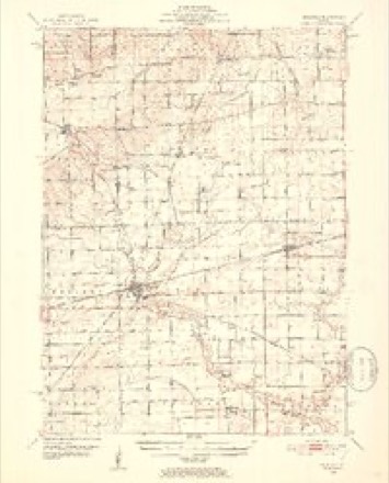
- 1951 USGS Earlville quadrangle1:62500, 2 printings
- 1958 USGS Aurora quadrangle1:250000, 3 printings
- 1961 USGS Aurora quadrangle1:250000
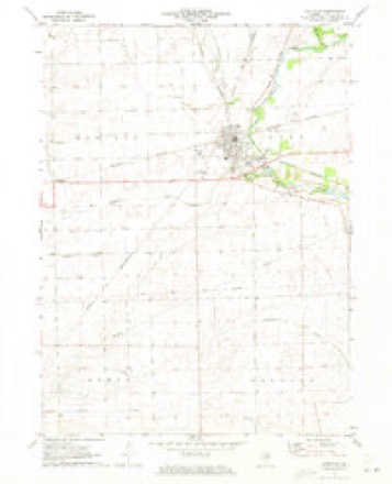
- 1971 USGS Earlville quadrangle1:24000
- 1985 USGS Aurora quadrangle1:100000



In the county-history sources
1,191 words on this townshipHistory of LaSalle County, Illinois : Its Topography, Geology, Botany, Natural History, History of the Mound Builders, Indian Tribes, French Explorations, and a Sketch of the Pioneer Settlers of Each Town to 1840, with an Appendix, Giving the Present Status of the County, Its Population, Resources, Manufactures and Institutions, published 1877 names this settlement in its chapter on Earl Township. These are the passages that mention it, exactly as the scans read.
Mr. Sutphen brought his family in the month of October, and built adonble log house on the site of the village, The land came in market in 1839, when Mr. Sutphen purchased one thousand acres where Earlville now stands, and has occupied it as a stock farm for about twenty years.
Mr. Wilson's history is a striking example of the result of industry and economy. From the poor boy trudging on foot through the weary distance to feach the West, le has become the possessor of wealth. being a large land owner, farmer and banker. He married Sarah Thornton; his children Thomas, who married Mary Wood, lives ne - liam, who married Nettie Doane, lives in Earlville, & banker; Edwin, in California; Abram, married Frances Pope, lives in Earlville ; Richard, Caroline, John T., Charlotte Ann, and Osman John, are at home
Machine-read from a century-old scan, so expect the errors a machine makes: misspelled names, dropped words, stray characters.
Storms near this place
30 since 1996Regional context, not property-specific evidence. The National Weather Service names Earlville in 30 storm reports between 1996 and 2026: 12 thunderstorm wind, 11 hail, 4 tornado, 1 flash flood. No death or injury is recorded in these reports. Each account below is quoted exactly as the forecast office filed it, from the NOAA Storm Events Database, and each date opens the federal record of that event.
| When | Event | Place named | Harm | What the report says |
|---|---|---|---|---|
| June 2014 | Tornado (EF1) | Earlville | $250,000 | An aerial survey from local media showed clear convergent swirling and scarring near Earlville. A short lived tornado touched down embedded within a larger area of straight line wind damage. Numerous trees were blown down with damage to roofs and a garage blown out on the south and southwest portions of town. Maximum winds were estimated to 110 mph. |
| June 2010 | Flash Flood | Earlville | $10,000 | Several roads were flooded across northern LaSalle County from heavy rain during the early morning hours of June 2nd. Route 52 was closed and impassable just west of Route 23. A car was submerged in flood waters on Route 23 just north of Route 34. The driver was able to escape before the quickly rising waters submerged the car. Rainfall amounts included 3.72 inches near Sheridan; 2.51 inches 2 miles south southwest of Sandwich and 2.50 inches 3 miles south of Earlville. |
| August 2008 | Thunderstorm Wind | Earlville | $5,000 | Numerous trees, tree limbs and power lines were blown down across Earlville. Wind damage was also reported to fences and store signs. |
| April 2026 | Thunderstorm Wind | Earlville | - | Photos shared via social media showed doors blown out of a farm outbuilding near Earlville. |
| July 2024 | Thunderstorm Wind | Earlville | - | Tree damage was reported in Earlville. |
| July 2024 | Thunderstorm Wind | Earlville | - | Trees and power lines were blown down throughout Earlville. |
| April 2023 | Hail | Earlville | - | A photo shared on social media showed hail at least golf ball size north of Earlville. |
| April 2023 | Hail | Earlville | - | A photo shared on social media showed half dollar size hail northeast of Earlville. |
| August 2021 | Thunderstorm Wind | Earlville | - | Widespread significant wind damage occurred across portions of northern La Salle County consisting of snapped trees near their base, snapped utility poles, flattened corn and damage to farm buildings. Winds were estimated to at least 80 mph. |
| August 2021 | Thunderstorm Wind | Earlville | - | A wind gust to 69 mph was measured by a personal weather station east of Earlville. |
| September 2021 | Hail | Earlville | - | Multiple reports of two inch diameter hail in and near Earlville were received. Hail covered the ground in many areas and took several hours to melt with fog forming over the hail after the storm ended. |
| July 2020 | Funnel Cloud | Earlville | - | A funnel cloud was reported northeast of Earlville. |
| June 2016 | Tornado (EF1) | Earlville | - | The tornado started in a field approximately a half mile northeast of Earlville. As it headed southeast it crossed East 1351st Rd and took out numerous large branches. Approximately at intersection of N 4550th Rd and E 1369th Rd, the tornado intensified as windows were blown out of a home, numerous trees snapped in half, multiple uprooted trees, and was corn flattened. The tornado continued moving southeast, crossing E 14th Rd approaching US Rt. 34 and that is where the winds took down a metal barn. As the tornado approached E 1550th Rd, 2 metal barns were destroyed with sheet metal embedded in nearby trees. Peak winds were estimated at 110 mph, and max width was 400 yards. (Tornado 3 of 15). |
| June 2016 | Tornado (EF1) | Earlville | - | The tornado started near the intersection of N 47th Rd and Rt 41 moving south-southwest, as was captured on video by a storm chaser. Approximately three tenths of a mile southwest of the intersection, the tornado turned off to the southeast. As it crossed E 1401st Rd, there was a tree snapped and damage to a barn. Peak winds were estimated at 95 mph, and max width was 250 yards. (Tornado 5 of 15). |
| June 2016 | Tornado (EF0) | Earlville | - | This tornado was determined from video documentation. As the tornado crossed Rt. 41, a farmer also reported corn crop damage in different directions on either side of Rt. 41. Peak winds were estimated at 80 mph, and max width was 75 yards. (Tornado 4 of 15). |
| May 2011 | Flood | Earlville | - | Approximately 100 acres of farmland was flooded in the Earlville and Leland areas. The young plants in these areas did not survive because they had been under water for too long. Some of this land was expected to be replanted. Storm total rainfall of 2.94 inches was measured three miles south of Earlville. |
| November 2010 | Thunderstorm Wind | Earlville | - | A tree was blown down blocking a road. |
| June 2009 | Thunderstorm Wind | Earlville | - | Wind gusts were estimated to 60 mph with small tree limbs blown down. |
| August 2007 | Thunderstorm Wind | Earlville | - | Estimated gust to 60 mph. |
| March 2026 | Hail | Earlville | - | no account filed |
| April 2023 | Hail | Earlville | - | no account filed |
| April 2023 | Hail | Earlville | - | no account filed |
| September 2021 | Hail | Earlville | - | no account filed |
| June 2013 | Hail | Earlville | - | no account filed |
| May 2006 | Hail | Earlville | - | no account filed |
| May 2006 | Hail | Earlville | - | no account filed |
| August 2001 | Thunderstorm Wind | Earlville | - | no account filed |
| May 1998 | Hail | Earlville | - | no account filed |
| August 1997 | Thunderstorm Wind | Earlville | - | no account filed |
| July 1996 | Thunderstorm Wind | Earlville | - | no account filed |
Nearest settlements
The eight closest, with where each one stands in the county. Distances are straight-line, computed from the Geographic Names Information System coordinates.
| Map | Place | Distance | Sheets |
|---|---|---|---|
| Munson (historical) | 5.7 miles | 9 | |
| Meriden | 6.0 miles | 11 | |
| Baker | 6.3 miles | 9 | |
| Harding | 6.4 miles | 9 | |
| Leland | 6.7 miles | 9 | |
| Freedom Centre (historical) | 7.6 miles | 25 | |
| Triumph | 8.2 miles | 20 | |
| Prairie Center | 8.3 miles | 25 |
Elsewhere
Matched on this settlement's Geographic Names Information System number rather than its name, so it cannot be a different place of the same name in another state.
| Wikipedia article on Earlville | An encyclopaedic summary. Its text is share-alike, so it is linked here rather than copied. |
| Wikidata item Q18818575 | The structured record the population and elevation above come from. Public domain (CC0). |
Provenance
This settlement is recorded in the Geographic Names Information System as feature 407590. The sheet list is computed by point-in-boundary test against the United States Geological Survey's historical topographic inventory. Both are works of the United States government and carry no copyright under 17 U.S.C. 105.
Storms. NOAA National Centers for Environmental Information, Storm Events Database https://www.ncei.noaa.gov/stormevents/ A work of the United States government, no copyright under 17 U.S.C. 105. Narratives are quoted verbatim from the National Weather Service report and are not edited or summarised.