 Block
Elmore, Illinois
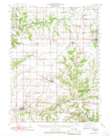
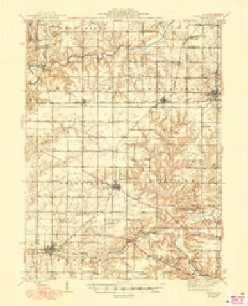
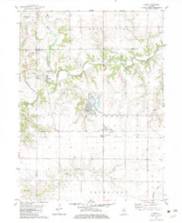
14 topographic sheets cover this place, the earliest surveyed in 1944 and the latest in 1990. It stands in Millbrook Township. It lies in ZIP code area 61451. The Survey maps it on the Laura quadrangle.
Topographic sheets covering this place
9 surveys from 14 printed sheetsMatched by testing this settlement's coordinate against the published boundary of every sheet in the United States Geological Survey's historical collection. Each opens the scanned sheet at the Survey.
- 1944 USGS Elmwood quadrangle1:62500, 2 printings
- 1948 USGS Elmwood quadrangle1:62500, 2 printings
- 1958 USGS Peoria quadrangle1:250000, 4 printings
- 1961 USGS Peoria quadrangle1:250000
- 1963 USGS Peoria quadrangle1:250000
- 1982 USGS Laura quadrangle1:24000
- 1985 USGS Peoria quadrangle1:100000
- 1989 USGS Peoria quadrangle1:100000
- 1990 USGS Peoria quadrangle1:250000






In the county-history sources
1,760 words on this townshipThe History of Peoria County, Illinois. Containing a History of the Northwest--history of Illinois--history of the County, Its Early Settlement, Growth, Development, Resources, Etc., Etc. .., published 1880 names this settlement in its chapter on Millbrook Township. These are the passages that mention it, exactly as the scans read.
Congregational Church was organized June 30, 1841, at the house of Elias Wycoff, Jr., in Stark county. Ministers present were S. S. Miles and S. G. Wright. The original members were nine in number. After entering into covenant, Wm. Webster and N. Wycoff were elected ruling elders, and duly installed in office, and S. G. Wright moderator of session. In 1854, the meetings were held in Rochester, in Millbrook township. It appears on record that Chas. B. Donaldson was acting pastor after December, 1854. At a meeting of the church held April 14, 1866, the name was changed from that of Spoon River Congregational Church to that of Elmore Congregational Church of Rochester.
Passage source: The History of Peoria County, Illinois. Containing a History of the Northwest--history of Illinois--history of the County, Its Early Settlement, Growth, Development, Resources, Etc., Etc. .., published 1880.
Machine-read from a century-old scan, so expect the errors a machine makes: misspelled names, dropped words, stray characters.
Fires near this place
2 since 2018Regional context, not property-specific evidence. The federal wildfire occurrence database lists 2 fires within 5 miles of Elmore between 2018 and 2019, burning about 25 acres in total. None started naturally. None was recorded as arson. Distance is straight-line from the map coordinates, so a fire counted here may appear on a neighbouring settlement's page as well.
| Reported cause | Fires |
|---|---|
| Debris and open burning | 2 |
The most recent of them, most recent first, with the day each was reported and the service that recorded it.
| Date | Cause | Size | Reported by | Name on the report |
|---|---|---|---|---|
| 29 April 2018 | Debris and open burning | 25 acres | Illinois Division of Forestry Resources | 2018220 |
| 3 March 2019 | Debris and open burning | under an acre | Illinois Division of Forestry Resources | 2019153 |
Settlements close enough to share some of these fires:
Storms near this place
18 since 2006Regional context, not property-specific evidence. The National Weather Service names Elmore in 18 storm reports between 2006 and 2024: 10 flash flood, 5 thunderstorm wind, 2 flood, 1 hail. No death or injury is recorded in these reports. Each account below is quoted exactly as the forecast office filed it, from the NOAA Storm Events Database, and each date opens the federal record of that event.
| When | Event | Place named | Harm | What the report says |
|---|---|---|---|---|
| June 2013 | Flash Flood | Elmore | $30,000,000 | Thunderstorms moving over the same areas multiple times resulted in 3.00 to 7.50 inches of rain in the northeast half of Peoria County during the early morning hours of June 24th. The locations that experienced the greatest impacts from the flooding included Princeville, Rome, Mossville, Dunlap and the north and west portions of the city of Peoria. Multiple roads were closed, motorists were stranded and homes were flooded. Several state highways were impassable, including Highway 6, 29, 40, 78, 90 and 91. A box culvert was also damaged on a rural road outside of Princeville. This was the second major flash flood to impact Peoria County since mid-April. Most of the flash flooding subsided by mid-afternoon. |
| April 2014 | Thunderstorm Wind | Elmore | $275,000 | Twenty train cars were blown off the tracks and between 4 and 6 power poles were knocked down west of Laura. |
| July 2016 | Thunderstorm Wind | Elmore | $3,000 | Two 3-foot diameter trees were blown down at Route 78 and Lorance Road. |
| May 2013 | Thunderstorm Wind | Elmore | $3,000 | Two large trees were blown down across Illinois Route 78 north of Laura. |
| July 2024 | Thunderstorm Wind | Elmore | - | A tree fell onto an RV that was parked on a property off Cedar Bluff Road near the Spoon River south of Elmore. Nearly a week later, on July 23, 2024, a 77-year old man from New York was reported missing after last being seen in his RV. Law enforcement found that his cell phone last used a phone tower near Elmore, and began search operations. The man was found later on July 23 in the brush near the Spoon River, in the vicinity of the damaged RV. He was still breathing but unresponsive, and despite life-saving medical efforts he succumbed to his ailments and was pronounced deceased on July 23. |
| May 2019 | Flash Flood | Elmore | - | A line of thunderstorms produced nearly 2.00 inches of rain in less than one hour during the late evening of May 28th. Due to recent heavy rain and an already saturated ground, flash flooding developed rapidly in Peoria County. Multiple streets were flooded in Peoria, Bellevue and Princeton, and numerous rural roads were impassable. The flooding subsided during the early morning hours of May 29th. |
| June 2015 | Flash Flood | Elmore | - | Thunderstorms with rainfall rates of 1.00 to 1.50 per hour persisted for nearly three hours in extreme northwest Peoria County. Observers reported 3.00 to 6.00 of rain on ground already saturated by flooding the previous week. The flooding made Illinois Route 78 near the Stark County line impassable. Many rural roads in the vicinity of the village of Elmore were also flooded. |
| June 2015 | Flash Flood | Elmore | - | Heavy rainfall of 2.50 to 5.00 was measured in a large part of Peoria County, mainly outside the city of Peoria, on ground already saturated from flooding three days prior. Parts of Illinois Routes 8, 29, 40, 6, 90 and 91 were impassable. Streets in Chillicothe, Mossville, Princeville and Elmwood were also flooded. |
| May 2013 | Flash Flood | Elmore | - | Several rounds of thunderstorms with torrential rainfall produced 2.50 to 4.00 inches of rain in extreme northern Peoria County, mainly north of State Highway 90, late in the evening of May 26th. This resulted in flash flooding which impacted mainly rural roads. Most roads were impassable and closed through the night. |
| May 2013 | Flood | Elmore | - | Several rounds of thunderstorms with torrential rainfall produced 2.50 to 4.00 inches of rain in extreme northern Peoria County, mainly north of State Highway 90, late in the evening of May 26th. This resulted in flash flooding which impacted mainly rural roads. Most roads were impassable and closed through the night. Additional rainfall overnight kept many roads closed through the night. Most of the flooding subsided by early afternoon. |
| May 2010 | Flash Flood | Elmore | - | Rainfall rates of 2.00 to 2.50 inches in less than two hours produced flash flooding in northwest Peoria County. Numerous rural roads and small streams were inundated by the flooding. |
| June 2010 | Flash Flood | Elmore | - | Heavy rain produced 2.50 of rain in about an hour across much of northern Peoria County. Numerous rural roads were inundated and impassable due to the accumulated water. |
| May 2010 | Flash Flood | Elmore | - | A slow moving single cell thunderstorm, which also spawned a brief landspout tornado northwest of Princeville, produced nearly 3.00 inches of rain in one hour across a small part of northwest Peoria County. Most rural roads were inundated from the heavy rain. Illinois Route 91 north of Princeville, and Illinois Route 90 between Princeville and Laura were closed due to the flooding. |
| March 2009 | Flood | Elmore | - | Three county roads across Peoria County were closed due to high water. |
| May 2009 | Flash Flood | Elmore | - | Heavy rain of 2.00 to 3.00 inches on already saturated ground produced widespread flash flooding of most roads across western Peoria County. U.S. Route 150 from 2 miles west of Brimfield to 1 mile east of Brimfield was impassible. |
| May 2009 | Flash Flood | Elmore | - | Another round of thunderstorms with 1.00 to 1.50 inches of rain resulted in renewed flash flooding in western Peoria County. The heavy rain caused many roads, particularly in rural areas, to be impassible. |
| March 2006 | Thunderstorm Wind | Elmore | - | Two outbuildings severely damaged and numerous large tree limbs blown down. |
| April 2023 | Hail | Elmore | - | no account filed |
Nearest settlements
The eight closest, with where each one stands in the county. Distances are straight-line, computed from the Geographic Names Information System coordinates.
Provenance
This settlement is recorded in the Geographic Names Information System as feature 407948. The sheet list is computed by point-in-boundary test against the United States Geological Survey's historical topographic inventory. Both are works of the United States government and carry no copyright under 17 U.S.C. 105.
Wildfire. Short, Karen C. 2022. Spatial wildfire occurrence data for the United States, 1992-2020 [FPA_FOD_20221014]. 6th Edition. Fort Collins, CO: Forest Service Research Data Archive. https://doi.org/10.2737/RDS-2013-0009.6 Collected with United States Government funding and usable without additional permissions or fees.
Storms. NOAA National Centers for Environmental Information, Storm Events Database https://www.ncei.noaa.gov/stormevents/ A work of the United States government, no copyright under 17 U.S.C. 105. Narratives are quoted verbatim from the National Weather Service report and are not edited or summarised.