 Block
Elmwood, Illinois
15 topographic sheets cover this place, the earliest surveyed in 1944 and the latest in 1998. It stands in Elmwood Township. It lies in ZIP code area 61529. The Survey maps it on the Elmwood quadrangle. 2,058 people lived here at the 2020 count. It stands 623 feet above sea level.
On record in Elmwood
Buildings and businesses the archive holds for this place. Each opens its own page, with the source record it came from.
On the National Register 1 record
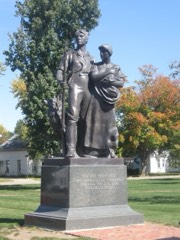 Pioneers, Thelisted 2001
Population over time
2 figuresElmwood fell from 2,097 to 2,058 between 2010 and 2020. These are the recorded population figures Wikidata holds for this place, reached through the Geographic Names Information System number this page is keyed on rather than by name, so they belong to this place and not to another of the same name. Most are census counts, but not all are: an early figure may be a founding or settlement estimate, and an estimate published within five years of a census is left out. The change column is computed, and is left blank where more than 20 years separate a figure from the one before it, because a gap that long is not a change between two counts.
| Year | People | Change |
|---|---|---|
| 2010 | 2,097 | |
| 2020 | 2,058 | -39 (-2%) |
Topographic sheets covering this place
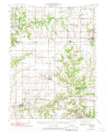
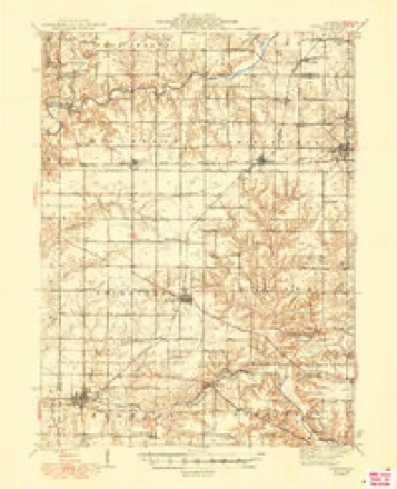
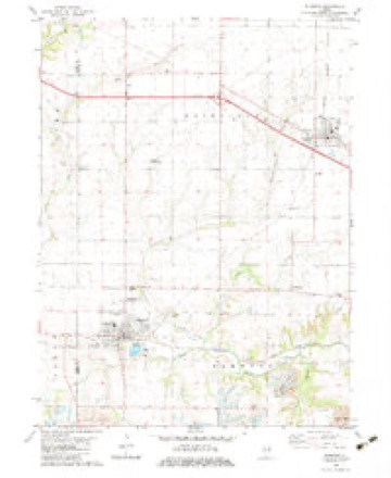
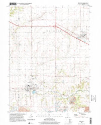
10 surveys from 15 printed sheetsMatched by testing this settlement's coordinate against the published boundary of every sheet in the United States Geological Survey's historical collection. Each opens the scanned sheet at the Survey.
- 1944 USGS Elmwood quadrangle1:62500, 2 printings
- 1948 USGS Elmwood quadrangle1:62500, 2 printings
- 1958 USGS Peoria quadrangle1:250000, 4 printings
- 1961 USGS Peoria quadrangle1:250000
- 1963 USGS Peoria quadrangle1:250000
- 1982 USGS Elmwood quadrangle1:24000
- 1985 USGS Peoria quadrangle1:100000
- 1989 USGS Peoria quadrangle1:100000
- 1990 USGS Peoria quadrangle1:250000
- 1998 USGS Elmwood quadrangle1:24000






In the county-history sources
17,121 words on this townshipThe History of Peoria County, Illinois. Containing a History of the Northwest--history of Illinois--history of the County, Its Early Settlement, Growth, Development, Resources, Etc., Etc. .., published 1880 names this settlement in its chapter on Elmwood Township. These are the passages that mention it, exactly as the scans read.
Elmwood is in town nine noitli, range five east, and is one of the western tier of townships in Peoria county. It was originall}- about one half prairie and one half timber, and possesses a superior soil. The surface is gently undulating and well adapted to agriculture. Some parts are slightly broken by the branches of Kickapoo creek, along which are some of the finest coal mines in the county. The township is crossed by two branches of the C. B. & Q. railroad, wliich form a junction at Elmwood city. The Peoria branch connects it with that city, twenty-five miles distant. Elmwood city is located on sections seven and eight, was laid out in 1854, and is a flourishing place of 2,000 population ; is next to Peoria city the largest and most important commercial manufacturing town in Peoria county. Durino- the year ending June 1, 1879, 681 cars of produce, and 1010 of coal were shipped from Elmwood.
Passage source: The History of Peoria County, Illinois. Containing a History of the Northwest--history of Illinois--history of the County, Its Early Settlement, Growth, Development, Resources, Etc., Etc. .., published 1880.
First Settlers. - John Ewalt was the first settler in Elmwood township. He came from Sangamon county. Ills., on the 1st of May, 1831, located on section twenty-nine, and broke tlie first soil. Isaac Doyle was the next, settling on Section thirty. May 1, 1832. In the Fall of 1834, W. J. Phelps settled on section eighteen, where he now resides. During the Winter of the same year Fountain Watkins settled and made improvements on section twenty-nine. Avery Dalton settled on section nineteen in 1837, coming from Fulton count}-. The early pioneers went thirty-five miles to mill. One barrel of Kanawha salt cost them $20.58. Isaac Doyle was the first justice of the peace, elected in 1883. The first marriage was that of Abner Smith to Eliza Ann Doyle, in March, 1834. The first child born in the township was Rebecca Ewalt, February, 1834. Daniel Fast was the first school teacher. The post office was established in the township in 1847, at the residence of Hon. Wm. J. Phelps, which was first called Elmwood, before the name was given to the township. Mr. Phelps was the first postmaster.
Passage source: The History of Peoria County, Illinois. Containing a History of the Northwest--history of Illinois--history of the County, Its Early Settlement, Growth, Development, Resources, Etc., Etc. .., published 1880.
For some time after Mr. and Mrs. Phelps settled in their new home the township including it was not laid out, nor was there at first any post office nearer than Peoria or Canton, though a little later one was established at Farmington, Fulton county. They felt it necessary that their place should be known by some more specific designation than that which described it as a " place in Peoria county," and accordingly decided to call it " Elmwood,'" from the beautiful grove of elms near their dwelling. And in this way Elmwood became noted as the home of Mr. Phelps long before the township or the village had been so called. Mr. Phelps succeeded in getting the mail route extended from Farmington to his place. Subsequently when the township was laid out it took the same name as did the village and railroad station, all taking their names from Elmwood, Mr. Phelps' home.
Passage source: The History of Peoria County, Illinois. Containing a History of the Northwest--history of Illinois--history of the County, Its Early Settlement, Growth, Development, Resources, Etc., Etc. .., published 1880.
Machine-read from a century-old scan, so expect the errors a machine makes: misspelled names, dropped words, stray characters.
Read the whole chapter on Elmwood Township - it names this place 77 more 77 times.
Fires near this place
7 since 2002Regional context, not property-specific evidence. The federal wildfire occurrence database lists 7 fires within 5 miles of Elmwood between 2002 and 2018, burning about 52 acres in total. None started naturally. 1 was recorded as arson. Distance is straight-line from the map coordinates, so a fire counted here may appear on a neighbouring settlement's page as well.
| Reported cause | Fires |
|---|---|
| Smoking | 2 |
| Missing data/not specified/undetermined | 2 |
| Debris and open burning | 2 |
| Arson/incendiarism | 1 |
The most recent of them, most recent first, with the day each was reported and the service that recorded it.
| Date | Cause | Size | Reported by | Name on the report |
|---|---|---|---|---|
| 26 March 2003 | Arson/incendiarism | 25 acres | Illinois State Fire Marshal's Office | not named |
| 23 March 2013 | Debris and open burning | 20 acres | Illinois Division of Forestry Resources | 323133 |
| 23 March 2013 | Missing data/not specified/undetermined | under an acre | Illinois Division of Forestry Resources | 323132 |
| 23 March 2002 | Smoking | under an acre | Illinois State Fire Marshal's Office | not named |
| 22 March 2018 | Debris and open burning | 2.0 acres | Illinois Division of Forestry Resources | 2018186 |
| 31 December 2002 | Smoking | 1.0 acres | Illinois State Fire Marshal's Office | not named |
| 4 October 2004 | Missing data/not specified/undetermined | 4.0 acres | Illinois State Fire Marshal's Office | not named |
Settlements close enough to share some of these fires:
Storms near this place
39 since 1995Regional context, not property-specific evidence. The National Weather Service names Elmwood in 39 storm reports between 1995 and 2024: 27 thunderstorm wind, 9 hail, 2 tornado, 1 flash flood. No death or injury is recorded in these reports. Each account below is quoted exactly as the forecast office filed it, from the NOAA Storm Events Database, and each date opens the federal record of that event.
| When | Event | Place named | Harm | What the report says |
|---|---|---|---|---|
| June 2010 | Tornado (EF2) | Elmwood | $85,000,000 | A tornado crossed the Knox-Peoria County line 1.1 miles west of Elmwood, then continued southeastward through the town of Elmwood. Considerable structural damage occurred to 10 homes, 30 businesses and nearly two dozen vehicles in downtown Elmwood, amounting to approximately $85 million in damages. There was a total of about 80 people, some that were attending an outdoor festival in the downtown and some that were at a theater, that took shelter in the basement of the movie theater. As a result, there were no injuries. The tornado dissipated 1 mile east of Elmwood. |
| November 2016 | Hail | Elmwood | $2,000,000 | Wind-driven hail caused significant damage to the roofs and siding of 50 houses in Elmwood. One house suffered a broken window. Numerous cars were damaged as well. |
| June 2009 | Thunderstorm Wind | Elmwood | $1,100,000 | A grain bin was blown down. Numerous trees and power lines were knocked down as well. Most homes in the town of Elmwood experienced damage due to falling trees and limbs. |
| November 2020 | Thunderstorm Wind | Elmwood | $100,000 | The roof of an apartment building was blown off. |
| June 2014 | Thunderstorm Wind | Elmwood | $35,000 | Numerous trees up to 12 inches in diameter were blown over on the southeast side of Elmwood. |
| April 1997 | Tornado (F0) | Elmwood | $25,000 | no account filed |
| April 2014 | Thunderstorm Wind | Elmwood | $12,000 | Several tree limbs were blown down in Elmwood. |
| May 2013 | Thunderstorm Wind | Elmwood | $12,000 | Several large tree limbs were blown onto power lines at Illinois Route 78 and Schissler Road. |
| October 2017 | Thunderstorm Wind | Elmwood | $8,000 | Several 8 to 12-inch diameter tree branches were snapped. |
| July 2011 | Thunderstorm Wind | Elmwood | $8,000 | Trees were blown down across Route 8 in Elmwood. |
| July 2024 | Thunderstorm Wind | Elmwood | - | A small outbuilding was destroyed. 71 mph winds were measured less than a mile away. |
| May 2023 | Thunderstorm Wind | Elmwood | - | Tree limbs were blown onto powerlines on the west side of Elmwood. |
| August 2023 | Thunderstorm Wind | Elmwood | - | Power lines were blown down. Additionally, a large tree was split and downed over a road in Elmwood. |
| July 2020 | Thunderstorm Wind | Elmwood | - | Several trees were blown down. |
| August 2020 | Thunderstorm Wind | Elmwood | - | A ten-inch diameter tree was blown across IL-78 near Graham Chapel Road. |
| June 2017 | Thunderstorm Wind | Elmwood | - | An 18 to 24-inch diameter tree was blown down. |
| August 2014 | Thunderstorm Wind | Elmwood | - | A 6 to 7-inch diameter branch was broken off a cedar tree. |
| June 2010 | Flash Flood | Elmwood | - | Around 2.50 of rain fell between 0630 and 0830 CST on top of already saturated ground. This produced rapid flash flooding in western and central Peoria County. Most rural roads were flooded, from Hanna City toward Farmington to Elmwood, as drainage ditches were overflowing. |
| April 2006 | Thunderstorm Wind | Elmwood | - | Numerous trees, power poles and power lines were blown down. |
| May 2004 | Thunderstorm Wind | Elmwood | - | A large tree was blown down. |
| July 2003 | Thunderstorm Wind | Elmwood | - | Widespread wind damage to trees and power lines was reported in Elmwood, Princeville, Mossville, Chillicothe, Peoria and Bartonville. Some of the fallen trees landed on a couple of homes causing minor roof damage. A couple of sheds were destroyed and part of a roof on a business in Princeville was blown off. No injuries were reported. |
| August 2000 | Thunderstorm Wind | Elmwood | - | Thunderstorm winds blew down several large trees. Also, numerous shingles were blown off of a garage 3 miles south of Laura. |
| September 2000 | Thunderstorm Wind | Elmwood | - | A corn field was damaged in the area as a result of straight line winds. |
| June 2000 | Thunderstorm Wind | Elmwood | - | Several large tree limbs and power lines were blown down. |
| April 1999 | Thunderstorm Wind | Elmwood | - | As a line of severe storms moved into Peoria County, a power pole was snapped off at the ground near Elmwood and an awning at a gas station in Brimfield was damaged. No injuries were reported. |
| July 1999 | Thunderstorm Wind | Elmwood | - | Several large tree limbs were blown down in Elmwood. |
| May 1998 | Thunderstorm Wind | Elmwood | - | Thunderstorm winds blew down several large trees in Elmwood. No injuries or damage to property were reported. |
| June 1998 | Thunderstorm Wind | Elmwood | - | Thunderstorm winds blew down numerous trees, tree limbs, and power lines in an area extending from Elmwood to Peoria. Some of the trees fell onto homes causing structural damage. No injuries were reported and no damage estimate was available. |
| March 1998 | Thunderstorm Wind | Elmwood | - | As a line of severe thunderstorms moved through Peoria county, numerous reports of damage were received. Six miles south of Elmwood, several small greenhouses and a metal building were damaged. In Peoria, a 200 foot by 75 foot section of the post office garage roof was blown off and curled into a ball and the second story of an abandoned business collapsed due to the thunderstorm winds. No injuries were reported. Throughout the county numerous trees, tree limbs, power poles, and power lines were blown down. No damage estimate was available. |
| May 1995 | Thunderstorm Wind | Elmwood | - | Thunderstorm winds blew down numerous trees. One tree fell onto a house and caused minor damage to the roof. Also, there was some damage to five outbuildings. No damage estimate was available. |
| July 2024 | Thunderstorm Wind | Elmwood | - | no account filed |
| February 2017 | Hail | Elmwood | - | no account filed |
| April 2015 | Hail | Elmwood | - | no account filed |
| June 2014 | Hail | Elmwood | - | no account filed |
| March 2006 | Hail | Elmwood | - | no account filed |
| April 2006 | Hail | Elmwood | - | no account filed |
| July 2003 | Hail | Elmwood | - | no account filed |
| May 2002 | Hail | Elmwood | - | no account filed |
| May 1998 | Hail | Elmwood | - | no account filed |
Nearest settlements
The eight closest, with where each one stands in the county. Distances are straight-line, computed from the Geographic Names Information System coordinates.
Elsewhere
Matched on this settlement's Geographic Names Information System number rather than its name, so it cannot be a different place of the same name in another state.
| Wikipedia article on Elmwood | An encyclopaedic summary. Its text is share-alike, so it is linked here rather than copied. |
| Wikidata item Q575921 | The structured record the population and elevation above come from. Public domain (CC0). |
Provenance
This settlement is recorded in the Geographic Names Information System as feature 407949. The sheet list is computed by point-in-boundary test against the United States Geological Survey's historical topographic inventory. Both are works of the United States government and carry no copyright under 17 U.S.C. 105.
Wildfire. Short, Karen C. 2022. Spatial wildfire occurrence data for the United States, 1992-2020 [FPA_FOD_20221014]. 6th Edition. Fort Collins, CO: Forest Service Research Data Archive. https://doi.org/10.2737/RDS-2013-0009.6 Collected with United States Government funding and usable without additional permissions or fees.
Storms. NOAA National Centers for Environmental Information, Storm Events Database https://www.ncei.noaa.gov/stormevents/ A work of the United States government, no copyright under 17 U.S.C. 105. Narratives are quoted verbatim from the National Weather Service report and are not edited or summarised.