 Block
Fairdale, Illinois
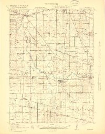
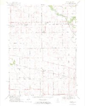
14 topographic sheets cover this place, the earliest surveyed in 1918 and the latest in 1981. It stands in Franklin Township. It lies in ZIP code area 60146. The Survey maps it on the Fairdale quadrangle.
Topographic sheets covering this place
7 surveys from 14 printed sheetsMatched by testing this settlement's coordinate against the published boundary of every sheet in the United States Geological Survey's historical collection. Each opens the scanned sheet at the Survey.
- 1918 USGS Kirkland quadrangle1:62500, 4 printings
- 1954 USGS Rockford quadrangle1:250000
- 1955 USGS Rockford quadrangle1:250000
- 1958 USGS Rockford quadrangle1:250000, 4 printings
- 1963 USGS Rockford quadrangle1:250000
- 1968 USGS Fairdale quadrangle1:24000, 2 printings
- 1981 USGS Elgin quadrangle1:100000





What happened here
An account from the chapter on Franklin township. The inset identifies its exact source book and publication year.
Toavn Of Franklin
A terrible tornado passed through the northern portion of the town of Franklin on one Sunday in May, 1853. It prostrated immense trees, fences, buildings, and everything that stood in its course. The first house struck was Mr. John Youngs'. It was a large building, but in an instant it was lifted up, shattered to splinters, and considerable parts of it carried off' so far that they were never found.
In the county-history sources
6,310 words on this townshipHistory of DeKalb County, Illinois, published 1868 names this settlement in its chapter on Franklin Township. These are the passages that mention it, exactly as the scans read.
His body was returned to Franklin, and beneath the grand old oaks of the family home the largest concourse ever assembled in the town gathered to honor the memory of their martyred hero, by one of the grandest of funeral ceremonies.
Passage source: History of DeKalb County, Illinois, published 1868.
In 1860 another tornado passed through the central portion of the town, passing, like the former, from the southwest to the northeast. It carried off one house, of which the occupants were absent, and twisted off and carried away huge trees, which could never after be found. Some electric force seemed to be at work in this terrible gale. It tore the ironwork from tools and machinery, and played numberless strange pranks.
Passage source: History of DeKalb County, Illinois, published 1868.
Machine-read from a century-old scan, so expect the errors a machine makes: misspelled names, dropped words, stray characters.
Mines and quarries near this place
5 within 5 milesRegional context, not property-specific evidence. The federal mineral resources record lists 5 workings within 5 miles of Fairdale: 3 past producers, 2 producers. 2 still produce. What was taken out: Stone, Crushed/Broken. Distance is straight-line from the map coordinates, so a quarry counted here may appear on a neighbouring settlement's page as well.
| Where | Site | Commodity | Status | Recorded |
|---|---|---|---|---|
| Ault Quarry | Stone, Crushed/Broken | Producer | ||
| Dummer Quarry | Stone, Crushed/Broken | Past Producer | ||
| Ebens Quarry | Stone, Crushed/Broken | Past Producer | ||
| J. Vowles Quarry | Stone, Crushed/Broken | Past Producer | ||
| Lee Quarry | Stone, Crushed/Broken | Producer |
Storms near this place
11 since 2000Regional context, not property-specific evidence. The National Weather Service names Fairdale in 11 storm reports between 2000 and 2024: 5 thunderstorm wind, 3 tornado, 1 hail, 1 flash flood. The reports record 2 deaths and 11 injuries. Each account below is quoted exactly as the forecast office filed it, from the NOAA Storm Events Database, and each date opens the federal record of that event.
| When | Event | Place named | Harm | What the report says |
|---|---|---|---|---|
| April 2015 | Tornado (EF3) | Fairdale | 2 killed, 11 hurt, $8,000,000 | This is the third segment of the Rochelle-Fairdale EF-4 tornado. At its strongest, peak winds were estimated to be 200 mph. The tornado entered the county just southwest of Fairdale before directly hitting the small community. Peak winds were estimated at 165 mph in Dekalb County, rating this section of the tornado a high end EF-3. Approximately 71 homes in the community had been damaged, 17 of which had been completely destroyed with all walls collapsed or removed from the buildings. Some homes that were only nailed to the foundation were swept clean. Two fatalities and 11 injuries occurred in Fairdale. A 67-year-old woman and her neighbor, a 69-year-old woman, were both killed in their homes. The tornado began to shift north (left) at this point during its lifecycle as it left Fairdale. Several homes were heavily damaged with large sections of the roofs removed along Wheeler road and dozens of trees were snapped and uprooted. A few trees were debarked. The second story was ripped off of a home near the intersection of McNeal Road and Irene Road. A two-story rebar reinforced cinder block silo was destroyed. The tornado continued into Boone County just east of Irene Road. (Tornado 2c of 7). |
| September 2008 | Flash Flood | Fairdale | $3,000,000 | Flash flooding or significant flooding was reported across much of DeKalb County, including street closures due to flooding, basement flooding and creek, stream and river flooding. Extensive flooding was reported in the Evergreen mobile home park near Sycamore. Street flooding was reported in Waterman, Hinckley and Shabbona. |
| June 2008 | Thunderstorm Wind | Fairdale | $100,000 | The roof of a one story house was completely blown off and the east wall of the house was also blown down on Irene Road, about 2 miles south of Route 72. Trees were also blown down. |
| April 2015 | Tornado (EF1) | Fairdale | $5,000 | This tornado was identified from a storm chaser video and survey. Heavy damage to two small outbuildings occurred on Paulson Road. Maximum winds speeds were estimated to be 110 mph. The tornado continued into Boone County. (Tornado 4a of 7). |
| July 2024 | Flood | Fairdale | - | A photo shared on social media showed roadway flooding near Irene Road and McNeal Road due to Trimble Run. |
| August 2021 | Thunderstorm Wind | Fairdale | - | Wind damage was reported to agriculture and some trees north of Quarry Road and southwest of Cherry Valley Road in northwest De Kalb County. |
| August 2020 | Tornado (EF0) | Fairdale | - | A tornado with peak winds of 80 mph touched down just southeast of Fairdale and moved northeast until it ended in a field east of Myelle Road. Drone footage showed a narrow swath of corn flattened in a convergent pattern. A utility pole was snapped along Buck Road. Tree damage occurred at a vocational farm along Pearl Street, just north of Wolf Road and a plastic covering was ripped off a greenhouse. The path of this tornado was determined, in part, using high resolution satellite imagery. |
| August 2018 | Thunderstorm Wind | Fairdale | - | A tree was blown down near McNeal and Irene Roads, blocking part of the roadway. A motorist didn't see the tree and drove into it. No injuries were reported. |
| June 2016 | Thunderstorm Wind | Fairdale | - | Large tree down blocking Rt. 72 between Kirkland and Fairdale. Time estimated based on radar. |
| August 2011 | Thunderstorm Wind | Fairdale | - | A tree was blown down as well as power lines around Fairdale. |
| May 2000 | Hail | Fairdale | - | no account filed |
Nearest settlements
The eight closest, with where each one stands in the county. Distances are straight-line, computed from the Geographic Names Information System coordinates.
| Map | Place | Distance | Sheets |
|---|---|---|---|
| Kirkland | 4.4 miles | 13 | |
| Esmond | 4.6 miles | 14 | |
| Clare | 8.0 miles | 13 | |
| Colvin Park | 8.3 miles | 15 | |
| Kingston | 9.2 miles | 13 | |
| Wilkinson | 10.2 miles | 13 | |
| Five Points | 12.2 miles | 13 | |
| Malta | 12.4 miles | 10 |
Elsewhere
Matched on this settlement's Geographic Names Information System number rather than its name, so it cannot be a different place of the same name in another state.
| Wikipedia article on Fairdale | An encyclopaedic summary. Its text is share-alike, so it is linked here rather than copied. |
| Wikidata item Q5430105 | The structured record the population and elevation above come from. Public domain (CC0). |
Provenance
This settlement is recorded in the Geographic Names Information System as feature 421795. The sheet list is computed by point-in-boundary test against the United States Geological Survey's historical topographic inventory. Both are works of the United States government and carry no copyright under 17 U.S.C. 105.
Mines and quarries. USGS Mineral Resources Data System (MRDS) https://mrdata.usgs.gov/mrds/ A work of the United States government, no copyright under 17 U.S.C. 105.
Storms. NOAA National Centers for Environmental Information, Storm Events Database https://www.ncei.noaa.gov/stormevents/ A work of the United States government, no copyright under 17 U.S.C. 105. Narratives are quoted verbatim from the National Weather Service report and are not edited or summarised.