 Block
Kirkland, Illinois
13 topographic sheets cover this place, the earliest surveyed in 1918 and the latest in 1981. It stands in Franklin Township. It lies in ZIP code area 60146. It stands on Bull Run. The Survey maps it on the Kirkland quadrangle. 1,650 people lived here at the 2020 count. It stands 768 feet above sea level.
Population over time
2 figuresKirkland fell from 1,744 to 1,650 between 2010 and 2020. These are the recorded population figures Wikidata holds for this place, reached through the Geographic Names Information System number this page is keyed on rather than by name, so they belong to this place and not to another of the same name. Most are census counts, but not all are: an early figure may be a founding or settlement estimate, and an estimate published within five years of a census is left out. The change column is computed, and is left blank where more than 20 years separate a figure from the one before it, because a gap that long is not a change between two counts.
| Year | People | Change |
|---|---|---|
| 2010 | 1,744 | |
| 2020 | 1,650 | -94 (-5%) |
Topographic sheets covering this place
7 surveys from 13 printed sheetsMatched by testing this settlement's coordinate against the published boundary of every sheet in the United States Geological Survey's historical collection. Each opens the scanned sheet at the Survey.
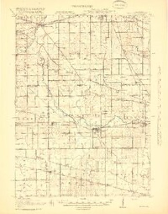
- 1918 USGS Kirkland quadrangle1:62500, 4 printings
- 1954 USGS Rockford quadrangle1:250000
- 1955 USGS Rockford quadrangle1:250000
- 1958 USGS Rockford quadrangle1:250000, 4 printings
- 1963 USGS Rockford quadrangle1:250000
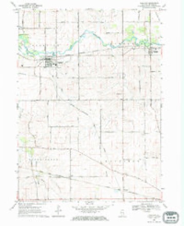
- 1968 USGS Kirkland quadrangle1:24000
- 1981 USGS Elgin quadrangle1:100000





What happened here
An account from the chapter on Franklin township. The inset identifies its exact source book and publication year.
Toavn Of Franklin
A terrible tornado passed through the northern portion of the town of Franklin on one Sunday in May, 1853. It prostrated immense trees, fences, buildings, and everything that stood in its course. The first house struck was Mr. John Youngs'. It was a large building, but in an instant it was lifted up, shattered to splinters, and considerable parts of it carried off' so far that they were never found.
In the county-history sources
6,310 words on this townshipHistory of DeKalb County, Illinois, published 1868 names this settlement in its chapter on Franklin Township. These are the passages that mention it, exactly as the scans read.
At the disastrous battle of Guntown he lost his life, and with that loss the army lost one of its most distinguished and most fearless officers, and De Kalb County one of the most heroic of her sons.
Passage source: History of DeKalb County, Illinois, published 1868.
His body was returned to Franklin, and beneath the grand old oaks of the family home the largest concourse ever assembled in the town gathered to honor the memory of their martyred hero, by one of the grandest of funeral ceremonies.
Passage source: History of DeKalb County, Illinois, published 1868.
A terrible tornado passed through the northern portion of the town of Franklin on one Sunday in May, 1853. It prostrated immense trees, fences, buildings, and everything that stood in its course. The first house struck was Mr. John Youngs'. It was a large building, but in an instant it was lifted up, shattered to splinters, and considerable parts of it carried off' so far that they were never found. Mrs. Young was killed instantly. The residence of Mr. Ira Dean was next struck. It was torn in pieces ; and a lady relative, who chanced to be visiting there, had her back broken, and died soon after. In a chamber were two boys, engaged in playing cards. Both were blown out of the window, but not seriously injured. Several other houses were unroofed, and some barns destroyed.
Passage source: History of DeKalb County, Illinois, published 1868.
Machine-read from a century-old scan, so expect the errors a machine makes: misspelled names, dropped words, stray characters.
Read the whole chapter on Franklin Township - it names this place 5 more 5 times.
Mines and quarries near this place
1 within 5 milesRegional context, not property-specific evidence. The federal mineral resources record lists 1 working within 5 miles of Kirkland: 1 producer. All of them still produce. What was taken out: Stone, Crushed/Broken. Distance is straight-line from the map coordinates, so a quarry counted here may appear on a neighbouring settlement's page as well.
| Where | Site | Commodity | Status | Recorded |
|---|---|---|---|---|
| Ault Quarry | Stone, Crushed/Broken | Producer |
Storms near this place
18 since 1998Regional context, not property-specific evidence. The National Weather Service names Kirkland in 18 storm reports between 1998 and 2024: 14 thunderstorm wind, 2 hail, 2 tornado. The reports record 12 injuries. Each account below is quoted exactly as the forecast office filed it, from the NOAA Storm Events Database, and each date opens the federal record of that event.
| When | Event | Place named | Harm | What the report says |
|---|---|---|---|---|
| August 1998 | Thunderstorm Wind | Kirkland | 12 hurt | no account filed |
| June 2008 | Thunderstorm Wind | Kirkland | $10,000 | Numerous trees, tree limbs and power lines were blown down in Kirkland. A construction trailer was overturned near Route 72 and Malta Road. |
| August 2018 | Thunderstorm Wind | Kirkland | $1,000 | A tree was blown down which took down a power line and some phone lines. |
| March 2024 | Hail | Kirkland | - | Quarter size hail was reported southwest of Kirkland. Some melting occurred prior to the observation. |
| July 2024 | Thunderstorm Wind | Kirkland | - | Numerous tree limbs were blown down, some onto power lines. A few trees were uprooted. Nearby corn crops were bent or broken. |
| August 2021 | Tornado (EF1) | Kirkland | - | A tornado with peak winds of 90 mph touched down near Owens Creek, west of Malta Road. Video of this tornado showed it may have intermittently skipped on the ground shortly after touching down. Drone footage showed crop damage increased in a farm east of Byers Road and a barn was heavily damaged. This tornado dissipated east of Pearl Street. The path of this tornado was determined, in part, using high resolution satellite imagery. |
| August 2020 | Thunderstorm Wind | Kirkland | - | Power lines were blown down in Kirkland. |
| August 2008 | Thunderstorm Wind | Kirkland | - | A one foot diameter tree was blown down. |
| July 2008 | Thunderstorm Wind | Kirkland | - | Eight inch diameter tree limbs were blown down. |
| June 2007 | Thunderstorm Wind | Kirkland | - | Tree limbs blown down in the northwest part of DeKalb County. |
| July 2006 | Thunderstorm Wind | Kirkland | - | Tree damage reported in Kirkland. |
| September 2005 | Thunderstorm Wind | Kirkland | - | A large tree was blown down in a park along with several tree limbs. |
| May 2001 | Tornado (F0) | Kirkland | - | A tornado was spotted by police, a trained spotter and the public in a farm field. There was no damage reported. |
| June 1999 | Thunderstorm Wind | Kirkland | - | 60 mph winds were reported at Kirkland. Trees were uprooted northeast of Dekalb Airport and winds were estimated at 80 mph. |
| July 1998 | Thunderstorm Wind | Kirkland | - | Trees and limbs were blown down. |
| June 2001 | Thunderstorm Wind | Kirkland | - | no account filed |
| May 2000 | Hail | Kirkland | - | no account filed |
| September 2000 | Thunderstorm Wind | Kirkland | - | no account filed |
Nearest settlements
The eight closest, with where each one stands in the county. Distances are straight-line, computed from the Geographic Names Information System coordinates.
| Map | Place | Distance | Sheets |
|---|---|---|---|
| Fairdale | 4.4 miles | 14 | |
| Colvin Park | 4.8 miles | 15 | |
| Kingston | 4.9 miles | 13 | |
| Clare | 5.4 miles | 13 | |
| Esmond | 6.0 miles | 14 | |
| Wilkinson | 6.9 miles | 13 | |
| Genoa | 8.4 miles | 13 | |
| Five Points | 8.5 miles | 13 |
Elsewhere
Matched on this settlement's Geographic Names Information System number rather than its name, so it cannot be a different place of the same name in another state.
| Wikipedia article on Kirkland | An encyclopaedic summary. Its text is share-alike, so it is linked here rather than copied. |
| Wikidata item Q2671956 | The structured record the population and elevation above come from. Public domain (CC0). |
Provenance
This settlement is recorded in the Geographic Names Information System as feature 421887. The sheet list is computed by point-in-boundary test against the United States Geological Survey's historical topographic inventory. Both are works of the United States government and carry no copyright under 17 U.S.C. 105.
Mines and quarries. USGS Mineral Resources Data System (MRDS) https://mrdata.usgs.gov/mrds/ A work of the United States government, no copyright under 17 U.S.C. 105.
Storms. NOAA National Centers for Environmental Information, Storm Events Database https://www.ncei.noaa.gov/stormevents/ A work of the United States government, no copyright under 17 U.S.C. 105. Narratives are quoted verbatim from the National Weather Service report and are not edited or summarised.