 Block
Green River, Illinois
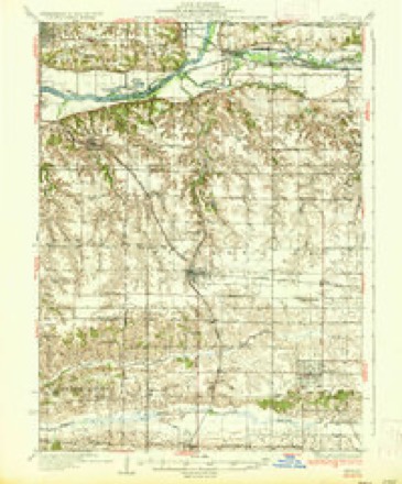
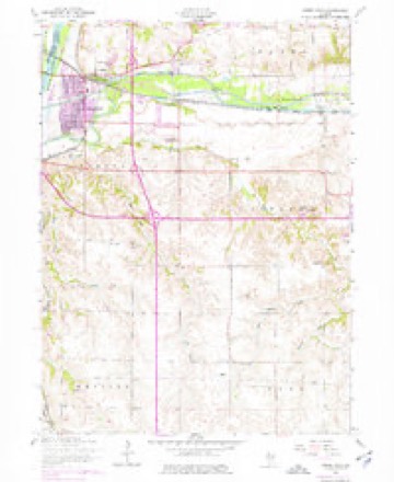
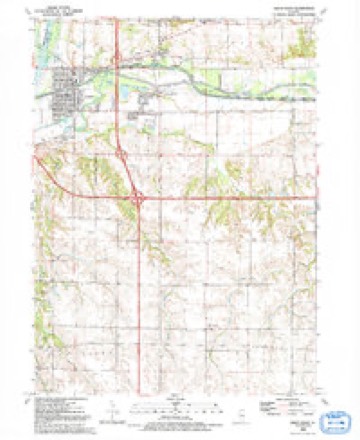
12 topographic sheets cover this place, the earliest surveyed in 1937 and the latest in 1992. It stands in Edford Township. It lies in ZIP code area 61241. The Survey maps it on the Green Rock quadrangle. It stands 594 feet above sea level.
Topographic sheets covering this place
8 surveys from 12 printed sheetsMatched by testing this settlement's coordinate against the published boundary of every sheet in the United States Geological Survey's historical collection. Each opens the scanned sheet at the Survey.
- 1937 USGS Orion quadrangle1:62500, 2 printings
- 1953 USGS Green Rock quadrangle1:24000, 3 printings
- 1958 USGS Davenport quadrangle1:250000, 2 printings
- 1961 USGS Davenport quadrangle1:250000
- 1962 USGS Davenport quadrangle1:250000
- 1984 USGS Aledo quadrangle1:100000
- 1989 USGS Aledo quadrangle1:100000
- 1992 USGS Green Rock quadrangle1:24000





In the county-history sources
3,982 words on this townshipHistory of Henry County, Illinois : It's Taxpayers and Voters; Containing Also, a Biographical Directory, a Condensed History of the State; Map of the County; a Business Directory...etc, published 1877 names this settlement in its chapter on Edford Township. These are the passages that mention it, exactly as the scans read.
DIL.ENBECK M. H. Farmer and Stock Raiser, Sec. 23, P.O. Geneseo; born in Leroy, Jefferson Co. N.Y. March 6, 1840; came to this county in June, 1855; Rep; Meih; owns 115 acres, val. $7,000; wife was Sarah C. Spickler, born in Lancaster Co. Pa. April 26, 1843; came here April 28, 1856; married Jan. 7, 1864; have had three children, all living: Albert Courtland, born March 7, 1865; Elvin Francis, born Aug. 22, 1871; and Minnie V., April 22, 1876; was in H2th Regt. I. V. L; have been School Director eight years.
Passage source: History of Henry County, Illinois : It's Taxpayers and Voters; Containing Also, a Biographical Directory, a Condensed History of the State; Map of the County; a Business Directory...etc, published 1877.
DILENBECK S. S. Farmer and Stock Raiser, Sec. 22, P.O. Geneseo; born in Jefferson Co. N.Y. April 6, 1845; came to this county in 1855; Rep; Church of God; owns 160 acres, val. $7,000; wife was Genieve L. Seaton, born Bureau Co. 111. Sept. 8, 1850; married Dec. 25, 1868; have had three children - one living, Chauncy Burdett; those deceased, Otis \V. and Arthur A.; all born on homestead.
Passage source: History of Henry County, Illinois : It's Taxpayers and Voters; Containing Also, a Biographical Directory, a Condensed History of the State; Map of the County; a Business Directory...etc, published 1877.
ELLISOX EDWARD T. Farmer and Stock Raiser, Sees. 24, 25, and 31, in Geneseo Tp.; P.O. Geneseo; born in Chester, Windsor Co. Vt. Jan. 10, 1828; came to this county in 1854; Rep; Cong; owns 240 acres, val. $14,400; wife was Eleanor Carpenter, born Plymouth.Windsor Co.Vt. Nov. 12, 1845; marriedAug. 7, 1864, at Geneseo; have had five children, three living, Sherman J., Homer E., and Ursula S.; those dead, Emma and Stella.
Passage source: History of Henry County, Illinois : It's Taxpayers and Voters; Containing Also, a Biographical Directory, a Condensed History of the State; Map of the County; a Business Directory...etc, published 1877.
Machine-read from a century-old scan, so expect the errors a machine makes: misspelled names, dropped words, stray characters.
Read the whole chapter on Edford Township - it names this place 26 more 26 times.
Fires near this place
1 since 2018Regional context, not property-specific evidence. The federal wildfire occurrence database lists 1 fire within 5 miles of Green River in 2018, burning about 1 acre in total. None started naturally. None was recorded as arson. Distance is straight-line from the map coordinates, so a fire counted here may appear on a neighbouring settlement's page as well.
| Reported cause | Fires |
|---|---|
| Missing data/not specified/undetermined | 1 |
The most recent of them, most recent first, with the day each was reported and the service that recorded it.
| Date | Cause | Size | Reported by | Name on the report |
|---|---|---|---|---|
| 24 July 2018 | Missing data/not specified/undetermined | under an acre | Illinois Division of Forestry Resources | 18-108 MM 1 I-88 |
Settlements close enough to share some of these fires:
Mines and quarries near this place
3 within 5 milesRegional context, not property-specific evidence. The federal mineral resources record lists 3 workings within 5 miles of Green River: 2 producers, 1 past producer. 2 still produce. What was taken out: Sand and Gravel, Construction, Stone, Crushed/Broken. Distance is straight-line from the map coordinates, so a quarry counted here may appear on a neighbouring settlement's page as well.
| Where | Site | Commodity | Status | Recorded |
|---|---|---|---|---|
| Cleveland Quarry Plant #31 | Stone, Crushed/Broken | Producer | ||
| Mc Dowell Sand & Excavating | Sand and Gravel, Construction | Producer | ||
| Oberlander Pit | Sand and Gravel, Construction | Past Producer |
Storms near this place
8 since 2008Regional context, not property-specific evidence. The National Weather Service names Green River in 8 storm reports between 2008 and 2026: 4 thunderstorm wind, 3 hail, 1 tornado. The reports record 2 deaths and 4 injuries. Each account below is quoted exactly as the forecast office filed it, from the NOAA Storm Events Database, and each date opens the federal record of that event.
| When | Event | Place named | Harm | What the report says |
|---|---|---|---|---|
| July 2008 | Thunderstorm Wind | Green River | 2 killed, 4 hurt | Wind gusts estimated to be 90 mph toppled over 100 trees at the Indian Trails Resort in Colona, IL around 615 am July 21. One tree fell onto a tent killing a 4 year old boy and a 9 month old girl and injuring four other children. A family pet (dog) was also killed. |
| August 2025 | Thunderstorm Wind | Green River | - | Lots of small branches blown down. |
| April 2025 | Tornado (EF0) | Green River | - | A brief tornado caused EF-0 damage to trees with a peak estimated wind speed of 80 MPH. |
| June 2022 | Hail | Green River | - | Close to the Interstate 74, Interstate 80 interchange. |
| July 2020 | Thunderstorm Wind | Green River | - | Significant damage to a homestead, with three large garage doors blown in and windows broken. Strong winds also removed the roof of a barn, and blew down numerous trees. |
| April 2011 | Hail | Green River | - | Quarter sized hail fell 2 miles east southeast of Colona, IL at 906 pm CDT April 3. |
| April 2011 | Hail | Green River | - | Quarter sized hail fell 2 miles southeast of Colona, IL at 910 pm CDT April 3. |
| April 2026 | Thunderstorm Wind | Green River | - | no account filed |
Nearest settlements
The eight closest, with where each one stands in the county. Distances are straight-line, computed from the Geographic Names Information System coordinates.
| Map | Place | Distance | Sheets |
|---|---|---|---|
| Level Acres | 0.5 miles | 12 | |
| Dayton | 0.9 miles | 12 | |
| Colona | 1.9 miles | 12 | |
| Green Rock | 2.0 miles | 12 | |
| Cleveland | 2.1 miles | 23 | |
| Briar Bluff | 2.6 miles | 12 | |
| Woodcrest | 3.6 miles | 12 | |
| Hickory Hills | 3.7 miles | 12 |
Elsewhere
Matched on this settlement's Geographic Names Information System number rather than its name, so it cannot be a different place of the same name in another state.
| Wikipedia article on Green River | An encyclopaedic summary. Its text is share-alike, so it is linked here rather than copied. |
| Wikidata item Q5603111 | The structured record the population and elevation above come from. Public domain (CC0). |
Provenance
This settlement is recorded in the Geographic Names Information System as feature 409396. The sheet list is computed by point-in-boundary test against the United States Geological Survey's historical topographic inventory. Both are works of the United States government and carry no copyright under 17 U.S.C. 105.
Wildfire. Short, Karen C. 2022. Spatial wildfire occurrence data for the United States, 1992-2020 [FPA_FOD_20221014]. 6th Edition. Fort Collins, CO: Forest Service Research Data Archive. https://doi.org/10.2737/RDS-2013-0009.6 Collected with United States Government funding and usable without additional permissions or fees.
Mines and quarries. USGS Mineral Resources Data System (MRDS) https://mrdata.usgs.gov/mrds/ A work of the United States government, no copyright under 17 U.S.C. 105.
Storms. NOAA National Centers for Environmental Information, Storm Events Database https://www.ncei.noaa.gov/stormevents/ A work of the United States government, no copyright under 17 U.S.C. 105. Narratives are quoted verbatim from the National Weather Service report and are not edited or summarised.