 Block
Green Rock, Illinois
12 topographic sheets cover this place, the earliest surveyed in 1937 and the latest in 1992. It stands in Colona Township. It lies in ZIP code area 61241. It stands on Turner Creek. The Survey maps it on the Green Rock quadrangle.
Topographic sheets covering this place
8 surveys from 12 printed sheetsMatched by testing this settlement's coordinate against the published boundary of every sheet in the United States Geological Survey's historical collection. Each opens the scanned sheet at the Survey.
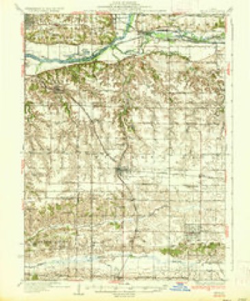
- 1937 USGS Orion quadrangle1:62500, 2 printings
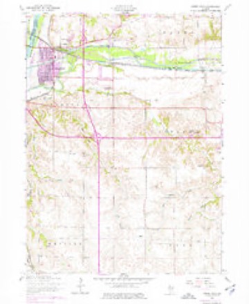
- 1953 USGS Green Rock quadrangle1:24000, 3 printings
- 1958 USGS Davenport quadrangle1:250000, 2 printings
- 1961 USGS Davenport quadrangle1:250000
- 1962 USGS Davenport quadrangle1:250000
- 1984 USGS Aledo quadrangle1:100000
- 1989 USGS Aledo quadrangle1:100000
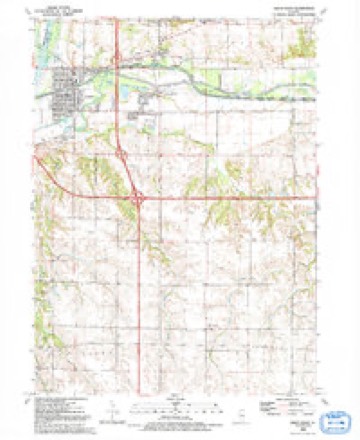
- 1992 USGS Green Rock quadrangle1:24000





In the county-history sources
4,324 words on this townshipHistory of Henry County, Illinois : It's Taxpayers and Voters; Containing Also, a Biographical Directory, a Condensed History of the State; Map of the County; a Business Directory...etc, published 1877 has no passage naming this settlement, which was common for smaller places. Its township is covered in full.
The chapter on Colona Township covers the township.
Read the chapter on Colona Township - 4,324 words.
Fires near this place
1 since 2018Regional context, not property-specific evidence. The federal wildfire occurrence database lists 1 fire within 5 miles of Green Rock in 2018, burning about 1 acre in total. None started naturally. None was recorded as arson. Distance is straight-line from the map coordinates, so a fire counted here may appear on a neighbouring settlement's page as well.
| Reported cause | Fires |
|---|---|
| Missing data/not specified/undetermined | 1 |
The most recent of them, most recent first, with the day each was reported and the service that recorded it.
| Date | Cause | Size | Reported by | Name on the report |
|---|---|---|---|---|
| 24 July 2018 | Missing data/not specified/undetermined | under an acre | Illinois Division of Forestry Resources | 18-108 MM 1 I-88 |
Settlements close enough to share some of these fires:
Mines and quarries near this place
3 within 5 milesRegional context, not property-specific evidence. The federal mineral resources record lists 3 workings within 5 miles of Green Rock: 2 producers, 1 past producer. 2 still produce. What was taken out: Sand and Gravel, Construction, Stone, Crushed/Broken. Distance is straight-line from the map coordinates, so a quarry counted here may appear on a neighbouring settlement's page as well.
| Where | Site | Commodity | Status | Recorded |
|---|---|---|---|---|
| Cleveland Quarry Plant #31 | Stone, Crushed/Broken | Producer | ||
| Mc Dowell Sand & Excavating | Sand and Gravel, Construction | Producer | ||
| Oberlander Pit | Sand and Gravel, Construction | Past Producer |
Storms near this place
22 since 1995Regional context, not property-specific evidence. The National Weather Service names Green Rock in 22 storm reports between 1995 and 2025: 9 thunderstorm wind, 6 hail, 3 flood, 3 flash flood. The reports record 1 injury. Each account below is quoted exactly as the forecast office filed it, from the NOAA Storm Events Database, and each date opens the federal record of that event.
| When | Event | Place named | Harm | What the report says |
|---|---|---|---|---|
| July 2009 | Thunderstorm Wind | Green Rock | 1 hurt, $25,000 | Wind gusts estimated to be 70 mph blew a tree down onto a van in Colona, IL around 921 pm July 24. One person was injured which required transport to the hospital. |
| May 2010 | Flash Flood | Green Rock | $5,000,000 | Heavy rains resulted in widespread flash flooding of roads and highways across all of Henry County, especially the northwest half during the morning of May 13. |
| June 2009 | Flood | Green Rock | $250,000 | Heavy rains during the middle of the month resulted in the Rock River at Joslin going above the moderate flood stage level of 14 feet on June 22nd around 12 am. It crested around 14.73 feet around 830 pm on June 23. It fell below the moderate flood stage level around 5 pm June 24. |
| July 2010 | Flood | Green Rock | $125,000 | no account filed |
| August 2009 | Flash Flood | Green Rock | $2,500 | Heavy rain resulted in flash flooding just northwest of Warner, IL during the late afternoon of August 19. Rainfall totals of 2 to 3 inches fell in about a 30 minute period between 3 and 4 pm. Flooding was observed in the basement of a residence. |
| August 2025 | Thunderstorm Wind | Green Rock | - | A tree was blown down blocking the intersection of U.S. 6 and Highway 84. |
| April 2023 | Thunderstorm Wind | Green Rock | - | Law enforcement reported that trees were down and blocking the road at this location. |
| April 2023 | Tornado (EF2) | Green Rock | - | A brief tornado developed Tuesday morning in Colona, Illinois, and was embedded in a broader swath of damaging straight line winds. The tornado was on the ground for 0.4 miles and west 50 yards wide. the peak estimated winds were 115 MPH. The tornado moved through the northern portion of Colona, and was on the ground for about a half mile. The tornado was captured on video, ripping the entire roof off a gas station and tossing it into a brick building just to the south. The front wall of the building also collapsed. The tornado also uprooted trees, and caused minor house damage.The tornado was rated a low-end EF-2, with maximum winds around 115 mph. |
| July 2022 | Thunderstorm Wind | Green Rock | - | Public report of large tree down via social media. The time of the event estimated using radar. |
| February 2019 | Flash Flood | Green Rock | - | Emergency management reported an ice jam at the lower end of the Green River, which caused rapid rises. Water was observed on properties and in some homes in the city of |Colona. |
| June 2019 | Thunderstorm Wind | Green Rock | - | A public report via social media of numerous trees down in the city. The time of the event was estimated using radar. |
| April 2011 | Hail | Green Rock | - | Quarter sized hail fell 5 miles south southeast of East Moline, IL at 903 pm CDT April 3. |
| July 2009 | Thunderstorm Wind | Green Rock | - | Wind gusts estimated to be 70 mph blew down several trees in Colona, IL around 920 pm July 24. |
| July 2008 | Thunderstorm Wind | Green Rock | - | Wind gusts estimated to be 70 mph blew down several trees along Highway 6 from Colona, IL toward Cambridge, IL around 610 am July 21. Some of the trees were 24 inches in diameter. Areas of flattened corn were also observed. |
| July 2008 | Thunderstorm Wind | Green Rock | - | Wind gusts estimated to be 70 mph blew down several trees across Highway 6 in Henry County Illinois around 621 am July 21 forcing its closure. |
| June 1997 | Thunderstorm Wind | Green Rock | - | Trees downed on power lines. |
| February 2024 | Hail | Green Rock | - | no account filed |
| August 2022 | Hail | Green Rock | - | no account filed |
| June 2022 | Hail | Green Rock | - | no account filed |
| April 2013 | Flood | Green Rock | - | no account filed |
| May 1995 | Hail | Green Rock | - | no account filed |
| May 1995 | Hail | Green Rock | - | no account filed |
Nearest settlements
The eight closest, with where each one stands in the county. Distances are straight-line, computed from the Geographic Names Information System coordinates.
| Map | Place | Distance | Sheets |
|---|---|---|---|
| Colona | 0.8 miles | 12 | |
| Briar Bluff | 1.0 miles | 12 | |
| Level Acres | 1.9 miles | 12 | |
| Green River | 2.0 miles | 12 | |
| Dayton | 2.2 miles | 12 | |
| Cleveland | 3.2 miles | 23 | |
| Timber Ridge | 3.9 miles | 14 | |
| Warner | 4.4 miles | 14 |
Provenance
This settlement is recorded in the Geographic Names Information System as feature 409401. The sheet list is computed by point-in-boundary test against the United States Geological Survey's historical topographic inventory. Both are works of the United States government and carry no copyright under 17 U.S.C. 105.
Wildfire. Short, Karen C. 2022. Spatial wildfire occurrence data for the United States, 1992-2020 [FPA_FOD_20221014]. 6th Edition. Fort Collins, CO: Forest Service Research Data Archive. https://doi.org/10.2737/RDS-2013-0009.6 Collected with United States Government funding and usable without additional permissions or fees.
Mines and quarries. USGS Mineral Resources Data System (MRDS) https://mrdata.usgs.gov/mrds/ A work of the United States government, no copyright under 17 U.S.C. 105.
Storms. NOAA National Centers for Environmental Information, Storm Events Database https://www.ncei.noaa.gov/stormevents/ A work of the United States government, no copyright under 17 U.S.C. 105. Narratives are quoted verbatim from the National Weather Service report and are not edited or summarised.