 Block
Harrison, Illinois
17 topographic sheets cover this place, the earliest surveyed in 1918 and the latest in 1981. It stands in Harrison Township. It lies in ZIP code area 61072. It stands on Sugar River. The Survey maps it on the Shirland quadrangle. It stands 728 feet above sea level.
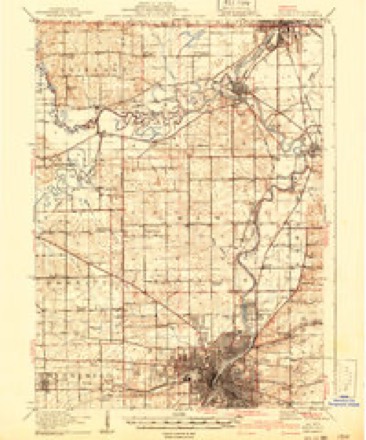
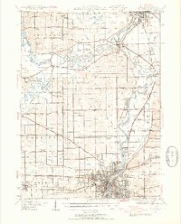
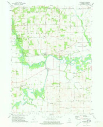
Topographic sheets covering this place
8 surveys from 17 printed sheetsMatched by testing this settlement's coordinate against the published boundary of every sheet in the United States Geological Survey's historical collection. Each opens the scanned sheet at the Survey.
- 1918 USGS Rockford quadrangle1:62500, 3 printings
- 1938 USGS Rockford quadrangle1:62500, 3 printings
- 1954 USGS Rockford quadrangle1:250000
- 1955 USGS Rockford quadrangle1:250000
- 1958 USGS Rockford quadrangle1:250000, 4 printings
- 1963 USGS Rockford quadrangle1:250000
- 1971 USGS Shirland quadrangle1:24000, 2 printings
- 1981 USGS Rockford quadrangle1:100000, 2 printings





In the county-history sources
4,958 words on this townshipThe History of Winnebago County, Illinois : Its Past and Present, Containing ... a Biographical Directory of Its Citizens, War Record of Its Volunteers in the Late Rebellion, General and Local Statistics ... History of the Northwest, History of Illinois ... Etc, published 1877 names this settlement in its chapter on Harrison Township. These are the passages that mention it, exactly as the scans read.
The village of Harrison, situated on the banks of the Pecatonica, contains a number of shops, and two or three groceries, and small stores, hotel, church, etc. The Western Union Raih-oad missed the village by about one mile.
Passage source: The History of Winnebago County, Illinois : Its Past and Present, Containing ... a Biographical Directory of Its Citizens, War Record of Its Volunteers in the Late Rebellion, General and Local Statistics ... History of the Northwest, History of Illinois ... Etc, published 1877.
BRAlTJfllVG CHESTER I. Labor er; P. O. Harrison; born in Pike Co., Pa., Dec.24, 1854 ; came to this Co. Nov. 22, 1876 ; makes his home with George F. Branning, who is a renter; Sec. 14; P. O. Harrison; born in Wayne Co., Penn., July 1, 1845; came to this Co. in 1867 ; married Mary J. Hagencamp, April 15, 1871 ; she was born in Potter Co., Penn. ; have three children : Delia, aged 5 ; India, 3, and Furnam, 2 years ; the family attend the M. E. Church, of which Mrs. Branning is a member.
Passage source: The History of Winnebago County, Illinois : Its Past and Present, Containing ... a Biographical Directory of Its Citizens, War Record of Its Volunteers in the Late Rebellion, General and Local Statistics ... History of the Northwest, History of Illinois ... Etc, published 1877.
GOODWIX J:X0. Farmer; Sec. 33; P. O. Harrison; born in Roscoe, in 1850; unmarried; owns 38 acres land, valued at $1,600; his fiither, Silas Goodwin, came to this farm in 1853, with his wife and five children, Jane, John, Charles, Theresa and George ; Jane died, aged 8 years, and George, aged 1 ; the father enlisted in the 12th I. V. C. ; was with them nearly three years ; was taken sick and sent to the hospital, where he soon afterward died ; Mr. G. went West when only 12 years old, and has been absent ever since, until last spring, when he returned, after having wandered through the mining districts of Montana, Idaho, Coh)rado, and parts of Dakota; has led the life of a miner since he was 13 years old, undergoing all of the dangers, trials, Indian tights, hairbreadth escapes, etc., incident to the life of a frontiersman.
Passage source: The History of Winnebago County, Illinois : Its Past and Present, Containing ... a Biographical Directory of Its Citizens, War Record of Its Volunteers in the Late Rebellion, General and Local Statistics ... History of the Northwest, History of Illinois ... Etc, published 1877.
Machine-read from a century-old scan, so expect the errors a machine makes: misspelled names, dropped words, stray characters.
Read the whole chapter on Harrison Township - it names this place 27 more 27 times.
Fires near this place
3 since 2018Regional context, not property-specific evidence. The federal wildfire occurrence database lists 3 fires within 5 miles of Harrison between 2018 and 2020, burning about 2 acres in total. None started naturally. None was recorded as arson. Distance is straight-line from the map coordinates, so a fire counted here may appear on a neighbouring settlement's page as well.
| Reported cause | Fires |
|---|---|
| Missing data/not specified/undetermined | 2 |
| Fireworks | 1 |
The most recent of them, most recent first, with the day each was reported and the service that recorded it.
| Date | Cause | Size | Reported by | Name on the report |
|---|---|---|---|---|
| 4 May 2020 | Fireworks | under an acre | Illinois Division of Forestry Resources | 20-0000217 |
| 26 March 2018 | Missing data/not specified/undetermined | under an acre | Illinois Division of Forestry Resources | 18-0274 |
| 13 March 2018 | Missing data/not specified/undetermined | 1.0 acres | Illinois Division of Forestry Resources | 18-0230 |
Settlements close enough to share some of these fires:
Mines and quarries near this place
6 within 5 milesRegional context, not property-specific evidence. The federal mineral resources record lists 6 workings within 5 miles of Harrison: 6 past producers. None of them still produces. What was taken out: Stone, Crushed/Broken. Distance is straight-line from the map coordinates, so a quarry counted here may appear on a neighbouring settlement's page as well.
| Where | Site | Commodity | Status | Recorded |
|---|---|---|---|---|
| Austin Quarry | Stone, Crushed/Broken | Past Producer | ||
| E. Sharp Quarry | Stone, Crushed/Broken | Past Producer | ||
| Ed Truman Quarry | Stone, Crushed/Broken | Past Producer | ||
| Faulkner Quarry | Stone, Crushed/Broken | Past Producer | ||
| Unnamed Limestone Quarry | Stone, Crushed/Broken | Past Producer | ||
| Unnamed Limestone Quarry | Stone, Crushed/Broken | Past Producer |
Storms near this place
3 since 2013Regional context, not property-specific evidence. The National Weather Service names Harrison in 3 storm reports between 2013 and 2026: 2 tornado, 1 thunderstorm wind. No death or injury is recorded in these reports. Each account below is quoted exactly as the forecast office filed it, from the NOAA Storm Events Database, and each date opens the federal record of that event.
| When | Event | Place named | Harm | What the report says |
|---|---|---|---|---|
| April 2026 | Tornado (EF1) | Harrison | - | An EF-1 tornado began near the intersection of Freeport Road and Bates Road southeast of Harrison, initially downing several tree branches at and near a small cemetery. The tornado produced additional tree damage as it tracked eastward along Roscoe Road before entering the west side of Roscoe and reaching its peak intensity as it tracked through the Hawks Point, Crystal Hills, and Oxford Commons subdivisions. There, multiple homes had portions of their roofs torn off or damaged and had sections of siding and fascia peeled off. A few homes also had their garage doors blown in, leading to parts of their garage walls getting blown out in a few cases. Numerous trees were also uprooted or damaged in these subdivisions. The tornado then continued eastward, knocking down several power poles along Gleasman Road and damaging a nearby farm outbuilding before crossing the Rock River. East of the Rock River, the tornado continued to cause extensive tree damage. Multiple additional houses sustained roof and fascia damage from the tornado as well. The tornado appeared to dissipate just as it reached the Winnebago-Boone County line. Extensive straight-line wind damage was also observed in close proximity to the tornadic circulation, particularly along its southern flank. |
| April 2026 | Tornado (EF1) | Harrison | - | A high-end EF-1 tornado began near Meridian Road between Favor Road and Steward Road southeast of Harrison, initially causing damage to trees and an outbuilding. Video footage from storm chasers documented the tornado becoming fully condensed and growing in size and intensity as it tracked east-northeastward across Favor Road and impacted two farmsteads, causing significant damage to a few outbuildings and snapping and uprooting multiple trees. Additional storm chaser footage showed the tornado intensifying again as it tracked northeastward across Gummow Road and then reaching peak intensity as it impacted a property along Freeport Road. At this property, the majority of an older two-story house's roof was removed, several trees were snapped, and an old barn was destroyed. The footage then captured the tornado making a sharp turn to the southeast and crossing Freeport Road once again before roping out and eventually dissipating in open fields near Owen Center Road. |
| May 2013 | Thunderstorm Wind | Harrison | - | Eight inch diameter tree limbs were blown down on Route 75, one mile east of Meridian Road. An estimated 25 to 30 inch diameter tree was blown down on Route 75, 1.5 miles east of Meridian Road. |
Nearest settlements
The eight closest, with where each one stands in the county. Distances are straight-line, computed from the Geographic Names Information System coordinates.
| Map | Place | Distance | Sheets |
|---|---|---|---|
| Shirland | 1.2 miles | 17 | |
| Owen Center | 5.7 miles | 20 | |
| Wempletown | 5.8 miles | 18 | |
| Rockton | 6.6 miles | 19 | |
| Hutchins Park | 7.4 miles | 19 | |
| Durand | 7.5 miles | 15 | |
| Nottingham Manor | 7.8 miles | 20 | |
| Latham Park | 7.9 miles | 20 |
Elsewhere
Matched on this settlement's Geographic Names Information System number rather than its name, so it cannot be a different place of the same name in another state.
| Wikipedia article on Harrison | An encyclopaedic summary. Its text is share-alike, so it is linked here rather than copied. |
| Wikidata item Q3127747 | The structured record the population and elevation above come from. Public domain (CC0). |
Provenance
This settlement is recorded in the Geographic Names Information System as feature 409853. The sheet list is computed by point-in-boundary test against the United States Geological Survey's historical topographic inventory. Both are works of the United States government and carry no copyright under 17 U.S.C. 105.
Wildfire. Short, Karen C. 2022. Spatial wildfire occurrence data for the United States, 1992-2020 [FPA_FOD_20221014]. 6th Edition. Fort Collins, CO: Forest Service Research Data Archive. https://doi.org/10.2737/RDS-2013-0009.6 Collected with United States Government funding and usable without additional permissions or fees.
Mines and quarries. USGS Mineral Resources Data System (MRDS) https://mrdata.usgs.gov/mrds/ A work of the United States government, no copyright under 17 U.S.C. 105.
Storms. NOAA National Centers for Environmental Information, Storm Events Database https://www.ncei.noaa.gov/stormevents/ A work of the United States government, no copyright under 17 U.S.C. 105. Narratives are quoted verbatim from the National Weather Service report and are not edited or summarised.