 Block
Durand, Illinois
15 topographic sheets cover this place, the earliest surveyed in 1932 and the latest in 1981. It stands in Durand Township. It lies in ZIP code area 61024. It stands on North Branch Otter Creek. The Survey maps it on the Durand quadrangle. 1,390 people lived here at the 2020 count. It stands 778 feet above sea level.
On record in Durand
Buildings and businesses the archive holds for this place. Each opens its own page, with the source record it came from.
On the National Register 2 records
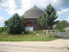 Robert Weber Round Barnlisted 1984
- Christenson-Anderson Farmlisted 2022
Population over time
2 figuresDurand fell from 1,443 to 1,390 between 2010 and 2020. These are the recorded population figures Wikidata holds for this place, reached through the Geographic Names Information System number this page is keyed on rather than by name, so they belong to this place and not to another of the same name. Most are census counts, but not all are: an early figure may be a founding or settlement estimate, and an estimate published within five years of a census is left out. The change column is computed, and is left blank where more than 20 years separate a figure from the one before it, because a gap that long is not a change between two counts.
| Year | People | Change |
|---|---|---|
| 2010 | 1,443 | |
| 2020 | 1,390 | -53 (-4%) |
Topographic sheets covering this place
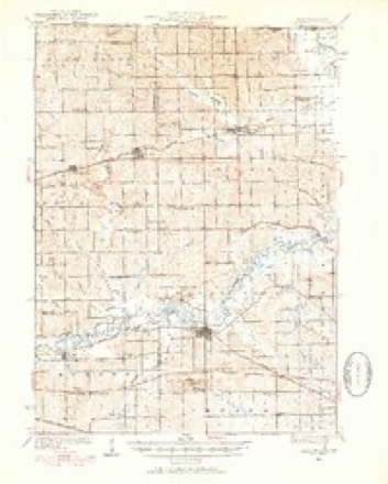
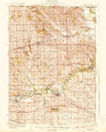
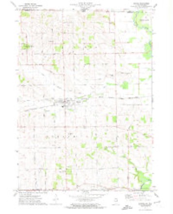
8 surveys from 15 printed sheetsMatched by testing this settlement's coordinate against the published boundary of every sheet in the United States Geological Survey's historical collection. Each opens the scanned sheet at the Survey.
- 1932 USGS Pecatonica quadrangle1:62500, 3 printings
- 1936 USGS Pecatonica quadrangle1:62500, 2 printings
- 1954 USGS Rockford quadrangle1:250000
- 1955 USGS Rockford quadrangle1:250000
- 1958 USGS Rockford quadrangle1:250000, 4 printings
- 1963 USGS Rockford quadrangle1:250000
- 1971 USGS Durand quadrangle1:24000
- 1981 USGS Rockford quadrangle1:100000, 2 printings





What happened here
An account from the chapter on Durand township. The inset identifies its exact source book and publication year.
Winnebago Cottntt War Record
Was organized by Col. Aro Voss, in March, 1862, and mustered into the United States' service Feb. ist, and proceeded immediately to Virginia and immediately participated in several minor engagements, in all of which the Twelfth came out victorious. At Harper's Ferry, when the pbice was entirely surrounded, the Twelfth had permission to cut through the enemy's lines, which it did, and surprised and captured 112 wagons loaded with ammunition and provisions, 100 beef cattle, and 50 prisoners.
In the county-history sources
11,455 words on this townshipThe History of Winnebago County, Illinois : Its Past and Present, Containing ... a Biographical Directory of Its Citizens, War Record of Its Volunteers in the Late Rebellion, General and Local Statistics ... History of the Northwest, History of Illinois ... Etc, published 1877 names this settlement in its chapter on Durand Township. These are the passages that mention it, exactly as the scans read.
The One Hundred and Forty-sixth Illinois Volunteers was organized at Camp Butler, Illinois, Sept. 18, 1864, for one year, «nd Henry H. Uean appointed Colonel. Companies C and B were ordered to Brighton, Illinois, Companies D and H to Quincy, Illinois, and Co. F to Jacksonville, Illinois, and were assigned to duty guarding drafted men and substitutes. The remaining companies were assigned to similar duty at Camp Butler, Illinois. On 5th July, 1865, the regiment was mustered out of service at Camp Butler, Illinois. Colonel Henry H. Dean, com. Captain Co. B, Sept. 17,
Passage source: The History of Winnebago County, Illinois : Its Past and Present, Containing ... a Biographical Directory of Its Citizens, War Record of Its Volunteers in the Late Rebellion, General and Local Statistics ... History of the Northwest, History of Illinois ... Etc, published 1877.
The One Hundred and Fifty third Infantry Illinois Volunteers was organized at Camp Fry, Illinois, by Colonel Stephen Bronson, and was mustered in February 27, 1865, for one year. On March 4th, moved, bv rail, -Liia Louisville and Nashville, to TuUahoma, reporting to Major General Millroy. The regiment was assigned to the Second Brigade, Defenses of Nashville and Chattanooga Railroad. Brevet Brigadier General Dudley commanding Brigade. In the latter part of March, Major Wilson, with three companies, went on a campaign into Alabama and returned. On July ist, moved, via Nashville and Louisville, to Memphis, Tennessee, and was assigned to the command of Brevet Major General .A.. L. Chetlain. Was mustered out September is, 1S65, and moved to Springfield, Illinois, and September 24th, received final pay and discharge. Colonel Bronson received appointment as Brevet Brigadier General.
Passage source: The History of Winnebago County, Illinois : Its Past and Present, Containing ... a Biographical Directory of Its Citizens, War Record of Its Volunteers in the Late Rebellion, General and Local Statistics ... History of the Northwest, History of Illinois ... Etc, published 1877.
Early in June following, the First Battalion was ordered to St. Louis, and the Second Battalion followed immediately. Both being fully mounted were ordered at onci to North Missouri District. The First Battalion, Lieutenant Colonel Denuis J. Hynes commanding, proceeded to .^t. Joseph, Mo., where the commanding officer reported in person to General Fisk, commanding District of North Missouri. The Second Battalion, Major Lucius C. Matlack commanding, was assigned by General C. B. Fisk to the post ot Glasgow, Mo. From this period, for four months, the three battalions were separate and remote from each other, and so extended were their movements, that it is impossible to follow them in this brief sketch. They seem to have been all over Missouri after Price's and Jeff. Thompson's Guerilla Bands, following them into Kansas and Arkansas., doing most efficient service.
Passage source: The History of Winnebago County, Illinois : Its Past and Present, Containing ... a Biographical Directory of Its Citizens, War Record of Its Volunteers in the Late Rebellion, General and Local Statistics ... History of the Northwest, History of Illinois ... Etc, published 1877.
Machine-read from a century-old scan, so expect the errors a machine makes: misspelled names, dropped words, stray characters.
Read the whole chapter on Durand Township - it names this place 78 more 78 times.
Fires near this place
2 since 2015Regional context, not property-specific evidence. The federal wildfire occurrence database lists 2 fires within 5 miles of Durand between 2015 and 2016, burning about 501 acres in total. None started naturally. None was recorded as arson. Distance is straight-line from the map coordinates, so a fire counted here may appear on a neighbouring settlement's page as well.
| Reported cause | Fires |
|---|---|
| Missing data/not specified/undetermined | 2 |
The most recent of them, most recent first, with the day each was reported and the service that recorded it.
| Date | Cause | Size | Reported by | Name on the report |
|---|---|---|---|---|
| 1 April 2015 | Missing data/not specified/undetermined | 1.0 acres | Illinois Division of Forestry Resources | 15-0000144 |
| 30 March 2016 | Missing data/not specified/undetermined | 500 acres | Wisconsin Department of Natural Resources | ROCK CO. FIRE |
Settlements close enough to share some of these fires:
Mines and quarries near this place
6 within 5 milesRegional context, not property-specific evidence. The federal mineral resources record lists 6 workings within 5 miles of Durand: 5 past producers, 1 producer. 1 still produces. What was taken out: Stone, Crushed/Broken. Distance is straight-line from the map coordinates, so a quarry counted here may appear on a neighbouring settlement's page as well.
| Where | Site | Commodity | Status | Recorded |
|---|---|---|---|---|
| Davis Quarry | Stone, Crushed/Broken | Producer | ||
| Richardson Quarry | Stone, Crushed/Broken | Past Producer | ||
| Salem Pit | Stone, Crushed/Broken | Past Producer | ||
| Trask Bridge Quarry | Stone, Crushed/Broken | Past Producer | ||
| Unnamed Limestone Quarry | Stone, Crushed/Broken | Past Producer | ||
| Unnamed Limestone Quarry | Stone, Crushed/Broken | Past Producer |
Storms near this place
23 since 1998Regional context, not property-specific evidence. The National Weather Service names Durand in 23 storm reports between 1998 and 2026: 13 thunderstorm wind, 8 hail, 1 tornado, 1 flash flood. No death or injury is recorded in these reports. Each account below is quoted exactly as the forecast office filed it, from the NOAA Storm Events Database, and each date opens the federal record of that event.
| When | Event | Place named | Harm | What the report says |
|---|---|---|---|---|
| April 2026 | Thunderstorm Wind | Durand | - | A photo was shared of a tree uprooted in Durand. |
| April 2026 | Hail | Durand | - | A few hail reports came from south of Durand ranging in size from 1.25 to 2.25 inches in diameter. |
| April 2026 | Thunderstorm Wind | Durand | - | Softwood trees were snapped near the intersection of Task Bridge Rd and Best Rd north of Pecatonica. |
| April 2026 | Thunderstorm Wind | Durand | - | Several photos were received of broken windows and damaged siding from in and around Durand due to a combination of severe winds and hail. |
| July 2024 | Thunderstorm Wind | Durand | - | Multiple reports of tree damage were received southeast of Durand. |
| April 2024 | Thunderstorm Wind | Durand | - | Power lines were downed in Durand. |
| May 2022 | Hail | Durand | - | Nickel to quarter size hail was reported near Center and Main Streets. |
| July 2022 | Thunderstorm Wind | Durand | - | Several large tree limbs were blown down and a large tree was snapped along Laube Road, between Center and Rowley Roads. Some of the large tree limbs fell onto a house, damaging a deck railing. |
| July 2018 | Thunderstorm Wind | Durand | - | A three foot diameter tree was uprooted on Route 75, one mile east of Wheeler Road. |
| June 2017 | Thunderstorm Wind | Durand | - | Five trees and numerous tree limbs were blown down. |
| July 2016 | Thunderstorm Wind | Durand | - | Two trees down across road with one utility pole pulled down by trees. Time estimated. |
| June 2010 | Hail | Durand | - | Nickel size hail was reported near Lake Summerset. |
| July 2007 | Thunderstorm Wind | Durand | - | Two trees blown down. |
| August 2007 | Thunderstorm Wind | Durand | - | A tree and limbs were blown down near Lake Summerset and the Winnebago Stephenson County line. |
| May 2005 | Hail | Durand | - | Nickel size hail was reported near Lake Summerset. |
| June 1998 | Tornado (F0) | Durand | - | A small tornado touched down briefly near Durand. There was no damage. |
| April 2026 | Hail | Durand | - | no account filed |
| May 2017 | Hail | Durand | - | no account filed |
| May 2011 | Hail | Durand | - | no account filed |
| October 2006 | Hail | Durand | - | no account filed |
| May 2004 | Flash Flood | Durand | - | no account filed |
| August 2002 | Thunderstorm Wind | Durand | - | no account filed |
| September 2000 | Thunderstorm Wind | Durand | - | no account filed |
Nearest settlements
The eight closest, with where each one stands in the county. Distances are straight-line, computed from the Geographic Names Information System coordinates.
| Map | Place | Distance | Sheets |
|---|---|---|---|
| Lake Summerset | 3.3 miles | 15 | |
| Shirland | 7.1 miles | 17 | |
| Harrison | 7.5 miles | 17 | |
| Pecatonica | 8.6 miles | 15 | |
| Westlake Village | 9.3 miles | 15 | |
| Wempletown | 9.3 miles | 18 | |
| Owen Center | 12.3 miles | 20 | |
| Winnebago | 12.7 miles | 18 |
Elsewhere
Matched on this settlement's Geographic Names Information System number rather than its name, so it cannot be a different place of the same name in another state.
| Wikipedia article on Durand | An encyclopaedic summary. Its text is share-alike, so it is linked here rather than copied. |
| Wikidata item Q569966 | The structured record the population and elevation above come from. Public domain (CC0). |
Provenance
This settlement is recorded in the Geographic Names Information System as feature 407516. The sheet list is computed by point-in-boundary test against the United States Geological Survey's historical topographic inventory. Both are works of the United States government and carry no copyright under 17 U.S.C. 105.
Wildfire. Short, Karen C. 2022. Spatial wildfire occurrence data for the United States, 1992-2020 [FPA_FOD_20221014]. 6th Edition. Fort Collins, CO: Forest Service Research Data Archive. https://doi.org/10.2737/RDS-2013-0009.6 Collected with United States Government funding and usable without additional permissions or fees.
Mines and quarries. USGS Mineral Resources Data System (MRDS) https://mrdata.usgs.gov/mrds/ A work of the United States government, no copyright under 17 U.S.C. 105.
Storms. NOAA National Centers for Environmental Information, Storm Events Database https://www.ncei.noaa.gov/stormevents/ A work of the United States government, no copyright under 17 U.S.C. 105. Narratives are quoted verbatim from the National Weather Service report and are not edited or summarised.