 Block
Heman, Illinois
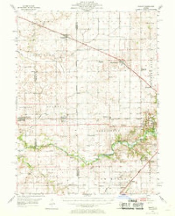
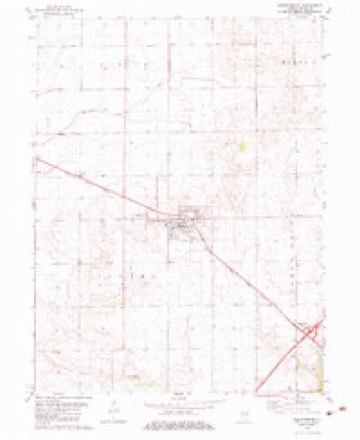
11 topographic sheets cover this place, the earliest surveyed in 1954 and the latest in 1985. It stands in Illini Township. It lies in ZIP code area 62573. The Survey maps it on the Warrensburg quadrangle.
Topographic sheets covering this place
5 surveys from 11 printed sheetsMatched by testing this settlement's coordinate against the published boundary of every sheet in the United States Geological Survey's historical collection. Each opens the scanned sheet at the Survey.
- 1954 USGS Niantic quadrangle1:62500, 3 printings
- 1958 USGS Decatur quadrangle1:250000, 3 printings
- 1961 USGS Decatur quadrangle1:250000, 2 printings
- 1982 USGS Warrensburg quadrangle1:24000
- 1985 USGS Springfield quadrangle1:100000, 2 printings



In the county-history sources
3,676 words on this townshipHistory of Macon County, Illinois : with Illustrations Descriptive of Its Scenery, and Biographical Sketches of Some of Its Prominent Men and Pioneers, published 1880 has no passage naming this settlement, which was common for smaller places. Its township is covered in full.
The chapter on Illini Township covers the township.
Read the chapter on Illini Township - 3,676 words.
Storms near this place
10 since 2009Regional context, not property-specific evidence. The National Weather Service names Heman in 10 storm reports between 2009 and 2025: 6 flash flood, 2 thunderstorm wind, 2 tornado. No death or injury is recorded in these reports. Each account below is quoted exactly as the forecast office filed it, from the NOAA Storm Events Database, and each date opens the federal record of that event.
| When | Event | Place named | Harm | What the report says |
|---|---|---|---|---|
| June 2014 | Thunderstorm Wind | Heman | $1,000 | A large tree was blown down at the junction of Kenney Road and Duroc Road. |
| May 2025 | Thunderstorm Wind | Heman | - | A few power poles were blown down. |
| April 2025 | Tornado (EF0) | Heman | - | This tornado crossed from Logan County into Macon County north of the intersection of 2400th Avenue and 500th Street at 3:42 PM CDT. It tracked northeastward and uprooted a tree near the intersection of West School Road and Strawn Road before crossing into DeWitt County at the intersection of North Bearsdale Road and Lake Fork Road at 3:49 PM CDT. |
| April 2024 | Tornado (EF1) | Heman | - | The tornado began in Logan County, about 1.5 miles south-southeast of Latham. It progressed east into Macon County, entering the county at the intersection of 2400th Avenue and Heman Street, about 1.75 miles south-southwest of Heman. The tornado uprooted softwood and hardwood trees along 2400th Avenue, which is the county line between Logan and Macon counties. As the tornado progressed east along Heman Street it produced extensive damage to several outbuildings, including knocking down several walls and throwing debris for a mile downstream. The tornado snapped some trees and damaged an outbuilding on 500E Road before dissipating a few hundred yards east of there. |
| February 2014 | Flash Flood | Heman | - | Rainfall of 0.50 to 1.00 combined with a frozen ground to produce flash flooding across northern and central Macon County. Many streets in Decatur were flooded and most rural roads were impassable. Nearly all of the roads in northwest Macon County, including Illinois Route 121 from Warrensburg to the Logan County line, were closed. |
| July 2013 | Flash Flood | Heman | - | Very heavy rainfall, with accumulations of 2.50 to 4.00 inches in 90 minutes during the morning, resulted in flash flooding in northwest Macon County. Six to ten inches of flowing water was reported over Illinois Route 121 between Warrensburg and the Logan County line. Numerous rural roads were also reported to be impassable. Street flooding was also reported on the north side of Decatur. The water diminished quickly by early afternoon. |
| June 2013 | Flash Flood | Heman | - | Scattered thunderstorms, with heavy rainfall amounts of 2 to 3 inches in one hour, produced flash flooding in extreme northwest Macon County during the early afternoon. Many rural roads between Illinois Route 121 and the De Witt County line were impassable. The flooding subsided by early evening. |
| June 2010 | Flash Flood | Heman | - | Around 2.00 to 3.00 of rain fell between 0900 and 1100 CST on top of already saturated ground. This produced rapid flash flooding in most of Macon County. Many city streets in Decatur were flooded, which stranded several cars and flooded hundreds of basements. In addition, most rural roads in the western and central part of the county were impassable. |
| September 2009 | Flash Flood | Heman | - | Slow moving thunderstorms produced rainfall rates of 2.00 inches per hour and flash flooding in northwest Macon County. The heaviest rain was near Warrensburg where 4.00 to 5.00 inches was reported. Numerous streets and rural roads were flooded. |
| May 2009 | Flash Flood | Heman | - | Heavy rain of 1.50 to 2.50 inches fell within two hours across parts of northern Macon County. This produced extensive flash flooding, particularly on rural roads. |
Nearest settlements
The eight closest, with where each one stands in the county. Distances are straight-line, computed from the Geographic Names Information System coordinates.
| Map | Place | Distance | Sheets |
|---|---|---|---|
| Warrensburg | 2.5 miles | 11 | |
| Bearsdale | 6.1 miles | 11 | |
| Harristown | 6.5 miles | 11 | |
| Niantic | 7.2 miles | 11 | |
| Wyckles | 7.6 miles | 11 | |
| Wyckles Corners | 8.2 miles | 11 | |
| Forsyth | 8.2 miles | 14 | |
| Emery | 8.5 miles | 14 |
Elsewhere
Matched on this settlement's Geographic Names Information System number rather than its name, so it cannot be a different place of the same name in another state.
| Wikipedia article on Heman | An encyclopaedic summary. Its text is share-alike, so it is linked here rather than copied. |
| Wikidata item Q60764834 | The structured record the population and elevation above come from. Public domain (CC0). |
Provenance
This settlement is recorded in the Geographic Names Information System as feature 422797. The sheet list is computed by point-in-boundary test against the United States Geological Survey's historical topographic inventory. Both are works of the United States government and carry no copyright under 17 U.S.C. 105.
Storms. NOAA National Centers for Environmental Information, Storm Events Database https://www.ncei.noaa.gov/stormevents/ A work of the United States government, no copyright under 17 U.S.C. 105. Narratives are quoted verbatim from the National Weather Service report and are not edited or summarised.