 Block
Hoopeston, Illinois
12 topographic sheets cover this place, the earliest surveyed in 1933 and the latest in 1987. It stands in Grant Township. It lies in ZIP code area 60942. The Survey maps it on the Hoopeston quadrangle. 4,915 people lived here at the 2020 count. It stands 725 feet above sea level.
On record in Hoopeston
Buildings and businesses the archive holds for this place. Each opens its own page, with the source record it came from.
On the National Register 2 records
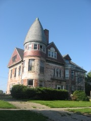 Hoopes-Cunningham Mansionlisted 1985
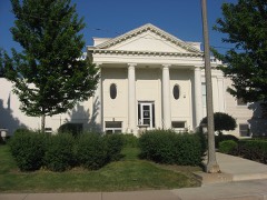 Hoopeston Carnegie Public Librarylisted 2002
Topographic sheets covering this place
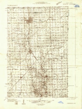
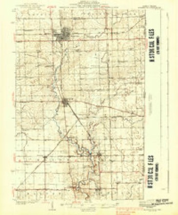
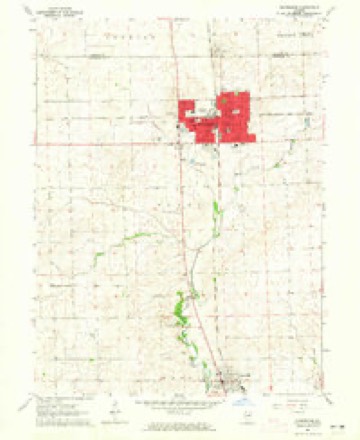
8 surveys from 12 printed sheetsMatched by testing this settlement's coordinate against the published boundary of every sheet in the United States Geological Survey's historical collection. Each opens the scanned sheet at the Survey.
- 1933 USGS Hoopeston quadrangle1:48000
- 1938 USGS Hoopeston quadrangle1:62500, 3 printings
- 1953 USGS Danville quadrangle1:250000, 3 printings
- 1955 USGS Danville quadrangle1:250000
- 1956 USGS Danville quadrangle1:250000
- 1964 USGS Hoopeston quadrangle1:24000
- 1984 USGS Danville quadrangle1:100000
- 1987 USGS Danville quadrangle1:100000





In the county-history sources
30,917 words on this townshipHistory of Vermilion County, Together with Historic Notes on the Northwest, Gleaned from Early Authors, Old Maps and Manuscripts, Private and Official Correspondence, and Other Authentic, Though, for the Most Part, Out-of-the-way Sources, published 1879 names this settlement in its chapter on Grant Township. These are the passages that mention it, exactly as the scans read.
The earliest settlements were made along the Chicago road extending from the present Rossville north. As early as 1835, George and "William Bicknell took up the land at Bicknell's Point, which was the last piece of timber on the route to Chicago until the valley of the Iroquois was reached. Asel Gilbert entered a quarter-section south of Bicknell's Point, about 1838. Oliver Prickett, who had come from Brown county, Ohio, in 1832, after farming awhile near Danville, came to live in the vicinity of Rossville. Albert Comstock had come to where B. C. Green now lives in 1837. A few years later he sold to Green and purchased in the vicinity of the Point, and lived there for several years. B. C. Green purchased the land where Thomas Armstrong lived before he bought where he now lives, which was probably about 1840, but he did nothing to improve it, as at that time he was a " bachelor of moderate means and no family." James R. Stewart, a brother-in-law of the Bicknells, came in and settled on the Chicago road, south of the Point, where the house known as the " Townsend House," which was built in 1847, now stands. Stewart
Passage source: History of Vermilion County, Together with Historic Notes on the Northwest, Gleaned from Early Authors, Old Maps and Manuscripts, Private and Official Correspondence, and Other Authentic, Though, for the Most Part, Out-of-the-way Sources, published 1879.
Churchill Boardman settled in lv4.">. and made a farm. His son lives near Rossville yet. (.'apt. McKibben, so well known to the early settlers of this county, lived a portion of the time in the same neighborhood. He had done valiant service fighting the Indians, had served as deputy sheriff and sheriff, and was probably as well known as any man in the county. Charles Leighton settled in the neighborhood about the same time. Fie still resides there at the age of nearly ninety years.
Passage source: History of Vermilion County, Together with Historic Notes on the Northwest, Gleaned from Early Authors, Old Maps and Manuscripts, Private and Official Correspondence, and Other Authentic, Though, for the Most Part, Out-of-the-way Sources, published 1879.
Charles Wier was early, and Mr. Smart, who soon went back east, and settled just north of Bicknell's Point, on the Chicago road. Robert Crane (whom m the early settler- sist in calling Cream) made an earlv settlement. Robert Davison entered what is now known as the Webb farm, but returned to Myersville. John Chenoweth, from Perrvsville. came in and remained one year. He died at Perrvsville. and Charles Wier purchased his land. Mr. Glover lived three or four yean on the land now owned by L. F. Goodman. Robert Anderson took land just west of the Davison place.
Passage source: History of Vermilion County, Together with Historic Notes on the Northwest, Gleaned from Early Authors, Old Maps and Manuscripts, Private and Official Correspondence, and Other Authentic, Though, for the Most Part, Out-of-the-way Sources, published 1879.
Machine-read from a century-old scan, so expect the errors a machine makes: misspelled names, dropped words, stray characters.
Read the whole chapter on Grant Township - it names this place 62 more 62 times.
Mines and quarries near this place
1 within 5 milesRegional context, not property-specific evidence. The federal mineral resources record lists 1 working within 5 miles of Hoopeston: 1 producer. All of them still produce. What was taken out: Sand and Gravel, Construction. Distance is straight-line from the map coordinates, so a quarry counted here may appear on a neighbouring settlement's page as well.
| Where | Site | Commodity | Status | Recorded |
|---|---|---|---|---|
| Bush Gravel Pit | Sand and Gravel, Construction | Producer |
Storms near this place
60 of 73 shownRegional context, not property-specific evidence. The National Weather Service names Hoopeston in 73 storm reports between 1997 and 2025: 37 thunderstorm wind, 30 hail, 4 flash flood, 1 tornado. No death or injury is recorded in these reports. Each account below is quoted exactly as the forecast office filed it, from the NOAA Storm Events Database, and each date opens the federal record of that event.
| When | Event | Place named | Harm | What the report says |
|---|---|---|---|---|
| July 2001 | Thunderstorm Wind | Hoopeston | $8,500,000 | Downburst winds caused considerable damage on the west side of Hoopeston. Three businesses were destroyed, one hundred homes sustained minor to moderate damage, and the EMS building was destroyed. Also, the sewer department suffered major damage and a church suffered minor damage. Numerous trees, tree limbs, power poles, and power lines were blown down in Hoopeston and areas to the southeast, east of Rossville. No injuries or deaths were reported. Damage was estimated around 8.5 million dollars. |
| August 2008 | Thunderstorm Wind | Hoopeston | $50,000 | Twenty five to thirty large trees were blown down in Hoopeston. One tree destroyed a car. |
| May 2009 | Thunderstorm Wind | Hoopeston | $40,000 | A barn was destroyed by high winds 3 miles south of Hoopeston. |
| June 2008 | Thunderstorm Wind | Hoopeston | $35,000 | Numerous large tree limbs and a power pole were blown down. |
| August 2017 | Thunderstorm Wind | Hoopeston | $32,000 | A machine shed was damaged and a few tree branches were blown down. |
| June 2015 | Thunderstorm Wind | Hoopeston | $30,000 | Several trees were blown down and a small shed was destroyed. |
| November 1998 | Thunderstorm Wind | Hoopeston | $30,000 | One mile west of Hoopeston, a shed was destroyed and a house sustained window and roof damage. No injuries were reported and damage was estimated around $30,000. |
| July 2015 | Thunderstorm Wind | Hoopeston | $25,000 | Several large tree limbs were blown down and a shed was damaged by the wind. |
| September 2014 | Thunderstorm Wind | Hoopeston | $25,000 | Numerous tree branches and power lines were blown down. |
| May 2013 | Thunderstorm Wind | Hoopeston | $25,000 | Numerous trees were blown down in Hoopeston. |
| August 2009 | Thunderstorm Wind | Hoopeston | $25,000 | Numerous trees were blown down and structural damage was reported to the FMC building on the south side of Hoopeston. |
| April 2011 | Thunderstorm Wind | Hoopeston | $20,000 | Power poles were blown down at the intersection of Illinois Route 1 and Illinois Route 9. |
| May 2018 | Thunderstorm Wind | Hoopeston | $15,000 | Numerous tree limbs were blown down on the southwest side of Hoopeston. |
| June 2015 | Thunderstorm Wind | Hoopeston | $15,000 | Several 4 to 8-inch diameter tree branches were blown down. |
| July 2014 | Thunderstorm Wind | Hoopeston | $12,000 | Several tree branches up to 6 inches in diameter were blown down in Hoopeston. |
| May 2012 | Thunderstorm Wind | Hoopeston | $12,000 | Power poles were blown down near the junction of highways 1 and 9 near Hoopeston. |
| May 2018 | Thunderstorm Wind | Hoopeston | $10,000 | Minor roof damage occurred to the middle school in Hoopeston due to strong outflow winds that passed well to the north across Iroquois County. |
| September 2014 | Thunderstorm Wind | Hoopeston | $10,000 | Several 12 to 15-inch diameter tree branches were blown down on the southeast side of Hoopeston. |
| March 2009 | Thunderstorm Wind | Hoopeston | $10,000 | A trailer was blown over on Route 1 just south of Hoopeston. |
| June 2010 | Thunderstorm Wind | Hoopeston | $8,000 | Numerous tree limbs were blown down and corn was flattened near Hoopston. |
| June 2009 | Thunderstorm Wind | Hoopeston | $8,000 | Several 3 to 6 inch diameter trees were blown down. A flagpole was also knocked over by strong winds. |
| April 2012 | Hail | Hoopeston | $1,000 | A hail stone cracked the windshield of a pickup truck. |
| July 1997 | Thunderstorm Wind | Hoopeston | $200 | Thunderstorm winds blew down numerous trees in Hoopeston and Danville. One tree in Hoopeston fell near a business...breaking several windows in the building. No injuries were reported and damage was estimated around $200. |
| June 2025 | Thunderstorm Wind | Hoopeston | - | A 12 inch tree limb was blown down. A photo of the damage was shared via social media. |
| June 2025 | Thunderstorm Wind | Hoopeston | - | Multiple tree branches were blown down at this location, and a wind gust of 71 mph was measured. |
| May 2024 | Thunderstorm Wind | Hoopeston | - | Multiple tree branches were blown down at Floral Hill Cemetery. |
| May 2024 | Thunderstorm Wind | Hoopeston | - | Estimated 60 mph wind gusts in Hoopeston. |
| July 2024 | Thunderstorm Wind | Hoopeston | - | A few trees were blown down across powerlines. |
| March 2023 | Thunderstorm Wind | Hoopeston | - | A machine shed was destroyed along Illinois Route 1 and Iroquois County Road. |
| August 2022 | Thunderstorm Wind | Hoopeston | - | A power line was blown down on West Main Street. |
| June 2021 | Thunderstorm Wind | Hoopeston | - | Several 6 to 8-inch diameter tree limbs were blown down. |
| May 2019 | Thunderstorm Wind | Hoopeston | - | Numerous trees and power lines were blown down across town. |
| May 2017 | Hail | Hoopeston | - | Hail drifts of 1.5 to 3 feet deep due to flooding were reported west of Hoopeston. |
| September 2015 | Flash Flood | Hoopeston | - | Slow moving thunderstorms produced 4.00 to 6.00 inches of rain in two hours around daybreak in extreme northeast Vermilion County, including the town of Hoopeston. Extensive flooding of streets occurred in Hoopeston. Illinois Route 1 west of Hoopeston to the Iroquois County line was flooded. A four mile stretch of Illinois Route 9 southwest and south of Hoopeston was closed. The flooding subsided by late in the morning. |
| September 2015 | Flash Flood | Hoopeston | - | Thunderstorms with heavy rainfall produced flash flooding in northeast Vermilion County for the second time in less than two weeks. Rainfall amounts of 3.50 to 5.00 inches resulted from two separate rounds of storms - one in the late evening and one after Midnight. Extensive street flooding was reported in the town of Hoopeston. Most rural roads from Hoopeston to Rossville, and east to the Indiana border were impassable. |
| September 2015 | Flood | Hoopeston | - | Thunderstorms with heavy rainfall produced flash flooding in northeast Vermilion County for the second time in less than two weeks. Rainfall amounts of 3.50 to 5.00 inches resulted from two separate rounds of storms - one in the late evening and one after Midnight. Extensive street flooding was reported in the town of Hoopeston. Most rural roads from Hoopeston to Rossville, and east to the Indiana border were impassable. The rainfall finally ended in the early morning hours, which allowed the flooding to subsided around daybreak on the 19th. |
| July 2006 | Tornado (F0) | Hoopeston | - | A tornado briefly touched down and caused damage to a shed. |
| June 2005 | Thunderstorm Wind | Hoopeston | - | Numerous trees and power lines down. |
| June 2004 | Flash Flood | Hoopeston | - | Several streets flooded in Hoopston. |
| August 2004 | Flash Flood | Hoopeston | - | Very heavy rain fell on already saturated ground causing street flooding. |
| August 2001 | Thunderstorm Wind | Hoopeston | - | A large tree was blown down near Rossville. |
| December 1998 | Thunderstorm Wind | Hoopeston | - | Thunderstorm winds destroyed a shed and blew down several trees and power lines one mile west of Hoopeston. |
| July 1998 | Thunderstorm Wind | Hoopeston | - | Thunderstorm winds blew some siding off of one house and blew down several small trees and tree limbs. Also, the post office window was pushed out slightly but not blown out from the winds. No injuries were reported and no damage estimate was available. |
| June 2024 | Hail | Hoopeston | - | no account filed |
| May 2021 | Hail | Hoopeston | - | no account filed |
| June 2019 | Hail | Hoopeston | - | no account filed |
| August 2018 | Hail | Hoopeston | - | no account filed |
| June 2017 | Hail | Hoopeston | - | no account filed |
| March 2017 | Hail | Hoopeston | - | no account filed |
| March 2017 | Hail | Hoopeston | - | no account filed |
| March 2017 | Hail | Hoopeston | - | no account filed |
| May 2017 | Hail | Hoopeston | - | no account filed |
| November 2017 | Hail | Hoopeston | - | no account filed |
| September 2015 | Hail | Hoopeston | - | no account filed |
| March 2012 | Hail | Hoopeston | - | no account filed |
| March 2012 | Hail | Hoopeston | - | no account filed |
| May 2012 | Hail | Hoopeston | - | no account filed |
| May 2012 | Hail | Hoopeston | - | no account filed |
| May 2012 | Hail | Hoopeston | - | no account filed |
| May 2012 | Hail | Hoopeston | - | no account filed |
Nearest settlements
The eight closest, with where each one stands in the county. Distances are straight-line, computed from the Geographic Names Information System coordinates.
| Map | Place | Distance | Sheets |
|---|---|---|---|
| Cheneyville | 4.4 miles | 12 | |
| Coalton | 4.8 miles | 12 | |
| Heaton | 5.7 miles | 12 | |
| Rossville | 6.1 miles | 12 | |
| College Corners | 6.5 miles | 12 | |
| East Lynn | 7.0 miles | 13 | |
| Rossville Junction | 7.7 miles | 12 | |
| Hustle | 8.7 miles | 13 |
Elsewhere
Matched on this settlement's Geographic Names Information System number rather than its name, so it cannot be a different place of the same name in another state.
| Wikipedia article on Hoopeston | An encyclopaedic summary. Its text is share-alike, so it is linked here rather than copied. |
| Wikidata item Q429706 | The structured record the population and elevation above come from. Public domain (CC0). |
Provenance
This settlement is recorded in the Geographic Names Information System as feature 410494. The sheet list is computed by point-in-boundary test against the United States Geological Survey's historical topographic inventory. Both are works of the United States government and carry no copyright under 17 U.S.C. 105.
Mines and quarries. USGS Mineral Resources Data System (MRDS) https://mrdata.usgs.gov/mrds/ A work of the United States government, no copyright under 17 U.S.C. 105.
Storms. NOAA National Centers for Environmental Information, Storm Events Database https://www.ncei.noaa.gov/stormevents/ A work of the United States government, no copyright under 17 U.S.C. 105. Narratives are quoted verbatim from the National Weather Service report and are not edited or summarised.