 Block
Joliet, Illinois
23 topographic sheets cover this place, the earliest surveyed in 1892 and the latest in 1998. It stands in Joliet Township. It lies in ZIP code area 60432. It stands on Spring Creek. The Survey maps it on the Joliet quadrangle. 150,362 people lived here at the 2020 count. It stands 541 feet above sea level.
Research this city
On record in Joliet
Buildings and businesses the archive holds for this place. Each opens its own page, with the source record it came from.
On the National Register 12 of 19 shown
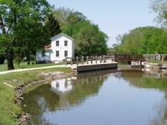 Illinois and Michigan CanalNational Historic Landmark · listed 1966
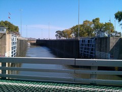 Brandon Road Lock and Dam Historic Districtlisted 2004
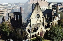 Christ Episcopal Churchlisted 1982
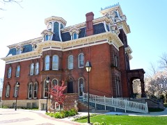 Jacob H. Henry Houselisted 1979
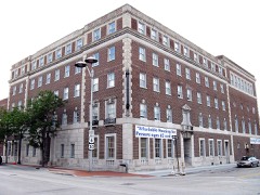 Joilet YMCAlisted 2006
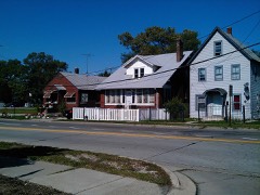 Joliet East Side Historic Districtlisted 1980
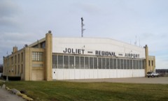 Joliet Municipal Airportlisted 1980
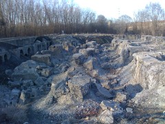 Joliet Steel Workslisted 1991
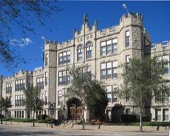 Joliet Township High Schoollisted 1982
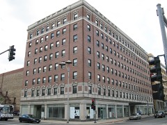 Louis Joliet Hotellisted 1990
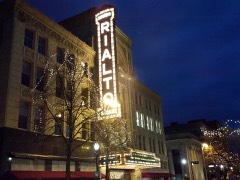 Rubens Rialto Square Theaterlisted 1978
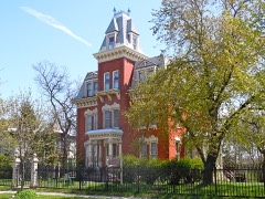 Hiram B. Scutt Mansionlisted 2003
Population over time
2 figuresJoliet fell from 152,812 to 150,362 between 2008 and 2020. These are the recorded population figures Wikidata holds for this place, reached through the Geographic Names Information System number this page is keyed on rather than by name, so they belong to this place and not to another of the same name. Most are census counts, but not all are: an early figure may be a founding or settlement estimate, and an estimate published within five years of a census is left out. The change column is computed, and is left blank where more than 20 years separate a figure from the one before it, because a gap that long is not a change between two counts.
| Year | People | Change |
|---|---|---|
| 2008 | 152,812 | |
| 2020 | 150,362 | -2,450 (-2%) |
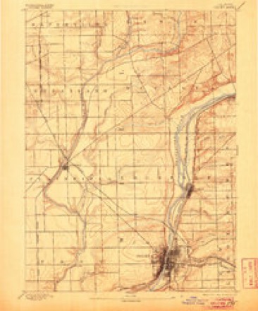
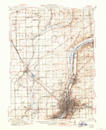
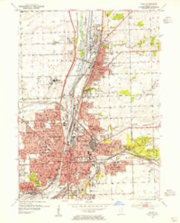
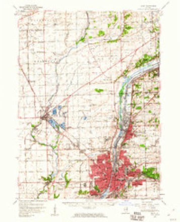
Topographic sheets covering this place
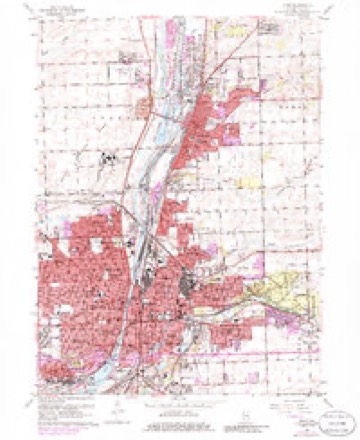
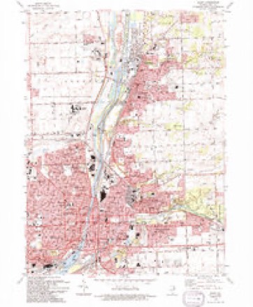
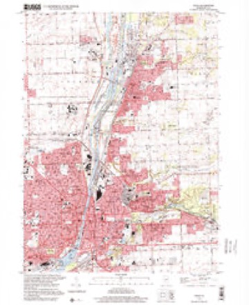
10 surveys from 23 printed sheetsMatched by testing this settlement's coordinate against the published boundary of every sheet in the United States Geological Survey's historical collection. Each opens the scanned sheet at the Survey.
- 1892 USGS Joliet quadrangle1:62500, 6 printings
- 1923 USGS Joliet quadrangle1:62500, 5 printings
- 1954 USGS Joliet quadrangle1:24000
- 1954 USGS Joliet quadrangle1:62500
- 1958 USGS Aurora quadrangle1:250000, 3 printings
- 1961 USGS Aurora quadrangle1:250000
- 1962 USGS Joliet quadrangle1:24000, 3 printings
- 1985 USGS Aurora quadrangle1:100000
- 1993 USGS Joliet quadrangle1:24000
- 1998 USGS Joliet quadrangle1:24000



In the county-history sources
16,216 words on this townshipThe History of Will County, Illinois, Containing a History of the County ... a Directory of Its Real Estate Owners; Portraits of Early Settlers and Prominent Men; General and Local Statistics ... History of Illinois ... History of the Northwest .., published 1878 names this settlement in its chapter on Joliet Township. These are the passages that mention it, exactly as the scans read.
Joliet, or as sometimes styled, and very appropriately, too, the " Stone City," is situated on both sides of the Des Planes River, in a beautiful valley, with its suburbs extending back on to the bluffs like the wings of a great army. It is thirty-eight miles from Chicago, and connected with that suburban retreat by two of the greatest railroads in the State of Illinois, and has also water communication with Chicago via the Illinois & Michigan Canal. If Joliet is not a " city set on a hill," it is certainly " founded on a rock," for the entire surface upon which it is situated is stone. It is well laid out, the streets broad, with excellent sidewalks, and bordered with handsome trees. Many fine residences and business houses, built of stone - products of its own enterprise - are to be found here which would adorn any city. Its railroad facilities are excellent ; having the advantage of the Chicago, Rock Island & Pacific to the West ; the Chicago, Alton & St. Louis to the South ; the Chicago, Pekin & Southwestern to the Southwest ; and the Michigan Central to the East. These roads have been of much advantage in building up Joliet ; and their machine shops located here give employment to a large number of men. A full sketch of the railroads and of the canal is given in the general history, and so will not be repeated here.
Passage source: The History of Will County, Illinois, Containing a History of the County ... a Directory of Its Real Estate Owners; Portraits of Early Settlers and Prominent Men; General and Local Statistics ... History of Illinois ... History of the Northwest .., published 1878.
The names of many of the early settlers of the city have already been ^iven in the settlement of the township, but no mention made of them beyond the date of their coming to the county, their works and their deeds being left for this chapter. As common in townships containing county seats, most of the important history of Joliet centers in the city of the same name. Here many of the more stirring events of the times transpired, and here, as just stated, much of the important history has occurred. Charles Reed is generally regarded as the first settler in the city of Joliet, or was, at least, the first to lay claim to any portion of the land in the original city. He had made a claim on the southsast quarter of Section 9, upon which, in 1833, he built a small log house, west of the river, and very near where the National Hotel now stands. Reed was from Indiana, and had settled in Reed's Grove about 1831; but, attracted by the water power, came to this place, as already noted, and commenced preparations for building a mill. In the Fall of 1833, James B. Campbell and James McKee purchased the " floats " granted by the State to Silvia and Rachel Hall, two girls who had been captured by the Indians, as narrated in the general history. Campbell located his float in the early part of 1834, on the east side of the river, embracing a part of the present city of Joliet. On the 13th day of May, the Surveyor's certificate was filed, and on the 10th of June, 1834, the plat was recorded and the town christened to "Juliet," for Campbell's daughter, it is said ; a name it bore until 1845, when it was changed by act of the Legislature. President Van Buren and his Secretary of the Navy, Mr. Paulding, while on a tour through the West, stopped at " Juliet," and, noticing the difierence in the name of the city and of Joliet Mound, urged the people to have the former changed to correspond with the latter, which was done as above stated, by act of the Legislature, and approved February 26, 1845. The act further provided that all additions subsequently laid out " shall be known as additions to Joliet." In January, 1834, McKee, after purchasing the claim of Reed, located his float on the west side of the river, and laid it out into one-acre lots. In April, 1834, Charles Clement bought one acre from McKee, for which he paid him $125, and on which he erected a story and a half building, the first frame house in West Joliet. Bailey Brothers had sometime previously built a frame house on the East Side.
Passage source: The History of Will County, Illinois, Containing a History of the County ... a Directory of Its Real Estate Owners; Portraits of Early Settlers and Prominent Men; General and Local Statistics ... History of Illinois ... History of the Northwest .., published 1878.
As already stated, Charles Reed is regarded as the first permanent settler in the original town of Joliet, or "Juliet." David Maggard, however, settled in what is at present the city of Joliet, some three years before Reed. But at the time Maggard built his house, which was nearly opposite the Rolling Mill, there was no city of Joliet. and it was years after the birth of the city before it extended its limits to include Maggard's original cabin. Charles Reed, the pioneer of Joliet, finally went to Winnebago County, where he died a few years ago. Charles Clement, who is considered the oldest living resident of the city, settled permanently in the Spring of 1834. He commenced merchandising after he had been here some time, a business he continued for many years. In 1839, he with others started the first newspaper in Joliet, which is more particularly referred to in the history of the city press. In late years, he has retired from active business life, and is enjoying his well-earned possessions. Hon. Goerge H. Woodruff, perhaps the next "oldest inhabitant," also came to Joliet in 1834. He is still an active business man of the West Side, and entertains the warmest feelings for the "country beyond the river," and it may be, some prejudice for that side of the city. His able pen has furnished some valuable history to the county, in his lectures of "Forty Years Ago" and the "Patriotism of Will County," a book every soldier of the late war should have. His last literary effort, and perhaps one of his best, is the wi'iting of the General County History of this work. Otis Hardy settled here in 1836. His father died when he was but 16 years old, leaving the care of the family to him, a duty he faithfully performed. He began business in Joliet as a carpenter, but finally drifted into the lumber business, which he followed for twenty years. Mr. Hardy has been a member of the M. E. Church since 22 years of age, a member of the Quarterly Conference since 1837. and President of the Will County Bible Society for forty years. He is a man of large benevolence and exalted charity, and built at his own expense the Richards Street Methodist Church and parsonage at a cost of over $5,000, besides liberal contributions to the other Methodist churches of the city. He had little when he came to Joliet except a strong arm and willing hand, and here he has accumulated his wealth. George Woodruff, one of the successful merchants and bankers of the city, came here in 1836. He first commenced in the grocery and commission business, which he continued a number of years. In 1852, he built a grain elevator and engaged in the grain business until 1864, in which year the First National Bank was organized, with him as President - a business he is still engaged in. Edmund Wilcox is another of the old settlers of 1836. He was for a time engaged in merchandising in partnership with Charles Clement. In 1858, sold out and became one of the originators of the Joliet Gaslight Company, was its first President, and superintended the erection of the works of the company. He is at present one of the Justices of the Peace of the city and township. In 1852, he was on the Legislative Committee for laying off the city into wards, and also member of a committee to confer with Eastern capitalists as to the expediency of building a railroad, the final result of which was the building by the Michigan Southern, the Rock Island Railroad, one of the best appointed roads in the State of Illinois. Another of the business men of the city still surviving, is R. Doolittle. He came in 1837, and was elected Justice of the Peace a few years later, an office he held for twelve years ; was also Assignee in Bankruptcy during the existence of the old bankrupt act of the United States years ago. In 1852, he resumed business as a merchant, which he had formerly been engaged in, and the firm of Doolittle & Stone erected the thiee-story brick building on the south side of Jefferson street, which was the second building west of Ottawa street. He sold to his partner in 1864, and engaged in railroad contracting, and, in 1871, was again elected Justice of the Peace, which office he now holds. Uri Osgood came from New
Passage source: The History of Will County, Illinois, Containing a History of the County ... a Directory of Its Real Estate Owners; Portraits of Early Settlers and Prominent Men; General and Local Statistics ... History of Illinois ... History of the Northwest .., published 1878.
Machine-read from a century-old scan, so expect the errors a machine makes: misspelled names, dropped words, stray characters.
Read the whole chapter on Joliet Township - it names this place 59 more 59 times.
Fires near this place
1 since 2008Regional context, not property-specific evidence. The federal wildfire occurrence database lists 1 fire within 5 miles of Joliet in 2008, burning about 6 acres in total. None started naturally. None was recorded as arson. Distance is straight-line from the map coordinates, so a fire counted here may appear on a neighbouring settlement's page as well.
| Reported cause | Fires |
|---|---|
| Debris and open burning | 1 |
The most recent of them, most recent first, with the day each was reported and the service that recorded it.
| Date | Cause | Size | Reported by | Name on the report |
|---|---|---|---|---|
| 15 August 2008 | Debris and open burning | 6.5 acres | Midewin National Tall Grass Prairie | MILLSDALE FIRE |
Settlements close enough to share some of these fires:
Mines and quarries near this place
10 of 13 shownRegional context, not property-specific evidence. The federal mineral resources record lists 13 workings within 5 miles of Joliet: 9 past producers, 3 producers, 1 plant. 4 still produce. What was taken out: Stone, Crushed/Broken, Phosphorus-Phosphates, Magnesite. Distance is straight-line from the map coordinates, so a quarry counted here may appear on a neighbouring settlement's page as well.
| Where | Site | Commodity | Status | Recorded |
|---|---|---|---|---|
| U S Refactories Div. Mill | Magnesite | Producer | ||
| Joliet Phos-Acid Plant | Phosphorus-Phosphates | Plant | ||
| Joliet Phosphoric Acid Plant | Phosphorus-Phosphates | Past Producer | ||
| Gross & Mc Cowan Lumber Co. Quarry | Stone, Crushed/Broken | Past Producer | ||
| Inland Crushed Stone Co Quarry | Stone, Crushed/Broken | Past Producer | ||
| Joliet Quarry & Mill Yard 340 | Stone, Crushed/Broken | Producer | ||
| Lincoln Stone Quarry | Stone, Crushed/Broken | Past Producer | ||
| Markgraf Stone Company Quarry | Stone, Crushed/Broken | Past Producer | ||
| National Stone Co Limestone Quarry | Stone, Crushed/Broken | Past Producer | ||
| Rockdale Quarry | Stone, Crushed/Broken | Producer |
Storms near this place
60 of 87 shownRegional context, not property-specific evidence. The National Weather Service names Joliet in 87 storm reports between 1994 and 2024: 32 thunderstorm wind, 24 hail, 11 lightning, 10 flood. The reports record 2 injuries. Each account below is quoted exactly as the forecast office filed it, from the NOAA Storm Events Database, and each date opens the federal record of that event.
| When | Event | Place named | Harm | What the report says |
|---|---|---|---|---|
| March 2004 | Lightning | Joliet | 1 hurt | Person struck by lightning at Salma and Lasser Rds |
| June 2002 | Lightning | Joliet | 1 hurt | no account filed |
| April 2004 | Tornado (F1) | Joliet | $5,000,000 | The tornado swept out a path through a mainly residential section on the near west side of Joliet known as the "Cathedral Area". Initial damage was found near the intersection of Jefferson St. (U.S. route 52) and William Street. The damage path then continued northeastward to a point near the intersections of Ruby Street, Bluff Street, and the Des Plaines River. Most of the damage was of F-0 intensity, with extensive tree damage and very minor damage to structures. However there were three pockets of more substantial primary structural damage which consisted mainly of roofs being torn off residences and garages being totally demolished. In all, 10 residences were declared uninhabitable. |
| July 2006 | Flash Flood | Joliet | $3,000,000 | Major flooding affected the city of Joliet during the afternoon and evening hours of July 27th. Torrential Rains fell across parts of the city with 5.50 inches falling in just 90 minutes between 4 pm and 530 pm near Black Road and Infantry Drive. Storm total rainfall of 6.13 inches was reported on the west side of Joliet. Approximately 30 homes and businesses suffered basement flooding. Center Street Ramps to Interstate 80 were closed with four feet of standing water. Cars were stranded in 4 to 5 feet of water under the viaduct on Route 30 east of Briggs Street. Pavement buckled under the force of the flood waters at Western and Cass Avenues. Raynor and Ingallis were closed with 12 to 16 inches of water. The intersection of Larkin and Jefferson closed with 2 to 3 feet of water. Springfield and Glenwood Streets had 10 to 12 inches of water. Numerous other locations reported less significant flooding. |
| June 2013 | Lightning | Joliet | $150,000 | A natural gas transmission facility was struck by lightning resulting in the building catching on fire. |
| June 2012 | Thunderstorm Wind | Joliet | $120,000 | High winds moving across the area caused power lines to fall onto the roof of a house on Eastern Avenue in Joliet igniting a fire. Nobody was home at the time. The home was destroyed. |
| August 2006 | Lightning | Joliet | $100,000 | Lightning struck a house in the Springwood Subdivision, a second house near Origon and Ingles, and a third house near Earl and Jefferson. A bolt of lightning also struck a transformer. |
| May 2003 | Tornado (F1) | Joliet | $60,000 | A second tornado touched down two miles north of downtown Joliet, near the Des Plaines River, about a half mile south of Bruce Road. The tornado continued east and lifted about four miles southeast of Lockport near Cedar and Bruce Roads. The tornado severely damaged commercial buildings on Route 171 south of Bruce Road. It ripped apart cinder block and metal buildings and some of the debris was deposited over 100 yards away. A house one the east side of 171 was damaged. Tree limbs were blown down in the Fairmont neighborhood. Outbuildings were damaged on Briggs street near Oak Street. There was also tree damage eastward to a subdivision south of Bruce Street west of Cedar Road. |
| May 1994 | Thunderstorm Wind | Joliet | $50,000 | Winds damaged roofs on the west side of Joliet. |
| July 2010 | Lightning | Joliet | $40,000 | Lightning struck a house on North Hickory Street and started a fire in a dormer. While the fire was contained in the dormer, the house suffered smoke and water damage throughout the house. |
| July 2010 | Lightning | Joliet | $20,000 | A house on Essington Road was struck by lightning and set on fire. |
| July 2006 | Thunderstorm Wind | Joliet | $15,000 | A tree fell onto a garage at a church. |
| June 2010 | Thunderstorm Wind | Joliet | $10,000 | A large tree was uprooted near Mason and Mack Streets. The tree fell onto a house causing roof damage. A four foot diameter tree approximately 80 feet tall was split in half by high winds near Mason and Raynor. |
| May 2010 | Lightning | Joliet | $5,000 | Lightning struck a house on Kelly Avenue causing minor damage to the attic. |
| July 2010 | Thunderstorm Wind | Joliet | $1,000 | Large trees and power lines were blown down on the west side of Joliet. |
| June 2010 | Thunderstorm Wind | Joliet | $500 | Wind gusts were estimated to 70 mph with tree limbs and gutters blown down. |
| March 2024 | Flood | Joliet | - | Multiple public reports of minor street flooding in the Joliet area were received via social media. |
| July 2024 | Thunderstorm Wind | Joliet | - | Part of the roof of the Joliet Junior College was blown off, hitting the Illinois Rock and Roll Museum to its south and causing damage to that roof before landing on Cass Street. |
| July 2024 | Thunderstorm Wind | Joliet | - | Multiple reports of tree damage including snapped trees and tree limbs blown down were received from Joliet. Power lines were also blown down. Some roads were blocked by debris. |
| July 2024 | Thunderstorm Wind | Joliet | - | Tree limbs were blown down on the southeast side of Crest Hill. |
| July 2017 | Thunderstorm Wind | Joliet | - | Several large tree limbs were blown down including one blocking a road. |
| July 2017 | Thunderstorm Wind | Joliet | - | Six inch diameter tree limbs were blown down near Western and Raynor Avenues. |
| June 2017 | Thunderstorm Wind | Joliet | - | A small Maple tree was blown down on the west side of Joliet. |
| June 2015 | Flood | Joliet | - | A foot to a foot and a half of standing water was reported on portions of Western Avenue. |
| August 2014 | Thunderstorm Wind | Joliet | - | A tree which was around a foot in diameter was uprooted in the 900 block of Western Avenue. |
| June 2014 | Flood | Joliet | - | About a foot of standing water was reported on Center Street just north of I-80. Viaducts in the area had about 8 to 10 inches of water. A CoCoRaHS observer near Plainfield measured 1.30 inches of rain in 30 minutes. |
| July 2012 | Thunderstorm Wind | Joliet | - | Wind gusts were estimated to 70 mph. A ten inch diameter tree limb was snapped from a tree. |
| June 2010 | Thunderstorm Wind | Joliet | - | Wind gusts were estimated to 60 mph. |
| March 2009 | Flood | Joliet | - | Nine inches of standing water was reported at Whittier and Glenwood. |
| June 2008 | Thunderstorm Wind | Joliet | - | Large tree limbs were blown down on the west side of Joliet with a measured wind gust to 63 mph. |
| June 2007 | Flood | Joliet | - | Minor flooding was reported near St. Joseph hospital, Houbolt and Interstate 80 and at Center Street and Interstate 80. Three quarters of an inch of rain was measured between 219 pm and 239 pm and 1.46 inches storm total was measured on the north side of Joliet. |
| May 2007 | Flood | Joliet | - | Standing water on Interstate 80 at Larkin Avenue. |
| May 2007 | Flood | Joliet | - | Richards Street at Interstate 80 was flooded and barely passable. |
| July 2007 | Flood | Joliet | - | Two and two and a half feet of water at Richards and Washington Streets. Water one foot deep at Center Street, north of Interstate 80. |
| October 2007 | Hail | Joliet | - | Golfball size hail was reported on the east side of Joliet. |
| August 2007 | Thunderstorm Wind | Joliet | - | Measured gust to 68 mph at the intersection of Essington and Ann Streets. A large tree fell next to a house on Schriber Road. Tree limbs were blown down on Lilac Lane. |
| August 2007 | Flood | Joliet | - | Three to four inches of standing water on Cherry Hill Road at Route 52. |
| March 2006 | Hail | Joliet | - | Golfball size hail was reported along Interstate 80, between Larkin and Hubolt Roads. |
| April 2006 | Hail | Joliet | - | Marble to penny size hail covering the ground on the west side of Joliet. |
| May 2006 | Hail | Joliet | - | Penny to nickle size hail was reported at US 30 and Briggs in Joliet to US 30 and Interstate 80 in New Lenox. |
| July 2006 | Heavy Rain | Joliet | - | 1.88 inches of rain fell in 45 minutes on the north side of Joliet near Larkin and Theodore. |
| July 2006 | Funnel Cloud | Joliet | - | A funnel cloud was reported near Houlbolt and Jefferson Roads. |
| July 2006 | Funnel Cloud | Joliet | - | A funnel cloud was reported near Route 6 and Larkin Avenue. |
| August 2006 | Flood | Joliet | - | One foot of water was reported covering numerous roads near St. Joseph Medical Center and 18 inches of standing water was reported under a viaduct near Briggs and Route 30. Rainfall reports included 3.50 inches near Infantry Drive and Black Roads, 1.91 inches near Theodore and Larkin and 1.75 inches at the Joliet Lock and Dam. |
| September 2006 | Hail | Joliet | - | Nickel size hail was reported at the Joliet Race Track on the south side of the city. |
| March 2005 | Hail | Joliet | - | Penny sized hail reported at the intersection of Caton Farm and Essington Rds, 1705-1710 CST.Golf ball sized hail reported at Joliet Junior College, 1708-1713 CST. |
| March 2005 | Hail | Joliet | - | Quarter sized hail was reported at the intersection of Rt. 7 and Rt. 52, 1905-1910 CST.Quarter sized hail was reported at the University of St. Francis, 1910-1915 CST.Quarter sized hail was reported on Kelly Ave., 1910-1915 CST.Golf ball sized hail was reported near St. Joseph Hospital, 1911-1916 CST. |
| June 2005 | Thunderstorm Wind | Joliet | - | A four inch diameter tree limb was blown down on Wake Island Drive. Manhattan Road was blocked after a tree was blown over. |
| March 2004 | Thunderstorm Wind | Joliet | - | Wires down |
| March 2004 | Lightning | Joliet | - | House struck by lightning at the subdivision in Black Hill Ridge and Blue Ridge |
| April 2004 | Hail | Joliet | - | Several vehicles damaged. |
| April 2004 | Flash Flood | Joliet | - | Deep standing water at intersection of Larkin Rd. and Rt. 30. |
| May 2004 | Thunderstorm Wind | Joliet | - | Power poles were blown down. |
| April 2004 | Thunderstorm Wind | Joliet | - | Trees down on the west side of the city. |
| April 2004 | Flash Flood | Joliet | - | Deep standing water at intersection of Black and Essington Rds. |
| May 2004 | Lightning | Joliet | - | A house was struck by lightning on Borshire Road. |
| May 2004 | Flash Flood | Joliet | - | Flooding occurred on Briggs Street. |
| July 2004 | Thunderstorm Wind | Joliet | - | 8 inch diameter tree limbs torn down at the intersection of Ridge Rd. and Manhattan Rd., west of Rt. 52. |
| June 2004 | Thunderstorm Wind | Joliet | - | Power lines down at the intersection of Marquette and Glenwood Rds. |
| June 2004 | Lightning | Joliet | - | House hit by lightning at the intersection of Prestige and Mason Rds. |
Nearest settlements
The eight closest, with where each one stands in the county. Distances are straight-line, computed from the Geographic Names Information System coordinates.
| Map | Place | Distance | Sheets |
|---|---|---|---|
| Michigan Beach | 1.3 miles | 23 | |
| East Joliet | 1.7 miles | 23 | |
| Raynor Park | 1.9 miles | 23 | |
| Forest Park | 2.0 miles | 23 | |
| Ingalls Park | 2.1 miles | 23 | |
| Lidice | 2.1 miles | 23 | |
| Rockdale | 2.2 miles | 23 | |
| Idylside | 2.2 miles | 23 |
Elsewhere
Matched on this settlement's Geographic Names Information System number rather than its name, so it cannot be a different place of the same name in another state.
| Wikipedia article on Joliet | An encyclopaedic summary. Its text is share-alike, so it is linked here rather than copied. |
| Wikidata item Q40345 | The structured record the population and elevation above come from. Public domain (CC0). |
Provenance
This settlement is recorded in the Geographic Names Information System as feature 411192. The sheet list is computed by point-in-boundary test against the United States Geological Survey's historical topographic inventory. Both are works of the United States government and carry no copyright under 17 U.S.C. 105.
Wildfire. Short, Karen C. 2022. Spatial wildfire occurrence data for the United States, 1992-2020 [FPA_FOD_20221014]. 6th Edition. Fort Collins, CO: Forest Service Research Data Archive. https://doi.org/10.2737/RDS-2013-0009.6 Collected with United States Government funding and usable without additional permissions or fees.
Mines and quarries. USGS Mineral Resources Data System (MRDS) https://mrdata.usgs.gov/mrds/ A work of the United States government, no copyright under 17 U.S.C. 105.
Storms. NOAA National Centers for Environmental Information, Storm Events Database https://www.ncei.noaa.gov/stormevents/ A work of the United States government, no copyright under 17 U.S.C. 105. Narratives are quoted verbatim from the National Weather Service report and are not edited or summarised.