 Block
Kewanee, Illinois
11 topographic sheets cover this place, the earliest surveyed in 1944 and the latest in 1985. It stands in Kewanee Township. It lies in ZIP code area 61443. The Survey maps it on the Kewanee South quadrangle. 12,509 people lived here at the 2020 count. It stands 801 feet above sea level.
On record in Kewanee
Buildings and businesses the archive holds for this place. Each opens its own page, with the source record it came from.
On the National Register 4 records
 Frederick Francis Woodland Palacelisted 1975
 Kewanee Hotellisted 2006
 Kewanee Public Librarylisted 2006
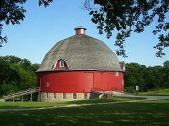 Ryan Round Barnlisted 1974
Topographic sheets covering this place
5 surveys from 11 printed sheetsMatched by testing this settlement's coordinate against the published boundary of every sheet in the United States Geological Survey's historical collection. Each opens the scanned sheet at the Survey.
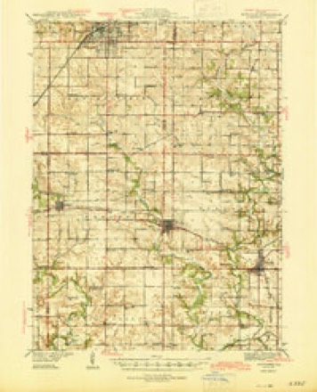
- 1944 USGS Kewanee quadrangle1:62500, 3 printings
- 1958 USGS Aurora quadrangle1:250000, 3 printings
- 1961 USGS Aurora quadrangle1:250000
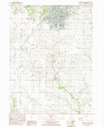
- 1983 USGS Kewanee South quadrangle1:24000, 2 printings
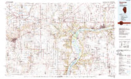
- 1985 USGS Kewanee quadrangle1:100000, 2 printings


In the county-history sources
18,665 words on this townshipHistory of Henry County, Illinois : It's Taxpayers and Voters; Containing Also, a Biographical Directory, a Condensed History of the State; Map of the County; a Business Directory...etc, published 1877 names this settlement in its chapter on Kewanee Township. These are the passages that mention it, exactly as the scans read.
The traveler in 1853, had he passed from Dixon to Wethersfield, would have found where now stands Kewanee, a modest and well-tilled farm, the property of M. B. and J. P. Potter, on the west, and a broad, undulating prairie on the east, the division line being then a township road, and now known as Main Street. The unpretentious farm-house, now the residence of Harry Thompson, ma}' still be seen by the curious, standing directly north of the building known as " Phillips Block." The first settlers of the land comprised in the township were John Kilvington, Robert Coultis and Cornelius Bryan, who came in the Fall of 1836. In first entries. They were followed by Goodrich and Blish, whose entries bear date May 7, 1836, and in July by Henry Kemerling. This same year twenty-one sections - 13,440 acres - were taken up by the Connecticut Association, and before 1850 almost every acre was entered.
Passage source: History of Henry County, Illinois : It's Taxpayers and Voters; Containing Also, a Biographical Directory, a Condensed History of the State; Map of the County; a Business Directory...etc, published 1877.
Nothing particularly noteworthy took place until the railroad depot was fixed on the northwest quarter of section 33. The company had at first decided to place it on the northeast quarter of section 82, but a defective title compelled a re - location. Matthew B. and J. P. Potter and Col. Blish owned the site. The former, after selling five acres of their quarter section to Geo. A. Morse and Silas Willard, traded the balance to D wight Need ham for his beautiful farm a little farther south. Mr. Needham at once sold to Capt. Sullivan Howard, Ralph A. Tenney - - better known as " Ralph''- - and Henry G. Little ; and these gentlemen sold a quarter interest to Nelson Lay. Willard and Morse's tract lay oh either side of the railroad, on Main street, and here they built a store and warehouse in 1853. This was known as the "Pioneer" store, and did a lucrative business for nearly twelve months without opposition. The building stood on the lot now occupied by the residence of Mr. Joseph O'Brien, and was, in 1863, destroyed by fire.
Passage source: History of Henry County, Illinois : It's Taxpayers and Voters; Containing Also, a Biographical Directory, a Condensed History of the State; Map of the County; a Business Directory...etc, published 1877.
On May 1, 1854, the town was laid out by the following named gentlemen : Sullivan Howard, Nelson Lay, H. G.. Little, R. A. Tenney, Geo. A. Morse, and Sylvester Blish, all of whom, excepting Col. Blish, are still living. At that time all was life and activity. Wethersfield, which was then quite a thriving village, suffered in a very short time a loss of nearly all of her business houses, which were one by one put on wheels and moved to Kewanee.
Passage source: History of Henry County, Illinois : It's Taxpayers and Voters; Containing Also, a Biographical Directory, a Condensed History of the State; Map of the County; a Business Directory...etc, published 1877.
Machine-read from a century-old scan, so expect the errors a machine makes: misspelled names, dropped words, stray characters.
Read the whole chapter on Kewanee Township - it names this place 162 more 162 times.
Storms near this place
58 since 1996Regional context, not property-specific evidence. The National Weather Service names Kewanee in 58 storm reports between 1996 and 2026: 22 thunderstorm wind, 22 hail, 5 funnel cloud, 4 heavy rain. The reports record 1 injury. Each account below is quoted exactly as the forecast office filed it, from the NOAA Storm Events Database, and each date opens the federal record of that event.
| When | Event | Place named | Harm | What the report says |
|---|---|---|---|---|
| June 1999 | Thunderstorm Wind | Kewanee | 1 hurt | Straight line winds blew a truck over in Kewanee. The driver escaped with only minor injuries. The sheriff's department received many calls regarding power lines being downed. Winds also ripped the top off a grain elevator and blew part of a roof off a building. A tree was also blown over onto a car at Lexington and Fourth street. |
| April 2003 | Flash Flood | Kewanee | $250,000 | 6 inches water over roads |
| July 2024 | Tornado (EF1) | Kewanee | $50,000 | An NWS Storm Survey found a second tornado in Kewanee. The tornado was 50 yards wide with peak winds of 105 MPH, which caused damage on the north side of Kewanee. Damage was noted to several large trees including large ones snapped in a park and golf course. There was also some roof damage to a couple of businesses and a storage building. |
| April 2003 | Hail | Kewanee | $50,000 | no account filed |
| May 2006 | Thunderstorm Wind | Kewanee | $35,000 | Numerous large tree limbs and power lines downed on the east side of the city. One garage was pushed 10 feet off its foundation and collapsed. The car inside was not damaged. |
| August 2006 | Thunderstorm Wind | Kewanee | $10,000 | Numerous trees and large branches were downed across the city with the power out. A porch was damaged by a downed tree. |
| April 2000 | Thunderstorm Wind | Kewanee | $10,000 | Thunderstorm winds downed trees and large limbs, and caused extensive roof damage to one home. Vehicles were also damaged and an empty semi-trailer was blown over. |
| June 2010 | Thunderstorm Wind | Kewanee | $6,000 | Wind gusts estimated to be 70 mph snapped off 6 power poles and blew down several tree limbs in Kewanee, IL at 523 pm CDT June 23. |
| July 2007 | Thunderstorm Wind | Kewanee | $2,000 | Winds estimated to be 70 mph downed a tree 1.5 to 2 feet in diameter. Several limbs 6 to 8 inches in diameter were also blown down as well as some power and phone lines. |
| July 2003 | Heavy Rain | Kewanee | $2,000 | Street flooding & Mill Creek bankfull |
| August 1997 | Hail | Kewanee | $2,000 | Hail dented car hoods. |
| March 2026 | Funnel Cloud | Kewanee | - | Henry County watched this funnel cloud within a rotating wall cloud before taking cover. There were no reports of damage or of the circulation on the ground. |
| March 2026 | Hail | Kewanee | - | The time of the event was estimated using radar. |
| June 2024 | Thunderstorm Wind | Kewanee | - | Trees downed by thunderstorm winds. |
| April 2023 | Hail | Kewanee | - | The time of the event was estimated using radar. |
| July 2023 | Thunderstorm Wind | Kewanee | - | Six inch diameter tree branches were blown down. |
| August 2021 | Thunderstorm Wind | Kewanee | - | Power poles were blown down near the Baker Park Golf Course and and another near New Street and High Street. The time was estimated from radar data. |
| July 2020 | Thunderstorm Wind | Kewanee | - | Several tree branches snapped off in Kewanee. |
| June 2018 | Thunderstorm Wind | Kewanee | - | Power lines were blown down in Kewanee. |
| May 2018 | Hail | Kewanee | - | A public report was received of hail up to the size of dimes and nickels. |
| May 2017 | Thunderstorm Wind | Kewanee | - | Local law enforcement reported power lines were down in town. |
| July 2015 | Hail | Kewanee | - | Information was relayed via social media to WQAD and KWQC Twitter feeds which was forwarded to the office. |
| July 2015 | Hail | Kewanee | - | This report was relayed by Central Illinois Forecast Office from a local spotter. |
| June 2013 | Thunderstorm Wind | Kewanee | - | Radar was used to estimate the time of this event. |
| June 2013 | Flash Flood | Kewanee | - | Law Enforcement reported street flooding and flash flooding. |
| May 2012 | Hail | Kewanee | - | A trained spotter reported nickel sized hail. |
| May 2012 | Thunderstorm Wind | Kewanee | - | A person from the public reported a 5 inch tree limb down. |
| May 2011 | Hail | Kewanee | - | Golf ball sized hail fell in Kewanee, IL at 721 pm CDT May 22. |
| May 2011 | Hail | Kewanee | - | Quarter sized hail fell 1 mile south southwest of Kewanee, IL at 718 pm CDT May 22. |
| June 2011 | Thunderstorm Wind | Kewanee | - | Wind gusts estimated to be 65 mph blew down some 7 to 8 inch diameter tree limbs in Kewanee, IL around 600 am CDT June 9. |
| August 2011 | Thunderstorm Wind | Kewanee | - | Wind speeds were estimated by the public and lasted approximately ten minutes. Power is out in the town of Kewanee. Several large 8 inch tree limbs were also down in Kewanee. |
| November 2010 | Thunderstorm Wind | Kewanee | - | Law enforcement reported 40 to 50 evergreen trees, 35 to 60 feet tall, broken off at the 20 foot level near Kewanee. Winds were estimated at over 90 mph. |
| June 2010 | Thunderstorm Wind | Kewanee | - | Wind gusts estimated to be 70 mph blew down trees and tree limbs 1 mile west northwest of Kewanee, IL at 523 pm June 23. |
| July 2009 | Thunderstorm Wind | Kewanee | - | Wind gusts estimated to be 70 mph blew down several 8 to 10 inch diameter trees across the western parts of Kewanee, IL around 950 pm July 24. Some of the fallen trees blocked some city streets. |
| June 2005 | Heavy Rain | Kewanee | - | Water ponding on streets. |
| May 2004 | Heavy Rain | Kewanee | - | Creek out of banks |
| June 2004 | Funnel Cloud | Kewanee | - | Also reported by spotters |
| June 2002 | Flash Flood | Kewanee | - | Mill Creek out of it's banks onto city roads. Water estimated to be about 6 inches deep in some areas. |
| June 2001 | Heavy Rain | Kewanee | - | Trained storm spotter reported 3.92 inches of rain between midnight and 11 a.m. |
| July 2001 | Thunderstorm Wind | Kewanee | - | Tree limbs and power lines downed. Reported by trained storm spotter. |
| March 2026 | Hail | Kewanee | - | no account filed |
| April 2023 | Hail | Kewanee | - | no account filed |
| April 2023 | Hail | Kewanee | - | no account filed |
| September 2022 | Hail | Kewanee | - | no account filed |
| September 2019 | Hail | Kewanee | - | no account filed |
| February 2017 | Hail | Kewanee | - | no account filed |
| April 2013 | Hail | Kewanee | - | no account filed |
| April 2011 | Hail | Kewanee | - | no account filed |
| May 2011 | Hail | Kewanee | - | no account filed |
| July 2010 | Hail | Kewanee | - | no account filed |
| May 2004 | Funnel Cloud | Kewanee | - | no account filed |
| April 2003 | Funnel Cloud | Kewanee | - | no account filed |
| May 2003 | Funnel Cloud | Kewanee | - | no account filed |
| May 2000 | Tornado (F0) | Kewanee | - | no account filed |
| May 2000 | Thunderstorm Wind | Kewanee | - | no account filed |
| May 2000 | Hail | Kewanee | - | no account filed |
| April 1999 | Hail | Kewanee | - | no account filed |
| May 1996 | Thunderstorm Wind | Kewanee | - | no account filed |
Nearest settlements
The eight closest, with where each one stands in the county. Distances are straight-line, computed from the Geographic Names Information System coordinates.
| Map | Place | Distance | Sheets |
|---|---|---|---|
| Brandenburg Corners | 3.1 miles | 10 | |
| German Corner | 6.5 miles | 11 | |
| Saxon (historical) | 6.7 miles | 11 | |
| Galva | 8.2 miles | 14 | |
| Annawan | 10.5 miles | 10 | |
| Bishop Hill | 10.7 miles | 14 | |
| Ulah | 11.8 miles | 11 | |
| Atkinson | 13.0 miles | 11 |
Elsewhere
Matched on this settlement's Geographic Names Information System number rather than its name, so it cannot be a different place of the same name in another state.
| Wikipedia article on Kewanee | An encyclopaedic summary. Its text is share-alike, so it is linked here rather than copied. |
| Wikidata item Q578989 | The structured record the population and elevation above come from. Public domain (CC0). |
Provenance
This settlement is recorded in the Geographic Names Information System as feature 411436. The sheet list is computed by point-in-boundary test against the United States Geological Survey's historical topographic inventory. Both are works of the United States government and carry no copyright under 17 U.S.C. 105.
Storms. NOAA National Centers for Environmental Information, Storm Events Database https://www.ncei.noaa.gov/stormevents/ A work of the United States government, no copyright under 17 U.S.C. 105. Narratives are quoted verbatim from the National Weather Service report and are not edited or summarised.