 Block
Kinmundy, Illinois
11 topographic sheets cover this place, the earliest surveyed in 1945 and the latest in 1986. It stands in Kinmundy Township. It lies in ZIP code area 62854. The Survey maps it on the Kinmundy quadrangle. 733 people lived here at the 2020 count. It stands 594 feet above sea level.
On record in Kinmundy
Buildings and businesses the archive holds for this place. Each opens its own page, with the source record it came from.
On the National Register 2 records
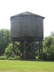 Illinois Central Railroad Water Tower and Pump Houselisted 1998
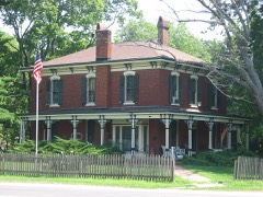 Calendar Rohrbough Houselisted 1979
Population over time
2 figuresKinmundy fell from 796 to 733 between 2010 and 2020. These are the recorded population figures Wikidata holds for this place, reached through the Geographic Names Information System number this page is keyed on rather than by name, so they belong to this place and not to another of the same name. Most are census counts, but not all are: an early figure may be a founding or settlement estimate, and an estimate published within five years of a census is left out. The change column is computed, and is left blank where more than 20 years separate a figure from the one before it, because a gap that long is not a change between two counts.
| Year | People | Change |
|---|---|---|
| 2010 | 796 | |
| 2020 | 733 | -63 (-8%) |
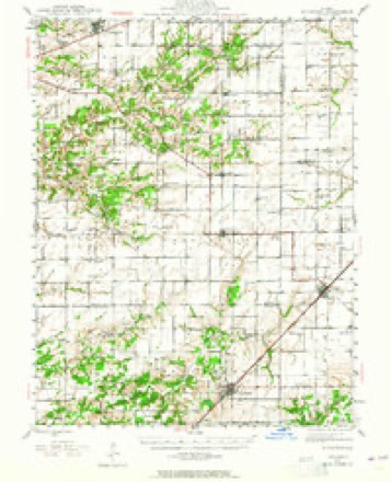
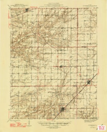
Topographic sheets covering this place
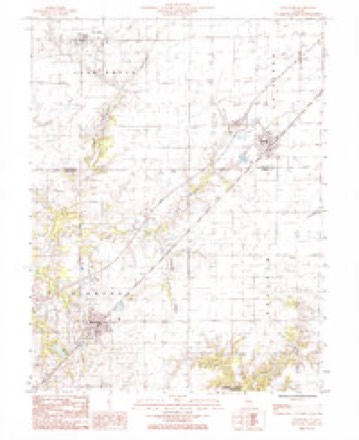
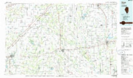
6 surveys from 11 printed sheetsMatched by testing this settlement's coordinate against the published boundary of every sheet in the United States Geological Survey's historical collection. Each opens the scanned sheet at the Survey.
- 1945 USGS Kinmundy quadrangle1:62500, 2 printings
- 1947 USGS Kinmundy quadrangle1:62500, 2 printings
- 1958 USGS Belleville quadrangle1:250000, 3 printings
- 1962 USGS Belleville quadrangle1:250000
- 1985 USGS Kinmundy quadrangle1:24000
- 1986 USGS Olney quadrangle1:100000, 2 printings


In the county-history sources
629 words on this townshipBrinkerhoff's History of Marion County, Illinois, published 1909 names this settlement in its chapter on Kinmundy Township. These are the passages that mention it, exactly as the scans read.
Kinmundy, a city of about fifteen hundred inhabitants, is situated on the Chicago branch of the Illinois Central Railroad. It was laid out in April, 1857, on section 22, which brings it near the center of the township. W. T. Sprouse laid out the city. Isaac Eagan laid out an addition in 1858. Other additions have been laid out from time to time. In 1895 trie Chicago & Eastern Illinois Railroad, then the Chicago, Peoria & Memphis, was built through the township, and passed through the western part of the city. The city and township are said to be named after a Scotchman, who was a stockholder in the Central when it was built, and visited this part of the county. W. B. Eagan built the first house in 1857, in which he kept a general store and was the first postmaster. The house was two stories and Eagan lived above the store. Eagan had kept a country store two or three years at the old homestead before Kinmundy was laid out. The Illinois depot was built in 1856, and like most Illinois Central depots of that day, was a big barn-like structure. Later a neat little depot was built and the old one used as a freight room. Kinmundy, like nearly all towns along the Illinois Central, is built on both sides of the railroad, and the crossing is dangerous, and deaths from being struck by trains are too often the result of this building of the towns. Several deaths at Kinmundy have resulted, among them that of Miss Cammerer, daughter of Dr. and Mrs. Cammerer, about twelve years ago. Miss Cammerer was walking with her mother, and stepping around the end of a car standing on the track, was struck by a fast train, the mother barely escaping the same fate. About the same time an entire family, except one child, were killed at the crossing at Alma. At the south side of the town Willis Wilburn built a small store room and sold goods for a time, in 1855. He built a hotel south of the present depot, about the same time. Doctor Skilling kept the first drug store, and Dr. W. W. Elliott was the first medical practitioner. Henry Eagan was the first "village blacksmith". In 1858 Sprouse built a saw and grist mill, but it was moved away in a short time, but he buit another in 1864. and in 1868 Songer Brothers built the present brick mill. It too, was moved away. Another mill was built in 1877 and passed into
Passage source: Brinkerhoff's History of Marion County, Illinois, published 1909.
The building of the Chicago & Eastern Illinois Railroad gave an impetus to business of Kinmundy, and several good brick business houses were built, but an extensive fire in 1904 destroyed about one-half of the business part of the town. It has, however, been rebuilt. A short time later another fire destroyed a large part of the remainder of the town. It too, has been rebuilt.
Passage source: Brinkerhoff's History of Marion County, Illinois, published 1909.
Kinmundy has six churches, the Methodist Episcopal, and Christian churches are fine, modern structures; the others are old style frame buildings, and are xised by the Cumberland Presbyterians, Presbyterians, Methodist Episcopal, South, and Catholic.
Passage source: Brinkerhoff's History of Marion County, Illinois, published 1909.
Machine-read from a century-old scan, so expect the errors a machine makes: misspelled names, dropped words, stray characters.
Read the whole chapter on Kinmundy Township - it names this place 1 more 1 time.
Mines and quarries near this place
1 within 5 milesRegional context, not property-specific evidence. The federal mineral resources record lists 1 working within 5 miles of Kinmundy: 1 occurrence. None of them still produces. What was taken out: Stone, Crushed/Broken. Distance is straight-line from the map coordinates, so a quarry counted here may appear on a neighbouring settlement's page as well.
| Where | Site | Commodity | Status | Recorded |
|---|---|---|---|---|
| Limestone Prospect | Stone, Crushed/Broken | Occurrence |
Storms near this place
19 since 1994Regional context, not property-specific evidence. The National Weather Service names Kinmundy in 19 storm reports between 1994 and 2017: 8 thunderstorm wind, 6 hail, 4 tornado, 1 flash flood. No death or injury is recorded in these reports. Each account below is quoted exactly as the forecast office filed it, from the NOAA Storm Events Database, and each date opens the federal record of that event.
| When | Event | Place named | Harm | What the report says |
|---|---|---|---|---|
| April 1994 | Thunderstorm Wind | Kinmundy | $5,000 | A mobile home was severely damaged in Pakota causing one minor injury. The county sheriff also reported numerous trees down from Pakota to Kinmundy. |
| April 2017 | Thunderstorm Wind | Kinmundy | - | Thunderstorm winds caused minor roof damage to one house. Also, two barns sustained minor roof damage and a power pole was bent. |
| February 2014 | Thunderstorm Wind | Kinmundy | - | Thunderstorm winds blew down several power lines in Kinmundy. |
| July 2011 | Flash Flood | Kinmundy | - | Up to four inches of rain fell in a short amount of time causing flash flooding. Several roads were flooded including the intersection of Kinlou and Vandeveer Roads. |
| February 2008 | Thunderstorm Wind | Kinmundy | - | Numerous large tree limbs were blown down in Kinmundy. |
| June 2008 | Tornado (EF0) | Kinmundy | - | A tornado briefly touched down in a farm destroying a machine shed and flipped over an unoccupied and unanchored mobile home. Also, the farm house sustained minor roof damage and several trees were blown over. |
| February 2008 | Thunderstorm Wind | Kinmundy | - | The damaging winds persisted into northeastern Marion county. About one and a half miles southeast of Farina, another machine shed was completely destroyed by the winds with debris tossed approximately 100 yards. There was also widespread tree damage in this area as well. On Interstate 57, 3 semi tractor trailers were blown over around mile marker 133. One of the drivers sustained minor injuries and was taken to Salem Township Hospital for treatment of the injuries. |
| June 2008 | Thunderstorm Wind | Kinmundy | - | Thunderstorm winds blew down numerous trees and limbs in Kinmundy. |
| September 2003 | Hail | Kinmundy | - | The Salem EMA office reported 1 inch hail just west of Kinmundy. |
| May 2002 | Hail | Kinmundy | - | County emergency management personnel reported 1 inch hail in Kinmundy. |
| May 2002 | Tornado (F1) | Kinmundy | - | Three tornadoes caused damage near Kinmundy. The first tornado caused considerable damage to a 2 story structure near the intersection of Highway 37 and Kinoka Road. The roof and 2 walls of the structure were thrown across Highway 37 into the woods. There was also tree and power line damage along the path. |
| May 2002 | Tornado (F1) | Kinmundy | - | Three tornadoes caused damage near Kinmundy, Illinois. The second tornado damaged 2 homes. Over 50 percent of the roof of one home was blown 70 yards away. The rest of the damage was to trees and power lines. |
| June 2002 | Thunderstorm Wind | Kinmundy | - | The County Sheriff reported the roof of a home damaged just east of Kinmundy. |
| May 2002 | Tornado (F1) | Kinmundy | - | Three tornadoes caused damage near Kinmundy, Illinois. The third tornado significantly damaged a mobile home. This tornado also destroyed several large trees. |
| May 2000 | Hail | Kinmundy | - | Storm spotters reported nickel size hail. |
| April 2012 | Hail | Kinmundy | - | no account filed |
| March 2012 | Hail | Kinmundy | - | no account filed |
| February 1999 | Hail | Kinmundy | - | no account filed |
| June 1999 | Thunderstorm Wind | Kinmundy | - | no account filed |
Nearest settlements
The eight closest, with where each one stands in the county. Distances are straight-line, computed from the Geographic Names Information System coordinates.
Elsewhere
Matched on this settlement's Geographic Names Information System number rather than its name, so it cannot be a different place of the same name in another state.
| Wikipedia article on Kinmundy | An encyclopaedic summary. Its text is share-alike, so it is linked here rather than copied. |
| Wikidata item Q575560 | The structured record the population and elevation above come from. Public domain (CC0). |
Provenance
This settlement is recorded in the Geographic Names Information System as feature 411525. The sheet list is computed by point-in-boundary test against the United States Geological Survey's historical topographic inventory. Both are works of the United States government and carry no copyright under 17 U.S.C. 105.
Mines and quarries. USGS Mineral Resources Data System (MRDS) https://mrdata.usgs.gov/mrds/ A work of the United States government, no copyright under 17 U.S.C. 105.
Storms. NOAA National Centers for Environmental Information, Storm Events Database https://www.ncei.noaa.gov/stormevents/ A work of the United States government, no copyright under 17 U.S.C. 105. Narratives are quoted verbatim from the National Weather Service report and are not edited or summarised.