 Block
Lawrenceville, Illinois
17 topographic sheets cover this place, the earliest surveyed in 1915 and the latest in 1986. It stands in Lawrence Township. It lies in ZIP code area 62439. The Survey maps it on the Lawrenceville quadrangle. 4,164 people lived here at the 2020 count. It stands 469 feet above sea level.
Research this city
On record in Lawrenceville
Buildings and businesses the archive holds for this place. Each opens its own page, with the source record it came from.
On the National Register 1 record
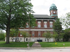 Lawrence County Courthouselisted 2010
Population over time
2 figuresLawrenceville fell from 4,348 to 4,164 between 2010 and 2020. These are the recorded population figures Wikidata holds for this place, reached through the Geographic Names Information System number this page is keyed on rather than by name, so they belong to this place and not to another of the same name. Most are census counts, but not all are: an early figure may be a founding or settlement estimate, and an estimate published within five years of a census is left out. The change column is computed, and is left blank where more than 20 years separate a figure from the one before it, because a gap that long is not a change between two counts.
| Year | People | Change |
|---|---|---|
| 2010 | 4,348 | |
| 2020 | 4,164 | -184 (-4%) |
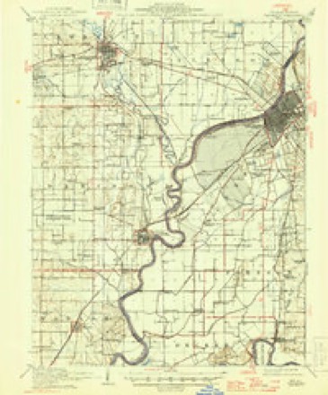
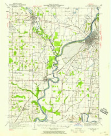
Topographic sheets covering this place
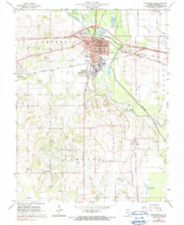
7 surveys from 17 printed sheetsMatched by testing this settlement's coordinate against the published boundary of every sheet in the United States Geological Survey's historical collection. Each opens the scanned sheet at the Survey.
- 1915 USGS Vincennes quadrangle1:62500, 5 printings
- 1944 USGS Vincennes quadrangle1:62500
- 1956 USGS Vincennes quadrangle1:250000, 4 printings
- 1957 USGS Vincennes quadrangle1:250000
- 1958 USGS Vincennes quadrangle1:250000, 2 printings
- 1965 USGS Lawrenceville quadrangle1:24000, 2 printings
- 1986 USGS Vincennes quadrangle1:100000, 2 printings
What happened here
An account from the chapter on Lawrence township. The inset identifies its exact source book and publication year.
Captain G. M. Keniepp
CHRISTIAN KENIEPP, the founder of the family, living in Wabash and Lawrence counties, Illinois, was a Hessian soldier captured at Trenton. He joined the colonial army, and after the war married and located in Geauga county, Ohio. He had four sons and several daughters, the eldest being the first white female child born in that section in Ohio.
In the county-history sources
32,475 words on this townshipCombined History of Edwards, Lawrence and Wabash Counties, Illinois. With Illustrations ... and Biographical Sketches of Some of Their Prominent Men and Pioneers, published 1883 names this settlement in its chapter on Lawrence Township. These are the passages that mention it, exactly as the scans read.
The first permanent English immigration and settlements were made in 1816-'17 after the Indian troubles had ceased, at which time there was quite an active influx of emigrants, who were mainly families from some portion of the South. Among these was Geo. W. Kinkaid who came with his family from Kentucky in the above year and settled in section 28, township 4, range 11. He had one son, Albert, and three daughters. Mr. K. resided on his farm for some years, when his wife died, and he moved into Lawrenceville. He was one of the early postmasters of the town. He remained here until his death, which occurred in 1848. Albert, his son, is a citizen of Richland county.
Passage source: Combined History of Edwards, Lawrence and Wabash Counties, Illinois. With Illustrations ... and Biographical Sketches of Some of Their Prominent Men and Pioneers, published 1883.
John Buchanan was also from the South, and as early as 1816 he came to the State and settled in section 12, township 3, range 12. He was a man of family, several of his children being old enough to aid him in his pioneer efforts. He improved a farm, where he resided until his children had grown up and married. He then moved to Lawrenceville, where he resided until his death, which occurred long ago. Some of his descendants are yet living in the county.
Passage source: Combined History of Edwards, Lawrence and Wabash Counties, Illinois. With Illustrations ... and Biographical Sketches of Some of Their Prominent Men and Pioneers, published 1883.
Another pioneer of 1817 was John Brigman, a native of South Carolina. On coming to Illinois, he first stopped upon the site where Lawrenceville now stands. His family consisted of his wife, two children and two brothers. The names of the latter were, Solomon and Isaac. He built him a small house, or rather hut, but remained here only a short time, moving to what is known as Brigman's Island. He located in section 22, township 4, range 12, on the farm now owned and occupied by Joseph Griggs. This was a sickly locality, and nearly all the family soon died. Mr. B. also died here, and was buried on his own land.
Passage source: Combined History of Edwards, Lawrence and Wabash Counties, Illinois. With Illustrations ... and Biographical Sketches of Some of Their Prominent Men and Pioneers, published 1883.
Machine-read from a century-old scan, so expect the errors a machine makes: misspelled names, dropped words, stray characters.
Read the whole chapter on Lawrence Township - it names this place 14 more 14 times.
Fires near this place
6 since 2008Regional context, not property-specific evidence. The federal wildfire occurrence database lists 6 fires within 5 miles of Lawrenceville between 2008 and 2010, burning about 7 acres in total. None started naturally. None was recorded as arson. Distance is straight-line from the map coordinates, so a fire counted here may appear on a neighbouring settlement's page as well.
| Reported cause | Fires |
|---|---|
| Missing data/not specified/undetermined | 4 |
| Debris and open burning | 1 |
| Equipment and vehicle use | 1 |
The most recent of them, most recent first, with the day each was reported and the service that recorded it.
| Date | Cause | Size | Reported by | Name on the report |
|---|---|---|---|---|
| 8 September 2010 | Debris and open burning | 1.0 acres | Illinois Division of Forestry Resources | MICHAEL |
| 15 September 2010 | Missing data/not specified/undetermined | 1.0 acres | Illinois Division of Forestry Resources | SEWARD |
| 24 June 2008 | Equipment and vehicle use | 1.0 acres | Illinois Division of Forestry Resources | GOSNELL |
| 24 June 2008 | Missing data/not specified/undetermined | 3.0 acres | Illinois Division of Forestry Resources | BUCHANAN |
| 3 March 2009 | Missing data/not specified/undetermined | under an acre | Illinois Division of Forestry Resources | STATE |
| 29 January 2008 | Missing data/not specified/undetermined | under an acre | Illinois Division of Forestry Resources | GARDNER |
Settlements close enough to share some of these fires:
Mines and quarries near this place
5 within 5 milesRegional context, not property-specific evidence. The federal mineral resources record lists 5 workings within 5 miles of Lawrenceville: 3 producers, 1 past producer, 1 prospect. 3 still produce. What was taken out: Sand and Gravel, Construction, Clay, Sulfur. Distance is straight-line from the map coordinates, so a quarry counted here may appear on a neighbouring settlement's page as well.
| Where | Site | Commodity | Status | Recorded |
|---|---|---|---|---|
| Embarras River C Ay Shale Exposure | Clay | Prospect | ||
| Lawrenceville Plant | Sulfur | Producer | ||
| Gregory Gravel Co. - Dredge | Sand and Gravel, Construction | Producer | ||
| Lawerence County Pit | Sand and Gravel, Construction | Past Producer | ||
| Lawrenceville Plant | Sand and Gravel, Construction | Producer |
Storms near this place
56 since 1994Regional context, not property-specific evidence. The National Weather Service names Lawrenceville in 56 storm reports between 1994 and 2025: 37 thunderstorm wind, 16 hail, 3 flash flood. No death or injury is recorded in these reports. Each account below is quoted exactly as the forecast office filed it, from the NOAA Storm Events Database, and each date opens the federal record of that event.
| When | Event | Place named | Harm | What the report says |
|---|---|---|---|---|
| May 2018 | Thunderstorm Wind | Lawrenceville | $100,000 | Numerous trees and power lines were blown down across Lawrenceville. |
| July 2017 | Thunderstorm Wind | Lawrenceville | $75,000 | Numerous trees and power lines were blown down across Lawrenceville. |
| May 2016 | Thunderstorm Wind | Lawrenceville | $75,000 | Numerous trees and power lines were blown down in Lawrenceville. |
| July 2011 | Thunderstorm Wind | Lawrenceville | $55,000 | Numerous tree branches and power lines were blown down in Lawrenceville. |
| May 1995 | Thunderstorm Wind | Lawrenceville | $50,000 | Numerous trees were blown down in the vicinity of Lawrenceville and Bridgeport Illinois. Several homes sustained minor damage. Record or near record rainfall across southwest Indiana, southeast Illinois, as well as west and south-central Kentucky produced widespread flashlooding during the month of May. Thirteen and fifty-one hundredths inches of rain was recorded in Evansville, with 4.92 inches falling on the 17th. Numerous roads were closed across the tri state area. |
| April 2011 | Thunderstorm Wind | Lawrenceville | $30,000 | Five power poles and several large trees were blown down. |
| October 2010 | Thunderstorm Wind | Lawrenceville | $25,000 | Numerous trees and tree branches were blown down in Lawrenceville. |
| April 2020 | Thunderstorm Wind | Lawrenceville | $20,000 | Trees were uprooted or snapped. |
| December 2015 | Thunderstorm Wind | Lawrenceville | $20,000 | Two Ameren power poles were snapped off at the ground. |
| July 2016 | Thunderstorm Wind | Lawrenceville | $15,000 | Several trees were blown down across Route 1 just north of Lawrenceville. |
| July 2012 | Thunderstorm Wind | Lawrenceville | $15,000 | Several small trees and tree branches were blown down. |
| May 2015 | Thunderstorm Wind | Lawrenceville | $12,000 | A power pole was snapped and the roof of an outbuilding was torn off. |
| January 2013 | Thunderstorm Wind | Lawrenceville | $8,000 | Windows were blown out of a house. |
| July 1994 | Thunderstorm Wind | Lawrenceville | $5,000 | Large limbs were blown down in Lawrenceville. |
| May 2015 | Thunderstorm Wind | Lawrenceville | $3,000 | Two trees were blown down in Lawrenceville. |
| September 2014 | Thunderstorm Wind | Lawrenceville | $2,000 | A tree and several tree branches were blown down in Lawrenceville. |
| April 1994 | Thunderstorm Wind | Lawrenceville | $500 | Trees were blown down around Lawrenceville. |
| April 2025 | Flash Flood | Lawrenceville | - | An estimated 9 inches of water was flowing across 15th Street in Lawrenceville, prompting the closure of the road in a few spots. In addition, water was flowing across parts of 12th Street and James Street. |
| August 2025 | Thunderstorm Wind | Lawrenceville | - | Several 4 to 6-inch diameter tree branches were blown down near the intersection of IL-1 and County Road 880 North. |
| June 2025 | Thunderstorm Wind | Lawrenceville | - | Trees and limbs were blown down across Lawrence County. |
| July 2024 | Thunderstorm Wind | Lawrenceville | - | Several large tree branches were blown down. |
| May 2024 | Thunderstorm Wind | Lawrenceville | - | Several trees were blown down. |
| May 2022 | Thunderstorm Wind | Lawrenceville | - | Several 3-inch diameter tree limbs were snapped. |
| June 2022 | Thunderstorm Wind | Lawrenceville | - | A few small branches were blown down near Walmart. |
| May 2011 | Thunderstorm Wind | Lawrenceville | - | Numerous trees were blown down along Route 1 between Lawrenceville and Birds. |
| May 2011 | Thunderstorm Wind | Lawrenceville | - | Numerous trees were blown down in Lawrenceville. One tree fell onto a mobile home. |
| April 2006 | Thunderstorm Wind | Lawrenceville | - | Numerous trees and power lines blown down. A chain link fence was blown down, a scoreboard was bent over and railroad crossing arms were broken off in Lawrenceville. |
| May 2006 | Thunderstorm Wind | Lawrenceville | - | Numerous trees, power poles and power lines were blown down. Minor roofing damage occurred to several homes. |
| August 2006 | Thunderstorm Wind | Lawrenceville | - | Numerous trees and power lines were blown down across town. |
| September 2005 | Thunderstorm Wind | Lawrenceville | - | Numerous trees and power lines blown down. |
| November 2005 | Thunderstorm Wind | Lawrenceville | - | Measured gust from Lawrenceville ASOS. |
| July 2004 | Thunderstorm Wind | Lawrenceville | - | Several trees and power lines were blown down. Some of the trees fell onto U.S. Highway 50 west of Lawrenceville. |
| April 2002 | Thunderstorm Wind | Lawrenceville | - | Several powerlines were blown down in town. |
| July 2001 | Flash Flood | Lawrenceville | - | Water was reported over the road on Route 250, between Lawrenceville and Bridgeport at 405 am CST. Several roads were also reported flooded in the towns of Lawrenceville and Bridgeport. |
| July 2001 | Flash Flood | Lawrenceville | - | Several streets were reported to be flooded in town. |
| May 2000 | Thunderstorm Wind | Lawrenceville | - | Numerous trees and tree limbs were blown down in Lawrenceville. Two homes sustained moderate roof damage from a large tree that was uprooted. Also, a garage was destroyed by a fallen tree. No injuries were reported. |
| June 2000 | Thunderstorm Wind | Lawrenceville | - | A large tree was blown over onto the river road near the Wabash River. |
| May 1999 | Thunderstorm Wind | Lawrenceville | - | Numerous trees and power lines were blown down. Trees fell onto 4 houses in Russellville causing minor roof damage. |
| April 1997 | Thunderstorm Wind | Lawrenceville | - | Thunderstorm winds blew over several trees in Lawrenceville. No injuries were reported. |
| June 2024 | Thunderstorm Wind | Lawrenceville | - | no account filed |
| August 2023 | Hail | Lawrenceville | - | no account filed |
| June 2023 | Hail | Lawrenceville | - | no account filed |
| March 2016 | Hail | Lawrenceville | - | no account filed |
| March 2016 | Hail | Lawrenceville | - | no account filed |
| March 2016 | Hail | Lawrenceville | - | no account filed |
| April 2013 | Hail | Lawrenceville | - | no account filed |
| April 2011 | Hail | Lawrenceville | - | no account filed |
| April 2011 | Hail | Lawrenceville | - | no account filed |
| March 2009 | Hail | Lawrenceville | - | no account filed |
| March 2009 | Hail | Lawrenceville | - | no account filed |
| January 2008 | Hail | Lawrenceville | - | no account filed |
| January 2008 | Hail | Lawrenceville | - | no account filed |
| June 2006 | Hail | Lawrenceville | - | no account filed |
| September 2006 | Hail | Lawrenceville | - | no account filed |
| July 2004 | Hail | Lawrenceville | - | no account filed |
| June 1998 | Hail | Lawrenceville | - | no account filed |
Nearest settlements
The eight closest, with where each one stands in the county. Distances are straight-line, computed from the Geographic Names Information System coordinates.
| Map | Place | Distance | Sheets |
|---|---|---|---|
| Grisold (historical) | 1.0 miles | 17 | |
| Jackson | 1.8 miles | 17 | |
| Bridgeport | 4.5 miles | 13 | |
| Pinkstaff | 4.6 miles | 13 | |
| Billett | 4.7 miles | 17 | |
| Petrolia | 5.6 miles | 12 | |
| Grays Corner | 6.3 miles | 17 | |
| Birds | 7.5 miles | 13 |
Elsewhere
Matched on this settlement's Geographic Names Information System number rather than its name, so it cannot be a different place of the same name in another state.
| Wikipedia article on Lawrenceville | An encyclopaedic summary. Its text is share-alike, so it is linked here rather than copied. |
| Wikidata item Q578457 | The structured record the population and elevation above come from. Public domain (CC0). |
Provenance
This settlement is recorded in the Geographic Names Information System as feature 411873. The sheet list is computed by point-in-boundary test against the United States Geological Survey's historical topographic inventory. Both are works of the United States government and carry no copyright under 17 U.S.C. 105.
Wildfire. Short, Karen C. 2022. Spatial wildfire occurrence data for the United States, 1992-2020 [FPA_FOD_20221014]. 6th Edition. Fort Collins, CO: Forest Service Research Data Archive. https://doi.org/10.2737/RDS-2013-0009.6 Collected with United States Government funding and usable without additional permissions or fees.
Mines and quarries. USGS Mineral Resources Data System (MRDS) https://mrdata.usgs.gov/mrds/ A work of the United States government, no copyright under 17 U.S.C. 105.
Storms. NOAA National Centers for Environmental Information, Storm Events Database https://www.ncei.noaa.gov/stormevents/ A work of the United States government, no copyright under 17 U.S.C. 105. Narratives are quoted verbatim from the National Weather Service report and are not edited or summarised.