 Block
Lockport, Illinois
23 topographic sheets cover this place, the earliest surveyed in 1892 and the latest in 1998. It stands in Lockport Township. It lies in ZIP code area 60441. It stands on Fiddyment Creek. The Survey maps it on the Joliet quadrangle. 26,094 people lived here at the 2020 count. It stands 696 feet above sea level.
On record in Lockport
Buildings and businesses the archive holds for this place. Each opens its own page, with the source record it came from.
On the National Register 7 records
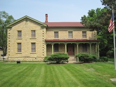 Fitzpatrick Houselisted 1984
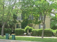 John Heck Houselisted 1994
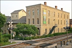 Lockport Historic Districtlisted 1975
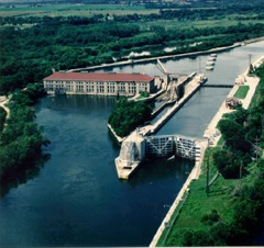 Lockport Lock, Dam and Power House Historic Districtlisted 2004
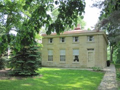 Robert Milne Houselisted 1979
 Stone Manorlisted 1980
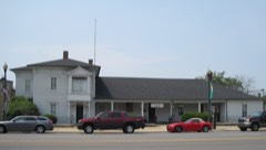 Will County Historical Society Headquarterslisted 1972
Population over time
2 figuresLockport grew from 24,839 to 26,094 between 2010 and 2020. These are the recorded population figures Wikidata holds for this place, reached through the Geographic Names Information System number this page is keyed on rather than by name, so they belong to this place and not to another of the same name. Most are census counts, but not all are: an early figure may be a founding or settlement estimate, and an estimate published within five years of a census is left out. The change column is computed, and is left blank where more than 20 years separate a figure from the one before it, because a gap that long is not a change between two counts.
| Year | People | Change |
|---|---|---|
| 2010 | 24,839 | |
| 2020 | 26,094 | +1,255 (+5%) |
Topographic sheets covering this place
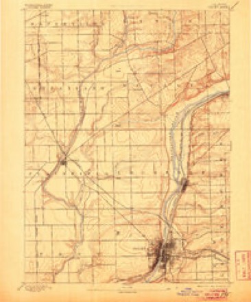
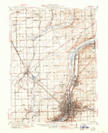
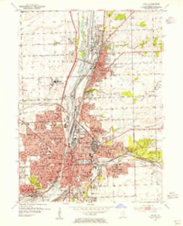
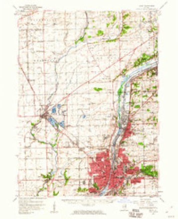
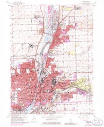
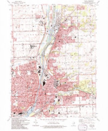
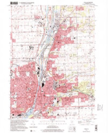
10 surveys from 23 printed sheetsMatched by testing this settlement's coordinate against the published boundary of every sheet in the United States Geological Survey's historical collection. Each opens the scanned sheet at the Survey.
- 1892 USGS Joliet quadrangle1:62500, 6 printings
- 1923 USGS Joliet quadrangle1:62500, 5 printings
- 1954 USGS Joliet quadrangle1:24000
- 1954 USGS Joliet quadrangle1:62500
- 1958 USGS Aurora quadrangle1:250000, 3 printings
- 1961 USGS Aurora quadrangle1:250000
- 1962 USGS Joliet quadrangle1:24000, 3 printings
- 1985 USGS Aurora quadrangle1:100000
- 1993 USGS Joliet quadrangle1:24000
- 1998 USGS Joliet quadrangle1:24000



In the county-history sources
2,883 words on this townshipThe History of Will County, Illinois, Containing a History of the County ... a Directory of Its Real Estate Owners; Portraits of Early Settlers and Prominent Men; General and Local Statistics ... History of Illinois ... History of the Northwest .., published 1878 names this settlement in its chapter on Lockport Township. These are the passages that mention it, exactly as the scans read.
The first store was established in Runyontown town (now North Lockport) by a man named Kellogg, and was but a sort of grocery store, a rather small affair. Goss & Parks kept the first dry goods store at the same place, and at the layingout of Lockport proper, removed within its limits, Goss and Stephen Gooding opening a store in partnership, and Parks likewise opening one on his own hook. After the retirement of Stephen Gooding, Oliver P. Gooding took charge of this, and soon other mercantile establishments were opened, and Lockport grew rapidly. The first building of any pretensions erected, was the Canal office, as already stated. There were, however, several cabins and huts put up within the present limits of the village, by the early settlers, long before it was laid out as a village. The first tavern was built by Horace Morse, but Mr. Runyon, we believe, kept travelers before this tavern was built, though he did not pretend to keep a regular hotel. The first post office was established in 1836, over on the west side of the river, at the stone mill, and Edward P. Bush was the first Postmaster. The office remained at the mill until 1839, when it was removed across the river to the East Side, where it has ever since remained. While at the mill, the mail came once a week, and was brought on horseback. In 1839, coaches were put on the Chicago and Ottawa route, and the mail then came that way, which was considered, in that early day, quite an improvement, and a considerable advance toward civilization. The first representatives of the legal profession were Gen. James Turney and John W. Paddock, both long since dead. At present Messrs. L. S. Parker and W. S. Myers, men of ability, constitute the "learned in the law" of Lockport. The first village schoolhouse was built in 1839 ; a small frame building, about 18x32 feet, and cost perhaps $200. It was used for schools, religious services, townhall, and anything else that happened to come along. The present handsome stone building, with its fine clock, was erected a few years ago at a cost of $30,000 - quite a contrast to the little shanty built for school purposes forty years ago. The present building would be an ornament to any town. The following is the record of the school for the present year : Prof. D. H. Darling, Principal ; Misses Paxson, Gooding, Devine, Parker and Herron, Teachers.
Passage source: The History of Will County, Illinois, Containing a History of the County ... a Directory of Its Real Estate Owners; Portraits of Early Settlers and Prominent Men; General and Local Statistics ... History of Illinois ... History of the Northwest .., published 1878.
Before Lockport proper was laid out, and as early as 1836, Armstead Runyon laid out North Lockport, or what was long known as Runyontown, but now called Runyon's Addition to Lockport. West Lockport was laid out by William Gooding, Lyman Hawley, William Rogers and Eli Prescott, the parties that built the stone mill. At one time this was the most flourishing part of Lockport, but both it and Runyontown have been merged into the village proper. Lockport was incorporated under especial act of the Legislature, approved February 12, 1853, and signed by J. A. Matteson, Governor. At the election for adopting the village charter, the vote was 86 in favor of and 55 against the charter. The first Board of Trustees elected were Isaac H. Steward, Henry Torrey, S. S. Chamberlain, D. C. Baldwin and Chauncy Doud. Henry Torrey was chosen President of the Board, I. H. Stewart appointed Secretary, and Chauncy Doud, Treasurer. The following is the present Board : David C. Baldwin, William Shields, Samuel Matthews, John Ryan and Jacob Lotz. D. C. Baldwin is President of the Board ; William Shields, Clerk ; F. F. Stowe, Police Magistrate ; William A. Johnson, Police Constable, and James Wright, Jr., Street Commissioner.
Passage source: The History of Will County, Illinois, Containing a History of the County ... a Directory of Its Real Estate Owners; Portraits of Early Settlers and Prominent Men; General and Local Statistics ... History of Illinois ... History of the Northwest .., published 1878.
Lockport has always been the headquarters of the Canal Commissioners, and the General Superintendent, Mr. Thomas, has his ofiice here at this time. Without going into a detailed history of the Canal, which has been thoroughly given in another department of this work, we will mention one little anecdote especially pertaining to this section and to Lockport. The first boat that passed through the entire length of the Canal after its completion, was the " General Thornton," and made the passage in April, 1848. But the first that fioated on its Bridgeport-tainted waters was the " General Fry," named for one of the Canal Commissioners. It was built near where the depot now stands, and as it was an event of importance, unprecedented in the history of Lockport, everybody went down to see it launched. As it gently "slided" from the stocks into the " raging canawl," Dr. Daggett rode in on it, and the boat, seemingly conscious that it carried more than Caesar and his fortunes, acquitted itself handsomely, by dropping into the water "right side up." When the Canal was completed and opened to Chicago, in March, 1848, this boat was the first to make the trip to that city. It was the occasion of a grand excursion for the purpose of celebrating an event of great national importance. A magnificent reception was given the excursion, as Chicago, even then, knew how to entertain her country cousins. The boat was met at Bridgeport by a propeller and a large number of citizens, who took the excursionists on through the river, and for a lide out on the lake. The river was lined with people on both sides, to see the first excursion that had come through the Canal. They were taken in and "dined and wined," and a general good time had all round. There are those (Blue or Red Ribbonists, perhaps) who remarked with some emphasis, that the entire excursion got gloriously drunk. But doubtless this is a sort of " stretch of conjecture," and should be taken with all due allowance for illnatured remarks.
Passage source: The History of Will County, Illinois, Containing a History of the County ... a Directory of Its Real Estate Owners; Portraits of Early Settlers and Prominent Men; General and Local Statistics ... History of Illinois ... History of the Northwest .., published 1878.
Machine-read from a century-old scan, so expect the errors a machine makes: misspelled names, dropped words, stray characters.
Read the whole chapter on Lockport Township - it names this place 7 more 7 times.
Fires near this place
5 since 2020Regional context, not property-specific evidence. The federal wildfire occurrence database lists 5 fires within 5 miles of Lockport in 2020, burning about 3 acres in total. None started naturally. None was recorded as arson. Distance is straight-line from the map coordinates, so a fire counted here may appear on a neighbouring settlement's page as well.
| Reported cause | Fires |
|---|---|
| Debris and open burning | 2 |
| Smoking | 1 |
| Missing data/not specified/undetermined | 1 |
| Equipment and vehicle use | 1 |
The most recent of them, most recent first, with the day each was reported and the service that recorded it.
| Date | Cause | Size | Reported by | Name on the report |
|---|---|---|---|---|
| 1 September 2020 | Debris and open burning | under an acre | Illinois Division of Forestry Resources | 20-0002215 |
| 3 August 2020 | Smoking | under an acre | Illinois Division of Forestry Resources | 20-0001661 |
| 5 May 2020 | Missing data/not specified/undetermined | under an acre | Illinois Division of Forestry Resources | 20-0000919 |
| 13 April 2020 | Debris and open burning | 1.0 acres | Illinois Division of Forestry Resources | 20-0000723 |
| 9 November 2020 | Equipment and vehicle use | under an acre | Illinois Division of Forestry Resources | 20-0002593 |
Settlements close enough to share some of these fires:
Mines and quarries near this place
7 within 5 milesRegional context, not property-specific evidence. The federal mineral resources record lists 7 workings within 5 miles of Lockport: 3 past producers, 3 plants, 1 producer. 4 still produce. What was taken out: Stone, Crushed/Broken, Sulfur, Sand and Gravel, Construction. Distance is straight-line from the map coordinates, so a quarry counted here may appear on a neighbouring settlement's page as well.
| Where | Site | Commodity | Status | Recorded |
|---|---|---|---|---|
| Lockport Pit/Yard 15 | Sand and Gravel, Construction | Past Producer | ||
| (Facility) Mobil Oil Joilet Refinery | Sulfur | Plant | ||
| (Facility) Union 76 Chicago Refinery | Sulfur | Plant | ||
| Gross & Mc Cowan Lumber Co. Quarry | Stone, Crushed/Broken | Past Producer | ||
| Romeo Quarry & Mill | Stone, Crushed/Broken | Plant | ||
| Texaco Lockport Plant | Sulfur | Producer | ||
| Will Co. Hwy. Dept. | Stone, Crushed/Broken | Past Producer |
Storms near this place
39 since 1996Regional context, not property-specific evidence. The National Weather Service names Lockport in 39 storm reports between 1996 and 2026: 18 thunderstorm wind, 17 hail, 1 flash flood, 1 lightning. No death or injury is recorded in these reports. Each account below is quoted exactly as the forecast office filed it, from the NOAA Storm Events Database, and each date opens the federal record of that event.
| When | Event | Place named | Harm | What the report says |
|---|---|---|---|---|
| July 2007 | Thunderstorm Wind | Lockport | $50,000 | A microburst hit the Cedar Glen Subdivision in Homer Glen, east of Lockport. This is just northwest of the intersection of 159th Street and Cedar Road. There was scattered damage to trees throughout the neighborhood. Objects such as trampolines and lawn furniture were blown over as well. The most concentrated damage was in the east end of the subdivision along Cedar Glen Drive where several mature spruce trees were uprooted and some hardwood trees had large limbs or trunks snapped. A large portion of a roof of a house was torn off. Most of the damage was blown down from the northwest to southeast. In the west end of the neighborhood, some of the limbs were blown more to the south and southwest, in a downburst pattern. More than 30 trees were blown down at Old Oak Country Club. |
| July 2017 | Thunderstorm Wind | Lockport | $10,000 | A large part of a roof was blown off a building and an 8 inch diameter tree was blown down. |
| June 2007 | Thunderstorm Wind | Lockport | $10,000 | Seven utility poles blown down at 151st Street and Creme Road in Homer Township. |
| August 2025 | Thunderstorm Wind | Lockport | - | Several large branches were broken in Lockport. The large trunk of a rotted tree also fell onto a house. |
| August 2025 | Thunderstorm Wind | South Lockport | - | Whole trees were snapped in the vicinity of the Lockport High School baseball fields. |
| February 2024 | Hail | Lockport | - | An NWS employee observed 1 hail in Lockport. |
| May 2024 | Thunderstorm Wind | Lockport | - | Tree limbs were blown down with one of the limbs 6 to 9 inches in diameter. |
| July 2024 | Thunderstorm Wind | Lockport | - | A two foot diameter tree was snapped and fell onto a house and power lines. |
| July 2023 | Thunderstorm Wind | Lockport | - | A power pole was reported down in Lockport. Time was estimated using radar. |
| July 2020 | Thunderstorm Wind | South Lockport | - | A large tree was blown down onto a utility pole and power lines near Division and Hamilton Streets. A transformer was also blown down. |
| August 2020 | Thunderstorm Wind | Lockport | - | Tree limbs and power lines were blown down in Lockport. |
| September 2010 | Thunderstorm Wind | Lockport | - | One large tree limb was blown down across a road. |
| September 2007 | Thunderstorm Wind | Lockport | - | Five to six inch diameter tree limbs were blown down on 159th street. Half of a Willow tree was also blown down. |
| July 2006 | Flood | Lockport | - | Eight inches of water covering Route 171, south of Division. |
| July 2006 | Thunderstorm Wind | Lockport | - | A one foot diameter tree was blown down near Farrell Street and Route 7. Tree limbs also blown down. |
| July 2006 | Funnel Cloud | Lockport | - | A funnel cloud was reported near Archer and New Avenue. |
| May 2006 | Thunderstorm Wind | Lockport | - | A six inch diameter, 30 foot long tree limb was blown down at 151st Street and Farrel Road. |
| June 2006 | Thunderstorm Wind | Lockport | - | Trees and tree limbs were blown down. |
| October 2006 | Hail | Lockport | - | Quarter size hail reported at New Avenue and Archer Avenue. |
| March 2005 | Hail | Lockport | - | Nickel sized hail was reported near the intersection of Bruce Rd. and Lawrence Ave. |
| April 2004 | Flash Flood | Lockport | - | Near intersection of State Hwy 171 and New Ave. One half foot of standing water on road. |
| May 2004 | Hail | Lockport | - | Reported at the intersection of 11th and Lincoln Streets. |
| March 2004 | Lightning | Lockport | - | Lightning struck electric line from pole to house at Barry Circle |
| May 2004 | Hail | Lockport | - | Reported at the intersection of 135th Street and County Line Road. |
| June 2004 | Hail | Lockport | - | Reported at the intersection of Rt. 7 and Madison St. |
| March 2026 | Hail | Lockport | - | no account filed |
| February 2024 | Hail | Lockport | - | no account filed |
| June 2019 | Hail | Lockport | - | no account filed |
| April 2015 | Hail | Lockport | - | no account filed |
| June 2015 | Hail | South Lockport | - | no account filed |
| June 2015 | Hail | Lockport | - | no account filed |
| June 2014 | Thunderstorm Wind | South Lockport | - | no account filed |
| June 2014 | Thunderstorm Wind | South Lockport | - | no account filed |
| June 2011 | Hail | Lockport | - | no account filed |
| June 2004 | Hail | Lockport | - | no account filed |
| August 2003 | Hail | Lockport | - | no account filed |
| June 1999 | Hail | Lockport | - | no account filed |
| January 1996 | Thunderstorm Wind | Lockport | - | no account filed |
| May 1996 | Hail | Lockport | - | no account filed |
Nearest settlements
The eight closest, with where each one stands in the county. Distances are straight-line, computed from the Geographic Names Information System coordinates.
| Map | Place | Distance | Sheets |
|---|---|---|---|
| South Lockport | 1.1 miles | 23 | |
| Bonnie Brae | 1.4 miles | 23 | |
| Forest Manor | 2.0 miles | 23 | |
| The Fields | 2.3 miles | 23 | |
| Fairmont | 2.3 miles | 23 | |
| Broken Arrow | 2.3 miles | 23 | |
| Deer Run | 2.4 miles | 23 | |
| Lockport Heights | 2.7 miles | 23 |
Elsewhere
Matched on this settlement's Geographic Names Information System number rather than its name, so it cannot be a different place of the same name in another state.
| Wikipedia article on Lockport | An encyclopaedic summary. Its text is share-alike, so it is linked here rather than copied. |
| Wikidata item Q575596 | The structured record the population and elevation above come from. Public domain (CC0). |
Provenance
This settlement is recorded in the Geographic Names Information System as feature 412473. The sheet list is computed by point-in-boundary test against the United States Geological Survey's historical topographic inventory. Both are works of the United States government and carry no copyright under 17 U.S.C. 105.
Wildfire. Short, Karen C. 2022. Spatial wildfire occurrence data for the United States, 1992-2020 [FPA_FOD_20221014]. 6th Edition. Fort Collins, CO: Forest Service Research Data Archive. https://doi.org/10.2737/RDS-2013-0009.6 Collected with United States Government funding and usable without additional permissions or fees.
Mines and quarries. USGS Mineral Resources Data System (MRDS) https://mrdata.usgs.gov/mrds/ A work of the United States government, no copyright under 17 U.S.C. 105.
Storms. NOAA National Centers for Environmental Information, Storm Events Database https://www.ncei.noaa.gov/stormevents/ A work of the United States government, no copyright under 17 U.S.C. 105. Narratives are quoted verbatim from the National Weather Service report and are not edited or summarised.